Lunenburg, Vermont | |
|---|---|
 Lunenburg, VT, from the southeast | |
 Lunenburg  Lunenburg | |
| Coordinates: 44°27′47″N71°40′57″W / 44.46306°N 71.68250°W | |
| Country | United States |
| State | Vermont |
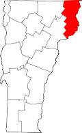
| County | Essex |
| Town | Lunenburg |
| Area | |
• Total | 2.54 sq mi (6.58 km2) |
| • Land | 2.54 sq mi (6.57 km2) |
| • Water | 0 sq mi (0.0 km2) |
| Elevation | 1,180 ft (360 m) |
| Time zone | UTC-5 (Eastern (EST)) |
| • Summer (DST) | UTC-4 (EDT) |
| ZIP Code | 05906 |
| Area code | 802 |
| FIPS code | 50-41350 |
| GNIS feature ID | 2805702 [2] |
Lunenburg is the primary village and a census-designated place (CDP) in the town of Lunenburg, Essex County, Vermont, United States. It was first listed as a CDP prior to the 2020 census.
The CDP is in southern Essex County, in the southeast part of the town of Lunenburg. U.S. Route 2 passes through the village center, leading west 21 miles (34 km) to St. Johnsbury and east 7 miles (11 km) to Lancaster, New Hampshire.