Danville, Vermont

Last updated

Danville, Vermont
Danville VT Post Office.jpg
Danville's post office
Nickname: 
"Village in the hills"
Danville vt highlight.png
Danville, Vermont
Usa edcp location map.svg
Red pog.svg
Danville, Vermont
Location in the United States
Coordinates: 44°25′N72°8′W / 44.417°N 72.133°W / 44.417; -72.133
Country United States
State Vermont
County Caledonia
EstablishedOctober 31, 1786 (chartered) [1]
Communities Danville
Danville Center
North Danville
Upper Narrows
West Danville
Area
  Total61.1 sq mi (158.3 km2)
  Land60.7 sq mi (157.3 km2)
  Water0.4 sq mi (1.1 km2)
Elevation
1,591 ft (485 m)
Population
 (2020)
  Total2,335
  Density38/sq mi (14.8/km2)
Time zone UTC-5 (Eastern (EST))
  Summer (DST) UTC-4 (EDT)
ZIP code
05828, 05873 (West Danville)
Area code 802
FIPS code 50-17125 [2]
GNIS feature ID1462080 [3]
Website www.danvillevermont.org

Danville is a town in Caledonia County, Vermont, United States. The population was 2,335 at the 2020 census. [4] The primary settlement in town is recorded as the Danville census-designated place (CDP) and had a population of 385 at the 2020 census. [5]

Contents

History

Danville was established on October 31, 1786, by the Vermont Legislature, making it one of the last towns to be created in Caledonia County.

The town was named for the 18th-century French cartographer Jean Baptiste Bourguignon d'Anville. [6]

A Debtors' prison was located here in the late 18th to the early 19th centuries. [7]

A thief in West Danville made national news in 2008 when he apologized for robbing a convenience store and left a roll of one-dollar bills to allow the store to open up the next morning. [8]

The annual convention of the American Society of Dowsers is held in Danville. [9] [10]

In July 2017, the Charles D. Brainerd Public Library reopened in the village of West Danville, making the town once again home to Vermont's smallest library. [11]

Education

Danville School is the town's public school but is open to tuition students from surrounding towns. It serves preschool through grade 12, totaling to approximately 400 students. The school is located at 148 Peacham Road, Danville, Vt 05828 and is a part of the Danville School District. The school was established in 1990 to replace the North Danville School. [12]

Geography

Scenery typical of the Danville area in mid-October. Field and Hills of Danville, Vermont.jpg
Scenery typical of the Danville area in mid-October.

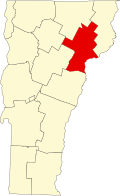
Danville is located west of St. Johnsbury, Vermont. Other towns bordering Danville are Barnet to the southeast, Peacham to the south, Cabot and Walden to the west, Stannard to the northwest, Wheelock to the north, and Lyndon to the northeast, touching Danville at a single corner. According to the United States Census Bureau, the town has a total area of 61.1 square miles (158.3 km2), of which 60.7 square miles (157.3 km2) is land and 0.42 square miles (1.1 km2), or 0.67%, is water. [13] The main village in town (not separately incorporated) comprises the Danville CDP, with an area of 1.0 square mile (2.7 km2), all land. [14]

U.S. Route 2 runs through the town, connecting St. Johnsbury to the east with Montpelier 26 miles (42 km) to the west. In West Danville the two-lane highway passes Joes Pond (named after Indian Joe [15] ), which extends into Cabot. Vermont Route 15 leaves US-2 in West Danville, heading northwest towards Hardwick and Morrisville.

The highest point in Danville is a 2,365-foot (721 m) summit on the ridge of the Kittredge Hills along the western border of the town.

Climate

This climatic region is typified by large seasonal temperature differences, with warm to hot summers and cold winters. According to the Köppen Climate Classification system, Danville has a humid continental climate, abbreviated "Dfb" on climate maps. [16]

Joe's Pond and Joe's Brook

Joe's Pond as seen from the Danville Bike Path in early August Joes Pond from the Danville Bike Path.jpg
Joe's Pond as seen from the Danville Bike Path in early August

The only major body of water in the town is the Joe's Pond, which covers 396 acres (160 ha) and is partially in Danville and partially in neighboring Cabot to the west. [9] The pond, an impoundment of the brook in West Danville, is the largest of the six bodies of water in the Joe's Brook watershed, which is in turn part of the Passumpsic River watershed. [17] Game fish in the pond include lake trout, smallmouth bass, northern pike (which were illegally introduced), rainbow smelt, rock bass, pumpkinseed, chain pickerel, yellow perch, and brown bullhead. [17] Plant species in the pond include the common mare's tail (Hippuris vulgaris) and the small bur-reed (Sparganium natans). [17]

The Greenbanks Hollow Covered Bridge, one of Vermont's many covered bridges, traverses Joe's Brook and lies within the Danville town boundaries. The covered bridge was built in 1886 and restored in its original condition in the early 2000s. [18] The bridge is owned by the Town of Danville, has a queen post truss, and is 74 feet, 9.5 inches in length and 14 feet, 6.5 inches in width. [18]

Demographics

Historical population
CensusPop.Note
1790 574
1800 1,514163.8%
1810 2,24048.0%
1820 2,3002.7%
1830 2,63114.4%
1840 2,6330.1%
1850 2,577−2.1%
1860 2,544−1.3%
1870 2,216−12.9%
1880 2,003−9.6%
1890 1,784−10.9%
1900 1,628−8.7%
1910 1,564−3.9%
1920 1,494−4.5%
1930 1,6007.1%
1940 1,472−8.0%
1950 1,312−10.9%
1960 1,3684.3%
1970 1,4052.7%
1980 1,70521.4%
1990 1,91712.4%
2000 2,21115.3%
2010 2,196−0.7%
2020 2,3356.3%
U.S. Decennial Census [19]

As of the census [2] of 2000, there were 2,211 people, 871 households, and 627 families residing in the town. The population density was 36.3 people per square mile (14.0/km2). There were 1,152 housing units at an average density of 18.9 per square mile (7.3/km2). The racial makeup of the town was 99.10% White, 0.18% African American, 0.23% Native American, 0.14% Asian, and 0.36% from two or more races. Hispanic or Latino of any race were 0.45% of the population.

There were 871 households, out of which 32.5% had children under the age of 18 living with them, 62.0% were married couples living together, 8.2% had a female householder with no husband present, and 28.0% were non-families. 23.1% of all households were made up of individuals, and 10.6% had someone living alone who was 65 years of age or older. The average household size was 2.52 and the average family size was 2.96.

In the town, the population was spread out, with 26.1% under the age of 18, 4.5% from 18 to 24, 25.4% from 25 to 44, 28.9% from 45 to 64, and 15.1% who were 65 years of age or older. The median age was 41 years. For every 100 females, there were 91.3 males. For every 100 females age 18 and over, there were 89.8 males.

The median income for a household in the town was $42,440, and the median income for a family was $47,150. Males had a median income of $33,654 versus $21,573 for females. The per capita income for the town was $19,012. About 6.2% of families and 8.3% of the population were below the federal poverty line, including 11.3% of those under age 18 and 6.1% of those age 65 or over.

Notable people

See also

Related Research Articles

<span class="mw-page-title-main">Washington County, Vermont</span> County in Vermont, United States

Washington County is a county located in the U.S. state of Vermont. Named after George Washington, its shire town is the city of Montpelier and the most populous municipality is the city of Barre. As of the 2020 census, the population was 59,807, making it the third-most populous county in Vermont, but the third-least populous capital county in the United States after Hughes County, South Dakota and Franklin County, Kentucky. Washington County comprises the Barre, Vermont micropolitan statistical area. In 2010, the center of population of Vermont was located in Washington County, in the town of Warren.

<span class="mw-page-title-main">Caledonia County, Vermont</span> County in Vermont, United States

Caledonia County is a county located in the northeastern part of the U.S. state of Vermont. As of the 2020 census, the population was 30,233. Its shire town is the town of St. Johnsbury. The county was created in 1792 and organized in 1796. It was given the Latin name for Scotland, in honor of the many settlers who claimed ancestry there.

<span class="mw-page-title-main">Barnet, Vermont</span> Town in Vermont, United States

Barnet is a town in Caledonia County, Vermont, United States. The population was 1,663 at the 2020 census. Barnet contains the locations of Barnet Center, East Barnet, McIndoe Falls, Mosquitoville, Passumpsic and West Barnet. The main settlement of Barnet is recorded as a census-designated place by the U.S. Census Bureau, with a population of 127 at the 2020 census.

<span class="mw-page-title-main">Burke, Vermont</span> Town in Vermont, United States

Burke is a town in Caledonia County, Vermont, United States. The population was 1,651 at the 2020 census. The town contains the villages of East Burke, West Burke and Burke Hollow. The town is home to Burke Mountain and Burke Mountain Academy.

<span class="mw-page-title-main">Groton, Vermont</span> Town in Vermont, United States

Groton is a town in Caledonia County, Vermont, United States. The population was 984 at the 2020 census. It contains the places Groton Pond, Rickers Mills, Rickers and West Groton. The unincorporated village of Groton in the southeast corner of town is recorded as the Groton census-designated place (CDP), with a population of 419 at the 2020 census.

<span class="mw-page-title-main">Lyndon, Vermont</span> Town in Vermont, United States

Lyndon is a town in Caledonia County, Vermont, United States. As of the 2020 census, the population was 5,491. Lyndon is the home of Lyndon State College. The town contains five unincorporated villages, Lyndonville just east of the geographic center of town, Lyndon Corner in the south, Lyndon Center in the center of town on the west side of Lyndonville, Little Egypt in the north, and East Lyndon in the southeast.

<span class="mw-page-title-main">Peacham, Vermont</span> Town in Vermont, United States

Peacham is a town in Caledonia County, Vermont, United States. The population was 715 at the 2020 census.

<span class="mw-page-title-main">Ryegate, Vermont</span> Town in Vermont, United States

Ryegate is a town in Caledonia County, Vermont, United States. The population was 1,165 at the 2020 census. The town contains the villages of South Ryegate, East Ryegate, and Ryegate Corner.

<span class="mw-page-title-main">Walden, Vermont</span> Town in Vermont, United States

Walden is a town in Caledonia County, Vermont, United States. The population was 956 at the 2020 census. The community has no ZIP code of its own; mail is routed through the West Danville and East Hardwick post offices.

<span class="mw-page-title-main">Waterford, Vermont</span> Town in Vermont, United States

Waterford is a town in Caledonia County, Vermont, United States. The population was 1,268 at the 2020 census.

<span class="mw-page-title-main">Wheelock, Vermont</span> Town in Vermont, United States

Wheelock is a town in Caledonia County, Vermont, United States. The population was 759 at the 2020 census.

<span class="mw-page-title-main">Concord, Vermont</span> Town in Vermont, United States

Concord is a town in Essex County, Vermont, United States. The population was 1,141 at the 2020 census. It is part of the Berlin, NH–VT Micropolitan Statistical Area.

Lancaster is a census-designated place (CDP) and the main village in the town of Lancaster in Coos County, New Hampshire, United States. The population of the CDP was 1,941 at the 2020 census, out of 3,218 in the entire town of Lancaster.

St. Johnsbury is a census-designated place (CDP) corresponding to the main settled areas in the town of St. Johnsbury, Caledonia County, Vermont, United States. As of the 2020 census it had a population of 5,994, out of 7,364 in the entire town.

<span class="mw-page-title-main">St. Johnsbury, Vermont</span> Town in Vermont, United States

St. Johnsbury is the shire town of Caledonia County, Vermont, United States. As of the 2020 census, the population was 7,364. St. Johnsbury is situated on the Passumpsic River and is located approximately six miles northwest of the Connecticut River and 48 miles (77 km) south of the Canada–U.S. border.

<span class="mw-page-title-main">East Montpelier (CDP), Vermont</span> Census-designated place in Vermont, United States

East Montpelier is a census-designated place (CDP) comprising the central village of the town of East Montpelier, Washington County, Vermont, United States. The population of the CDP was 80 at the 2010 census.

<span class="mw-page-title-main">Plainfield (CDP), Vermont</span> Census-designated place in Vermont, United States

Plainfield is a census-designated place (CDP) comprising the main village of the town of Plainfield, Washington County, Vermont, United States. The population of the CDP was 401 at the 2010 census.

Danville is the primary village and a census-designated place (CDP) in the town of Danville, Caledonia County, Vermont, United States. As of the 2020 census, the CDP had a population of 385, out of 2,335 in the entire town of Danville.

<span class="mw-page-title-main">Concord (CDP), Vermont</span> Census-designated place in Vermont, United States

Concord is a census-designated place comprising the main settlement in the town of Concord, Essex County, Vermont, United States. As of the 2010 census, it had a population of 271, out of a total town population of 1,235. It was an incorporated village for much of the 20th century, disincorporating in 1969.

Peacham is the primary village and a census-designated place (CDP) in the town of Peacham, Caledonia County, Vermont, United States. It was first listed as a CDP prior to the 2020 census. The Peacham Corner Historic District, listed on the National Register of Historic Places, occupies the four roads extending outward from the crossroads at the village center.

References

  1. Records of the Governor and Council of State of Vermont. Vol. 3. Montpelier, Vermont: Steam Press of J. and J.M. Poland. 1875. p. 138.
  2. 1 2 "U.S. Census website". United States Census Bureau . Retrieved January 31, 2008.
  3. "US Board on Geographic Names". United States Geological Survey. October 25, 2007. Retrieved January 31, 2008.
  4. "Census – Geography Profile: Danville town, Caledonia County, Vermont". United States Census Bureau . Retrieved December 29, 2021.
  5. "Census – Geography Profile: Danville CDP, Vermont". United States Census Bureau . Retrieved December 29, 2021.
  6. Gannett, Henry (1905). The Origin of Certain Place Names in the United States. Government Printing Office. pp.  100.
  7. Dunbar, Bethany M. (June 26, 2013). "Barton's hydroelectric history is revisited". The Chronicle . Barton, Vermont. pp. 1B.
  8. "Robber apologizes during Vt. general store holdup". Associated Press. November 21, 2008.
  9. 1 2 "Danville" in The Vermont Encyclopedia (eds. John J. Duffy, Samuel B. Hand & Ralph H. Orth: University of Vermont Press, 2003), p. 101.
  10. John Nobel Wilford, Dowsers Meet to Plumb the Unfathomable, New York Times (September 21, 1977).
  11. "Historic Library Now Open". The Caledonian-Record . St. Johnsbury, Vermont. July 17, 2017. Retrieved August 23, 2017.
  12. Danville School website
  13. "Geographic Identifiers: 2010 Demographic Profile Data (G001): Danville town, Caledonia County, Vermont". U.S. Census Bureau, American Factfinder. Archived from the original on February 12, 2020. Retrieved February 4, 2013.
  14. "Geographic Identifiers: 2010 Demographic Profile Data (G001): Danville CDP, Vermont". U.S. Census Bureau, American Factfinder. Archived from the original on February 12, 2020. Retrieved February 6, 2013.
  15. Brown, E. Jane (September 1994). "Welcome to Joe's Pond Vermont". Originally published in The Caledonian Record. Archived from the original on May 9, 2008. Retrieved January 31, 2015.
  16. "Danville, Vermont Köppen Climate Classification (Weatherbase)". Weatherbase.
  17. 1 2 3 Passumpsic River Watershed: Water Quality and Aquatic Habitat Assessment Report, Vermont Department of Environmental Conservation (June 2009), pp. 1, 17-18.
  18. 1 2 Benjamin D. Evans; June R. Evans (2004). New England's Covered Bridges: A Complete Guide. University Press of New England. pp. 198–99. ISBN   9781611683851.
  19. "U.S. Decennial Census". United States Census Bureau. Retrieved May 16, 2015.
  20. Wisconsin Legislative Manual (1876), p. 486.
  21. Albert G. Chadwick, Soldiers' Record of the Town of St. Johnsbury, Vermont, in the War of the Rebellion, 1883, page 25
  22. WCAX-TV, The End of an Era: Last 'Guiding Light' Episode Airs Today, September 18, 2009
  23. Robert Cecil Cook, Who's Who in American Education, 1966, page 270
  24. The American Almanac and Repository of Useful Knowledge, Vermont Government, 1835, page 167
  25. Baldwin, Frederick W. (1886). Biography of the Bar of Orleans County, Vermont. Montpelier, VT: Vermont Watchman and State Journal Press. pp.  65–69.
  26. "Deming, Benjamin F., (1790–1834)". Biographical Directory of the United States Congress. Retrieved November 26, 2012.
  27. Fort Leavenworth Historical Society, Biography, Henry Leavenworth Archived 2014-01-06 at the Wayback Machine , retrieved January 5, 2014
  28. 'Wisconsin Blue Book 1889,' Biographical Sketch of Cyrus Miner, pg. 517
  29. Eliakim Persons Walton, Records of the Governor and Council of the State of Vermont, Volume VIII, 1880, page 1
  30. "Stevens, Thaddeus, (1792–1868)". Biographical Directory of the United States Congress.
  31. Willard, Frances Elizabeth; Livermore, Mary Ashton Rice, eds. (1893), "Mary E. Ward", Woman of the Century, Buffalo, N.Y.: Charles Wells Moulton, retrieved September 21, 2022
  32. Smith, Eva Munson, ed. (1888). "Mrs. Mary Thompson Willard, nee Hill". Woman in Sacred Song – A Library of Hymns, Religious Poems and Sacred Music By Woman. Oakland, CA: Arthur E. Whitney. p. 464.