Kirby, Vermont

Last updated

Kirby, Vermont
South Kirby School House.JPG
South Kirby School House
Kirby vt highlight.png
Kirby, Vermont
Usa edcp location map.svg
Red pog.svg
Kirby, Vermont
Location in the United States
Coordinates: 44°31′N71°56′W / 44.517°N 71.933°W / 44.517; -71.933
Country United States
State Vermont
County Caledonia
Area
  Total24.4 sq mi (63.2 km2)
  Land24.4 sq mi (63.1 km2)
  Water0.04 sq mi (0.1 km2)
Elevation
1,558 ft (475 m)
Population
 (2020)
  Total575
  Density24/sq mi (9.1/km2)
Time zone UTC-5 (Eastern (EST))
  Summer (DST) UTC-4 (EDT)
ZIP code
05824
Area code 802
FIPS code 50-37900 [1]
GNIS feature ID1462130 [2]

Kirby is a town in Caledonia County, Vermont, United States. The population was 575 at the 2020 census. [3]

Contents

History

The town was chartered to Roswell Hopkins in 1790; Hopkins served as Clerk of the House of Representatives and Secretary of State of Vermont, and he accepted the land grant in lieu of cash as payment for his government service. [4] The grant Hopkins received was originally called Hopkinsville; it was later combined with a parcel from the town of Burke, and renamed Kirby. [5] Several ideas have been proposed for how the name Kirby was chosen; the most common is that it is a variant of the English Kirkby, which means a village or settlement around a church. [6] [7] By the time the town was organized in 1807, Hopkins had sold his interest and moved to Hopkinton, New York. [5]

Geography

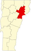
Kirby is located on the eastern border of Caledonia County in northeastern Vermont. It is bordered by the town of St. Johnsbury to the southwest, Lyndon to the west, Burke to the north, Victory to the northeast, Concord to the southeast, and Waterford to the south. According to the United States Census Bureau, the town has a total area of 24.4 square miles (63.2 km2), of which 24.4 square miles (63.1 km2) is land and 0.04 square miles (0.1 km2), or 0.20%, is water. [8]

U.S. Route 2 passes through the southern corner of the town, connecting St. Johnsbury to the west with Lancaster, New Hampshire, to the east.

The highest point in Kirby is the 2,750-foot (840 m) summit of Kirby Mountain, located along the town boundary with Victory. [9]

Demographics

Historical population
CensusPop.Note
1800 20
1810 3111,455.0%
1820 3120.3%
1830 40128.5%
1840 52029.7%
1850 509−2.1%
1860 473−7.1%
1870 417−11.8%
1880 398−4.6%
1890 355−10.8%
1900 350−1.4%
1910 297−15.1%
1920 3249.1%
1930 311−4.0%
1940 252−19.0%
1950 2572.0%
1960 235−8.6%
1970 224−4.7%
1980 28225.9%
1990 34723.0%
2000 45631.4%
2010 4938.1%
2020 57516.6%
U.S. Decennial Census [10]

As of the census [1] of 2000, there were 456 people, 168 households, and 122 families residing in the town. The population density was 18.7 people per square mile (7.2/km2). There were 207 housing units at an average density of 8.5 per square mile (3.3/km2). The racial makeup of the town was 96.05% White, 0.44% African American, 0.44% from other races, and 3.07% from two or more races. Hispanic or Latino of any race were 1.54% of the population.

There were 168 households, out of which 36.9% had children under the age of 18 living with them, 56.0% were married couples living together, 9.5% had a female householder with no husband present, and 26.8% were non-families. 19.0% of all households were made up of individuals, and 4.8% had someone living alone who was 65 years of age or older. The average household size was 2.71 and the average family size was 3.05.

In the town, the population was spread out, with 28.9% under the age of 18, 5.5% from 18 to 24, 28.3% from 25 to 44, 28.5% from 45 to 64, and 8.8% who were 65 years of age or older. The median age was 37 years. For every 100 females, there were 99.1 males. For every 100 females age 18 and over, there were 98.8 males.

The median income for a household in the town was $37,917, and the median income for a family was $43,333. Males had a median income of $27,778 versus $22,500 for females. The per capita income for the town was $16,675. About 15.2% of families and 15.3% of the population were below the poverty line, including 22.0% of those under age 18 and 12.8% of those age 65 or over.

Notable people

Related Research Articles

<span class="mw-page-title-main">Orange County, Vermont</span> County in Vermont, United States

Orange County is a county located in the U.S. state of Vermont. As of the 2020 census, the population was 29,277. Its shire town is the town of Chelsea. Orange County was organized on February 2, 1781, as an original county within the state.

<span class="mw-page-title-main">Caledonia County, Vermont</span> County in Vermont, United States

Caledonia County is a county located in the northeastern part of the U.S. state of Vermont. As of the 2020 census, the population was 30,233. Its shire town is the town of St. Johnsbury. The county was created in 1792 and organized in 1796. It was given the Latin name for Scotland, in honor of the many settlers who claimed ancestry there.

<span class="mw-page-title-main">Piermont, New Hampshire</span> Town in New Hampshire, United States

Piermont is a town in Grafton County, New Hampshire, United States. The population was 769 at the 2020 census. It is home to Camp Walt Whitman and Kingswood Camp for Boys.

<span class="mw-page-title-main">Burke, Vermont</span> Town in Vermont, United States

Burke is a town in Caledonia County, Vermont, United States. The population was 1,651 at the 2020 census. The town contains the villages of East Burke, West Burke and Burke Hollow. The town is home to Burke Mountain and Burke Mountain Academy.

<span class="mw-page-title-main">Danville, Vermont</span> Town in Vermont, United States

Danville is a town in Caledonia County, Vermont, United States. The population was 2,335 at the 2020 census. The primary settlement in town is recorded as the Danville census-designated place (CDP) and had a population of 385 at the 2020 census.

<span class="mw-page-title-main">Groton, Vermont</span> Town in Vermont, United States

Groton is a town in Caledonia County, Vermont, United States. The population was 984 at the 2020 census. It contains the places Groton Pond, Rickers Mills, Rickers and West Groton. The unincorporated village of Groton in the southeast corner of town is recorded as the Groton census-designated place (CDP), with a population of 419 at the 2020 census.

<span class="mw-page-title-main">Lyndon, Vermont</span> Town in Vermont, United States

Lyndon is a town in Caledonia County, Vermont, United States. As of the 2020 census, the population was 5,491. Lyndon is the home of Lyndon State College. The town contains one incorporated village, Lyndonville, and four unincorporated villages: Lyndon Corner in the south, Lyndon Center in the center of town on the west side of Lyndonville, Little Egypt in the north, and East Lyndon in the southeast.

<span class="mw-page-title-main">Lyndonville, Vermont</span> Village in Vermont, United States

Lyndonville is a village in the town of Lyndon, in Caledonia County, Vermont, United States. Lyndonville's population was 1,136 at the 2020 census. It is the closest community to the Lyndon campus of Northern Vermont University.

<span class="mw-page-title-main">Newark, Vermont</span> Town in Vermont, United States

Newark is a town in Caledonia County, Vermont, United States. The population was 584 at the 2020 census.

<span class="mw-page-title-main">Ryegate, Vermont</span> Town in Vermont, United States

Ryegate is a town in Caledonia County, Vermont, United States. The population was 1,165 at the 2020 census. The town contains the villages of South Ryegate, East Ryegate, and Ryegate Corner.

<span class="mw-page-title-main">Sheffield, Vermont</span> Town in Vermont, United States

Sheffield is a town in Caledonia County, Vermont, United States. The population was 682 at the 2020 census.

<span class="mw-page-title-main">Stannard, Vermont</span> Town in Vermont, United States

Stannard is a town in Caledonia County, Vermont. The population was 208 at the 2020 census. The town has no paved roads.

<span class="mw-page-title-main">Sutton, Vermont</span> Town in Vermont, United States

Sutton is a town in Caledonia County, Vermont, United States. The population was 913 at the 2020 census.

<span class="mw-page-title-main">Walden, Vermont</span> Town in Vermont, United States

Walden is a town in Caledonia County, Vermont, United States. The population was 956 at the 2020 census. The community has no ZIP code of its own; mail is routed through the West Danville and East Hardwick post offices.

<span class="mw-page-title-main">Waterford, Vermont</span> Town in Vermont, United States

Waterford is a town in Caledonia County, Vermont, United States. The population was 1,268 at the 2020 census.

West Burke is a village in the town of Burke, Caledonia County, Vermont, United States. The population was 281 at the 2020 census.

<span class="mw-page-title-main">Wheelock, Vermont</span> Town in Vermont, United States

Wheelock is a town in Caledonia County, Vermont, United States. The population was 759 at the 2020 census.

<span class="mw-page-title-main">Concord, Vermont</span> Town in Vermont, United States

Concord is a town in Essex County, Vermont, United States. The population was 1,141 at the 2020 census. It is part of the Berlin, NH–VT Micropolitan Statistical Area.

<span class="mw-page-title-main">Lunenburg, Vermont</span> Town in Vermont, United States

Lunenburg is a town in Essex County, Vermont, United States. The population was 1,246 at the 2020 census, the most populous in Essex County. Lunenburg contains the villages of West Lunenburg, South Lunenburg, Mill Village and Gilman, and is part of the Berlin, NH–VT Micropolitan Statistical Area.

<span class="mw-page-title-main">St. Johnsbury, Vermont</span> Town in Vermont, United States

St. Johnsbury is the shire town of Caledonia County, Vermont, United States. As of the 2020 census, the population was 7,364. St. Johnsbury is situated on the Passumpsic River and is located approximately six miles northwest of the Connecticut River and 48 miles (77 km) south of the Canada–U.S. border.

References

  1. 1 2 "U.S. Census website". United States Census Bureau . Retrieved January 31, 2008.
  2. "US Board on Geographic Names". United States Geological Survey. October 25, 2007. Retrieved January 31, 2008.
  3. "Census - Geography Profile: Kirby town, Caledonia County, Vermont". United States Census Bureau . Retrieved December 31, 2021.
  4. Grand Lodge of Vermont (1879). Records of the Grand Lodge of Free and Accepted Masons of the State of Vermont, 1794-1846. Burlington, VT: Free Press Association. pp. 32–34.
  5. 1 2 Records of the Grand Lodge of Vermont.
  6. Capace, Nancy (2000). Encyclopedia of Vermont. Santa Barbara, CA: Somerset Publishers. p. 329. ISBN   978-0-403-09602-2.
  7. Bardsley, Charles Wareing Endell (1901). A Dictionary of English and Welsh Surnames. New York, NY: Oxford University Press. p. 455.
  8. "Geographic Identifiers: 2010 Demographic Profile Data (G001): Kirby town, Caledonia County, Vermont". U.S. Census Bureau, American Factfinder. Archived from the original on February 12, 2020. Retrieved February 6, 2013.
  9. U.S. Geological Survey Burke Mountain, VT 7.5-minute quadrangle, 1988.
  10. "U.S. Decennial Census". United States Census Bureau. Retrieved May 16, 2015.