Lyndon Center, Vermont | |
|---|---|
 Lyndon Center  Lyndon Center | |
| Coordinates: 44°32′14″N72°00′46″W / 44.53722°N 72.01278°W | |
| Country | United States |
| State | Vermont |
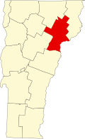
| County | Caledonia |
| Town | Lyndon |
| Area | |
• Total | 0.40 sq mi (1.03 km2) |
| • Land | 0.38 sq mi (0.99 km2) |
| • Water | 0.02 sq mi (0.04 km2) |
| Elevation | 715 ft (218 m) |
| Time zone | UTC-5 (Eastern (EST)) |
| • Summer (DST) | UTC-4 (EDT) |
| ZIP code | 05850 |
| Area code | 802 |
| GNIS feature ID | 2807127 [1] |
| FIPS code | 50-41800 |
Lyndon Center is an unincorporated village and census-designated place (CDP) in the town of Lyndon, Caledonia County, Vermont, United States. The community is located along the western border of Lyndonville. Lyndon Center has a post office with ZIP code 05850. [2] [3] The community was first listed as a CDP prior to the 2020 census. [1]