Sutton, Vermont

Last updated

Sutton, Vermont
Sutton vt highlight.png
Sutton, Vermont
Usa edcp location map.svg
Red pog.svg
Sutton, Vermont
Location in the United States
Coordinates: 44°39′15″N72°1′45″W / 44.65417°N 72.02917°W / 44.65417; -72.02917
Country United States
State Vermont
County Caledonia
CommunitiesSutton
East Sutton Ridge
Perry
Summit
Sutton Station
Area
  Total38.4 sq mi (99.4 km2)
  Land38.2 sq mi (98.9 km2)
  Water0.2 sq mi (0.5 km2)
Elevation
1,398 ft (426 m)
Population
 (2020)
  Total913
  Density24/sq mi (9.2/km2)
Time zone UTC-5 (Eastern (EST))
  Summer (DST) UTC-4 (EDT)
ZIP code
05867
Area code 802
FIPS code 50-71575 [1]
GNIS feature ID1462224 [2]

Sutton is a town in Caledonia County, Vermont, United States. The population was 913 at the 2020 census. [3]

Contents

History

Sutton was chartered on February 26, 1782 by the Vermont Legislature. Chartered as Billymead to Dr. Jonathan Arnold of Rhode Island and associates, and named for Arnold's younger son, William. By 1810, townsfolk had had enough of Billy and his name due to his bullying and drunken behavior, and at a town meeting they voted overwhelmingly to change the name to Sutton.

Villages and hamlets in Sutton include Sutton, Sutton Depot, and Summit Siding. The population at the 2010 US Census was 1,029.

Geography

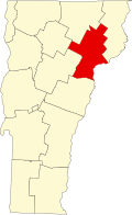
Sutton is located in northern Caledonia County. It is bordered by the town of Lyndon to the south, Wheelock to the southwest, Sheffield to the west, Barton to the northwest, Westmore to the north, Newark to the northeast, and Burke to the east. According to the United States Census Bureau, the town has a total area of 38.4 square miles (99.4 km2), of which 38.2 square miles (98.9 km2) is land and 0.19 square miles (0.5 km2), or 0.51%, is water. [4]

The highest point in Sutton is the summit of Mount Hor in the northern corner of town, with an elevation of 2,656 feet (809.5 m) above sea level. [5] The modest elevation of this town gives it a slightly cooler and wetter climate than nearby towns such as St. Johnsbury. Annual snowfall averages well over 100 inches per year at the weather station in the center of town.

Climate

Sutton has a humid continental climate (Koppen: Dfb), typified by large seasonal temperature differences, with warm to hot summers and cold winters. Exceptionally for such a small town, two NWS-certified weather stations have operated in the town for much of recent history. From January 1948 until spring 2017, the original station, located in a frost hollow at an altitude of about 1000 feet, reported data for the town. In January 2000, a new station was built in a hilly area a few miles away and at about 500 feet higher altitude. This station is still reporting today.

The two stations show distinct microclimates. At the valley station, a freeze has been recorded for every month of the year as well a temperature of at least 60 °F (16 °C). [6] The newer station has a much shorter period of record, but NOAA also lists mean monthly maximum and mean monthly minimum temperatures, which are the highest and lowest temperatures one can expect in a typical month each year. From this one can see that the hill station has much less variability of temperature, with much less chance of frost during the warm months.

Climate data for Sutton 2NE, Vermont, 1991–2020 normals: 1000ft (305m)
MonthJanFebMarAprMayJunJulAugSepOctNovDecYear
Record high °F (°C)61
(16)
61
(16)
77
(25)
85
(29)
88
(31)
95
(35)
95
(35)
96
(36)
96
(36)
80
(27)
70
(21)
58
(14)
96
(36)
Mean maximum °F (°C)44
(7)
46
(8)
57
(14)
75
(24)
83
(28)
88
(31)
89
(32)
88
(31)
84
(29)
73
(23)
62
(17)
46
(8)
90
(32)
Average high °F (°C)22.7
(−5.2)
26.6
(−3.0)
35.9
(2.2)
49.8
(9.9)
64.3
(17.9)
72.4
(22.4)
77.0
(25.0)
75.7
(24.3)
68.3
(20.2)
54.2
(12.3)
40.5
(4.7)
28.8
(−1.8)
51.4
(10.7)
Daily mean °F (°C)10.7
(−11.8)
12.9
(−10.6)
22.9
(−5.1)
37.3
(2.9)
50.3
(10.2)
59.4
(15.2)
64.0
(17.8)
62.1
(16.7)
54.4
(12.4)
42.4
(5.8)
30.7
(−0.7)
18.9
(−7.3)
38.8
(3.8)
Average low °F (°C)−1.3
(−18.5)
−0.8
(−18.2)
9.8
(−12.3)
24.7
(−4.1)
36.3
(2.4)
46.4
(8.0)
51.0
(10.6)
48.4
(9.1)
40.5
(4.7)
30.7
(−0.7)
20.8
(−6.2)
9.1
(−12.7)
26.3
(−3.2)
Mean minimum °F (°C)−26
(−32)
−24
(−31)
−17
(−27)
11
(−12)
23
(−5)
32
(0)
39
(4)
36
(2)
27
(−3)
18
(−8)
4
(−16)
−14
(−26)
−29
(−34)
Record low °F (°C)−38
(−39)
−38
(−39)
−31
(−35)
−1
(−18)
15
(−9)
23
(−5)
31
(−1)
31
(−1)
20
(−7)
11
(−12)
−10
(−23)
−29
(−34)
−38
(−39)
Average precipitation inches (mm)3.13
(80)
2.66
(68)
3.21
(82)
3.49
(89)
3.93
(100)
4.11
(104)
4.40
(112)
4.86
(123)
3.86
(98)
4.77
(121)
3.51
(89)
4.10
(104)
46.03
(1,170)
Average snowfall inches (cm)25.80
(65.5)
29.40
(74.7)
19.90
(50.5)
6.40
(16.3)
0.10
(0.25)
0.00
(0.00)
0.00
(0.00)
0.00
(0.00)
0.00
(0.00)
0.80
(2.0)
7.00
(17.8)
24.20
(61.5)
113.6
(288.55)
Source 1: NOAA [7]
Source 2: XMACIS (records & monthly max/mins) [8]

Four miles away on a hill, [9] a recently built weather station has data for the period from 2000 to 2020 only. The daily temperature amplitude is smaller, with warmer lows and cooler highs. Yet, despite the higher elevation [10] of the new station, its temperatures are slightly warmer than at the valley station. There is more rain and snow here, as well.

Climate data for Sutton, Vermont, 2000–2020 normals: 1500ft (457m)
MonthJanFebMarAprMayJunJulAugSepOctNovDecYear
Record high °F (°C)59
(15)
64
(18)
77
(25)
85
(29)
91
(33)
90
(32)
92
(33)
92
(33)
92
(33)
79
(26)
66
(19)
55
(13)
92
(33)
Mean maximum °F (°C)44
(7)
47
(8)
56
(13)
75
(24)
82
(28)
86
(30)
86
(30)
86
(30)
83
(28)
73
(23)
60
(16)
48
(9)
89
(32)
Average high °F (°C)23.2
(−4.9)
27.1
(−2.7)
36.1
(2.3)
49.4
(9.7)
63.2
(17.3)
70.7
(21.5)
75.9
(24.4)
74.9
(23.8)
68.2
(20.1)
54.1
(12.3)
40.4
(4.7)
29.3
(−1.5)
51.0
(10.6)
Daily mean °F (°C)13.6
(−10.2)
16.9
(−8.4)
25.9
(−3.4)
39.4
(4.1)
52.7
(11.5)
60.9
(16.1)
66.1
(18.9)
64.6
(18.1)
57.6
(14.2)
44.8
(7.1)
32.5
(0.3)
21.1
(−6.1)
41.3
(5.2)
Average low °F (°C)4.0
(−15.6)
6.6
(−14.1)
15.7
(−9.1)
29.4
(−1.4)
42.2
(5.7)
51.0
(10.6)
56.2
(13.4)
54.4
(12.4)
47.1
(8.4)
35.5
(1.9)
24.7
(−4.1)
12.8
(−10.7)
31.6
(−0.2)
Mean minimum °F (°C)−18
(−28)
−14
(−26)
−7
(−22)
16
(−9)
29
(−2)
38
(3)
46
(8)
44
(7)
32
(0)
23
(−5)
8
(−13)
−8
(−22)
−20
(−29)
Record low °F (°C)−30
(−34)
−26
(−32)
−19
(−28)
3
(−16)
25
(−4)
32
(0)
42
(6)
39
(4)
25
(−4)
17
(−8)
−2
(−19)
−25
(−32)
−30
(−34)
Average precipitation inches (mm)3.04
(77)
3.00
(76)
3.29
(84)
3.89
(99)
4.28
(109)
4.55
(116)
4.96
(126)
4.71
(120)
3.58
(91)
4.67
(119)
3.69
(94)
3.87
(98)
47.53
(1,209)
Average snowfall inches (cm)31.30
(79.5)
35.80
(90.9)
23.50
(59.7)
9.20
(23.4)
0.60
(1.5)
0.00
(0.00)
0.00
(0.00)
0.00
(0.00)
0.00
(0.00)
1.60
(4.1)
12.00
(30.5)
27.70
(70.4)
141.7
(360)
Source 1: XMACIS (Temp normals & max/mins) [8]
Source 2: NOAA (Precipitation & Snow) [11]

Demographics

Historical population
CensusPop.Note
1800 144
1810 433200.7%
1820 69761.0%
1830 1,00544.2%
1840 1,0686.3%
1850 1,001−6.3%
1860 987−1.4%
1870 920−6.8%
1880 838−8.9%
1890 746−11.0%
1900 694−7.0%
1910 7112.4%
1920 659−7.3%
1930 596−9.6%
1940 561−5.9%
1950 528−5.9%
1960 476−9.8%
1970 438−8.0%
1980 66752.3%
1990 85428.0%
2000 1,00117.2%
2010 1,0292.8%
2020 913−11.3%
U.S. Decennial Census [12]

As of the census [1] of 2000, there were 1,001 people, 366 households, and 270 families residing in the town. The population density was 26.2 people per square mile (10.1/km2). There were 439 housing units at an average density of 11.5 per square mile (4.4/km2). The racial makeup of the town was 97.60% White, 0.20% Native American, 0.20% Asian, 1.20% from other races, and 0.80% from two or more races. Hispanic or Latino of any race were 0.40% of the population.

There were 366 households, out of which 38.3% had children under the age of 18 living with them, 61.5% were married couples living together, 6.3% had a female householder with no husband present, and 26.2% were non-families. 18.6% of all households were made up of individuals, and 7.7% had someone living alone who was 65 years of age or older. The average household size was 2.73 and the average family size was 3.10.

In the town, the population was spread out, with 29.8% under the age of 18, 5.8% from 18 to 24, 27.9% from 25 to 44, 25.0% from 45 to 64, and 11.6% who were 65 years of age or older. The median age was 37 years. For every 100 females, there were 102.2 males. For every 100 females age 18 and over, there were 102.0 males.

The median income for a household in the town was $36,750, and the median income for a family was $40,368. Males had a median income of $27,303 versus $25,000 for females. The per capita income for the town was $14,564. About 10.5% of families and 13.0% of the population were below the poverty line, including 22.2% of those under age 18 and 17.9% of those age 65 or over.

Notable people

Related Research Articles

<span class="mw-page-title-main">Caledonia, Mississippi</span> Town in Mississippi, United States

Caledonia is a town in Lowndes County, Mississippi, United States, northeast of Columbus. The population was 1,041 at the 2010 census.

<span class="mw-page-title-main">New England, North Dakota</span> City in North Dakota, United States

New England is a city in Hettinger County, North Dakota, United States. The population was 683 at the 2020 census.

<span class="mw-page-title-main">Burke, Vermont</span> Town in Vermont, United States

Burke is a town in Caledonia County, Vermont, United States. The population was 1,651 at the 2020 census. The town contains the villages of East Burke, West Burke and Burke Hollow. The town is home to Burke Mountain and Burke Mountain Academy.

<span class="mw-page-title-main">Groton, Vermont</span> Town in Vermont, United States

Groton is a town in Caledonia County, Vermont, United States. The population was 984 at the 2020 census. It contains the places Groton Pond, Rickers Mills, Rickers and West Groton. The unincorporated village of Groton in the southeast corner of town is recorded as the Groton census-designated place (CDP), with a population of 419 at the 2020 census.

<span class="mw-page-title-main">Kirby, Vermont</span> Town in Vermont, United States

Kirby is a town in Caledonia County, Vermont, United States. The population was 575 at the 2020 census.

<span class="mw-page-title-main">Newark, Vermont</span> Town in Vermont, United States

Newark is a town in Caledonia County, Vermont, United States. The population was 584 at the 2020 census.

<span class="mw-page-title-main">Sheffield, Vermont</span> Town in Vermont, United States

Sheffield is a town in Caledonia County, Vermont, United States. The population was 682 at the 2020 census.

<span class="mw-page-title-main">Stannard, Vermont</span> Town in Vermont, United States

Stannard is a town in Caledonia County, Vermont. The population was 208 at the 2020 census. The town has no paved roads.

<span class="mw-page-title-main">Walden, Vermont</span> Town in Vermont, United States

Walden is a town in Caledonia County, Vermont, United States. The population was 956 at the 2020 census. The community has no ZIP code of its own; mail is routed through the West Danville and East Hardwick post offices.

<span class="mw-page-title-main">Waterford, Vermont</span> Town in Vermont, United States

Waterford is a town in Caledonia County, Vermont, United States. The population was 1,268 at the 2020 census.

West Burke is a village in the town of Burke, Caledonia County, Vermont, United States. The population was 281 at the 2020 census.

<span class="mw-page-title-main">Wheelock, Vermont</span> Town in Vermont, United States

Wheelock is a town in Caledonia County, Vermont, United States. The population was 759 at the 2020 census.

<span class="mw-page-title-main">Bloomfield, Vermont</span> Town in Vermont, United States

Bloomfield is a town in Essex County, Vermont, United States. The population was 217 at the 2020 census. It is part of the Berlin, NH–VT Micropolitan Statistical Area.

<span class="mw-page-title-main">Guildhall, Vermont</span> Town in Vermont, United States

Guildhall is a town in and the shire town of Essex County, Vermont. As of the 2020 census, the population was 262. According to a large sign in the town center, it is the only town in the world so named. The name derives from a meeting house on the square called the Guildhall.

<span class="mw-page-title-main">Jeffersonville, Vermont</span> Village in Vermont, United States

Jeffersonville is a village in the town of Cambridge, Vermont, United States. The population was 750 at the 2020 census.

<span class="mw-page-title-main">Morristown, Vermont</span> Town in Vermont, United States

Morristown is a town in Lamoille County, Vermont, United States. As of the 2020 census, the population was 5,434. Morristown is the largest town by population in Lamoille County, and its central village of Morrisville serves as the county's main commercial center.

<span class="mw-page-title-main">Chittenden, Vermont</span> Town in Vermont, United States

Chittenden is a town in Rutland County, Vermont, United States. The population was 1,237 at the 2020 census.

<span class="mw-page-title-main">Dover, Vermont</span> Town in Vermont, United States

Dover is a town in Windham County, Vermont, United States. The population was 1,798 at the 2020 census. It is famed for being the location of the Mount Snow ski area.

<span class="mw-page-title-main">Jacksonville, Vermont</span> Village in Vermont, United States

Jacksonville is a village in the town of Whitingham, Windham County, Vermont, United States. The population was 213 at the 2020 census.

<span class="mw-page-title-main">Londonderry, Vermont</span> Town in Vermont, United States

Londonderry is a town in Windham County, Vermont, United States. It is bounded on the north by Landgrove and Weston, on the east by Windham, on the south by Jamaica and on the west by Winhall and Landgrove. The population was 1,919 in the 2020 census. The town contains the villages of Londonderry and South Londonderry.

References

  1. 1 2 "U.S. Census website". United States Census Bureau . Retrieved August 12, 2016.
  2. "US Board on Geographic Names". United States Geological Survey. October 25, 2007. Retrieved August 12, 2016.
  3. "Census - Geography Profile: Sutton town, Caledonia County, Vermont". United States Census Bureau . Retrieved January 6, 2022.
  4. "Geographic Identifiers: 2010 Demographic Profile Data (G001): Sutton town, Caledonia County, Vermont". U.S. Census Bureau, American Factfinder. Archived from the original on February 12, 2020. Retrieved February 6, 2013.
  5. U.S. Geological Survey Sutton, VT 7.5-minute quadrangle, 1986.
  6. "Date! , - Climate Summary".
  7. "Sutton 2NE, Vermont 1991-2020 Monthly Normals" . Retrieved October 18, 2023.
  8. 1 2 "xmACIS". National Oceanic and Atmospheric Administration. Retrieved October 18, 2023.
  9. http://berkeleyearth.lbl.gov/auto/Stations/TAVG/Text/40342-TAVG-Data.txt [ bare URL plain text file ]
  10. "COOP library for state 43".
  11. "Sutton, Vermont 1991-2020 Monthly Normals" . Retrieved October 18, 2023.
  12. "U.S. Decennial Census". United States Census Bureau. Retrieved May 16, 2015.
  13. "Joint Concurrent House Resolution". State of Vermont. Retrieved August 12, 2016.
  14. "Edward Hoagland | American writer". Encyclopedia Britannica. Retrieved September 14, 2017.