In 1787, the fledgling United States defined the Northwest Territory, which included the area of present-day Indiana. In 1800, Congress separated Ohio from the Northwest Territory, designating the rest of the land as the Indiana Territory.[3] President Thomas Jefferson chose William Henry Harrison as the territory's first governor, and Vincennes was established as the territorial capital.[4] After the Michigan Territory was separated and the Illinois Territory was formed, Indiana was reduced to its current size and geography.[3] By December 1816 the Indiana Territory was admitted to the Union as a state.
Starting in 1794, Native American titles to Indiana lands were extinguished by usurpation, purchase, or war and treaty. The United States acquired land from the Native Americans in the 1809 treaty of Fort Wayne, and by the treaty of St. Mary's in 1818 considerably more territory became property of the government. This included the future Owen County. White settlers had been moving into the future Owen County area since 1816.[5]
The area in present-day Owen County was first placed under local jurisdiction in 1790, when Knox County was created. This all-encompassing county was repeatedly subdivided as its lands were occupied − in 1816 a portion was partitioned to create Sullivan County, and on February 2, 1818, another area to the south was partitioned to create Daviess County. That same winter (December 21, 1818) the state legislature took portions from northern Daviess and eastern Sullivan to create Owen County; it was named for Abraham Owen, a colonel in the US Army who had died at the Battle of Tippecanoe in 1811. The boundaries of this new county were reduced in 1822 when Putnam and in 1825 when Clay counties were created.
The first moves to organize the county's government were completed in 1819. In 1820 the first commissioners selected Spencer, the county's largest settlement, as its seat of government.[6]
In 1920, the United States census reported Owen County as the Center of Population for the US at a point 8 miles south-southeast of Spencer, Indiana. The center moved the shortest distance since census data collecting began in 1790 (just under 10 miles) from its previous center in Bloomington, Indiana. When the East experienced high rates of growth, as it did in the decades between 1890 and 1920, the Westward movement of the center slowed.[7]
Geography
Owen County's low hills were completely wooded before the nineteenth century. It is still largely tree-covered, but significant portions have been cleared and are dedicated to agriculture or urban use. Its highest point (934 feet/285 meters ASL) is a steep point 2.0 miles (3.2km) south of Quincy.[8] The White River flows southwestward through the lower central part, entering from Monroe County (its course delineates a portion of the border between Monroe and Owen counties), then continues its journey into Greene County.[9]
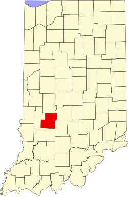
According to the 2010 United States census, the county has a total area of 387.82 square miles (1,004.4km2), of which 385.29 square miles (997.9km2) (or 99.35%) is land and 2.54 square miles (6.6km2) (or 0.65%) is water.
In recent years, average temperatures in Spencer have ranged from a low of 15°F (−9°C) in January to a high of 84°F (29°C) in July, although a record low of −33°F (−36°C) was recorded in January 1994 and a record high of 107°F (42°C) was recorded in July 1954. Average monthly precipitation ranged from 2.56 inches (65mm) in January to 4.97 inches (126mm) in May.[11]
County Council: The fiscal body of the county government, consisting of seven members. Three are elected county-wide (at-large members) and four are elected from districts. District One includes Harrison, Montgomery, Taylor, and Wayne Townships including the Town of Gosport. District Two includes Washington Township including the Town of Spencer. District Three includes Jackson, Jennings, Lafayette, and Morgan Townships. District Four includes Clay, Franklin, Jefferson, and Marion Townships. All council members serve four-year terms with at-large members elected during Presidential election cycles and district members elected during the other election cycles. One council member serves as president and another as vice-president. The council sets salaries, the annual budget, and special spending. The council has limited authority to impose local taxes, in the form of an income and property tax that is subject to state level approval, excise taxes, and service taxes. Several local boards such as the Alcoholic Beverage Board and Library Board have a member or members appointed by the council.[12][13][14]
Board of Commissioners: The executive body of the county; its three members are elected county-wide to four-year terms, however each must reside in their respective districts, two of which are elected during Presidential election cycles and the other during the other election cycles. Each serves a four-year term. The District One member must reside in Harrison, Jackson, Jennings, Montgomery, Taylor, or Wayne Townships. The District Two member must reside in Clay, Franklin, or Washington Townships. The District Three member must reside in Jefferson, Lafayette, Marion, or Morgan Townships. One commissioner serves as president and another as vice-president. Commissioners execute acts legislated by the council, collect revenue, and manage the county government.[12][13]
Court: The county has a Circuit Court. The judge on the court is elected to a term of six years and must be a member of the Indiana Bar Association.[13][15]
As of the 2010 United States census, there were 21,575 people, 8,486 households, and 5,992 families in the county.[23] The population density was 56.0 inhabitants per square mile (21.6/km2). There were 10,091 housing units at an average density of 26.2 per square mile (10.1/km2).[24] The racial makeup of the county was 97.9% white, 0.3% Asian, 0.3% American Indian, 0.3% black or African American, 0.2% from other races, and 0.9% from two or more races. Those of Hispanic or Latino origin made up 0.9% of the population.[23] In terms of ancestry, 28.7% were German, 20.7% were Irish, 8.9% were English, and 8.4% were American.[25]
Of the 8,486 households, 31.0% had children under the age of 18 living with them, 56.1% were married couples living together, 9.2% had a female householder with no husband present, 29.4% were non-families, and 24.0% of all households were made up of individuals. The average household size was 2.52 and the average family size was 2.96. The median age was 42.4 years.[23]
The median income for a household in the county was $47,697 and the median income for a family was $52,343. Males had a median income of $40,668 versus $30,556 for females. The per capita income for the county was $20,581. About 9.2% of families and 12.4% of the population were below the poverty line, including 17.8% of those under age 18 and 8.1% of those age 65 or over.<ref"> "Selected Economic Characteristics – 2006-2010 American Community Survey 5-Year Estimates". US Census Bureau. Archived from the original on February 14, 2020. Retrieved July 10, 2015.</ref>
This page is based on this Wikipedia article Text is available under the CC BY-SA 4.0 license; additional terms may apply. Images, videos and audio are available under their respective licenses.