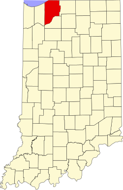
LaPorte County, Indiana

Last updated

LaPorte County
Laporte County Indiana courthouse 2.jpg
LaPorte County Courthouse in La Porte, Indiana
Map of Indiana highlighting LaPorte County.svg
Location in the state of Indiana
Map of USA IN.svg
Indiana's location in the U.S.
Coordinates: 41°36′N86°43′W / 41.600°N 86.717°W / 41.600; -86.717
CountryFlag of the United States (23px).png  United States
State Flag of Indiana.svg  Indiana
Regions Northwest Indiana and Michiana
Metro area Chicago Metropolitan
EstablishedApril 1, 1832
Named for "The Door" or "The Port" ( fr. ) [1]
County seat La Porte
Largest city Michigan City
(population and total area)
Incorporated
municipalities
11 cities and towns
Government
  Type County
  BodyBoard of Commissioners
  CommissionerConnie Gramarossa (R, 1st)
  CommissionerRichard Mrozinksi (R, 2nd)
  CommissionerJoe Haney (R, 3rd)
   County Council
Members
  • Justin Kiel(R)
  • Randy Novak (D)
  • Mark Yagelski (D)
  • Michael Rosenbaum (R)
  • Earl Cunningham (R)
  • Mike Mollenhauer (D)
  • Adam Koronka (R)
Area
   County 613.26 sq mi (1,588.3 km2)
  Land598.30 sq mi (1,549.6 km2)
  Water14.96 sq mi (38.7 km2)
  Metro
10,874 sq mi (28,160 km2)
  Rank 2nd largest county in Indiana
   Region 2,726 sq mi (7,060 km2)
Elevation
[2] (mean)
778 ft (237 m)
Highest elevation
[3] – SW Galena Twp
957 ft (292 m)
Lowest elevation
[4] – at Lake Michigan
581 ft (177 m)
Population
 (2020)
   County 112,417
  Rank 16th largest county in Indiana
  Density180/sq mi (71/km2)
   Metro
9,618,502
   Region
819,537
Time zone UTC−6 (Central)
  Summer (DST) UTC−5 (Central)
ZIP Codes
46340, 46345-46, 46348, 46350,
46352, 46360-61, 46365, 46371,
46382, 46390-91, 46532, 46552,
46554, 46574
Area code 219
Congressional districts 1st and 2nd
Indiana Senate districts5th and 8th
Indiana House of Representatives districts7th, 9th, 17th and 20th
FIPS code 18-091
GNIS feature ID0450507
Interstates I-80.svg Indiana Toll Road logo 1968.svg I-90.svg I-94.svg
U.S. Routes US 6.svg US 12.svg US 20.svg US 30.svg US 35.svg US 421.svg
State Routes Indiana 2.svg Indiana 4.svg Indiana 8.svg Indiana 39.svg Indiana 104.svg Indiana 212.svg
Airports La Porte Municipal
Michigan City Municipal
Waterways East Arm Little Calumet River
Kankakee River
Lake Michigan
Little Calumet River
Trail Creek
Amtrak station Michigan City (closed)
South Shore Line stations 11th StreetCarroll Avenue Hudson Lake
Public transit Michigan City Transit
Website www.laportecounty.org
  • Indiana county number 46

LaPorte County [5] is a county located in the U.S. state of Indiana. As of 2020, the population was 112,417. [6] The county seat is the city of La Porte, [7] and the largest city is Michigan City. This county is part of the Northwest Indiana and Michiana regions of the Chicago metropolitan area. The LaPorte County Courthouse is located in the county seat of La Porte and is listed on the National Register of Historic Places.

Contents

History

LaPorte County was formed in 1832. La porte means "the door" or "the port" in French. [1] French travelers or explorers so named the area after discovering a natural opening in the dense forests that used to exist in this region, providing a gateway to lands further west. [8] [9]

From 1832 to 1835 LaPorte County had its boundaries and jurisdiction of the land west of it going all the way to the east border of Chicago in Cook County, IL (land which is now Porter and Lake Counties).

Before European-American settlement, all of the land that forms modern-day LaPorte County, and adjacent Starke County to the south belonged to the Potawatomi Indian nation. These Indians were forcibly removed to Kansas by the United States government in 1838, and many died on what survivors called the Trail of Death. [10] [11]

LaPorte County's initial European-American settlers were Yankee migrants, that is to say they were from New England or were from upstate New York and had parents who were from New England, and were descended from the English Puritans who settled New England in the colonial era. They were part of a wave of New England settlers moving west into what was then the Northwest Territory after the completion of the Erie Canal through the Mohawk Valley of New York State.

These first settlers in LaPorte County specifically hailed from the Massachusetts towns of Granville, Boston, Bridgewater, West Bridgewater, Andover, Nantucket Island, and Hampshire County; the Connecticut towns of Colchester, Wethersfield, Granby, and New Haven; the New Hampshire towns of Bradford, Amherst and Goffstown; the Vermont villages of Dorset, Albany and Fairfax; many also came from Orange County, Vermont, Caledonia County, Vermont and Penobscot County, Maine. They were mainly members of the Congregational Church. As result of the Second Great Awakening, many became Baptists and many also converted to Pentecostalism and Methodism. When they arrived in what is now LaPorte County, there was nothing but virgin forest and prairie. The New England settlers cleared roads and brush, developed farms, constructed churches, erected government buildings, and established post routes. As a result of this migration, La Porte County was partially culturally continuous with early New England culture for many years. [12]

But by 1850, the three Eastern states that had contributed the most residents to LaPorte County were New York, Pennsylvania and Virginia, surpassing those migrants from New England. LaPorte County had the largest number of Southerners north of the Wabash Valley. [13]

During the Civil War, the Louisville Journal noted that the 29th Indiana Regiment (mustered out of LaPorte) "may almost be regarded as a Kentucky regiment for a large majority of its members are either natives or descendants of native Kentuckians". [14] Three Union Camps reigned in LaPorte County helping the Union to Civil War victory.

When the county was initially proposed and organized, its boundaries did not extend as far south or east as they do today. A section of land north of the Kankakee River originally belonged to Starke County. However, residents living in that area had difficulty crossing the river in order to reach the rest of the county. It was necessary to travel some distance east to Lemon's bridge, before making the journey south. Effectively isolated from the rest of Starke County, these residents asked that their land be annexed to LaPorte County, which was completed on January 28, 1842. Thereafter, the Kankakee River formed the southern boundary of the county. Finally, on January 10, 1850, some twenty sections of land were annexed from St. Joseph County to the east, giving LaPorte County the boundaries that essentially exist to this day. [10]

Whether the correct spelling of the city and county is "La Porte" or "LaPorte" is disputed, [15] although state law refers to "LaPorte County." [16] [17]

LaPorte County is noted for being the place of the Belle Gunness serial murders. Gunness lived on a farm on the outskirts of the county seat.

Geography

According to the 2010 census, the county has a total area of 613.26 square miles (1,588.3 km2), of which 598.30 square miles (1,549.6 km2) (or 97.56%) is land and 14.96 square miles (38.7 km2) (or 2.44%) is water. [18] The highest point, at 957 feet (292 m), [3] is in southwestern Galena Township near County Roads East 600 North and North 150 East. The lowest point, at 581 feet (177 m), [4] is along the Lake Michigan shoreline.

Adjacent counties

National protected area

Major highways

Railroads

Municipalities

The municipalities in LaPorte County and their populations as of the 2010 Census:

Cities

Towns

Census-designated places

Unincorporated communities

Townships

LaPorte County contains 21 townships, more than any other county in the state. [19] The townships, with their populations as of the 2010 Census, are:

Unincorporated towns

Demographics

Historical population
CensusPop.Note
1840 8,184
1850 12,14548.4%
1860 22,91988.7%
1870 27,06218.1%
1880 30,98514.5%
1890 34,44511.2%
1900 38,38611.4%
1910 45,79719.3%
1920 50,44310.1%
1930 60,49019.9%
1940 63,6605.2%
1950 76,80820.7%
1960 95,11123.8%
1970 105,34210.8%
1980 108,6323.1%
1990 107,066−1.4%
2000 110,1062.8%
2010 111,4671.2%
2020 112,4170.9%
U.S. Decennial Census [20]
1790-1960 [21] 1900-1990 [22]
1990-2000 [23] 2010 [24]
LaPorte County racial composition as of 2020 (NH = Non-Hispanic) [lower-alpha 1]
RacePop 2010 [27] Pop 2020 [28] % 2010% 2020
White (NH)90,69585,95781.4%76.5%
Black or African American (NH)11,85311,87410.6%10.6%
Native American or Alaska Native (NH)2462500.2%0.2%
Asian (NH)5707430.5%0.7%
Pacific Islander (NH)13180.0%0.0%
Some Other Race (NH)974670.1%0.4%
Mixed/Multi-Racial (NH)1,9185,1231.7%4.6%
Hispanic or Latino 6,0937,9855.5%7.1%
Total111,467112,417

As of the 2010 United States Census, there were 111,467 people, 42,331 households, and 28,228 families residing in the county. [29] The population density was 186.3 inhabitants per square mile (71.9/km2). There were 48,448 housing units at an average density of 81.0 per square mile (31.3/km2). [18] The racial makeup of the county was 84.1% white, 10.8% black or African American, 0.5% Asian, 0.3% American Indian, 2.0% from other races, and 2.3% from two or more races. Those of Hispanic or Latino origin made up 5.5% of the population. [29] In terms of ancestry, 30.7% were German, 15.3% were Irish, 11.5% were Polish, 8.3% were English, and 5.9% were American. [30]

Of the 42,331 households, 31.0% had children under the age of 18 living with them, 48.3% were married couples living together, 12.8% had a female householder with no husband present, 33.3% were non-families, and 27.3% of all households were made up of individuals. The average household size was 2.48 and the average family size was 3.00. The median age was 39.6 years. [29]

The median income for a household in the county was $47,697 and the median income for a family was $56,679. Males had a median income of $45,537 versus $30,774 for females. The per capita income for the county was $22,599. About 9.9% of families and 13.8% of the population were below the poverty line, including 22.7% of those under age 18 and 7.1% of those age 65 or over. [31]

Education

K-12 schools

School districts include: [32]

Public libraries

The county is served by five different public library systems:

Hospitals

Climate and weather

La Porte, Indiana
Climate chart (explanation)
J
F
M
A
M
J
J
A
S
O
N
D
 
 
1.8
 
 
30
12
 
 
1.7
 
 
36
16
 
 
3
 
 
47
27
 
 
4.1
 
 
60
37
 
 
4.3
 
 
71
47
 
 
4.8
 
 
80
58
 
 
3.9
 
 
84
62
 
 
3.9
 
 
81
60
 
 
3.3
 
 
75
51
 
 
3
 
 
63
39
 
 
3.6
 
 
48
30
 
 
2.7
 
 
35
19
Average max. and min. temperatures in °F
Precipitation totals in inches
Source: The Weather Channel [40]
Metric conversion
J
F
M
A
M
J
J
A
S
O
N
D
 
 
47
 
 
−1
−11
 
 
43
 
 
2
−9
 
 
75
 
 
8
−3
 
 
104
 
 
16
3
 
 
110
 
 
22
8
 
 
122
 
 
27
14
 
 
98
 
 
29
17
 
 
98
 
 
27
16
 
 
85
 
 
24
11
 
 
76
 
 
17
4
 
 
91
 
 
9
−1
 
 
69
 
 
2
−7
Average max. and min. temperatures in °C
Precipitation totals in mm

In recent years, average temperatures in La Porte have ranged from a low of 12 °F (−11 °C) in January to a high of 84 °F (29 °C) in July, although a record low of −28 °F (−33 °C) was recorded in January 1977 and a record high of 104 °F (40 °C) was recorded in June 1988. Average monthly precipitation ranged from 1.68 inches (43 mm) in February to 4.79 inches (122 mm) in June. [40]

Education

Public schools in LaPorte County are administered by seven different districts:

Colleges and Universities

Government

The county government is a constitutional body and is granted specific powers by the Constitution of Indiana, and by the Indiana Code.

United States presidential election results for LaPorte County, Indiana [49]
Year Republican Democratic Third party
No.%No.%No.%
2020 25,99752.54%22,42745.32%1,0592.14%
2016 22,68749.74%19,79843.41%3,1246.85%
2012 18,61542.62%24,10755.19%9592.20%
2008 17,91838.11%28,25860.10%8421.79%
2004 20,91649.09%21,11449.56%5761.35%
2000 18,99447.79%19,73649.65%1,0172.56%
1996 14,10635.82%19,87950.48%5,39213.69%
1992 14,96235.24%17,71741.72%9,78423.04%
1988 20,53753.64%17,58545.93%1630.43%
1984 23,34659.00%15,90440.20%3170.80%
1980 22,42455.32%15,38737.96%2,7276.73%
1976 21,98954.09%18,21744.81%4491.10%
1972 26,24365.98%13,22233.24%3110.78%
1968 20,29549.76%15,78038.69%4,70811.54%
1964 16,27042.16%22,22057.57%1040.27%
1960 22,73852.71%20,31747.10%850.20%
1956 24,62262.90%14,41736.83%1030.26%
1952 22,57659.83%15,01139.78%1460.39%
1948 15,66152.45%13,92346.63%2750.92%
1944 16,54354.12%13,89645.46%1290.42%
1940 15,77153.29%13,73246.40%900.30%
1936 11,72242.79%15,35956.07%3111.14%
1932 10,73941.31%14,89057.28%3661.41%
1928 14,76361.32%9,25438.44%580.24%
1924 11,59761.22%5,21427.52%2,13211.25%
1920 11,20465.00%5,45931.67%5753.34%
1916 5,72650.29%5,27646.33%3853.38%
1912 2,70124.87%4,84744.62%3,31430.51%
1908 5,82449.52%5,68048.30%2562.18%
1904 5,95255.68%4,47241.84%2652.48%
1900 4,80949.52%4,78349.25%1191.23%
1896 4,69150.28%4,51148.35%1271.36%
1892 3,54841.95%4,70355.61%2062.44%
1888 3,72244.11%4,60754.60%1091.29%

County Council: The county council is the fiscal-legislative branch of the county government and controls all the spending and revenue collection in the county. Representatives are elected from county districts. The council members serve four-year terms. They are responsible for setting salaries, the annual budget, and special spending. The council also has limited authority to impose local taxes, in the form of income and property taxes that are subject to state-level approval, excise taxes, and service taxes. [50] [51]

Board of Commissioners: The executive-legislative body of the county is the board of commissioners. The commissioners are elected county-wide, in staggered terms, and each serves a four-year term. One of the commissioners, typically the most senior, serves as president. The commissioners are charged with executing the acts legislated by the council, collecting revenue, and managing the day-to-day functions of the county government. [50] [51]

Court: The county has five elected trial court judges. They include the LaPorte Circuit Court and Superior Courts one through four. The judges are elected to six-year terms on partisan ballots. Superior Courts three and four maintain small claims dockets. Decisions from any trial court may be appealed to the Indiana Court of Appeals. [51] The Circuit Court and Superior court three are located in the city of La Porte; Superior courts one, two and four are located in Michigan City.

County Officials: The county has several other elected offices, including sheriff, coroner, auditor, treasurer, recorder, surveyor, and circuit court clerk. Each of these elected officers serves a term of four years and oversees a different part of county government. Members elected to county government positions are required to declare party affiliations and to be residents of the county. [51]

LaPorte County is split between Indiana's 1st and Indiana's 2nd congressional district and is represented by Rudy Yakym and Frank Mrvan in the United States Congress. It is also part of Indiana Senate districts 5 and 8 [52] and Indiana House of Representatives districts 7, 9, 17 and 20. [53]

County elected officials:

Board of Commissioners: [54]
County Council: [55]

See also

Notes

  1. Note: the US Census treats Hispanic/Latino as an ethnic category. This table excludes Latinos from the racial categories and assigns them to a separate category. Hispanics/Latinos can be of any race. [25] [26]

    Related Research Articles

    <span class="mw-page-title-main">Cass County, Michigan</span> County in Michigan, United States

    Cass County is a county in the U.S. state of Michigan. As of the 2020 Census, the population was 51,589. Its county seat is Cassopolis.

    <span class="mw-page-title-main">Berrien County, Michigan</span> County in Michigan, United States

    Berrien County is a county in the U.S. state of Michigan. It is located at the southwest corner of the state's Lower Peninsula, located on the shore of Lake Michigan and sharing a land border with Indiana. As of the 2020 Census, the population was 154,316. The county seat is St. Joseph.

    <span class="mw-page-title-main">Starke County, Indiana</span> County in Indiana, United States

    Starke County is a county in the U.S. state of Indiana. As of the 2020 United States Census, its population was 23,371. The county seat is Knox.

    <span class="mw-page-title-main">St. Joseph County, Indiana</span> County in Indiana, United States

    St. Joseph County, commonly called St. Joe County by residents, is a county located in the U.S. state of Indiana. As of the 2020 census, the population was 272,912, making it the fifth-most populous county in Indiana. Formed in 1830, it was named for the St. Joseph River which flows through it to Lake Michigan. The county seat is South Bend. St. Joseph County is part of the South Bend–Mishawaka, IN–MI "Michiana", Metropolitan Statistical Area.

    <span class="mw-page-title-main">Porter County, Indiana</span> County in Indiana, United States

    Porter County is a county in the U.S. state of Indiana. As of 2020, the population was 173,215, making it the 10th most populous county in Indiana. The county seat is Valparaiso. The county is part of Northwest Indiana, as well as the Chicago metropolitan area. Porter County is the site of much of the Indiana Dunes, an area of ecological significance. The Hour Glass Museum in Ogden Dunes documents the region's ecological significance.

    <span class="mw-page-title-main">Lake County, Indiana</span> County in Indiana, United States

    Lake County is a county located in the U.S. state of Indiana. In 2020, its population was 498,700, making it Indiana's second-most populous county. The county seat is Crown Point. The county is part of Northwest Indiana and the Chicago metropolitan area, and contains a mix of urban, suburban and rural areas. It is bordered on the north by Lake Michigan and contains a portion of the Indiana Dunes. It includes Marktown, Clayton Mark's planned worker community in East Chicago.

    <span class="mw-page-title-main">LaGrange County, Indiana</span> County in Indiana, United States

    LaGrange County is a county located in the U.S. state of Indiana. As of 2020, the population was 40,446. The county seat is LaGrange, Indiana.

    <span class="mw-page-title-main">Kingsford Heights, Indiana</span> Town in Indiana, United States

    Kingsford Heights is a town in Union Township, LaPorte County, Indiana, United States. The population was 1,335 at the 2020 census. It is included in the Michigan City, Indiana-La Porte, Indiana Metropolitan Statistical Area. Also known as "Victory City," the town was built by the United States government for workers that worked in the Kingsbury Ordnance Plant, an ammunitions plant that served the US during World War II and later the Korean War.

    <span class="mw-page-title-main">La Porte, Indiana</span> City in Indiana, United States

    La Porte is a city in LaPorte County, Indiana, United States, of which it is the county seat. Its population was estimated to be 21,341 in 2022. It is one of the two principal cities of the Michigan City-La Porte, Indiana metropolitan statistical area, which is included in the Chicago–Naperville–Michigan City, Illinois–Indiana–Wisconsin combined statistical area.

    <span class="mw-page-title-main">Michiana Shores, Indiana</span> Town in Indiana, United States

    Michiana Shores is a town in Springfield and Michigan townships, LaPorte County, Indiana, United States. The population was 313 at the 2010 census. It is included in the Michigan City, Indiana-La Porte, Indiana Metropolitan Statistical Area. Michiana Shores is located in northwesternmost Springfield Township, and is the township's sole incorporated community.

    <span class="mw-page-title-main">Westville, Indiana</span> Town in Indiana, United States

    Westville is a town in New Durham Township, LaPorte County, Indiana, United States. The population, as of the 2020 census is 5257. It is included in the Michigan City, Indiana-La Porte, Indiana Metropolitan Statistical Area. Westville is located in Northwest Indiana, also known as The Region.

    <span class="mw-page-title-main">New Carlisle, Indiana</span> Town in Indiana, United States

    New Carlisle is a town in Olive Township, St. Joseph County, in the U.S. state of Indiana. The population was 1,891, as of the 2020 Census. It is part of the South Bend–Mishawaka, IN-MI, Metropolitan Statistical Area.

    <span class="mw-page-title-main">Indiana's 1st congressional district</span> U.S. House district for Indiana

    Indiana's 1st congressional district is an electoral district for the U.S. Congress in Northwestern Indiana. The district is based in Gary and its surrounding suburbs and exurbs. It consists of all of Lake and Porter counties, as well as most of the western part La Porte County, on the border with Michigan. Redistricting passed by the Indiana General Assembly in 2011 shifted the district's boundaries, effective January 2013, to include all of Lake and Porter counties and the western and northwestern townships of La Porte County, while moving Benton, Jasper and Newton counties out of the district.

    <span class="mw-page-title-main">Davis Township, Starke County, Indiana</span> Township in Indiana, United States

    Davis Township is one of nine townships in Starke County, in the U.S. state of Indiana. As of the 2010 census, its population was 1,043 and it contained 439 housing units.

    <span class="mw-page-title-main">Jackson Township, Starke County, Indiana</span> Township in Indiana, United States

    Jackson Township is one of nine townships in Starke County, in the U.S. state of Indiana. At the 2010 census, its population was 549 and it contained 222 housing units.

    <span class="mw-page-title-main">Railroad Township, Starke County, Indiana</span> Township in Indiana, United States

    Railroad Township is one of nine townships in Starke County, in the U.S. state of Indiana. As of the 2010 census, its population was 1,226 and it contained 549 housing units.

    <span class="mw-page-title-main">New Durham Township, LaPorte County, Indiana</span> Township in Indiana, United States

    New Durham Township is one of twenty-one townships in LaPorte County, Indiana. As of the 2010 census, its population was 8,664 and it contained 2,396 housing units.

    <span class="mw-page-title-main">Olive Township, St. Joseph County, Indiana</span> Township in Indiana, United States

    Olive Township is one of thirteen townships in St. Joseph County, in the U.S. state of Indiana. As of the 2000 census, its population was 3,914.

    <span class="mw-page-title-main">Rolling Prairie, Indiana</span> Census-designated place in Indiana, United States

    Rolling Prairie is an unincorporated community and census-designated place (CDP) in Kankakee Township, LaPorte County, Indiana, United States. As of the 2010 census, it had a population of 582.

    South Wanatah is an unincorporated community in Cass Township, LaPorte County, Indiana.

    References

    1. 1 2 "Origin of Indiana County Names". Indiana Historical Bureau. Retrieved October 14, 2014.
    2. "LaPorte County". Geographic Names Information System . United States Geological Survey, United States Department of the Interior.
    3. 1 2 Springville Quadrangle – Indiana – LaPorte Co (Map). 1:24,000. 7.5-Minute Series (Topographic). United States Geological Survey. 2013.
    4. 1 2 Michigan City West Quadrangle – Indiana – LaPorte Co (Map). 1:24,000. 7.5-Minute Series (Topographic). United States Geological Survey. 2013.
    5. LaPorte County Information Technology. "LaPorte County Online Government". laportecounty.org.
    6. "La Porte County, Indiana". United States Census Bureau . Retrieved June 2, 2023.
    7. "Find a County". National Association of Counties. Retrieved June 7, 2011.
    8. Calumet Beginnings: Schoon, Kenneth J. (2003)
    9. De Witt Clinton Goodrich & Charles Richard Tuttle (1875). An Illustrated History of the State of Indiana. Indiana: R. S. Peale & co. p. 560.
    10. 1 2 "La Porte County Historical Society". Archived from the original on May 17, 2008.
    11. "History of 1838 Trail of Death". potawatomi-tda.org.
    12. The Expansion of New England: The Spread of New England Settlement and Institutions to the Mississippi River, 1620-1865, by Lois Kimball Matthews, pp. 201-202
    13. Lang, Elfrieda. “Southern Migration to Northern Indiana Before 1850.” Indiana Magazine of History, Volume 50, Issue 4, pp 349-356. 1954. Lang, Elfrieda. “An Analysis of Northern Indiana’s Population in 1850.” Indiana Magazine of History, Volume 49, Issue 1, March 1953. Rose, Gregory C.” Upland Southerners: The County Origins of Southern Migrants.” Indiana Magazine of History, Volume 82, Issue 3, September 1991.
    14. La Porte Herald, 19 October 1861, p. 2
    15. Stephens, Dave (January 22, 2012). "La(?)Porte's Space Odyssey". South Bend Tribune . Retrieved January 26, 2012.
    16. Indiana Code 33-33-46.
    17. Indiana Code 3-3-5.
    18. 1 2 "Population, Housing Units, Area, and Density: 2010 - County". United States Census Bureau. Archived from the original on February 12, 2020. Retrieved July 10, 2015.
    19. Daniels, E. D. (1904). A twentieth century history and biographical record of La Porte County, Indiana. Lewis Publishing Co. p. 38.
    20. "U.S. Decennial Census". United States Census Bureau. Retrieved July 10, 2014.
    21. "Historical Census Browser". University of Virginia Library. Retrieved July 10, 2014.
    22. "Population of Counties by Decennial Census: 1900 to 1990". United States Census Bureau. Retrieved July 10, 2014.
    23. "Census 2000 PHC-T-4. Ranking Tables for Counties: 1990 and 2000" (PDF). United States Census Bureau. Retrieved July 10, 2014.
    24. "La Porte County QuickFacts". United States Census Bureau. Archived from the original on June 7, 2011. Retrieved September 25, 2011.
    25. https://www.census.gov/ [ not specific enough to verify ]
    26. "About the Hispanic Population and its Origin". www.census.gov. Retrieved May 18, 2022.
    27. "American Fact Finder". American Fact Finder. Archived from the original on February 12, 2020. Retrieved March 11, 2024.
    28. "Explore Census Data". data.census.gov. Retrieved March 11, 2024.
    29. 1 2 3 "DP-1 Profile of General Population and Housing Characteristics: 2010 Demographic Profile Data". United States Census Bureau. Archived from the original on February 12, 2020. Retrieved July 10, 2015.
    30. "DP02 SELECTED SOCIAL CHARACTERISTICS IN THE UNITED STATES – 2006-2010 American Community Survey 5-Year Estimates". United States Census Bureau. Archived from the original on February 14, 2020. Retrieved July 10, 2015.
    31. "DP03 SELECTED ECONOMIC CHARACTERISTICS – 2006-2010 American Community Survey 5-Year Estimates". United States Census Bureau. Archived from the original on February 14, 2020. Retrieved July 10, 2015.
    32. "2020 CENSUS - SCHOOL DISTRICT REFERENCE MAP: LaPorte County, IN" (PDF). U.S. Census Bureau . Retrieved July 22, 2022. - Text list
    33. "LaCrosse Public Library" . Retrieved June 28, 2014.
    34. "LaPorte County Public Library" . Retrieved June 28, 2014.
    35. "Michigan City Public Library" . Retrieved June 28, 2014.
    36. "Wanatah Public Library" . Retrieved June 28, 2014.
    37. "Westville-New Durham Township Public Library" . Retrieved June 28, 2014.
    38. "Northwest Health – La Porte". Gresham Smith. Retrieved April 27, 2023.
    39. "Franciscan Health is New Name for Leading Hospital System". Franciscan Alliance, Inc. September 6, 2016. Retrieved September 11, 2016.
    40. 1 2 "Monthly Averages for La Porte, Indiana". The Weather Channel. Retrieved January 27, 2011.
    41. "John Glenn School Corporation".
    42. "LaPorte Community School Corporation".
    43. "Metropolitan School District of New Durham Township".
    44. "Michigan City Area Schools".
    45. "New Prairie United School Corporation".
    46. "South Central Community School Corporation".
    47. "Tri-Township Consolidated School Corporation".
    48. Joseph S. Pete (March 5, 2016). "Purdue University Northwest now officially exists". The Times of Northwest Indiana . Retrieved March 5, 2016.
    49. Leip, David. "Dave Leip's Atlas of U.S. Presidential Elections". uselectionatlas.org. Retrieved May 18, 2018.
    50. 1 2 Indiana Code. "Title 36, Article 2, Section 3". IN.gov. Retrieved September 16, 2008.
    51. 1 2 3 4 Indiana Code. "Title 2, Article 10, Section 2" (PDF). IN.gov. Retrieved September 16, 2008.
    52. "Indiana Senate Districts". State of Indiana. Retrieved July 14, 2011.
    53. "Indiana House Districts". State of Indiana. Retrieved July 14, 2011.
    54. LaPorte County Information Technology. "Board of Commissioners". laportecounty.org.
    55. LaPorte County Information Technology. "LaPorte County Council". laportecounty.org.

    Commons-logo.svg Media related to LaPorte County, Indiana at Wikimedia Commons