Dearborn County, Indiana

Last updated

Dearborn County
Dearborn County Courthouse, Lawrenceburg, IN (48370088711).jpg
Map of Indiana highlighting Dearborn County.svg
Location within the U.S. state of Indiana
Indiana in United States.svg
Indiana's location within the U.S.
Coordinates: 39°09′N84°59′W / 39.15°N 84.98°W / 39.15; -84.98
CountryFlag of the United States.svg United States
StateFlag of Indiana.svg  Indiana
Founded1803
Named for Dr. Henry Dearborn
Seat Lawrenceburg
Largest cityLawrenceburg
Area
  Total307.42 sq mi (796.2 km2)
  Land305.03 sq mi (790.0 km2)
  Water2.38 sq mi (6.2 km2)  0.77%
Population
 (2020)
  Total50,679
  Estimate 
(2023)
51,215 Increase2.svg
  Density160/sq mi (64/km2)
Demonym Dearbornian
Time zone UTC−5 (Eastern)
  Summer (DST) UTC−4 (EDT)
Congressional district 6th
Website www.dearborncounty.org
Indiana county number 15
Lawrenceburg on the Ohio River, from the air. AEP's Tanner's Creek Generating Station at lower-left. Lawrenceburg-indiana-from-above.jpg
Lawrenceburg on the Ohio River, from the air. AEP's Tanner's Creek Generating Station at lower-left.

Dearborn County is one of 92 counties of the U.S. state of Indiana. Located on the Ohio border near the southeast corner of the state, Dearborn County was formed in 1803 from a portion of Hamilton County, Ohio. In 2020, the population was 50,679. [1] The county seat and largest city is Lawrenceburg. [2] Dearborn County is part of the Cincinnati, OH-KY-IN Metropolitan Statistical Area.

Contents

History

In 1803, following Ohio's admission to the Union, a wedge, or pie shaped, remnant of the former Northwest Territory along Ohio's southwestern border was ceded to Indiana Territory and organized as Dearborn County. It was named after Henry Dearborn who was U.S. Secretary of War at that time. [3] Lawrenceburg was then designated as the county seat.

All or part of seven other present day counties were carved from the original county with the present boundaries being established in 1845. The region, nicknamed the "Gore", slices through the present-day counties of Dearborn, Franklin, Ohio, Randolph, Switzerland, Union, Wayne and Fayette. [4] Subdivision of Dearborn County began in 1811 with the formation of Franklin and Wayne Counties, followed by Switzerland in 1814. [4]

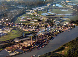
Early growth in the region was centered on Lawrenceburg which became an important railroad junction connecting two of the regions major rail lines. [5] A contention existed between the towns of Lawrenceburg and the mostly German-speaking immigrants that dominated Rising Sun over the favored status of Lawrenceburg as the county seat. The rivalry between the two towns was resolved in 1844 when the Indiana State legislature separated the portion of Dearborn County south of Laughery Creek and created the last and smallest Indiana county, county of Ohio on March 1, 1844, with Rising Sun designated as its county seat. [6]

Geography

According to the 2010 census, the county has a total area of 307.42 square miles (796.2 km2), of which 305.03 square miles (790.0 km2) (or 99.22%) is land and 2.38 square miles (6.2 km2) (or 0.77%) is water. [7] Part of the southeastern county line is formed by the Ohio River.


Cities

Towns

Census-designated places

Other unincorporated communities

Townships

Adjacent counties

Climate

In recent years, average temperatures in Lawrenceburg have ranged from a low of 21 °F (−6 °C) in January to a high of 86 °F (30 °C) in July, although a record low of −27 °F (−33 °C) was recorded in January 1994 and a record high of 107 °F (42 °C) was recorded in July 1988. Average monthly precipitation ranged from 2.94 inches (75 mm) in September to 5.53 inches (140 mm) in May. [8]

Lawrenceburg, Indiana
Climate chart (explanation)
J
F
M
A
M
J
J
A
S
O
N
D
 
 
3.5
 
 
38
21
 
 
3
 
 
44
24
 
 
4.4
 
 
54
31
 
 
4.4
 
 
64
39
 
 
5.5
 
 
74
49
 
 
4.6
 
 
82
58
 
 
4.6
 
 
86
63
 
 
4
 
 
85
62
 
 
2.9
 
 
79
55
 
 
3.2
 
 
67
43
 
 
3.8
 
 
55
35
 
 
3.7
 
 
43
26
Average max. and min. temperatures in °F
Precipitation totals in inches
Source: The Weather Channel [8]
Metric conversion
J
F
M
A
M
J
J
A
S
O
N
D
 
 
89
 
 
3
−6
 
 
77
 
 
7
−4
 
 
111
 
 
12
−1
 
 
112
 
 
18
4
 
 
140
 
 
23
9
 
 
117
 
 
28
14
 
 
116
 
 
30
17
 
 
100
 
 
29
17
 
 
75
 
 
26
13
 
 
80
 
 
19
6
 
 
97
 
 
13
2
 
 
93
 
 
6
−3
Average max. and min. temperatures in °C
Precipitation totals in mm

Demographics

Historical population
CensusPop.Note
1810 7,310
1820 11,46856.9%
1830 13,97421.9%
1840 19,32738.3%
1850 20,1664.3%
1860 24,40621.0%
1870 24,116−1.2%
1880 26,67110.6%
1890 23,364−12.4%
1900 22,194−5.0%
1910 21,396−3.6%
1920 20,033−6.4%
1930 21,0565.1%
1940 23,0539.5%
1950 25,1419.1%
1960 28,67414.1%
1970 29,4302.6%
1980 34,29116.5%
1990 38,83513.3%
2000 46,10918.7%
2010 50,0478.5%
2020 50,6791.3%
2023 (est.)51,215 [9] 1.1%
U.S. Decennial Census [10]
1790-1960 [11] 1900-1990 [12]
1990-2000 [13] 2010-2013 [1]

At the 2010 United States Census, there were 50,047 people, 18,743 households and 13,773 families residing in the county. [14] The population density was 164.1 inhabitants per square mile (63.4/km2). There were 20,171 housing units at an average density of 66.1 per square mile (25.5/km2). [7] The racial makeup of the county was 97.5% white, 0.6% black or African American, 0.4% Asian, 0.2% American Indian, 0.1% Pacific islander, 0.3% from other races, and 1.0% from two or more races. Those of Hispanic or Latino origin made up 1.0% of the population. [14] In terms of ancestry, 46.5% were German, 19.2% were Irish, 11.4% were English, and 7.8% were American. [15]

Of the 18,743 households, 35.1% had children under the age of 18 living with them, 58.5% were married couples living together, 10.0% had a female householder with no husband present, 26.5% were non-families, and 22.0% of all households were made up of individuals. The average household size was 2.64 and the average family size was 3.07. The median age was 40.0 years. [14]

The median household income was $47,697 and the median family income was $66,561. Males had a median income of $45,270 and females $33,353. The per capita income was $25,023. About 4.5% of families and 7.2% of the population were below the poverty line, including 8.5% of those under age 18 and 6.3% of those age 65 or over. [16]

2020 census

Dearborn County Racial Composition [17]
RaceNum.Perc.
White (NH)47,31993.37%
Black or African American (NH)2920.6%
Native American (NH)660.13%
Asian (NH)2110.42%
Pacific Islander (NH)90.02%
Other/Mixed (NH)2,0584.06%
Hispanic or Latino 7241.43%

Government

The county government is a constitutional body, and is granted specific powers by the Constitution of Indiana, and by the Indiana Code.

County Council: The county council is the legislative branch of the county government and controls all the spending and revenue collection in the county. Representatives are elected from county districts. The council members serve four-year terms. They are responsible for setting salaries, the annual budget, and special spending. The council also has limited authority to impose local taxes, in the form of an income and property tax that is subject to state level approval, excise taxes, and service taxes. [18] [19] [20] Board of Commissioners: The executive body of the county is made of a board of commissioners. The commissioners are elected county-wide, in staggered terms, and each serves a four-year term. One of the commissioners, typically the most senior, serves as president. The commissioners are charged with executing the acts legislated by the council, collecting revenue, and managing the day-to-day functions of the county government. [18] [19]

Court: Dearborn County's courts consist of a Circuit Court, presided over by the Honorable James Humphrey (shared with Ohio County in the only such arrangement in the state [21] ) and two Superior Courts, the Honorable Jonathan Cleary, presiding over Dearborn County Superior Court No. 1 and the Honorable Sally McLaughlin, presiding over Dearborn County z Superior Court No. 2. Judges are elected to six-year terms. Lawrenceburg also has City Courts, presided over by the Honorable Joseph R. Johns. The Lawrenceburg City Court Judge serves a four-year term.

County Officials: The county has several other elected offices, including sheriff, prosecuting attorney, coroner, auditor, treasurer, recorder, surveyor, and circuit court clerk. Each of these elected officers serves a term of four years and oversees a different part of county government. Members elected to county government positions are required to declare a party affiliation and to be residents of the county. [19]

Dearborn County is part of Indiana's 6th congressional district; Indiana Senate district 43; [22] and Indiana House of Representatives districts 55 and 68. [23]

United States presidential election results for Dearborn County, Indiana [24]
Year Republican Democratic Third party
No.%No.%No.%
2020 19,52876.78%5,44621.41%4601.81%
2016 18,11375.06%4,88320.24%1,1354.70%
2012 15,39468.86%6,52829.20%4341.94%
2008 14,88667.00%7,12332.06%2080.94%
2004 14,23167.87%6,59631.46%1420.68%
2000 11,45264.88%6,02034.11%1781.01%
1996 8,31850.60%6,26938.13%1,85211.27%
1992 6,97444.80%5,11632.86%3,47722.34%
1988 8,19561.57%5,06638.06%480.36%
1984 9,14964.74%4,92034.81%630.45%
1980 7,46756.36%5,13538.76%6474.88%
1976 6,17649.04%6,34850.40%710.56%
1972 7,68964.69%4,13734.81%590.50%
1968 6,20848.65%4,84237.95%1,71013.40%
1964 5,47341.47%7,69958.33%260.20%
1960 7,61954.99%6,21644.87%190.14%
1956 7,18956.40%5,53543.43%220.17%
1952 7,09154.82%5,81044.92%330.26%
1948 5,35346.70%6,04052.70%690.60%
1944 5,48751.32%5,15748.24%470.44%
1940 5,90849.29%6,03850.37%410.34%
1936 4,66941.48%6,36656.56%2211.96%
1932 4,71641.83%6,42957.02%1301.15%
1928 6,33458.49%4,45941.18%360.33%
1924 4,58848.11%4,33045.41%6186.48%
1920 5,15950.66%4,88447.96%1401.37%
1916 2,31842.18%3,01054.78%1673.04%
1912 1,36625.93%2,95756.13%94517.94%
1908 2,52041.81%3,36555.83%1422.36%
1904 2,58842.99%3,26454.22%1682.79%
1900 2,53342.00%3,37155.89%1272.11%
1896 2,71444.75%3,31354.62%380.63%
1892 2,27439.20%3,39758.56%1302.24%
1888 2,64842.25%3,53156.33%891.42%

Infrastructure

Major highways

Notable people

See also

Related Research Articles

<span class="mw-page-title-main">Hillsdale County, Michigan</span> County in Michigan, United States

Hillsdale County is a county located in the U.S. state of Michigan. As of the 2020 Census, the population was 45,746. The county seat is Hillsdale. Hillsdale County is the only county in Michigan to border both Indiana and Ohio. Due to an angle in the state's southern border, Hillsdale County has the southernmost point in the state. Hillsdale County is conterminous with the Hillsdale, MI Micropolitan Statistical Area. The Hillsdale County Courthouse was designed by Claire Allen, a prominent southern Michigan architect.

<span class="mw-page-title-main">Wayne County, Indiana</span> County in Indiana, United States

Wayne County is a county located in east central Indiana, United States, on the border with Ohio. As of the 2020 United States Census, the population was 66,553. The county seat is Richmond. Wayne County comprises the Richmond, IN Micropolitan Statistical Area. Richmond hosts Earlham College, a small private liberal arts college.

<span class="mw-page-title-main">Wabash County, Indiana</span> County in Indiana, United States

Wabash County is a county located in the northern central part of the U.S. state of Indiana. As of 2020, the population was 30,976. The county seat is Wabash.

<span class="mw-page-title-main">Union County, Indiana</span> County in Indiana, United States

Union County is a county in the U.S. state of Indiana. As of the 2020 United States census, the population was 7,087. The county seat is Liberty.

<span class="mw-page-title-main">Switzerland County, Indiana</span> County in Indiana, United States

Switzerland County is a county in the southeast corner of the U.S. state of Indiana. As of the 2020 United States Census, the population was 9,737. The county seat is Vevay, one of two incorporated towns in the county.

<span class="mw-page-title-main">Ripley County, Indiana</span> County in Indiana, United States

Ripley County is a county located at the southeastern corner of the U.S. state of Indiana. According to the 2020 Census, the population was 28,995. The county seat is Versailles.

<span class="mw-page-title-main">Randolph County, Indiana</span> County in Indiana, United States

Randolph County is a county located in the central section of U.S. state of Indiana, on its eastern border with Ohio. As of 2020, the population was 24,502. The county seat is Winchester.

<span class="mw-page-title-main">Perry County, Indiana</span> County in Indiana, United States

Perry County is a county located in the southwestern part of the U.S. state of Indiana. As of 2020, the population was 19,170. The county seat is Tell City. It is the hilliest county as well as one of the most forested counties in Indiana as it features more than 60,000 acres (240 km2) of Hoosier National Forest. The Ohio River Scenic Byway along Indiana State Road 66 runs along the southern border of the county while Interstate 64 traverses the northern portion of the county. Connecting the two is Indiana State Road 37.

<span class="mw-page-title-main">Ohio County, Indiana</span> County in Indiana, United States

Ohio County is a county located in southeastern Indiana. With a 2020 population of 5,940, and an area of just 87 square miles, Ohio County is the smallest county in Indiana by area and the least populous. The county seat and only incorporated municipality is Rising Sun. The county was officially established in 1844 and was one of the last Indiana counties to be created. Ohio County borders the state of Kentucky across the Ohio River for which it was named. It is part of the Cincinnati, OH-KY-IN Metropolitan Statistical Area. The county is divided into four townships which provide local services. Three state roads pass through or into the county.

<span class="mw-page-title-main">Kosciusko County, Indiana</span> County in Indiana, United States

Kosciusko County is a county in the U.S. state of Indiana. At the 2020 United States Census, its population was 80,240. The county seat is Warsaw.

<span class="mw-page-title-main">Johnson County, Indiana</span> County in Indiana, United States

Johnson County is a county located in the U.S. state of Indiana. As of 2020, the population was 161,765. The county seat is Franklin.

<span class="mw-page-title-main">Jefferson County, Indiana</span> County in Indiana, United States

Jefferson County is a county located in the U.S. state of Indiana. As of 2020, the population was 33,147. The county seat is Madison.

<span class="mw-page-title-main">Jackson County, Indiana</span> County in Indiana, United States

Jackson County is a county located in the U.S. state of Indiana. As of 2020, the population was 46,428. The county seat is Brownstown.

<span class="mw-page-title-main">Franklin County, Indiana</span> County in Indiana, United States

Franklin County is a county on the eastern border of the U.S. state of Indiana. In the 2020 United States Census, the county population was 22,785. The county seat is the town of Brookville. Franklin County is part of the Cincinnati, OH–KY–IN Metropolitan Statistical Area. The only incorporated city in Franklin County is Batesville, which lies mostly in adjoining Ripley County.

<span class="mw-page-title-main">Fayette County, Indiana</span> County in Indiana, United States

Fayette County is one of 92 counties in U.S. state of Indiana located in the east central portion of the state. As of 2020, the population was 23,398. Most of the county is rural; land use is farms, pasture and unincorporated woodland. The county seat and only incorporated town is Connersville, which holds a majority of the county's population.

<span class="mw-page-title-main">Dubois County, Indiana</span> County in Indiana, United States

Dubois County is a county located in the U.S. state of Indiana. As of 2020, the population was 43,637. The county seat is Jasper. Dubois County is now the sole county of the Jasper Micropolitan Statistical Area.

<span class="mw-page-title-main">Crawford County, Indiana</span> County in Indiana, United States

Crawford County is a county located in the U.S. state of Indiana. As of 2020, the population was 10,526. The county seat is English.

<span class="mw-page-title-main">Carroll County, Indiana</span> County in Indiana, United States

Carroll County is a county located in the U.S. state of Indiana. As of the 2020 United States Census, the population was 20,306. The county seat is Delphi.

<span class="mw-page-title-main">Bartholomew County, Indiana</span> County in Indiana, United States

Bartholomew County is a county located in the U.S. state of Indiana. The population was 82,208 at the 2020 census. The county seat is Columbus. The county was determined by the U.S. Census Bureau to be home to the mean center of U.S. population in 1900.

<span class="mw-page-title-main">Lawrenceburg, Indiana</span> City in Indiana, United States

Lawrenceburg is a city and the county seat of Dearborn County, Indiana, United States. The population was 5,129 at the 2020 census. It is the largest city in Dearborn County. Lawrenceburg is in southeast Indiana, on the Ohio River west of Cincinnati.

References

  1. 1 2 "Dearborn County QuickFacts". United States Census Bureau. Archived from the original on July 11, 2021. Retrieved September 17, 2021.
  2. "Find a County". National Association of Counties. Archived from the original on May 31, 2011. Retrieved June 7, 2011.
  3. "Profile for Dearborn County, Indiana, IN". ePodunk. Archived from the original on November 13, 2012. Retrieved August 24, 2012.
    - Gannett, Henry (1905). The Origin of Certain Place Names in the United States. Govt. Print. Off. pp.  102.
  4. 1 2 History of Dearborn and Ohio Counties, Indiana. F. E. Weakley. 1885. pp.  111.
  5. De Witt Clinton Goodrich & Charles Richard Tuttle (1875). An Illustrated History of the State of Indiana. Indiana: R. S. Peale & co. pp.  553.
  6. "More About Dearborn County". Indiana County History Preservation Society. Archived from the original on January 31, 2011. Retrieved December 16, 2012.
  7. 1 2 "Population, Housing Units, Area, and Density: 2010 - County". United States Census Bureau. Archived from the original on February 12, 2020. Retrieved July 10, 2015.
  8. 1 2 "Monthly Averages for Lawrenceburg, Indiana". The Weather Channel. Retrieved January 27, 2011.
  9. "Annual Estimates of the Resident Population for Counties: April 1, 2020 to July 1, 2023". United States Census Bureau. Retrieved April 2, 2024.
  10. "U.S. Decennial Census". United States Census Bureau. Retrieved July 10, 2014.
  11. "Historical Census Browser". University of Virginia Library. Archived from the original on August 11, 2012. Retrieved July 10, 2014.
  12. "Population of Counties by Decennial Census: 1900 to 1990". United States Census Bureau. Retrieved July 10, 2014.
  13. "Census 2000 PHC-T-4. Ranking Tables for Counties: 1990 and 2000" (PDF). United States Census Bureau. Retrieved July 10, 2014.
  14. 1 2 3 "DP-1 Profile of General Population and Housing Characteristics: 2010 Demographic Profile Data". United States Census Bureau. Archived from the original on February 13, 2020. Retrieved July 10, 2015.
  15. "DP02 SELECTED SOCIAL CHARACTERISTICS IN THE UNITED STATES – 2006-2010 American Community Survey 5-Year Estimates". United States Census Bureau. Archived from the original on February 14, 2020. Retrieved July 10, 2015.
  16. "DP03 SELECTED ECONOMIC CHARACTERISTICS – 2006-2010 American Community Survey 5-Year Estimates". United States Census Bureau. Archived from the original on February 14, 2020. Retrieved July 10, 2015.
  17. "P2 HISPANIC OR LATINO, AND NOT HISPANIC OR LATINO BY RACE – 2020: DEC Redistricting Data (PL 94-171) – Dearborn County, Indiana".
  18. 1 2 Indiana Code. "Title 36, Article 2, Section 3". IN.gov. Retrieved September 16, 2008.
  19. 1 2 3 Indiana Code. "Title 2, Article 10, Section 2" (PDF). IN.gov. Retrieved September 16, 2008.
  20. There are seven members of council from four districts and three elected at large. District 1-Elizabeth Morris (Council President) Republican District 2-Dan Lansing Democrat District 3-Kevin Turner Republican District 4- Denny Kraus Republican At large- Allen Goodman (Vice-President) Republican, Tim Doll Republican, and Glenn Wright Republican. "Staff Directory / Browse Staff / Dearborn County, Indiana".
  21. "Know Your Indiana Courts: Trial Courts: Types of Courts". Archived from the original on October 19, 2011. Retrieved December 3, 2011.
  22. "Indiana Senate Districts". State of Indiana. Retrieved January 23, 2011.
  23. "Indiana House Districts". State of Indiana. Retrieved January 23, 2011.
  24. Leip, David. "Dave Leip's Atlas of U.S. Presidential Elections". uselectionatlas.org. Retrieved May 14, 2018.

39°09′N84°59′W / 39.15°N 84.98°W / 39.15; -84.98