In 1787, the fledgling United States defined the Northwest Territory, which included the area of present-day Indiana. In 1800, Congress separated Ohio from the Northwest Territory, designating the rest of the land as the Indiana Territory.[3] President Thomas Jefferson chose William Henry Harrison as the territory's first governor, and Vincennes was established as the territorial capital.[4] After the Michigan Territory was separated and the Illinois Territory was formed, Indiana was reduced to its current size and geography.[3] By December 1816 the Indiana Territory was admitted to the Union as a state.
Starting in 1794, Native American titles to Indiana lands were extinguished by usurpation, purchase, or war and treaty. The United States acquired land from the Native Americans in the 1809 treaty of Fort Wayne, and by the treaty of St. Mary's in 1818 considerably more territory became property of the government. This included the future Boone County, designating areas covered by the Delaware New Purchase.
Boone County was created by the state legislature on April 1, 1830, with Jamestown (which had been first settled that year) named as the initial county seat. The county was named for frontiersman Daniel Boone.[5] The interim county commissioners met on May 1 of the following year to identify a permanent seat of government, which by law had to be within 2 miles (3.2km) of the county's center; the [future] city of Lebanon was selected to serve this purpose.[6]
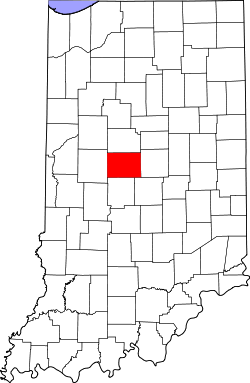
Geography
Boone County lies near the center of the state. It is 24 miles (39km) from east to west and 17.5 miles (28.2km) from north to south. It contains about 418.5 square miles (108,500 hectares), two-thirds of which is in cultivation. Its central position, excellent soil, and available water power have been in its favor.[7] The highest point of the county (984 feet (300 meters) ASL) is a small hill two miles/3.2km northeast of Lebanon.[8] The upper part of the county is drained by Sugar Creek, flowing westward into Montgomery County; the southwest part of the county is drained by Big Raccoon Creek, also flowing west-southwestward into Montgomery. The southeast part of the county is drained by Eagle Creek and its tributaries, flowing southward into Marion County.[9]
According to the 2010 census, the county has a total area of 423.25 square miles (1,096.2km2), of which 422.91 square miles (1,095.3km2) (or 99.92%) is land and 0.34 square miles (0.88km2) (or 0.08%) is water.[10]
In recent years, average temperatures in Lebanon have ranged from a low of 18°F (−8°C) in January to a high of 86°F (30°C) in July, although a record low of −27°F (−33°C) was recorded in January 1994 and a record high of 112°F (44°C) was recorded in July 1936. Average monthly precipitation ranged from 2.35 inches (60mm) in February to 4.54 inches (115mm) in July.[17]
County Council: The legislative branch of the county's government; controls and revenue collection in the county. Representatives are elected to four-year terms from county districts. They set salaries, the annual budget, and special spending. The council has limited authority to impose local taxes, in the form of an income and property tax that is subject to state level approval, excise taxes, and service taxes.[18][19]
Board of Commissioners: The executive body of the county; commissioners are elected county-wide to staggered four-year terms. One commissioner serves as president. The commissioners execute acts legislated by the council, collect revenue, and manage the county government.[18][19]
Court: The county maintains a small claims court that handles civil cases. The judge on the court is elected to a term of four years and must be a member of the Indiana Bar Association. The judge is assisted by a constable who is also elected to a four-year term. In some cases, court decisions can be appealed to the state level circuit court.[19]
County Officials: The county has other elected offices, including sheriff, coroner, auditor, treasurer, recorder, surveyor, and circuit court clerk. They are elected to four-year terms. Members elected to county government positions are required to declare a party affiliation and to be residents of the county.[19]
Prior to 1940, Boone County was a Democratic-leaning swing county in presidential elections, backing the national winner in every election from 1912 to 1936. From 1940 on, it has become a Republican stronghold. In 2024, Vice PresidentKamala Harris became the first Democratic presidential candidate since Lyndon B. Johnson to win a share of over forty percent of the vote.
United States presidential election results for Boone County, Indiana[22]
The median age was 38.7 years. 26.5% of residents were under the age of 18 and 14.8% of residents were 65 years of age or older. For every 100 females there were 97.8 males, and for every 100 females age 18 and over there were 94.0 males age 18 and over.[29]
72.8% of residents lived in urban areas, while 27.2% lived in rural areas.[31]
There were 26,593 households in the county, of which 36.3% had children under the age of 18 living in them. Of all households, 59.5% were married-couple households, 14.1% were households with a male householder and no spouse or partner present, and 20.5% were households with a female householder and no spouse or partner present. About 23.2% of all households were made up of individuals and 9.6% had someone living alone who was 65 years of age or older.[29]
There were 28,103 housing units, of which 5.4% were vacant. Among occupied housing units, 76.3% were owner-occupied and 23.7% were renter-occupied. The homeowner vacancy rate was 1.1% and the rental vacancy rate was 7.2%.[29]
2010 census
As of the 2010 United States census, there were 56,640 people, 21,149 households, and 15,509 families in the county.[32] The population density was 133.9 inhabitants per square mile (51.7/km2). There were 22,754 housing units at an average density of 53.8 per square mile (20.8/km2).[10] The racial makeup of the county was 95.3% white, 1.7% Asian, 0.9% black or African American, 0.2% American Indian, 0.7% from other races, and 1.4% from two or more races. Those of Hispanic or Latino origin made up 2.2% of the population.[32] In terms of ancestry, 28.9% were German, 19.3% were English, 14.1% were Irish, and 9.0% were American.[33]
Of the 21,149 households, 38.8% had children under the age of 18 living with them, 61.1% were married couples living together, 8.4% had a female householder with no husband present, 26.7% were non-families, and 22.4% of all households were made up of individuals. The average household size was 2.65 and the average family size was 3.12. The median age was 38.6 years.[32]
The median income for a household in the county was $47,697 and the median income for a family was $81,401. Males had a median income of $57,251 versus $41,309 for females. The per capita income for the county was $38,696. About 6.1% of families and 7.1% of the population were below the poverty line, including 8.6% of those under age 18 and 5.6% of those age 65 or over.[34]
This page is based on this Wikipedia article Text is available under the CC BY-SA 4.0 license; additional terms may apply. Images, videos and audio are available under their respective licenses.