Hazelrigg, Indiana

Last updated

Hazelrigg, Indiana
Hazelrigg, Indiana elevators.jpg
Grain elevators in Hazelrigg, Indiana
Map of Indiana highlighting Boone County.svg
Boone County's location in Indiana
Location map of Boone County, Indiana.svg
Red pog.svg
Hazelrigg
Location in Boone County
Coordinates: 40°04′56″N86°33′47″W / 40.08222°N 86.56306°W / 40.08222; -86.56306
Country United States
State Indiana
County Boone
Township Jefferson
Elevation
[1]
912 ft (278 m)
Time zone UTC-5 (Eastern (EST))
  Summer (DST) UTC-4 (EDT)
ZIP code
46052
Area code 765
FIPS code 18-32656 [2]
GNIS feature ID 435938

Hazelrigg is an unincorporated town in Jefferson Township, Boone County, in the U.S. state of Indiana. [3]

Contents

History

Upon the founding of the Lafayette and Indianapolis (L&I) Railroad Company in the 1860s, prominent local businessman Harvey G. Hazelrigg (1807–1877) [4] became a director of the company and a railway station was built on land he owned in rural Jefferson Township, a stop that was identified as Hazelrigg Station. [5] The L&I railroad that ran through town soon became the Indianapolis, Cincinnati and Lafayette Railroad, then in 1880 became the Cincinnati, Indianapolis, St. Louis and Chicago Railway, and finally in 1889 was merged into the Cleveland, Cincinnati, Chicago and St. Louis Railway, commonly known as the Big Four.

The stop attracted a small settlement; an 1887 history notes that Hazelrigg Station had been "a stopping and shipping point of some note for the last twenty years" and possessed a store, public hall, blacksmith, and residences. [6] It also had a post office, established 10 September 1873, with James Driskill serving as its first post master. [7]

Later identified simply as Hazelrigg, [8] , the town in the early 20th century had a church, school, and roughly 20 lots. [9] ; a 1914 history notes that it was "a stopping and shipping point of some note since its inception." [5] The town had at some point a small grocery. [10]

As of 1918, C. S. Byers, a poultry breeder specializing in buff, white and black Orpington chickens, was based in Hazelrigg. [11]

The post office closed in 1935. [12] On 11 April 1965 during the Palm Sunday tornado outbreak a tornado caused considerable damage to Hazelrigg and nearby areas of Boone County, with Indiana Governor Roger Branigin arriving to survey the destruction. [13]

The town has a grain elevator but otherwise is entirely residential.

Geography

The Big 4 Trail in Hazelrigg Hazelrigg, Indiana trail.jpg
The Big 4 Trail in Hazelrigg

Hazelrigg is located at 40°04′56″N86°33′47″W / 40.08222°N 86.56306°W / 40.08222; -86.56306 near the intersection of Boone County roads 300 North (Hazelrigg Road) and 500 West. Surrounded mostly by open farmland, the location is about three miles west of U.S. Route 52 and Interstate 65, about four miles southeast of Thorntown, and about five miles northwest of the city of Lebanon.

The Big 4 Trail (previously the Farm Heritage Trail) which passes along with southwest side of Hazelrigg stretches south to Lebanon and north to Colfax in Tippecanoe County along the path of the defunct railroad. [14] [15]

Related Research Articles

<span class="mw-page-title-main">Warren County, Indiana</span> County in Indiana, United States

Warren County is a county in the U.S. state of Indiana. It lies in the western part of the state between the Illinois state line and the Wabash River. According to the 2020 census, it had a population of 8,440. Its county seat is Williamsport.

<span class="mw-page-title-main">Boone County, Indiana</span> County in Indiana, United States

Boone County is a county in the U.S. state of Indiana. As of 2020, the population was 70,812. The county seat is Lebanon.

<span class="mw-page-title-main">Lebanon, Indiana</span> City in Indiana, United States

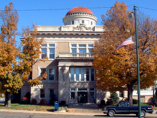
Lebanon is a city in and the county seat of Boone County, Indiana, United States. The population was 15,792 at the 2010 census. Lebanon is located in central Indiana, approximately 29 miles (47 km) northwest of downtown Indianapolis and 36 miles (58 km) southeast of Lafayette.

<span class="mw-page-title-main">Thorntown, Indiana</span> Town in Indiana, United States

Thorntown is a town in Sugar Creek Township, Boone County, Indiana. The population was 1,520 at the time of the 2010 census. Thorntown is located in northwestern Boone County, about halfway between Lafayette and Indianapolis.

<span class="mw-page-title-main">Whitestown, Indiana</span> Town in Indiana, United States

Whitestown is a town in Boone County, Indiana, United States. The population was 10,187 at the 2020 census. The town is located near Interstate 65, approximately 22 miles (35 km) northwest of Downtown Indianapolis, and about 7 miles (11 km) from the northern city limits of Indianapolis, between exits 130 and 133. Since 2010, Whitestown has been the fastest-growing municipality in Indiana; its population increased more than threefold between the 2010 and 2020 Census tabulations.

<span class="mw-page-title-main">Zionsville, Indiana</span> Town in Indiana, United States

Zionsville is a suburban town located in the extreme southeast area of Boone County, Indiana, United States, northwest of Indianapolis. The population was 14,160 at the 2010 census, 30,693 at the 2020 census.

<span class="mw-page-title-main">Lafayette, Indiana</span> City in Indiana, US

Lafayette is a city in and is the county seat of Tippecanoe County, Indiana, United States, located 63 miles (101 km) northwest of Indianapolis and 125 miles (201 km) southeast of Chicago. According to the 2020 census, the population of Lafayette was 70,783. West Lafayette, on the other side of the Wabash River, is home to Purdue University, which contributes significantly to both communities. Together, they form the core of the Lafayette metropolitan area, which had a population of 235,066 in 2020.

<span class="mw-page-title-main">West Lafayette, Indiana</span> City in Indiana, United States

West Lafayette is a city in Tippecanoe County, Indiana, United States, approximately 65 miles (105 km) northwest of the state capital of Indianapolis and 113 miles (182 km) southeast of Chicago. West Lafayette is directly across the Wabash River from its sister city, Lafayette. As of the 2020 census, its population was 44,595. Home to Purdue University, it is a college town and the most densely populated city in Indiana.

<span class="mw-page-title-main">Monon Railroad</span> Defunct American Class I railway

The Monon Railroad, also known as the Chicago, Indianapolis, and Louisville Railway from 1897 to 1971, was an American railroad that operated almost entirely within the state of Indiana. The Monon was merged into the Louisville and Nashville Railroad in 1971, and much of the former Monon right of way is owned today by CSX Transportation. In 1970, it operated 540 miles (870 km) of road on 792 miles (1,275 km) of track; that year it reported 1320 million ton-miles of revenue freight and zero passenger-miles.

<span class="mw-page-title-main">Pittsburgh, Cincinnati, Chicago and St. Louis Railroad</span> Railroad in the United States (1917–1956)

The Pittsburgh, Cincinnati, Chicago and St. Louis Railroad, commonly called the Pan Handle Route, was a railroad that was part of the Pennsylvania Railroad system. Its common name came from its main line, which began at Pittsburgh, Pennsylvania, crossed the Northern Panhandle of West Virginia, and continued west to Bradford, Ohio, where it split into a northern line to Chicago and a southern one through Indianapolis, Indiana, to East St. Louis, Illinois.

The Jeffersonville, Madison and Indianapolis Railroad (JM&I) was formed in 1866 as a merger between the Indianapolis and Madison Railroad and the Jeffersonville Railroad.

<span class="mw-page-title-main">Indiana's 4th congressional district</span> U.S. House district for Indiana

Indiana's 4th congressional district is a congressional district in the U.S. state of Indiana. From 2003 to 2013 the district was based primarily in the central part of the state, and consisted of all of Boone, Clinton, Hendricks, Morgan, Lawrence, Montgomery, and Tippecanoe counties and parts of Fountain, Johnson, Marion, Monroe, and White counties. The district surrounded Indianapolis including the suburban area of Greenwood and encompassed the more exurban areas of Crawfordsville and Bedford, as well as the college town of Lafayette-West Lafayette, containing Purdue University.

<span class="mw-page-title-main">Central Railroad of Indiana</span>

The Central Railroad Company of Indiana is a Class III short-line railroad that owns 92 miles (148 km) of track between Cincinnati, Ohio, and Shelbyville, Indiana, with trackage rights on CSX to Indianapolis, Indiana. CIND interchanges with CSX, Indiana & Ohio Railway, and Norfolk Southern in Cincinnati, and in North Bend, Ohio, with CSX; an Indiana & Ohio branchline splits from the CIND line at Valley Junction, a railroad location near Hooven, Ohio.

<span class="mw-page-title-main">Terre Haute, Indianapolis and Eastern Traction Company</span>

The Terre Haute, Indianapolis and Eastern Traction Company, or THI&E, was the second largest interurban in the U.S. state of Indiana during the height of the 1920s "interurban era." This system included over 400 miles (640 km) of track, with lines radiating from Indianapolis to the east, northwest, west and southwest as well as streetcar lines in several major cities. The THI&E was formed in 1907 by the Schoepf-McGowan Syndicate as a combination of several predecessor interurban and street car companies and was operated independently until incorporation into the Indiana Railroad in 1931. The THI&E served a wide range of territory, including farmlands in central Indiana, the mining region around Brazil, and numerous urban centers. Eventually, it slowly succumbed like all of the other central Indiana interurban lines, to competition from automobiles, trucks, and improved paralleling highways.

George L. Kinnard was a Representative from Indiana; born in Pennsylvania in 1803; moved with his widowed mother to Tennessee and completed preparatory studies; moved to Indianapolis, Ind., in 1823; studied law; was admitted to the bar and practised in Marion County, Indiana; assessor for Marion County in 1826 and 1827; member of the State house of representatives 1827–1830; county surveyor 1831–1835; colonel of the State militia; elected as a Jacksonian to the Twenty-third and Twenty-fourth Congresses and served from March 4, 1833, until his death on November 26, 1836; interment probably in Presbyterian Burying Ground, Cincinnati, Ohio.

<span class="mw-page-title-main">Jackson Township, Clinton County, Indiana</span> Township in Indiana, United States

Jackson Township is one of fourteen townships in Clinton County, Indiana. As of the 2020 census, its population was 1,207 and it contained 493 housing units.

<span class="mw-page-title-main">Perry Township, Clinton County, Indiana</span> Township in Indiana, United States

Perry Township is one of fourteen townships in Clinton County, Indiana. As of the 2020 census, its population was 1,494 and it contained 596 housing units. The township was named for Oliver Hazard Perry, an American naval officer in the War of 1812.

Transportation in Indianapolis consists of a complex network that includes a local public bus system, several private intercity bus providers, Amtrak passenger rail service, four freight rail lines, an Interstate Highway System, an airport, a heliport, bikeshare system, 115 miles (185 km) of bike lanes, and 116 miles (187 km) of trails and greenways. The city has also become known for its prevalence of electric scooters.

<span class="mw-page-title-main">Purdue Wreck</span> 1903 train collision

The Purdue Wreck was a railroad train collision in Indianapolis, Indiana, on Saturday, October 31, 1903, between two special trains that killed 17 people, including 14 players of the 1903 Purdue University football team team. Team captain and future Indiana governor Harry G. Leslie was initially thought to have died in the accident, but was later revived.

<span class="mw-page-title-main">Albert Clayton Dalton</span> United States army officer

Albert Clayton Dalton was a United States army officer. He took part in a number of U.S. military conflicts, including the Spanish–American War, Philippine–American War and World War I. After his retirement from military service, Dalton was an executive of the U.S. Shipping Board Merchant Fleet Corporation.

References

  1. "US Board on Geographic Names". United States Geological Survey. October 25, 2007. Retrieved January 31, 2008.
  2. "U.S. Census website". United States Census Bureau . Retrieved January 31, 2008.
  3. "Hazelrigg, Indiana". Geographic Names Information System . United States Geological Survey . Retrieved March 1, 2020.
  4. "Obituary for Harvey G. Hazelrigg". The Chicago Daily Tribune. December 17, 1877. Retrieved April 14, 2024 via Newspapers.com.
  5. 1 2 Crist, Leander Mead (1914). History of Boone County, Indiana. Vol. I. Indianapolis: A. W. Bowen. p. 402. Upon the organization of the LaFayette & Indianapolis Railroad Company, Major Hazelrigg became a stockholder and was immediately chosen as one of the directors... [Hazelrigg] has been a stopping and shipping point of some note since its inception.
  6. Harden, Samuel (May 1887). Early Life and Times in Boone County, Indiana. Indianapolis: Carlon & Hollenbeck. pp.  34-35, 63-64. This town is located on the Indianapolis, Cincinnati & Lafayette Railroad, six miles northwest of Lebanon, in the southeast corner of Washington Township. It was laid out on the land originally owned by the late H. G. Hazlerigg, and names in honor of him. It has been a stopping and shipping point of some note for the last twenty years.
  7. Stark, Ralph W. (May 1974). "Early Hamlets, Villages, Towns, and Post Offices of Boone County". Boone, Your County Magazine. Lebanon, Indiana: John R. Parsons. pp. 23–24. ISSN   0161-7958. Hazelrigg, five miles northwest of Lebanon and on the Big Four railroad, was commissioned a post office, September 10, 1873... Its first postmaster was James Driskill.
  8. Plat Book of Boone County, Indiana. Rockford, Illinois: W. W. Hixson & Company. c. 1925.
  9. Ogle, George A. (1904). Standard Atlas of Boone County, Indiana. Chicago: George A. Ogle & Company.
  10. Mavity, Mary Louise Byers (October 1976). "Journey to Hazelrigg". Boone, Your County Magazine. Whitestown, Indiana: Bob and Pat Heidemeich. pp. 8–9. ISSN   0161-7958.
  11. "Mr. Byers' Guarantee on Best Quality Eggs". Reliable Poultry Journal. April 1918. p. 257. Retrieved April 13, 2024.
  12. "Boone County". Jim Forte Postal History. Retrieved August 26, 2014.
  13. "2,000 Aiding Cleanup of Storm-Swept Boone Farms". Indianapolis News . Indianapolis. April 17, 1965. Retrieved April 13, 2024. The governor walked among the rubble from Hazlerigg, north of Lebanon, to Dover in western Boone County...
  14. "Making Connections: Towns collaborate to extend Big-4 Rail Trail to Lafayette". Current. Retrieved April 13, 2024. Construction workers put down pavement for the Big 4 Trail in Hazelrigg, a town between Thorntown and Lebanon.
Black Orpington hen owned and bred by C. S. Byers in Hazelrigg Black Orpington Hen.png
Black Orpington hen owned and bred by C. S. Byers in Hazelrigg