Tippecanoe County, Indiana

Last updated

Tippecanoe County
Tippecanoe courthouse 7-2004.jpg
Tippecanoe County Courthouse in Lafayette, Indiana
Map of Indiana highlighting Tippecanoe County.svg
Location within the U.S. state of Indiana
Indiana in United States.svg
Indiana's location within the U.S.
Coordinates: 40°23′N86°53′W / 40.39°N 86.89°W / 40.39; -86.89
CountryFlag of the United States.svg United States
StateFlag of Indiana.svg  Indiana
FoundedMarch 1, 1826
Named for Kethtippecanoogi ("Place of the Succor Fish People" in Miami)
Seat Lafayette
Largest cityLafayette
Area
  Total503.24 sq mi (1,303.4 km2)
  Land499.81 sq mi (1,294.5 km2)
  Water3.44 sq mi (8.9 km2)  0.68%
Population
 (2020)
  Total186,251
  Density370/sq mi (140/km2)
Time zone UTC−5 (Eastern)
  Summer (DST) UTC−4 (EDT)
Congressional district 4th
Website www.tippecanoe.in.gov
Indiana county number 79

Tippecanoe County is located in the west-central portion of the U.S. state of Indiana about 22 miles east of the Illinois state line and less than 50 miles from the Chicago and the Indianapolis metro areas. As of the 2020 census, the population was 186,251. [1] The county seat and largest city is Lafayette. [2] It was created in 1826 from Wabash County portion of New Purchase and unorganized territory. [3]

Contents

Tippecanoe County was formed March 1, 1826, and named for the anglicization of "Kiteepihkwana", a Miami people term meaning "place of the buffalo fish people." [4] The county is best known for Purdue University, the 1811 Battle of Tippecanoe, and the Tippecanoe County Courthouse, a structure built in 1881 and included in the National Register of Historic Places.

Tippecanoe County is part of the Lafayette, Indiana, Metropolitan Statistical Area.

History

The history of Tippecanoe County spans six distinct political and cultural periods: Native American lands from at least 8000BC, including the Mississippian culture, French occupation (part of New France beginning in the 1670s), British occupation starting in 1763, part of the United States Northwest Territory in 1787, part of Indiana Territory in 1800, and finally part of the State of Indiana in 1816. The political organization of the county began in 1826 by the act of the Indiana Legislature.

The first European explorers arrived in the 1670s and the first permanent settlement was Fort Ouiatenon by the French established in 1717. Lafayette was platted in 1825 and Purdue University founded in 1869.

Geography

According to the 2010 census, the county has a total area of 503.24 square miles (1,303.4 km2), of which 499.81 square miles (1,294.5 km2) (or 99.32%) is land and 3.44 square miles (8.9 km2) (or 0.68%) is water. [5] The county's highest point is in the Lauramie Township. [6]

Adjacent counties

Communities

The county courthouse and nearby buildings along the Wabash River in Lafayette and West Lafayette Lafayette skyline from West Lafayette.png
The county courthouse and nearby buildings along the Wabash River in Lafayette and West Lafayette
The view northeast into the town of Battle Ground Battle Ground, Indiana.png
The view northeast into the town of Battle Ground

Cities

Towns

Census-designated places

Other unincorporated places

Extinct

Townships

A freight train approaches the town of South Raub on the border of Randolph and Wea Townships. South Raub, Indiana Train.png
A freight train approaches the town of South Raub on the border of Randolph and Wea Townships.

Climate and weather

Lafayette, Indiana
Climate chart (explanation)
J
F
M
A
M
J
J
A
S
O
N
D
 
 
1.8
 
 
33
17
 
 
1.6
 
 
39
22
 
 
2.9
 
 
50
31
 
 
3.5
 
 
62
40
 
 
3.9
 
 
74
51
 
 
4.2
 
 
83
60
 
 
3.8
 
 
86
65
 
 
3.9
 
 
84
63
 
 
2.7
 
 
78
55
 
 
2.6
 
 
66
43
 
 
2.8
 
 
51
34
 
 
2.6
 
 
38
23
Average max. and min. temperatures in °F
Precipitation totals in inches
Source: The Weather Channel [8]
Metric conversion
J
F
M
A
M
J
J
A
S
O
N
D
 
 
47
 
 
1
−8
 
 
40
 
 
4
−6
 
 
73
 
 
10
−1
 
 
88
 
 
17
4
 
 
100
 
 
23
11
 
 
108
 
 
28
16
 
 
97
 
 
30
18
 
 
99
 
 
29
17
 
 
70
 
 
26
13
 
 
65
 
 
19
6
 
 
71
 
 
11
1
 
 
65
 
 
3
−5
Average max. and min. temperatures in °C
Precipitation totals in mm

In recent years, temperatures in Lafayette have ranged from an average low of 17 °F (−8 °C) in January to a high of 86 °F (30 °C) in July, although a record low of −23 °F (−31 °C) was recorded in January 1985 and a record high of 105 °F (41 °C) was recorded in June 1988. Average monthly precipitation ranged from 1.58 inches (40 mm) inches in February to 4.24 inches (108 mm) inches in June. [8]

Transportation

Highways

Railroads

Three different railroad lines intersect in Tippecanoe County, all running through the Lafayette area. CSX Transportation operates a north–south line; Norfolk Southern Railway operates a southwest-to-northeast line, [9] and the Kankakee, Beaverville and Southern Railroad operates a daily-service line running from the northwest to the southeast.

The Amtrak Cardinal stops at the Lafayette Station 3 times a week, and is the only provider of passenger rail service to Greater Lafayette.

Airport

The county contains one public-use airport: Purdue University Airport (LAF) in West Lafayette, Indiana. [10]

Government

The county government is a constitutional body, and is granted specific powers by the Constitution of Indiana, and by the Indiana Code.

County Council: The county council is the fiscal branch of the county government and controls all the spending and revenue collection in the county. The county council and the board of commissioners share legislative authority. [11] Representatives are elected from county districts. The council members serve four-year terms. They are responsible for setting salaries, the annual budget, and special spending. The council also has limited authority to impose local taxes, in the form of an income and property tax that is subject to state level approval, excise taxes, and service taxes. [12] [13]

Board of Commissioners: The executive body of the county is made of a board of commissioners. The commissioners are elected county-wide, in staggered terms, and each serves a four-year term. One of the commissioners, typically the most senior, serves as president. The commissioners are charged with executing the acts legislated by the council, collecting revenue, and managing the day-to-day functions of the county government. [12] [13]

Court: The county maintains a small claims court that can handle some civil cases. The judge on the court is elected to a term of four years and must be a member of the Indiana Bar Association. The judge is assisted by a constable who is also elected to a four-year term. In some cases, court decisions can be appealed to the state level circuit court. [13]

County Officials: The county has several other elected offices, including sheriff, coroner, auditor, treasurer, recorder, surveyor, and circuit court clerk. Each of these elected officers serves a term of four years and oversees a different part of county government. Members elected to county government positions are required to declare party affiliations and to be residents of the county. [13]

Politics

In the 2008 Democratic primary, Tippecanoe County was one of 10 (out of 92) Indiana counties to give the majority of its votes to Barack Obama. [14] In the 2008 presidential election, Tippecanoe County was one of 15 Indiana counties to give the majority of its votes to Obama/Biden. Thanks to the sizable support of Purdue University students, Tippecanoe County played a pivotal role in Barack Obama's upset win in Indiana (49.9%-49.0%; 1,367,264 votes to 1,341,101 votes) by supporting the Democratic ticket of Barack Obama/Joe Biden 55.1%-43.5% over the Republican ticket of John McCain/Sarah Palin. [15] However, in the 2020 presidential election, Tippecanoe County also voted for Democrat Joe Biden by a margin of 436 votes, the first time since 2008 the county went for the Democrats.

Historically, Tippecanoe has been somewhat conservative for a county dominated by a college town. While most such counties swung hard to the Democrats in the 1990s Obama's win in 2008 was only the fourth time it went Democratic in a presidential election since 1888.

Tippecanoe County is one of only thirteen counties to have voted for Obama in 2008, Romney in 2012, Trump in 2016, and Biden in 2020. [lower-alpha 1]

United States presidential election results for Tippecanoe County, Indiana [16]
Year Republican Democratic Third party
No.%No.%No.%
2020 34,58148.15%35,01748.75%2,2263.10%
2016 30,76848.57%27,28243.07%5,2928.35%
2012 28,75750.40%26,71146.81%1,5952.80%
2008 29,82243.45%37,78155.05%1,0331.51%
2004 30,89759.01%20,81839.76%6451.23%
2000 26,10656.39%18,22039.36%1,9694.25%
1996 22,55649.48%17,23237.80%5,79812.72%
1992 23,05045.79%17,34334.46%9,94119.75%
1988 27,89762.88%16,25636.64%2110.48%
1984 29,70664.75%15,78934.42%3810.83%
1980 27,58956.92%14,63630.20%6,24512.88%
1976 29,18661.33%17,85037.51%5511.16%
1972 31,56568.08%14,59831.48%2030.44%
1968 24,35259.44%14,52835.46%2,0885.10%
1964 19,03648.35%20,25751.45%790.20%
1960 24,57263.55%14,04136.31%550.14%
1956 23,77670.25%9,99529.53%720.21%
1952 23,44770.53%9,67829.11%1210.36%
1948 17,03460.60%10,82538.51%2480.88%
1944 15,88860.61%10,22939.02%950.36%
1940 16,14856.96%12,12942.78%730.26%
1936 13,08150.08%12,73248.74%3091.18%
1932 11,81846.05%13,60953.03%2360.92%
1928 15,16563.25%8,72036.37%930.39%
1924 12,16158.40%7,61936.59%1,0435.01%
1920 12,73061.68%7,56236.64%3471.68%
1916 6,38654.73%4,91842.15%3653.13%
1912 3,00628.22%4,44241.70%3,20530.09%
1908 6,16453.42%4,98443.19%3913.39%
1904 6,58159.83%4,03136.65%3883.53%
1900 6,31756.29%4,67341.64%2322.07%
1896 6,23956.77%4,63942.21%1111.01%
1892 4,85651.10%4,38646.15%2612.75%
1888 5,07253.39%4,28145.06%1471.55%

Demographics

Historical population
CensusPop.Note
1830 7,187
1840 13,72491.0%
1850 19,37741.2%
1860 25,72632.8%
1870 33,51530.3%
1880 35,9667.3%
1890 35,078−2.5%
1900 38,65910.2%
1910 40,0633.6%
1920 42,8136.9%
1930 47,53511.0%
1940 51,0207.3%
1950 74,47346.0%
1960 89,12219.7%
1970 109,37822.7%
1980 121,70211.3%
1990 130,5987.3%
2000 148,95514.1%
2010 172,78016.0%
2020 186,2517.8%
2023 (est.)188,792 [17] 1.4%
U.S. Decennial Census [18]
1790-1960 [19] 1900-1990 [20]
1990-2000 [21] 2010 [22]

As of the 2010 United States Census, there were 172,780 people, 65,532 households, and 37,003 families residing in the county. [23] The population density was 345.7 inhabitants per square mile (133.5/km2). There were 71,096 housing units at an average density of 142.2 per square mile (54.9/km2). [5] The racial makeup of the county was 84.0% white, 6.2% Asian, 4.0% black or African American, 0.3% American Indian, 3.3% from other races, and 2.2% from two or more races. Those of Hispanic or Latino origin made up 7.5% of the population. [23] In terms of ancestry, 27.5% were German, 13.9% were Irish, 10.8% were English, and 6.1% were American. [24]

Of the 65,532 households, 28.5% had children under the age of 18 living with them, 42.4% were married couples living together, 9.8% had a female householder with no husband present, 43.5% were non-families, and 29.2% of all households were made up of individuals. The average household size was 2.42 and the average family size was 3.02. The median age was 27.7 years. [23]

The median income for a household in the county was $47,697 and the median income for a family was $60,367. Males had a median income of $45,018 versus $31,995 for females. The per capita income for the county was $22,203. About 10.3% of families and 20.0% of the population were below the poverty line, including 18.2% of those under age 18 and 5.0% of those age 65 or over. [25]

Education

Public schools in rural/suburban Tippecanoe County are administered by the Tippecanoe School Corporation, while those in the cities are under either the Lafayette School Corporation or West Lafayette Community School Corporation. Purdue and Ivy Tech each have campuses at other sites in Indiana.

Libraries

Universities and colleges

High Schools

Middle Schools/Junior High Schools

Elementary Schools

Private Schools

Economy

Much of the economy of Tippecanoe County is centered in its two largest communities: Lafayette and West Lafayette. Purdue University is by far the largest employer in the county, but private industry and commerce independent of the university also employ many others. Major employers include Subaru-Indiana Automotive, Wabash National, Caterpillar, Fairfield Manufacturing, Franciscan Health Lafayette, Alcoa, State Farm, and Indiana University Health Arnett Hospital.

Notable people

See also

Notes

Related Research Articles

<span class="mw-page-title-main">White County, Indiana</span> County in Indiana, United States

White County is a county in the U.S. state of Indiana. As of the 2020 United States Census, the population was 24,688. The county seat is Monticello.

<span class="mw-page-title-main">Jasper County, Indiana</span> County in Indiana, United States

Jasper County is a county located in the U.S. state of Indiana. As of 2020, the population was 32,918. The county seat is Rensselaer.

<span class="mw-page-title-main">Carroll County, Indiana</span> County in Indiana, United States

Carroll County is a county located in the U.S. state of Indiana. As of the 2020 United States Census, the population was 20,306. The county seat is Delphi.

<span class="mw-page-title-main">Carmel, Indiana</span> City in Indiana, United States

Carmel is a suburban city in Hamilton County, Indiana, United States, immediately north of Indianapolis. With a population of 99,757 as of the 2020 census, the city spans 49 square miles (130 km2) across Clay Township and is bordered by the White River to the east and the Boone County line to the west. Although Carmel was home to one of the first electronic automated traffic signals in the country, the city has constructed 141 roundabouts between 1988 and 2022.

<span class="mw-page-title-main">Battle Ground, Indiana</span> Town in Indiana, US

Battle Ground is a town in Tippecanoe Township, Tippecanoe County in the U.S. state of Indiana. The population was 1,334 at the 2010 census. It is near the site of the Battle of Tippecanoe.

<span class="mw-page-title-main">Lafayette, Indiana</span> City in Indiana, US

Lafayette is a city in and is the county seat of Tippecanoe County, Indiana, United States, located 63 miles (101 km) northwest of Indianapolis and 125 miles (201 km) southeast of Chicago. According to the 2020 census, the population of Lafayette was 70,783. West Lafayette, on the other side of the Wabash River, is home to Purdue University, which contributes significantly to both communities. Together, they form the core of the Lafayette metropolitan area, which had a population of 235,066 in 2020.

<span class="mw-page-title-main">West Lafayette, Indiana</span> City in Indiana, United States

West Lafayette is a city in Tippecanoe County, Indiana, United States, approximately 65 miles (105 km) northwest of the state capital of Indianapolis and 113 miles (182 km) southeast of Chicago. West Lafayette is directly across the Wabash River from its sister city, Lafayette. As of the 2020 census, its population was 44,595. Home to Purdue University, it is a college town and the most densely populated city in Indiana.

<span class="mw-page-title-main">Jefferson High School (Indiana)</span> Public high school in Lafayette, Indiana, United States

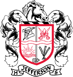
Jefferson High School is a high school located in Lafayette, Indiana, United States and administered by the Lafayette School Corporation. Its mascot is the Broncho and its school colors are red and black.

The Tippecanoe School Corporation administers three high schools, six middle schools and eleven elementary schools in Tippecanoe County, Indiana:

<span class="mw-page-title-main">McCutcheon High School</span> Public high school in Lafayette, Tippecanoe County, Indiana, United States

McCutcheon High School is located in Lafayette, Indiana, located on Old 231 South. The school was established in 1975 with the merger of Wainwright and Southwestern high schools and is named after John T. McCutcheon, who was a political cartoonist and Tippecanoe County native. It has been active in the North Central Conference since 2014.

<span class="mw-page-title-main">Stockwell, Indiana</span> Census-designated place in Indiana, United States

Stockwell, originally named Lauramie, is a census-designated place in Lauramie Township, Tippecanoe County, in the U.S. state of Indiana. It was once a stop along the Indianapolis, Cincinnati and Lafayette Railroad, but the rail line has since been removed.

<span class="mw-page-title-main">West Point, Indiana</span> Census-designated place in Indiana, United States

West Point is an unincorporated community and census-designated place in Wayne Township, Tippecanoe County, in the U.S. state of Indiana. The population was 594 at the 2010 census.

<span class="mw-page-title-main">John T. McCutcheon</span> American cartoonist

John Tinney McCutcheon was an American newspaper political cartoonist, war correspondent, combat artist, and author who won a Pulitzer Prize for his 1931 editorial cartoon, "A Wise Economist Asks a Question," and became known even before his death as the "Dean of American Cartoonists." The Purdue University graduate moved to Chicago, Illinois, in 1890 to work as an artist and occasional writer for the Chicago Morning News. His first front-page cartoon appeared in 1895 and his first published political cartoon was published during the U. S. presidential campaign of 1896. McCutcheon introduced human interest themes to newspaper cartoons in 1902 and joined the staff of the Chicago Tribune in 1903, remaining there until his retirement in 1946. McCutcheon's cartoons appeared on the front page of the Tribune for forty years.

<span class="mw-page-title-main">Fairfield Township, Tippecanoe County, Indiana</span> Township in Indiana, United States

Fairfield Township is one of thirteen townships in Tippecanoe County, Indiana. As of the 2010 census, its population was 51,113 and it contained 24,527 housing units.

<span class="mw-page-title-main">Lauramie Township, Tippecanoe County, Indiana</span> Township in Indiana, United States

Lauramie Township is one of thirteen townships in Tippecanoe County, Indiana, United States. As of the 2010 census, its population was 2,596 and it contained 1,021 housing units.

<span class="mw-page-title-main">Randolph Township, Tippecanoe County, Indiana</span> Township in Indiana, United States

Randolph Township is one of thirteen townships in Tippecanoe County, Indiana, United States. As of the 2010 census, its population was 931 and it contained 352 housing units. As for 2018, the population is estimated to be 1,084.

<span class="mw-page-title-main">Sheffield Township, Tippecanoe County, Indiana</span> Township in Indiana, United States

Sheffield Township is one of thirteen townships in Tippecanoe County, Indiana, United States. As of the 2010 census, its population was 3,865 and it contained 1,454 housing units.

<span class="mw-page-title-main">Union Township, Tippecanoe County, Indiana</span> Township in Indiana, United States

Union Township is one of thirteen townships in Tippecanoe County, Indiana, United States. As of the 2010 census, its population was 1,610 and it contained 675 housing units.

<span class="mw-page-title-main">Wea Township, Tippecanoe County, Indiana</span> Township in Indiana, United States

Wea Township is one of thirteen townships in Tippecanoe County, Indiana, United States. As of the 2010 census, its population was 31,660 and it contained 13,022 housing units.

<span class="mw-page-title-main">Concord, Tippecanoe County, Indiana</span> Unincorporated community in Indiana, United States

Concord is a small unincorporated community in Lauramie Township, Tippecanoe County, Indiana, located just west of Stockwell.

References

  1. "Tippecanoe County, Indiana". United States Census Bureau . Retrieved June 7, 2023.
  2. "Find a County". National Association of Counties. Retrieved June 7, 2011.
  3. DeHart 1909, p. 151.
  4. Kriebel, Robert C. (2000). Tippecanoe at 2000: A Hoosier County Recalls Its Past.
  5. 1 2 "Population, Housing Units, Area, and Density: 2010 - County". United States Census Bureau. Archived from the original on February 12, 2020. Retrieved July 10, 2015.
  6. "Tippecanoe County High Point - Peakbagger.com".
  7. "Ghost Towns of Tippecanoe County, Indiana". ingenweb.org.
  8. 1 2 "Monthly Averages for Lafayette, Indiana". The Weather Channel. Retrieved January 27, 2011.
  9. "Indiana Railroads" (PDF). Indiana Department of Transportation. 2008. Archived from the original (PDF) on November 18, 2009. Retrieved December 11, 2010.
  10. "Tippecanoe County Public and Private Airports". www.tollfreeairline.com.
  11. "Guide to Indiana County Government" (PDF). Association of Indiana Counties. Archived (PDF) from the original on July 14, 2015. Retrieved October 27, 2016.
  12. 1 2 Indiana Code. "Title 36, Article 2, Section 3". IN.gov. Retrieved September 16, 2008.
  13. 1 2 3 4 Indiana Code. "Title 2, Article 10, Section 2" (PDF). IN.gov. Archived (PDF) from the original on December 27, 2004. Retrieved September 16, 2008.
  14. "Election Center 2008: Primary Results - Elections & Politics news from CNN.com". CNN. Retrieved May 25, 2010.
  15. "Dave Leip's Atlas of U.S. Presidential Elections - State Data" . Retrieved March 3, 2024.
  16. Leip, David. "Dave Leip's Atlas of U.S. Presidential Elections". uselectionatlas.org. Retrieved May 20, 2018.
  17. "Annual Estimates of the Resident Population for Counties: April 1, 2020 to July 1, 2023". United States Census Bureau. Retrieved April 2, 2024.
  18. "U.S. Decennial Census". United States Census Bureau. Retrieved July 10, 2014.
  19. "Historical Census Browser". University of Virginia Library. Retrieved July 10, 2014.
  20. "Population of Counties by Decennial Census: 1900 to 1990". United States Census Bureau. Retrieved July 10, 2014.
  21. "Census 2000 PHC-T-4. Ranking Tables for Counties: 1990 and 2000" (PDF). United States Census Bureau. Archived (PDF) from the original on March 27, 2010. Retrieved July 10, 2014.
  22. "State & County QuickFacts". United States Census Bureau. Retrieved July 10, 2014.
  23. 1 2 3 "DP-1 Profile of General Population and Housing Characteristics: 2010 Demographic Profile Data". United States Census Bureau. Archived from the original on February 13, 2020. Retrieved July 10, 2015.
  24. "DP02 SELECTED SOCIAL CHARACTERISTICS IN THE UNITED STATES – 2006-2010 American Community Survey 5-Year Estimates". United States Census Bureau. Archived from the original on February 14, 2020. Retrieved July 10, 2015.
  25. "DP03 SELECTED ECONOMIC CHARACTERISTICS – 2006-2010 American Community Survey 5-Year Estimates". United States Census Bureau. Archived from the original on February 14, 2020. Retrieved July 10, 2015.
  26. "Home - Tippecanoe County Public Library". tcpl.lib.in.us. Retrieved April 29, 2018.
  27. "West Lafayette Public Library - Home". wlaf.lib.in.us. Retrieved April 29, 2018.
  28. "Purdue University - Indiana's Land Grant University". www.purdue.edu.
  29. "Home - Ivy Tech Community College". www.ivytech.edu.
  30. "TSC Schools". Archived from the original on June 11, 2013.
  31. "2006-2007 Curriculum and Academies Handbook". April 29, 2006. Archived from the original on April 29, 2006.
  32. "Home". ohs.lsc.k12.in.us.
  33. "Home - McCutcheon High School". mhs.tsc.k12.in.us.
  34. 1 2 "West Lafayette Junior/Senior High School". Archived from the original on June 13, 2006.
  35. "Home - William Henry Harrison High School". hhs.tsc.k12.in.us.
  36. "Lafayette School Corporation". Archived from the original on September 4, 2006.
  37. "Index". Archived from the original on June 18, 2006.
  38. "Home - Battle Ground Middle School". bgm.tsc.k12.in.us.
  39. "Home - East Tipp Middle School". etm.tsc.k12.in.us.
  40. "Home - Klondike Middle School". kms.tsc.k12.in.us.
  41. "Home - Southwestern Middle School". sms.tsc.k12.in.us.
  42. "Home - Wainwright Middle School". wms.tsc.k12.in.us.
  43. "Home - Wea Ridge Middle School". wrm.tsc.k12.in.us.
  44. "Welcome to Edgelea Elementary School". Archived from the original on July 17, 2011.
  45. "Welcome to Glen Acres!". Archived from the original on March 11, 2007.
  46. "Miami Elementary School". Archived from the original on July 17, 2011.
  47. "Welcome to Miller Elementary School". Archived from the original on July 17, 2011.
  48. "Murdock Elementary School". Archived from the original on September 28, 2011.
  49. "New Community School, Lafayette, IN". Archived from the original on August 9, 2011.
  50. "Welcome to Vinton Elementary School". Archived from the original on March 23, 2010.
  51. "Home - Battle Ground Elementary School". bge.tsc.k12.in.us.
  52. "Home - Burnett Creek Elementary". bce.tsc.k12.in.us.
  53. "Home - Hershey Elementary School". hes.tsc.k12.in.us.
  54. "Home - Klondike Elementary School". kes.tsc.k12.in.us.
  55. "Home - Dayton Elementary School". des.tsc.k12.in.us.
  56. "Home - James Cole Elementary School". ces.tsc.k12.in.us.
  57. "Home - Mayflower Mill Elementary School". mme.tsc.k12.in.us.
  58. "Home - Mintonye Elementary School". mes.tsc.k12.in.us.
  59. "Home - Wea Ridge Elementary School". wre.tsc.k12.in.us.
  60. "Home - Woodland Elementary School". wes.tsc.k12.in.us.
  61. "Home - Wyandotte Elementary School". wye.tsc.k12.in.us.
  62. "Cumberland Elementary School". Archived from the original on September 26, 2006.
  63. "Lafayette Catholic School System". www.lcss.org. Retrieved March 3, 2024.
  64. "Lafayette Christian School - Lafayette, IN". www.lafayettechristian.org.
  65. "Faith Christian School". Archived from the original on June 12, 2011.
  66. Stagg, Ronald J. "Lloyd, Jesse". Dictionary of Canadian Biography Online. University of Toronto/Université Laval.

Bibliography

40°23′N86°53′W / 40.39°N 86.89°W / 40.39; -86.89