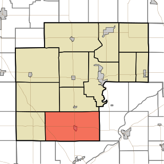
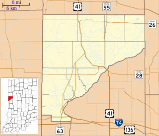
LaGrange, Tippecanoe County, Indiana

Last updated
LaGrange
Ghost town
Map of Indiana highlighting Tippecanoe County.svg
Tippecanoe County's location in Indiana
Locator map of Tippecanoe County, Indiana.svg
Red pog.svg
LaGrange
Location in Tippecanoe County
Coordinates: 40°22′28″N87°05′24″W / 40.37444°N 87.09000°W / 40.37444; -87.09000 Coordinates: 40°22′28″N87°05′24″W / 40.37444°N 87.09000°W / 40.37444; -87.09000
Country United States
State Indiana
County Tippecanoe
Township Shelby
Time zone Eastern (EST) (UTC-5)
  Summer (DST) EDT (UTC-4)
ZIP code 47906
Area code(s) 765

LaGrange was a small town, now extinct, in Shelby Township, Tippecanoe County, in the U.S. state of Indiana.

Shelby Township, Tippecanoe County, Indiana Township in Indiana, United States

Shelby Township is one of thirteen townships in Tippecanoe County, Indiana, United States. As of the 2010 census, its population was 2,352 and it contained 920 housing units.

Tippecanoe County, Indiana County in the United States

Tippecanoe County is a county located in the west central portion of the U.S. state of Indiana about 22 miles east of the Illinois state line. As of the 2010 census, the population was 172,780. The county seat and largest city is Lafayette. It was created in 1826 from Wabash County portion of New Purchase and unorganized territory.

U.S. state constituent political entity of the United States

In the United States, a state is a constituent political entity, of which there are currently 50. Bound together in a political union, each state holds governmental jurisdiction over a separate and defined geographic territory and shares its sovereignty with the federal government. Due to this shared sovereignty, Americans are citizens both of the federal republic and of the state in which they reside. State citizenship and residency are flexible, and no government approval is required to move between states, except for persons restricted by certain types of court orders. Four states use the term commonwealth rather than state in their full official names.

Contents

History

LaGrange was founded in 1827 by Isaac Shelby, and was named for the Marquis de Lafayette's ancestral home in France. The community was laid out with eight streets and a hotel. The decline of riverboat trade and the decision to build the Wabash Railroad on the other side of the Wabash River led to the town's extinction. [1]

Wabash Railroad transport company

The Wabash Railroad was a Class I railroad that operated in the mid-central United States. It served a large area, including track in the states of Ohio, Indiana, Illinois, Iowa, Michigan, and Missouri and the province of Ontario. Its primary connections included Chicago, Illinois; Kansas City, Missouri; Detroit, Michigan; Buffalo, New York; St. Louis, Missouri; and Toledo, Ohio.

Wabash River tributary of the Ohio River in the United States of America

The Wabash River is a 503-mile-long (810 km) river in Ohio and Indiana, United States, that flows from the headwaters near the middle of Ohio's western border northwest then southwest across northern Indiana turning south along the Illinois border where the southern portion forms the Indiana-Illinois border before flowing into the Ohio River. It is the largest northern tributary of the Ohio River. From the dam near Huntington, Indiana, to its terminus at the Ohio River, the Wabash flows freely for 411 miles (661 km). Its watershed drains most of Indiana. The Tippecanoe River, White River, Embarras River and Little Wabash River are major tributaries. The river's name comes from an Illini Indian word meaning "water over white stones".

A post office was established at LaGrange in 1828, and remained in operation until it was discontinued in 1835. [2]

Geography

LaGrange was likely located at 40°22′28″N87°05′24″W / 40.37444°N 87.09000°W / 40.37444; -87.09000 .

Related Research Articles

The Wabash Valley is a region with parts in both Illinois and Indiana. It is named for the Wabash River and spans the middle to the middle-lower portion of the river and is centered at Terre Haute, Indiana. The term Wabash Valley is frequently used in local media in Clinton, Lafayette, Mount Carmel, Princeton, Terre Haute, and Vincennes all of which are either on or near the Lower Wabash River.

Wabash Township, Tippecanoe County, Indiana Township in Indiana, United States

Wabash Township is one of thirteen townships in Tippecanoe County, Indiana, United States. As of the 2010 census, its population was 59,279 and it contained 21,448 housing units making it the most populous township in Tippecanoe County.

West Point, Indiana Census-designated place in Indiana, United States

West Point is an unincorporated community and census-designated place in Wayne Township, Tippecanoe County, in the U.S. state of Indiana. The population was 594 at the 2010 census.

Granville, Indiana Ghost town in Indiana, United States

Granville is a former town in Wayne Township, Tippecanoe County, in the U.S. state of Indiana.

Wabash Township, Parke County, Indiana Township in Indiana, United States

Wabash Township is one of thirteen townships in Parke County, Indiana, United States. As of the 2010 census, its population was 818 and it contained 353 housing units.

Prairie Township, White County, Indiana Township in Indiana, United States

Prairie Township is one of twelve townships in White County, Indiana, United States. As of the 2010 census, its population was 3,180 and it contained 1,311 housing units.

Round Grove Township, White County, Indiana Township in Indiana, United States

Round Grove Township is one of twelve townships in White County, Indiana, United States. As of the 2010 census, its population was 259 and it contained 103 housing units.

Wayne Township, Tippecanoe County, Indiana Township in Indiana, United States

Wayne Township is one of thirteen townships in Tippecanoe County, Indiana, United States. As of the 2010 census, its population was 1,580 and it contained 623 housing units.

Black Rock, Indiana Ghost town in Indiana, United States

Black Rock is an extinct community located in Warren Township in Warren County, Indiana, near the border with Tippecanoe County. The site, which is still listed as a populated place by the USGS, is mostly forested and is part of the Black Rock Nature Preserve administered by NICHES Land Trust.

Old Halfway, Indiana Unincorporated community in Indiana, United States

Old Halfway is an unincorporated community in Shelby Township, Tippecanoe County, in the U.S. state of Indiana.

Octagon, Indiana Unincorporated community in Indiana, United States

Octagon is an unincorporated community in Wabash Township, Tippecanoe County, in the U.S. state of Indiana.

Wabash Shores, Indiana Unincorporated community in Indiana, United States

Wabash Shores is an unincorporated community in Wabash Township, Tippecanoe County, in the U.S. state of Indiana.

Summit, Tippecanoe County, Indiana Unincorporated community in Indiana, United States

Summit is an unincorporated community in Wabash Township, Tippecanoe County, in the U.S. state of Indiana.

Indian Village, Tippecanoe County, Indiana Unincorporated community in Indiana, United States

Indian Village is an unincorporated community in Wabash Township, Tippecanoe County, in the U.S. state of Indiana.

Green Meadows, Indiana Unincorporated community in Indiana, United States

Green Meadows is an unincorporated community in Wabash Township, Tippecanoe County, in the U.S. state of Indiana.

Klondike, Indiana Unincorporated community in Indiana, United States

Klondike is an unincorporated community in Wabash Township, Tippecanoe County, in the U.S. state of Indiana.

Bar Barry Heights, Indiana Unincorporated community in Indiana, United States

Bar Barry Heights is an unincorporated community in Wabash Township, Tippecanoe County, in the U.S. state of Indiana.

References

  1. "Ghost Towns of Tippecanoe County" . Retrieved 2016-07-26.
  2. "Tippecanoe County". Jim Forte Postal History. Retrieved July 25, 2016.