
Tippecanoe County is located in the west-central portion of the U.S. state of Indiana about 22 miles east of the Illinois state line and less than 50 miles from the Chicago and the Indianapolis metro areas. As of the 2020 census, the population was 186,251. The county seat and largest city is Lafayette. It was created in 1826 from Wabash County portion of New Purchase and unorganized territory.

Parke County lies in the western part of the U.S. state of Indiana along the Wabash River. The county was formed in 1821 out of a portion of Vigo County. According to the 2020 census, the population was 16,156. The county seat is Rockville.

Gibson County is a county in the southwestern part of the U.S. state of Indiana. As of the 2020 United States Census, the population was 33,011. The county seat is Princeton.

Lafayette is a city in and is the county seat of Tippecanoe County, Indiana, United States, located 63 miles (101 km) northwest of Indianapolis and 125 miles (201 km) southeast of Chicago. West Lafayette, on the other side of the Wabash River, is home to Purdue University, which contributes significantly to both communities. Together, Lafayette and West Lafayette form the core of the Lafayette metropolitan area, which had a population of 224,709 in the 2021 US Census Bureau estimates.

West Lafayette is a city in Wabash Township, Tippecanoe County, Indiana, United States, approximately 65 miles (105 km) northwest of the state capital of Indianapolis and 113 miles (182 km) southeast of Chicago. West Lafayette is directly across the Wabash River from its sister city, Lafayette. As of the 2020 census, its population was 44,595. A college town, it is the most densely populated city in Indiana and is home to Purdue University.

The Wabash River is a 503-mile-long (810 km) river that drains most of the state of Indiana in the United States. It flows from the headwaters in Ohio, near the Indiana border, then southwest across northern Indiana turning south near the Illinois border, where the southern portion forms the Indiana-Illinois border before flowing into the Ohio River.

Illinois Route 15 is a 149.64-mile-long (240.82 km) east–west highway in southern Illinois with its western terminus at Illinois Route 3, U.S. Route 40, I-55, and I-64, and its eastern terminus at Wabash River at the Illinois/Indiana Border where it meets State Road 64.

State Route 107 (SR 107) is a 7.93-mile-long (12.76 km) state highway serving Grays Harbor County in the U.S. state of Washington. The highway travels northeast from U.S. Route 101 (US 101) south of Cosmopolis to an interchange with US 12 in Montesano. SR 107 was created during the 1964 highway renumbering as the successor to a branch of Primary State Highway 9 (PSH 9), established earlier in 1937.

State Road 43 in the U.S. State of Indiana is split into two segments.

State Road 62 (SR 62) in the U.S. state of Indiana is an east–west route that travels 204 miles (328 km) from the Illinois state line in the southwest corner of Indiana to the Louisville, Kentucky area, then northeast toward the Cincinnati, Ohio area.

State Road 154, in the U.S. State of Indiana, is a short two-lane east–west highway located in western Sullivan County.
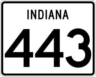
State Road 443 was a short state highway in West Lafayette, Indiana, less than 1.5 miles long. It ran along Happy Hollow Road for its entire length.

State Road 16 is an east–west state road in the US state of Indiana. The western terminus is at an intersection with U.S. Highway 41, near Ade, and its eastern terminus is at SR 5, near Huntington. The state road runs through seven counties in northern Indiana mostly through rural farm fields and small towns.

State Route 503 (SR 503) is a 54.11-mile-long (87.08 km) state highway serving Clark and Cowlitz counties in the U.S. state of Washington. The highway travels north from a short concurrency with SR 500 in Orchards through Battle Ground, the eastern terminus of SR 502, and communities in rural Clark County before crossing the Lewis River on the Yale Bridge. SR 503 intersects its spur route and turns west to parallel the Lewis River downstream to Woodland, where the highway ends at an interchange with Interstate 5 (I-5). The highway was part of the Lewis River Road, signed as State Road 15, from 1909 until 1919. The current route of SR 503 was split between Secondary State Highway 1S (SSH 1) from Woodland to Battle Ground and SSH 1U from Battle Ground to Orchards in 1937, combined to form SR 503 during the 1964 highway renumbering. A spur route, established in 1991, travels northeast into the Gifford Pinchot National Forest along Yale Lake, serving the community of Cougar.

Wabash Township is one of thirteen townships in Parke County, Indiana, United States. As of the 2010 census, its population was 818 and it contained 353 housing units.

Tippecanoe Township is one of thirteen townships in Tippecanoe County, Indiana, United States. As of the 2010 census, its population was 7,702 and it contained 3,085 housing units.

Interstate 64 (I-64) in the US state of Indiana is a major east–west highway providing access between Illinois and Kentucky. It passes through southern Indiana as part of its connection between the two metropolitan areas of St Louis, Missouri, and Louisville, Kentucky.
The Jessup Covered Bridge was north of Jessup, Indiana. The single-span Burr Arch covered bridge structure was built by the Jefferson P. Van Fossen in 1910 and destroyed by flood in 1989.

