
U.S. Route 52 (US 52) is a major United States highway in the central United States that extends from the northern to southeastern region of the United States. Contrary to most other even-numbered U.S. Highways, US 52 primarily follows a northwest–southeast route, and is signed north–south or east–west depending on the local orientation of the route. The highway's northwestern terminus is in Portal, North Dakota at the Canada–United States border, where it continues as Saskatchewan Highway 39. Its southeastern terminus is in Charleston, South Carolina, at Number 2 Meeting Street and White Point Garden along the Charleston Harbor.

U.S. Route 31 or U.S. Highway 31 (US 31) is a major north–south U.S. highway connecting southern Alabama to northern Michigan. Its southern terminus is at an intersection with US 90/US 98 in Spanish Fort, Alabama. Its northern terminus is at an interchange with Interstate 75 (I-75) south of Mackinaw City, Michigan.

U.S. Route 421 is a diagonal northwest–southeast United States Numbered Highway in the states of North Carolina, Tennessee, Virginia, Kentucky, and Indiana. The highway runs for 941 miles (1,514 km) from Fort Fisher, North Carolina, to US 20 in Michigan City, Indiana. Along its routing, US 421 serves several cities including Wilmington, North Carolina; Greensboro, North Carolina; Bristol, Tennessee and Virginia; Lexington, Kentucky; and Indianapolis, Indiana. US 421 is a spur route of US 21, which it meets west of Yadkinville, North Carolina.

U.S. Route 231 (US 231) is a north–south U.S highway that is a parallel route of US 31. It runs for 912 miles (1,468 km) from St. John, Indiana, at US 41 to south of US 98 in downtown Panama City, Florida. One of its most notable landmarks is the William H. Natcher Bridge, a 0.853 miles (1.373 km) long cable-stayed bridge that connects Rockport, Indiana, to Owensboro, Kentucky, spanning the Ohio River.

State Road 26 is an east–west discontinuous state road in the central part of the US state of Indiana. The western end of the western segment is at the Illinois border, where it continues as Illinois Route 9. The highway passes through rural areas of Warren and Tippecanoe counties, before ending near West Lafayette. The eastern segment begins at an interchange with Interstate 65 (I-65) and heads east passing through the cities of Kokomo, Hartford City, and Portland, before ending at the Ohio border, where it continues east as Ohio State Route 119. The road covers a distance of about 150.1 miles (241.6 km), passing through mostly rural areas.

State Road 1 (SR 1) is a north–south state highway in eastern Indiana, consisting of two segments. Its southern segment begins at U.S. Highway 50 and Interstate 275 in east-central Dearborn County, just east of Lawrenceburg, and ends at Interstate 469 south of Fort Wayne. Its northern segment begins at Interstate 69 on Fort Wayne's north side, and ends at U.S. Route 20 in east-central Steuben County, approximately 6 miles (9.7 km) east of Angola.

State Road 2 (SR 2) in the U.S. State of Indiana is an east–west route running from the Illinois border at Illinois Route 17 east to the outskirts of South Bend, Indiana, at the U.S. Route 20/U.S. Route 31 freeway, also known as the St. Joseph Valley Parkway. This is a distance of 80.98 miles (130.32 km).

State Road 3 (SR 3) in the U.S. state of Indiana is a discontinuous state highway running through eastern Indiana from near the Ohio River to near the Michigan state line. The southernmost terminus is at SR 62 in Charlestown, and the northernmost terminus is at SR 120 near Brighton.

State Road 67 in the U.S. state of Indiana cuts a diagonal route from southwest to northeast across the state from the north side of Vincennes to Indianapolis to the Ohio state line, where it becomes State Route 29 east of Bryant.
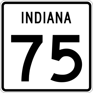
State Road 75, the highest two-digit route in the U.S. state of Indiana consists of two discontinuous north–south segments.

State Road 933 (SR 933) is an Indiana State Road that runs between Elkhart and South Bend in US state of Indiana. The 16.83 miles (27.09 km) of SR 933 that lie within the state serve as a major conduit. None of the highway is listed on the National Highway System. Various sections are urban two-lane highway and urbanized four-lane divided highway. The highway passes through residential and commercial properties.

State Road 10 (SR 10) is an east–west road in northwest Indiana. Its western terminus is at the Illinois state line west of Lake Village. Its eastern terminus is at State Road 19 (SR 19) south of Etna Green.

State Road 25 is a highway in the U. S. state of Indiana. Although it is designated a north–south road, in practice it travels generally northeast from its southern terminus at State Road 32 to its northern terminus at State Road 15 in Warsaw.

Interstate 65 (I-65) in the US state of Indiana traverses from the south-southeastern Falls City area bordering Louisville, Kentucky, through the centrally located capital city of Indianapolis, to the northwestern Calumet Region of the Hoosier State which is part of the Chicago metropolitan area. The Indiana portion of I-65 begins in Jeffersonville after crossing the Ohio River and travels mainly north, passing just west of Columbus prior to reaching the Indianapolis metro area. Upon reaching Indianapolis, the route alignment of I-65 begins to run more to the northwest and subsequently passes Lafayette on that city's east and north sides. Northwest of there, in west-central Jasper County, the route again curves more northward as it approaches the Calumet Region. Shortly after passing a major junction with I-80 and I-94, I-65 reaches its northern national terminus in Gary at I-90 which is carried on the Indiana East–West Toll Road. I-65 covers 261.27 miles (420.47 km) in the state of Indiana. This is one of the principal Interstate Highways that cross the state, and, more specifically, intersect at the city of Indianapolis, that has given the state the nickname of "Crossroads of America".
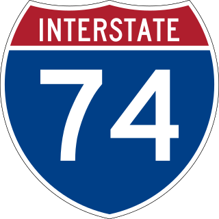
Interstate 74 (I-74) in the US state of Indiana traverses central parts of the state from west to east. It connects Champaign, Illinois, with Indianapolis in the center of the state, and Indianapolis with Cincinnati, Ohio. I-74 covers 171.54 miles (276.07 km) across Indiana, a portion of which is concurrently routed through Indianapolis along the southern and western legs of I-465.

U.S. Route 20 (US 20) in Indiana is a main east–west highway that is parallel to the Indiana Toll Road. The western terminus of US 20 is at the Illinois state line and the eastern terminus is at the Ohio state line. US 20 through Whiting, East Chicago, and Gary is concurrent with US 12 twice. The route varies between one-way, two-lane, and four-lane streets, in Northwest Indiana. From the east side of Gary to west of South Bend, US 20 is a four-lane undivided highway. The route then heads around the west and south sides of South Bend and Elkhart as a four-lane limited access divided highway. East of State Road 15 (SR 15), US 20 is two-lane rural highway.
U.S. Route 421 (US 421) enters Indiana from Kentucky, proceeding northwest to Indianapolis, joining Interstate 465, and then continuing northwest to Michigan City.

U.S. Route 24 (US 24) in Indiana runs east from the Illinois state line to Huntington. At Huntington, US 24 turns northeast and runs to Fort Wayne; it then runs concurrently with Interstate 69 (I-69) and I-469 to bypass the city before entering Ohio at the state line east of Fort Wayne. The segment of US 24 between Logansport and Toledo, Ohio, is part of the Hoosier Heartland Industrial Corridor project of the Intermodal Surface Transportation Efficiency Act.
U.S. Route 231 is the longest numbered highway in Indiana, covering over 284 miles (457 km). It is a main north–south highway in the western part of the state. The southern terminus of US 231 is at the Kentucky state line and the northern terminus is at US 41 just south of St. John. The highway is a mixture of expressway and two-lane roadway. The expressway portions exist mainly in southern Indiana and around the Lafayette area, with the rest mainly being two lanes.

