Fowler, Indiana

Last updated
Fowler, Indiana
Fowler town hall.png
Fowler's police department, town hall and public library
Benton County Indiana Incorporated and Unincorporated areas Fowler Highlighted 1825180.svg
Location of Fowler in Benton County, Indiana.
Map of Fowler, Indiana.svg
Map of Fowler
Location map for Benton County, Indiana.svg
Red pog.svg
Fowler, Indiana
Fowler's location in Benton County
Coordinates: 40°37′6″N87°19′9″W / 40.61833°N 87.31917°W / 40.61833; -87.31917 Coordinates: 40°37′6″N87°19′9″W / 40.61833°N 87.31917°W / 40.61833; -87.31917
Country United States
State Indiana
County Benton
Township Center
Area
[1]
  Total1.42 sq mi (3.67 km2)
  Land1.41 sq mi (3.66 km2)
  Water0.01 sq mi (0.01 km2)
Elevation
[2]
820 ft (250 m)
Population
 (2020)
  Total2,337
  Density1,655.10/sq mi (638.92/km2)
Time zone UTC-5 (EST)
  Summer (DST) UTC-4 (EDT)
ZIP codes
47944, 47984, 47986
Area code 765
FIPS code 18-25180 [3]
GNIS feature ID2396945 [2]
Website www.townoffowler.com

Fowler is a town in Center Township, Benton County, Indiana, United States. The population was 2,337 at the 2020 census. It is part of the Lafayette, Indiana Metropolitan Statistical Area.

Contents

History

Time capsule near the courthouse Fowler time capsule.png
Time capsule near the courthouse

Fowler was platted by husband and wife Moses and Eliza Fowler on October 26, 1872, [4] and originally consisted of 583 lots, though a re-platting on April 8, 1875, expanded it to 1,602 lots and 20 blocks. Several more additions were made to the town over subsequent years.

The town's first home was erected in March 1871 by Scott Shipman, and its first business opened in June of that year, a small general store run by Henry D. Clark. Many more businesses followed over the next few years, including the Henry Jacobs & Son grocery, grain elevators built by L. Templeton, and blacksmith John E. Mitchell, who was also the town's first postmaster (succeeded by grocer Henry Jacobs). In 1874, Fowler became the county seat, which until that time had occupied nearby Oxford.

The town was incorporated in 1875, and its rapid growth is clear from the following list, printed in an 1883 history of Benton County:

"In September, 1875, the town of Fowler contained ten lawyers, one minister, three doctors, one dentist, one baker, two barber shops, three billiard saloons, two blacksmith shops, one wagon shop, three boot and shoe stores, one grain elevator, two dry goods stores, twenty carpenters, one furniture store, two stove and tin stores, one hardware store, one hotel, three restaurants, two drug stores, three millinery establishments, two saloons, two livery stables, three retail groceries, one clothing store, one merchant tailor, one graded school, two printing offices, two lumber yards, two churches and about 1,200 inhabitants." [5]

Fowler is home to the Fowler Ridge Wind Farm.

The Benton County Courthouse, Fowler Theatre, and Fraser & Isham Law Office are listed on the National Register of Historic Places. [6]

Geography

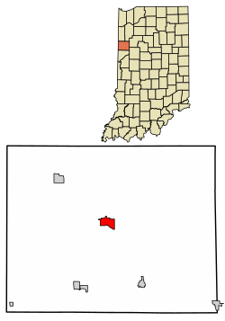
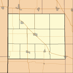
Fowler is located in Center Township. U.S. Route 52 and State Roads 18 and 55 pass through town, and U.S. Route 41 intersects 52 four miles to the northwest.

According to the 2010 census, Fowler has a total area of 1.41 square miles (3.65 km2), of which 1.4 square miles (3.63 km2) (or 99.29%) is land and 0.01 square miles (0.03 km2) (or 0.71%) is water. [7]

Demographics

Historical population
CensusPop.Note
1880 967
1890 1,28532.9%
1900 1,42911.2%
1910 1,4914.3%
1920 1,442−3.3%
1930 1,5648.5%
1940 1,90321.7%
1950 2,11711.2%
1960 2,49117.7%
1970 2,6436.1%
1980 2,319−12.3%
1990 2,3330.6%
2000 2,4153.5%
2010 2,317−4.1%
2020 2,3370.9%
U.S. Decennial Census [8]

2010 census

As of the census [9] of 2010, there were 2,317 people, 935 households, and 593 families living in the town. The population density was 1,655.0 inhabitants per square mile (639.0/km2). There were 1,062 housing units at an average density of 758.6 per square mile (292.9/km2). The racial makeup of the town was 96.7% White, 0.6% African American, 0.1% Native American, 0.1% Asian, 0.9% from other races, and 1.6% from two or more races. Hispanic or Latino of any race were 3.9% of the population.

There were 935 households, of which 30.2% had children under the age of 18 living with them, 47.9% were married couples living together, 11.4% had a female householder with no husband present, 4.1% had a male householder with no wife present, and 36.6% were non-families. 33.5% of all households were made up of individuals, and 15.3% had someone living alone who was 65 years of age or older. The average household size was 2.40 and the average family size was 3.08.

The median age in the town was 41.8 years. 25.1% of residents were under the age of 18; 7.1% were between the ages of 18 and 24; 21.9% were from 25 to 44; 25.9% were from 45 to 64; and 20% were 65 years of age or older. The gender makeup of the town was 47.9% male and 52.1% female.

2000 census

As of the census [3] of 2000, there were 2,415 people, 948 households, and 623 families living in the town. The population density was 1,730.6 inhabitants per square mile (668.2/km2). There were 1,020 housing units at an average density of 730.9 per square mile (282.2/km2). The racial makeup of the town was 98.14% White, 0.29% African American, 0.08% Asian, 0.41% from other races, and 1.08% from two or more races. Hispanic or Latino of any race were 0.87% of the population.

There were 949 households, out of which 32.9% had children under the age of 18 living with them, 53.7% were married couples living together, 9.6% had a female householder with no husband present, and 34.2% were non-families. 30.9% of all households were made up of individuals, and 14.9% had someone living alone who was 65 years of age or older. The average household size was 2.43 and the average family size was 3.04.

In the town, the population was spread out, with 27.0% under the age of 18, 6.9% from 18 to 24, 27.0% from 25 to 44, 21.0% from 45 to 64, and 18.1% who were 65 years of age or older. The median age was 38 years. For every 100 females, there were 96.3 males. For every 100 females age 18 and over, there were 88.1 males.

The median income for a household in the town was $40,396, and the median income for a family was $50,586. Males had a median income of $29,889 versus $21,781 for females. The per capita income for the town was $17,881. About 4.5% of families and 5.8% of the population were below the poverty line, including 7.1% of those under age 18 and 2.7% of those age 65 or over.

Education

The town has a lending library, the Benton County Public Library. [10]

Notable people

Related Research Articles

<span class="mw-page-title-main">Ambia, Indiana</span> Town in Indiana, United States

Ambia is a town in Hickory Grove Township, Benton County, Indiana, United States. The population was 239 at the 2010 census. It is part of the Lafayette, Indiana Metropolitan Statistical Area.

<span class="mw-page-title-main">Boswell, Indiana</span> Town in Indiana, United States

Boswell is a town in Grant Township, Benton County, Indiana, United States. The population was 778 at the 2010 census. It is part of the Lafayette, Indiana Metropolitan Statistical Area.

<span class="mw-page-title-main">Earl Park, Indiana</span> Town in Indiana, United States

Earl Park is a town in Richland Township, Benton County, Indiana, United States. The population was 348 at the 2010 census. It is part of the Lafayette, Indiana Metropolitan Statistical Area.

<span class="mw-page-title-main">Otterbein, Indiana</span> Town in Indiana, United States

Otterbein is a town in Bolivar Township, Benton County and Shelby Township, Tippecanoe County, Indiana, named for William Otterbein Brown who donated land for the town. As of the 2010 census, its population was 1,262.

<span class="mw-page-title-main">Oxford, Indiana</span> Town in Indiana, United States

Oxford is a town in Oak Grove Township, Benton County, Indiana. The population was 1,162 at the 2010 census. It is part of the Lafayette, Indiana, Metropolitan Statistical Area.

<span class="mw-page-title-main">St. Paul, Indiana</span> Town in Indiana, United States

St. Paul is a small town on the border of Decatur and Shelby counties in the U.S. state of Indiana. The population was 1,031 at the 2010 census.

<span class="mw-page-title-main">Daleville, Indiana</span> Town in Indiana, United States

Daleville is a town in Salem Township, Delaware County, Indiana, United States. The population was 1,651 at the 2020 census. It is part of the Muncie, IN Metropolitan Statistical Area.

<span class="mw-page-title-main">Bristol, Indiana</span> Town in Indiana, United States

Bristol is a town in Washington Township, Elkhart County, Indiana, United States. The population was 1,602 at the 2010 census.

<span class="mw-page-title-main">Spring Lake, Indiana</span> Town in Indiana, United States

Spring Lake is a town in Sugar Creek Township, Hancock County, Indiana, United States, along Sugar Creek. The population was 218 at the 2010 census.

<span class="mw-page-title-main">Coatesville, Indiana</span> Town in Indiana, United States

Coatesville is a town in Clay Township, Hendricks County, Indiana, United States. The population was 523 at the 2010 Census.

<span class="mw-page-title-main">Remington, Indiana</span> Town in Indiana, United States

Remington is a town in Carpenter Township, Jasper County, Indiana, United States. The population was 1,185 at the 2010 census.

<span class="mw-page-title-main">Clear Lake, Indiana</span> Town in Indiana, United States

Clear Lake is a town located in the northeast corner of Steuben County, Indiana, in Clear Lake Township. As such, is the northeasternmost community in the State of Indiana. The population was 339 at the 2010 census.

<span class="mw-page-title-main">Hudson, Indiana</span> Town in Indiana, United States

Hudson is a town in Salem and Steuben townships, Steuben County, in the U.S. state of Indiana. The population was 518 at the 2010 census.

<span class="mw-page-title-main">Wolcott, Indiana</span> Town in Indiana, United States

Wolcott is a town in Princeton Township, White County, in the U.S. state of Indiana. The population was 1,001 at the 2010 census.

<span class="mw-page-title-main">Atkins, Iowa</span> City in Iowa, United States

Atkins is a city in Benton County, Iowa, United States. The population was 2,056 at the 2020 census. It is part of the Cedar Rapids Metropolitan Statistical Area.

<span class="mw-page-title-main">Benton, Maine</span> Town in the state of Maine, United States

Benton is a town in Kennebec County, Maine, United States. It was formed in 1842, as a subdivision of the town of Clinton. The population was 2,715 at the 2020 census. The town was named for Missouri Senator Thomas Hart Benton.

<span class="mw-page-title-main">Benton, Missouri</span> City in Missouri, United States

Benton is a city in Scott County, Missouri, United States. The population was 863 at the 2010 census. It is the county seat of Scott County.

<span class="mw-page-title-main">Lake Benton, Minnesota</span> City in Minnesota, United States

Lake Benton is a city in Lincoln County, Minnesota, United States. The population was 683 at the 2010 census.

<span class="mw-page-title-main">Benton City, Washington</span> City in Washington, United States

Benton City is a city in Benton County, Washington, United States. The population was 3,038 at the 2010 census. The city shares a school district with the adjacent unincorporated community of Kiona.

<span class="mw-page-title-main">Millersburg, Indiana</span> Town in Indiana, United States

Millersburg is a town in Clinton and Benton townships, Elkhart County, Indiana, United States. The population was 903 at the 2010 census.

References

  1. "2020 U.S. Gazetteer Files". United States Census Bureau. Retrieved March 16, 2022.
  2. 1 2 U.S. Geological Survey Geographic Names Information System: Fowler, Indiana
  3. 1 2 "U.S. Census website". United States Census Bureau . Retrieved 2008-01-31.
  4. "Moses Fowler had far-reaching influence" - Journal & Courier , March 18, 2016
  5. Mossman 1883, p. 311.
  6. "National Register Information System". National Register of Historic Places . National Park Service. July 9, 2010.
  7. "G001 - Geographic Identifiers - 2010 Census Summary File 1". United States Census Bureau. Archived from the original on 2020-02-13. Retrieved 2015-07-16.
  8. "Census of Population and Housing". Census.gov. Retrieved June 4, 2015.
  9. "U.S. Census website". United States Census Bureau . Retrieved 2012-12-11.
  10. "Benton County Libraries". Benton County, IN. Retrieved 4 March 2018.

Bibliography