Gilboa Township | |
|---|---|
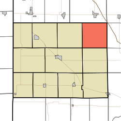 Location of Gilboa Township in Benton County | |
| Coordinates: 40°41′36″N87°09′31″W / 40.69333°N 87.15861°W | |
| Country | United States |
| State | Indiana |
| County | Benton |
| Organized | December 1866 |
| Government | |
| • Type | Indiana township |
| Area | |
• Total | 35.94 sq mi (93.1 km2) |
| • Land | 35.94 sq mi (93.1 km2) |
| • Water | 0 sq mi (0 km2) |
| Elevation | 758 ft (231 m) |
| Population (2020) | |
• Total | 282 |
| • Density | 7/sq mi (2.7/km2) |
| Time zone | UTC-5 (EST) |
| • Summer (DST) | UTC-4 (EDT) |
| Area code | 765 |
| FIPS code | 18-27630 [2] |
| GNIS feature ID | 453330 |
Gilboa Township is one of eleven townships in Benton County, Indiana. [3] As of the 2020 census, its population was 282 and it contained 100 housing units. [4] It is named for Mount Gilboa, a prominence in the southern part of the township. [5] It was created in 1866 out of the northern part of Pine Township, after the petition of 21 residents there. [6]
Contents
| Census | Pop. | Note | %± |
|---|---|---|---|
| 1890 | 854 | — | |
| 1900 | 839 | −1.8% | |
| 1910 | 721 | −14.1% | |
| 1920 | 705 | −2.2% | |
| 1930 | 625 | −11.3% | |
| 1940 | 578 | −7.5% | |
| 1950 | 513 | −11.2% | |
| 1960 | 442 | −13.8% | |
| 1970 | 363 | −17.9% | |
| 1980 | 311 | −14.3% | |
| 1990 | 281 | −9.6% | |
| 2000 | 241 | −14.2% | |
| 2010 | 250 | 3.7% | |
| 2020 | 282 | 12.8% | |
| Source: US Decennial Census [7] | |||
