Round Grove Township | |
|---|---|
 Part of the Meadow Lake Wind Farm in the township | |
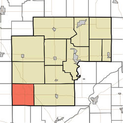 Location in White County | |
| Coordinates: 40°36′16″N87°02′12″W / 40.60444°N 87.03667°W | |
| Country | United States |
| State | Indiana |
| County | White |
| Government | |
| • Type | Indiana township |
| Area | |
• Total | 35.51 sq mi (92.0 km2) |
| • Land | 35.48 sq mi (91.9 km2) |
| • Water | 0.03 sq mi (0.078 km2) 0.08% |
| Elevation | 728 ft (222 m) |
| Population (2020) | |
• Total | 252 |
| • Density | 7.10/sq mi (2.74/km2) |
| ZIP codes | 47906, 47923 |
| GNIS feature ID | 453815 |
Round Grove Township is one of twelve townships in White County, Indiana, United States. As of the 2020 census, its population was 252 and it contained 100 housing units. [1]
Contents
- Geography
- Unincorporated towns
- Adjacent townships
- School districts
- Political districts
- References
- Citations
- Sources
- External links
Round Grove Township was established in 1858. [2] The township was named for a former round grove in the southern half of the township. [3]
| Census | Pop. | Note | %± |
|---|---|---|---|
| 1890 | 779 | — | |
| 1900 | 890 | 14.2% | |
| 1910 | 628 | −29.4% | |
| 1920 | 641 | 2.1% | |
| 1930 | 537 | −16.2% | |
| 1940 | 494 | −8.0% | |
| 1950 | 446 | −9.7% | |
| 1960 | 418 | −6.3% | |
| 1970 | 382 | −8.6% | |
| 1980 | 282 | −26.2% | |
| 1990 | 250 | −11.3% | |
| 2000 | 246 | −1.6% | |
| 2010 | 259 | 5.3% | |
| 2020 | 252 | −2.7% | |
| Source: US Decennial Census [4] | |||
