Freeland Park, Indiana | |
|---|---|
| A water pump in the town park | |
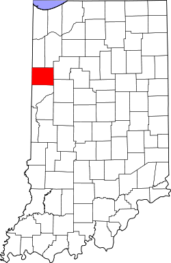
| Benton County's location in Indiana | |
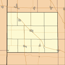
| Coordinates: 40°36′52″N87°29′28″W / 40.61444°N 87.49111°W | |
| Country | |
| State | |
| County | Benton |
| Township | Parish Grove |
| Platted | 1898 |
| Named after | Antoine Freeland |
| Elevation | 220 m (722 ft) |
| Time zone | UTC-5 (Eastern (EST)) |
| • Summer (DST) | UTC-4 (EDT) |
| ZIP code | 47944 |
| Area code | 765 |
| FIPS code | 18-25792 [2] |
| GNIS feature ID | 434812 |
Freeland Park is an unincorporated town in Parish Grove Township, Benton County, in the U.S. state of Indiana. [3] It is part of the Lafayette, Indiana Metropolitan Statistical Area.
Freeland Park was platted in 1898 and named for Antoine Freeland, the original owner of the town site. [4] It stood at the terminus of the Freeland Park branch of the Chicago and Eastern Illinois Railroad. A fire in 1914 badly damaged the town's business district. In the 1920s Freeland Park had two grain elevators, a high school, a Presbyterian church and eight to ten businesses. [5]
A post office was established at Freeland Park in 1901, and remained in operation until it was discontinued in 1957. [6]
Freeland Park is located at 40°36′52″N87°29′28″W / 40.61444°N 87.49111°W , half a mile south of the intersection of Indiana State Roads 18 and 71 and a little under two miles east of the Illinois state line. A small waterway known as Salmon Ditch runs just north of town and flows west into Illinois where it becomes Cole Creek.
...and named for Antoine Freeland, who owned the land.