List of U.S. Highways in Indiana

Last updated

US 6.svg US 41.svg US 231.svg
Standard US Highway shields
System information
NotesIndiana Routes are generally state-maintained.
Highway names
Interstates Interstate X (I-X)
US Highways U.S. Route X (US X)
State State Road X (SR X)
System links
  • Indiana State Highway System

The U.S. Highways in Indiana are those sections of United States Numbered Highways owned and maintained by the Indiana Department of Transportation (INDOT).

Contents

List

NumberLength (mi) [1] Length (km)Southern or western terminusNorthern or eastern terminusFormedRemovedNotes
US 6.svg US 6 149.490240.581 I-80/I-94/US 6 at Hammond US 6 near Butler 01931-06-081931 [2] currentGrand Army of the Republic Highway [2]
US 12.svg US 12 46.25874.445 US 12/US 20/US 41 at Whiting US 12 at Michiana Shores 01926-11-111926 [3] currentIron Brigade Highway [4]
US 20.svg US 20 155.734250.630 US 12/US 20/US 41 at Whiting US 20 near Angola 01926-11-111926 [5] current
US 24.svg US 24 166.846268.513 US 24/US 52 near Kentland US 24 near Fort Wayne 01926-11-111926 [5] current
US 27.svg US 27 117.765189.524 US 27 near Liberty I-69/US 24/US 30 at SR 3 in Fort Wayne 01926-11-111926 [5] currentPreviously extended northward into Michigan [5]
US 30.svg US 30 156.217251.407 US 30 at Dyer US 30 near Fort Wayne 01926-11-111926 [5] currentLincoln Highway
US 31.svg US 31 266.02428.12 US 31 at Clarksville US 31 near South Bend 01926-11-111926 [5] current
US 31E.svg US 31E US 31E at Clarksville US 31 in Sellersburg 01937-01-01193701980-01-011980Replaced by US 31 from Sellersburg to the Kentucky state line
US 31W.svg US 31W US 31W/US 150 at New Albany US 31 in Sellersburg 01937-01-01193701980-01-011980Replaced by SR 311
US 33.svg US 33 106.217170.940 US 33 near Decatur US 20 in Elkhart 01937-01-011937currentPreviously extended into Michigan
US 35.svg US 35 206.716332.677 I-70/US 35 near Richmond US 20 in Michigan City 01934-01-011934current
US 36.svg US 36 138.99223.68 US 36 near Dana US 36 near Lynn 01926-11-111926 [5] current
US 40.svg US 40 159.321256.402 US 40 near Liggett US 40 near Richmond 01926-11-111926 [5] currentNational Road
US 41.svg US 41 279.817450.322 US 41 at Evansville US 12/US 20/US 41 at Whiting 01926-11-111926 [5] current
US 50.svg US 50 171.38275.81 US 50 at Vincennes US 50 near Lawrenceburg 01926-11-111926 [5] current
US 52.svg US 52 202325 US 24/US 52 near Kentland I-74/US 52 at Ohio state line01926-11-111926 [5] current
US 131.svg US 131 0.6431.035 I-80/I-90 (Indiana Toll Road) near Middlebury US 131 near Middlebury01961-01-011961current
US 136.svg US 136 74.930120.588 US 136 near Foster I-74/I-465 in Speedway 01952-01-011952current
US 150.svg US 150 177.17285.13US 150 near West Terre Haute I-64/US 150 at New Albany 01926-01-011926current
US 152 (1926).svg US 152 168270 US 36/US 40/US 52 in Indianapolis US 41 in St. John 01934-01-01193401938-01-011938Replaced by US 231
US 224.svg US 224 39.37763.371 US 24 in Huntington US 224 near Decatur 01934-01-011934current
US 231.svg US 231 284.277457.499 US 231 at Rockport US 41 in St. John 01954-01-011954 [6] current
US 421.svg US 421 255.065410.487 US 421 near Madison US 20 in Michigan City 01951-01-011951current
US 460.svg US 460 Illinois state lineUS 31E/US 460 at Clarksville 01947-01-01194701977-01-011977Largely replaced by I-64, SR 62, and SR 66
US 641.svg US 641 US 41/US 641 at the Kentucky state lineUS 41/US 460/SR 62/SR 66 in Evansville01955-01-01195501971-01-011971Replaced by US 41
  •       Former

Special routes

NumberLength (mi)Length (km)Southern or western terminusNorthern or eastern terminusFormedRemovedNotes
Business plate.svg
US 6.svg US 6 Bus.
Illinois-Indiana state line Lake Station
Business plate.svg
US 6.svg US 6 Bus.
Served Bremen
Toll plate yellow.svg
US 12.svg US 12 Toll
Illinois-Indiana state line Hammond
US 20 Toll Bus. Illinois-Indiana state line Hammond
Alternate plate.svg
US 20.svg US 20 Alt.
Tremont Michigan City
Business plate.svg
US 20.svg US 20 Bus.
South Bend Mishawaka
By-pass plate.svg
US 20.svg US 20 Byp.
South Bend Elkhart
Truck plate.svg
US 20.svg US 20 Truck
Osceola Elkhart
Business plate.svg
US 24.svg US 24 Bus.
Logansport Richvalley
Business plate.svg
US 24.svg US 24 Bus.
Serves Peru
Business plate.svg
US 24.svg US 24 Bus.
Serves Wabash
Truck plate.svg
US 24.svg US 24 Truck
Served Fort Wayne
Truck plate.svg
US 27.svg US 27 Truck
Served Fort Wayne
US 31A.svg US 31A US 31/US 50 near Seymour US 31 in Columbus 01939-01-01193901981-01-011981Replaced by SR 11
By-pass plate.svg
US 31.svg US 31 Byp.
Served Kokomo
Business plate.svg
US 31.svg US 31 Bus.
Serves Peru
Alternate plate.svg
US 31.svg US 31 Alt.
Served Plymouth
Business plate.svg
US 31.svg US 31 Bus.
Serves Plymouth
Business plate.svg
US 31.svg US 31 Bus.
Serves South Bend
By-pass plate.svg
US 31.svg US 31 Byp.
Served South Bend
Business plate.svg
US 33.svg US 33 Bus.
Served Fort Wayne
Truck plate.svg
US 33.svg US 33 Truck
Served Fort Wayne
Business plate.svg
US 41.svg US 41 Bus.
Served Terre Haute
Business plate.svg
US 41.svg US 41 Bus.
Serves Vincennes
Business plate.svg
US 41.svg US 41 Bus.
Serves Princeton
Business plate.svg
US 41.svg US 41 Bus.
Serves Evansville
Business plate.svg
US 50.svg US 50 Bus.
Served Vincennes
Business plate.svg
US 50.svg US 50 Bus.
Served Washington
Business plate.svg
US 50.svg US 50 Bus.
Serves Bedford
Business plate.svg
US 52.svg US 52 Bus.
Serves Fowler
Business plate.svg
US 52.svg US 52 Bus.
Served Lafayette
US 112S (1926).svg US 112S Rolling Prairie Michigan state line01933-01-01193301934-01-011934
No image.svgBy-pass plate.svgNo image.svg
US 231.svg US 231 Byp.
Served Lafayette
  •       Former

See also

Related Research Articles

<span class="mw-page-title-main">Interstate Highway System</span> Network of freeways in the United States

The Dwight D. Eisenhower National System of Interstate and Defense Highways, commonly known as the Interstate Highway System or the Eisenhower Interstate System, is a network of controlled-access highways that forms part of the National Highway System in the United States. The system extends throughout the contiguous United States and has routes in Hawaii, Alaska, and Puerto Rico.
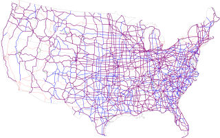
<span class="mw-page-title-main">United States Numbered Highway System</span> Highway system of the United States of America

The United States Numbered Highway System is an integrated network of roads and highways numbered within a nationwide grid in the contiguous United States. As the designation and numbering of these highways were coordinated among the states, they are sometimes called Federal Highways, but the roadways were built and have always been maintained by state or local governments since their initial designation in 1926.
<span class="mw-page-title-main">U.S. Route 224</span> U.S. Numbered Highway in Indiana, Ohio, and Pennsylvania in the United States

U.S. Route 224 (US 224) is a spur of US 24 that runs through the states of Indiana, Ohio and Pennsylvania. It currently runs for 289 miles (465 km) from US 24 in Huntington, Indiana, east to US 422 Business and Pennsylvania Route 18 (PA 18) in New Castle, Pennsylvania. It goes through the cities of Canfield, Ohio, Akron, Ohio, and Findlay, Ohio. In Northeast Ohio, US 224 is located a short distance north of the Western Reserve's southern boundary.

<span class="mw-page-title-main">U.S. Route 730</span> Highway in Oregon and Washington

U.S. Route 730 (US 730) is an east–west United States Highway, of which all but 6.08 miles of its 41.78 miles are within the state of Oregon. The highway starts in rural Morrow County in Eastern Oregon at an interchange with Interstate 84 (I-84) and US 30, located east of the city of Boardman. US 730 travels east along the Columbia River as a continuation of Columbia River Highway No. 2 into Umatilla County, intersecting I-82 and US 395 in the city of Umatilla. US 730 and US 395 form a short concurrency within the city before the highways part, with US 730 continuing northeast into Washington. The highway travels through rural Walla Walla County and ends at an intersection with US 12 south of Wallula.
<span class="mw-page-title-main">U.S. Route 12 in Indiana</span>

U.S. Route 12 (US 12) is a part of the United States Numbered Highway System that runs from Aberdeen, Washington, to Detroit, Michigan. In the U.S. state of Indiana, it is part of the state road system. US 12 enters the state concurrent with US 20 and US 41 in Whiting. The 46.258 miles (74.445 km) of US 12 that lie within Indiana serve as a major conduit. Some of the highway is listed on the National Highway System (NHS). Various sections are rural two-lane highway, urbanized four-lane undivided highway, and one-way streets. The easternmost community along the highway is Michiana Shores at the Michigan state line.

<span class="mw-page-title-main">U.S. Route 30 in Indiana</span> Highway in Indiana

U.S. Route 30 (US 30) is a road in the United States Numbered Highway System that runs from Astoria, Oregon, to Atlantic City, New Jersey. In Indiana, the route runs from the Illinois state line at Dyer to the Ohio state line east of Fort Wayne and New Haven. The 155.96 miles (250.99 km) of US 30 that lie within Indiana serve as a major conduit. The entire length of U.S. Route 30 in Indiana is included in the National Highway System (NHS). The highway includes four-lane, rural sections, an urbanized, four-lane divided expressway, and several high-traffic, six-lane freeway areas. First designated as a US Highway in 1926, US 30 replaced the original State Road 2 (SR 2) and SR 44 designation of the highway which dated back to the formation of the Indiana State Road system. A section of the highway originally served as part of the Lincoln Highway. Realignment and construction projects have expanded the highway to four lanes across the state, and the road is now part of a long stretch of US 30 from New Lenox, Illinois, to Canton, Ohio, where the road has at least four lanes. There are over 40 traffic signals between I-65 at Merrillville and I-69 at Fort Wayne.

References

  1. Indiana Department of Transportation (July 2016). Reference Post Book (PDF). Indianapolis: Indiana Department of Transportation. Retrieved January 24, 2018.
  2. 1 2 Weingroff, Richard F. (April 7, 2011). "U.S. 6 and The Grand Army of the Republic Highway". Highway History. Federal Highway Administration . Retrieved August 10, 2011.
  3. Weingroff, Richard (April 7, 2011). "US 12 Michigan to Washington". Highway History. Federal Highway Administration. Retrieved May 17, 2012.
  4. "Memorial Highways and Bridges". Indiana Department of Transportation. Archived from the original on May 15, 2011. Retrieved June 18, 2010.
  5. 1 2 3 4 5 6 7 8 9 10 11 Bureau of Public Roads & American Association of State Highway Officials (November 11, 1926). United States System of Highways Adopted for Uniform Marking by the American Association of State Highway Officials (Map). 1:7,000,000. Washington, DC: United States Geological Survey. OCLC   32889555 . Retrieved November 7, 2013 via Wikimedia Commons.
  6. Weingroff, Richard (April 7, 2011). "US 231 Indiana to Florida: How a Highway Grew". Highway History. Federal Highway Administration. Retrieved May 15, 2012.