Town of St. John, Indiana | |
---|---|
Coordinates: 41°26′36″N87°29′12″W / 41.44333°N 87.48667°W | |
Country | United States |
State | Indiana |
County | Lake |
Townships | Center, Hanover and St. John |
Founded | 1837 |
Government [1] (update needed) | |
• Type | Town |
• Body | Town Council |
• President | Gerald Swets (R, 3rd) |
• Vice-President | Mike Aurelio (R, 1st) |
• Members: | Bryan Blazak (R, AL), Wayne Pondinas (R, AL), Michael Schilling (R, 2nd) |
• Clerk-Treasurer | Beth Hernandez (R) |
Area | |
• Total | 12.75 sq mi (33.02 km2) |
• Land | 12.66 sq mi (32.80 km2) |
• Water | 0.09 sq mi (0.22 km2) |
Elevation | 699 ft (213 m) |
Population (2020) | |
• Total | 20,303 |
• Density | 1,603.33/sq mi (619.06/km2) |
Standard of living (2008-12) | |
• Per capita income | $36,490 |
• Median home value | $254,600 |
Time zone | UTC-6 (Central) |
• Summer (DST) | UTC-5 (Central) |
ZIP code | 46373 |
Area code | 219 |
FIPS code | 18-66852 [5] |
GNIS feature ID | 2396898 [3] |
Website | www.stjohnin.com |
Demographic | Proportion |
---|---|
White | 93.5% |
Black | 1.3% |
Asian | 1.3% |
Islander | 0.1% |
Native | 0.1% |
Other | 3.7% |
Hispanic (any race) | 8.2% |
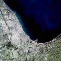
St. John or Saint John [3] is a town in Lake County, Indiana, United States. The town of St. John has homes in St. John Township, Hanover Township, and Center Township. It is a southeastern suburb of Chicago. St. John was founded in 1837. The population was 14,850 at the 2010 census. In 2009, St. John ranked 48th among CNN's top 100 places to live in the United States. [7] In 2014, St. John was ranked as the 4th safest place in Indiana by Movoto Real Estate. [8]
The St. John post office was established in 1846. [9] The community took its name from Saint Johns Church. [10] The Church was the first church in Lake County and was founded by German immigrant John Hack.
St. John is home to the Shrine of Christ’s Passion, opened in 2008. [11] An interactive display of the Passion of Christ, it contains 40 life-size statues depicting the time from the Agony in the Garden all the way to the Resurrection. It has attracted visitors from all 50 US states and more than 40 countries.[ citation needed ]
The Francis P. Keilman House was listed in the National Register of Historic Places in 2013. [12]
According to the 2010 census, St. John has a total area of 11.481 square miles (29.74 km2), of which 11.39 square miles (29.50 km2) (or 99.21%) is land and 0.091 square miles (0.24 km2) (or 0.79%) is water. [13]
Census | Pop. | Note | %± |
---|---|---|---|
1880 | 40 | — | |
1920 | 279 | — | |
1930 | 332 | 19.0% | |
1940 | 383 | 15.4% | |
1950 | 684 | 78.6% | |
1960 | 1,128 | 64.9% | |
1970 | 1,757 | 55.8% | |
1980 | 3,974 | 126.2% | |
1990 | 4,921 | 23.8% | |
2000 | 8,382 | 70.3% | |
2010 | 14,850 | 77.2% | |
2020 | 20,303 | 36.7% | |
U.S. Decennial Census [14] |
As of the census [4] of 2010, there were 14,850 people, 5,047 households, and 4,225 families living in the town. The population density was 1,303.8 inhabitants per square mile (503.4/km2). There were 5,201 housing units at an average density of 456.6 per square mile (176.3/km2). The racial makeup of the town was 93.5% White, 1.3% African American, 0.1% Native American, 1.3% Asian, 0.1% Pacific Islander, 2.4% from other races, and 1.2% from two or more races. Hispanic or Latino of any race were 8.2% of the population.
There were 5,047 households, of which 40.2% had children under the age of 18 living with them, 75.5% were married couples living together, 5.6% had a female householder with no husband present, 2.6% had a male householder with no wife present, and 16.3% were non-families. 13.9% of all households were made up of individuals, and 6% had someone living alone who was 65 years of age or older. The average household size was 2.94 and the average family size was 3.25.
The median age in the town was 40.2 years. 27.3% of residents were under the age of 18; 6.3% were between the ages of 18 and 24; 23.6% were from 25 to 44; 31.2% were from 45 to 64; and 11.3% were 65 years of age or older. The gender makeup of the town was 49.9% male and 50.1% female.
As of the census [5] of 2000, there were 8,382 people, 2,800 households, and 2,441 families living in the town. The population density was 1,246.6 inhabitants per square mile (481.3/km2). There were 2,847 housing units at an average density of 423.4 per square mile (163.5/km2). The racial makeup of the town was 91.55% White, 0.13% African American, 0.17% Native American, 0.47% Asian, 0.75% from other races, and 0.93% from two or more races. Hispanic or Latino of any race were 4.20% of the population.
There were 2,800 households, out of which 43.3% had children under the age of 18 living with them, 79.8% were married couples living together, 5.1% had a female householder with no husband present, and 12.8% were non-families. 11.1% of all households were made up of individuals, and 4.9% had someone living alone who was 65 years of age or older. The average household size was 2.99 and the average family size was 3.24.
In the town, the population was spread out, with 28.4% under the age of 18, 6.5% from 18 to 24, 28.3% from 25 to 44, 28.0% from 45 to 64, and 8.9% who were 65 years of age or older. The median age was 39 years. For every 100 females, there were 100.9 males. For every 100 females age 18 and over, there were 98.0 males.
The median income for a household in the town was $71,378, and the median income for a family was $75,231. Males had a median income of $55,554 versus $30,603 for females. The per capita income for the town was $25,106. About 1.1% of families and 1.7% of the population were below the poverty line, including 0.9% of those under age 18 and 2.9% of those age 65 or over.
St. John is served mostly by the Lake Central School Corporation (north of 101st Ave and west of Cline Ave), the Hanover Community School Corporation (south of 101st Ave and west of Cline Ave), and the Crown Point Community School Corporation (south of 101st Ave and east of Cline Ave). Three of the ten Lake Central schools are located in Saint John. These include:
In addition to public schools, the community is home to a variety of private schools including St. John Evangelist School, a Roman Catholic School serving grades K-8 and Crown Point Christian School, an evangelical school headed by a parent-owned association. Alongside Crown Point Christian School, Illiana Christian High School is an evangelical high school in the town. Many other residents attend for high school studies: Andrean High School (Merrillville), Bishop Noll Institute (Hammond), Marian Catholic High School (Chicago Heights, IL) and Mount Carmel High School (Chicago, IL).
John Kass, a columnist and radio broadcaster who comments on Chicago and Illinois politics, lives in Saint John. [15]
Leo-Cedarville is a town in Cedar Creek Township, Allen County, Indiana, United States. The population was 3,624 at the 2020 census.
Royal Center is a town in Boone Township, Cass County, Indiana, United States. The population was 861 at the 2010 census.
St. Leon or Saint Leon is a town in Kelso Township, Dearborn County, Indiana, United States. The population was 678 at the 2010 census.
Saint Joe is a town in Concord Township, DeKalb County, Indiana, United States. The population was 460 at the 2010 census.
Haubstadt is the second largest town, after Fort Branch, and fourth largest community in Gibson County, Indiana, United States. The population was 1,638 at the 2020 census. Haubstadt has recently become a bedroom community of Evansville and such, is part of the Evansville, Indiana, Metropolitan Area.
Syracuse is a town in Turkey Creek Township, Kosciusko County, in the U.S. state of Indiana. The population was 3,079 at the 2020 census. Syracuse is the location of Lake Syracuse and the nearby, larger Lake Wawasee, in addition to several other lakes in the region. The National Weather Service operates a Weather Forecast Office South of town, toward North Webster. It serves Northern Indiana, Northwestern Ohio and Southwestern Michigan.
Griffith is a town in North and St. John townships in Lake County, Indiana, United States. It is a part of the Chicago metropolitan area. The population was 16,420 in 2020. The town's population is currently declining at a rate of 0.69% annually. Griffith is the town with the 11th largest population and 17th largest town by area in the State of Indiana.
Lowell is a town in West Creek and Cedar Creek townships, Lake County, Indiana, United States. The population was 10,680 at the 2020 census.
Merrillville is a town in Ross Township, Lake County, Indiana, United States. The population was 35,246 at the 2010 census. Merrillville is in east-central Lake County, in the Chicago metropolitan area. On January 1, 2015, Merrillville became the most populated town in Indiana, as Fishers in Hamilton County was converted from a town to a city. The town serves as a major shopping hub for Northwest Indiana.
New Chicago is a town in Hobart Township, Lake County, Indiana, United States. The population was 2,035 at the 2010 census.
Schererville is a town in St. John Township, Lake County, Indiana, United States. The population was 29,646 at the 2020 census It is a suburb of Chicago, located 30 miles south of the city.
Winfield is a town in Winfield Township, Lake County, Indiana. The population was 2,298 at the time of the 2000 census, 4,383 in 2010, and 5,987 in 2019. The town was incorporated in 1993 in order to keep the residents from being annexed by other neighboring communities. Prior to that time it had been part of Winfield Township as an unincorporated town. Winfield is named for General Winfield Scott. The town is served by the Crown Point post office and addresses in Winfield share the Crown Point ZIP code.
Brooklyn is a town in Clay and Brown townships, Morgan County, Indiana, United States. The population was 2,511 at the 2020 census, up from 1,598 in 2010.
Monrovia is a town in Monroe Township, Morgan County, in the U.S. state of Indiana. The population was 1,643 at the 2020 census, up from 1,063 in 2010.
New Carlisle is a town in Olive Township, St. Joseph County, in the U.S. state of Indiana. The population was 1,891, as of the 2020 Census. It is part of the South Bend–Mishawaka, IN-MI, Metropolitan Statistical Area.
North Liberty is a town in Liberty Township, St. Joseph County, in the U.S. state of Indiana. The population was 1,896 at the 2010 Census. North Liberty is part of the South Bend–Mishawaka, IN-MI, Metropolitan Statistical Area.
Osceola is a town in Penn Township, St. Joseph County, in the U.S. state of Indiana. The population was 2,463 at the 2010 Census. It is part of the South Bend–Mishawaka, IN-MI, Metropolitan Statistical Area.
Walkerton is a town in Lincoln Township, St. Joseph County, in the U.S. state of Indiana. The population was 2,144 at the 2010 Census. It is part of the South Bend–Mishawaka, IN-MI, Metropolitan Statistical Area.
Sleepy Eye is a small city in rural Brown County, Minnesota, United States. The city is named after a famed local Dakota chief from the 1800s. The population was 3,599 at the 2010 census.
Stokesdale is a town in Guilford County, North Carolina, United States with small parts in the counties of Rockingham, Forsyth, and Stokes. The population was 5,924 at the 2020 census. Belews Lake is located nearby, and North Carolina Highway 68 and North Carolina Highway 65 both intersect U.S. Route 158 near the town's center.
...The community took its name from Saint Johns Church....