The area now known as Bartholomew County was long populated by indigenous peoples, including the Miami, Potawatomi, and Shawnee. The county is the site of numerous mounds, and human remains dating back as far as 3,000 years have been uncovered in the county. Early settlers recounted the presence of large villages along the various creeks and rivers in the area.[3][4] The area was within the territory of the Haudenosaunee, and was part of the lands officially ceded to Great Britain in the 1701 Nanfan Treaty. Encroachment by European settlers, contested by indigenous peoples, began in the years after the American Revolutionary War with the 1787 Northwest Ordinance. By then, Delaware people lived in the area. A series of treaties, beginning with the 1804 Treaty with the Piankeshaw,[5] initiated the incorporation of the area into the United States. This process was ended with the 1818 Treaty of St. Mary's, although violent conflict with indigenous peoples was mostly over by 1813 and white settlers had begun to squat on the land by 1816.[6]
Bartholomew County was formed on February 12, 1821, and was named for Lt. Col. Joseph Bartholomew, wounded at the Battle of Tippecanoe.[7] Bartholomew and his fellow officer John Tipton led militia through the county in 1813, and Tipton purchased several parcels in the area in 1820, building a cabin at the confluence of the White and Driftwood rivers. The site of the county seat was chosen on February 15, 1821, by a team of commissioners, who suggested the name Tiptona, in honor of Tipton. In July of the same year, the Legislature renamed Tiptona to Columbus, in honor of Christopher Columbus.
The county's first general store was built in the fall of 1821, and trade routes connecting Columbus with Cincinnati, Indianapolis, Chicago, and Madison were built by 1835. Although indigenous people continued living in Bartholomew County after its formation, they were soon forced out by settlers. A band visited the courthouse in 1830, and Dr. John Beck, an early settler, recounted visits by solitary natives as late as 1839.[6] Mills were built along the Driftwood River following the establishment of trade routes, and the Madison and Indianapolis Railroad began servicing Columbus in 1844. The arrival of the railroad spurred the establishment of local industry in and around Columbus. The current Bartholomew County Courthouse was completed in 1871. Notably, Cummins Inc. was established in Columbus in 1919.
Cummins grew rapidly during and after World War II to become a national, and later global, leader in the production of engines and generators. Under the leadership of J. Irwin Miller, the company sponsored the building of dozens of structures in and around Columbus by eminent architects including I.M. Pei, Eilel and Eero Saarinen, and Harry Weese.[8] Today, the local economy continues to be shaped by the presence of Cummins and other manufacturers. Its built heritage attracts a large number of tourists and architects.[9]
Geography
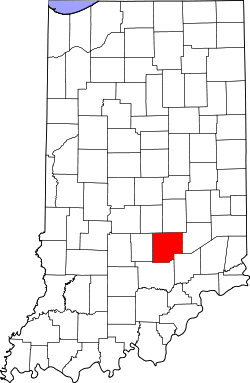
Map of Bartholomew County
According to the 2010 census, the county has a total area of 409.52 square miles (1,060.7km2), of which 406.91 square miles (1,053.9km2) (or 99.36%) is land and 2.62 square miles (6.8km2) (or 0.64%) is water.[10]Camp Atterbury occupies the northwestern corner of the county.
In recent years, average temperatures in Columbus have ranged from a low of 19°F (−7°C) in January to a high of 86°F (30°C) in July, although a record low of −27°F (−33°C) was recorded in January 1912 and a record high of 111°F (44°C) was recorded in July 1934. Average monthly precipitation ranged from 2.63 inches (67mm) in February to 4.63 inches (118mm) in May.[11]
County Council: The county council is the legislative branch of the county government and controls all the spending and revenue collection in the county. Representatives are elected from county districts. The council members serve four-year terms. They are responsible for setting salaries, the annual budget, and special spending. The council also has limited authority to impose local taxes, in the form of an income and property tax that is subject to state level approval, excise taxes, and service taxes.[12][13]
Board of Commissioners: The executive body of the county is made of a board of commissioners. The commissioners are elected county-wide, in staggered terms, and each serves a four-year term. One of the commissioners, typically the most senior, serves as president. The commissioners are charged with executing the acts legislated by the council, collecting revenue, and managing the day-to-day functions of the county government.[12][13]
Court: The county maintains a small claims court that can handle some civil cases. The judge on the court is elected to a term of four years and must be a member of the Indiana Bar Association. The judge is assisted by a constable who is also elected to a four-year term. In some cases, court decisions can be appealed to the state level circuit court.[13]
County Officials: The county has several other elected offices, including sheriff, coroner, auditor, treasurer, recorder, surveyor, and circuit court clerk. Each of these elected officers serves a term of four years and oversees a different part of county government. Members elected to county government positions are required to declare a party affiliation and to be residents of the county.[13]
As of the 2020 United States census, there were 82,208people and 31,452households residing in the county.[24] The population density was 188.7 inhabitants per square mile (72.9/km2). There were 33,098 housing units at an average density of 81.3 per square mile (31.4/km2).[10] Per the 2020 census, the racial makeup of the county was 80.0% white, 6.6% Asian, 2.2% black or African American, 0.4% American Indian, 0.1% Pacific islander, 4.7% from other races, and 6.1% from two or more races. Those of Hispanic or Latino origin made up 8.8% of the population.[24] In terms of ancestry, according the 2010 census, 28.5% were German, 12.4% were English, 12.2% were Irish, and 10.7% were American.[25]
Of the 29,860households in 2010, 34.6% had children under the age of 18 living with them, 54.1% were married couples living together, 10.7% had a female householder with no husband present, 30.4% were non-families, and 25.3% of all households were made up of individuals. The average household size was 2.53 and the average family size was 3.02. The median age was 38.2 years.[24]
In 2010, the median income for a household in the county was $47,697 and the median income for a family was $64,024. Males had a median income of $50,358 versus $32,334 for females; the per capita income for the county was $26,860; and approximately 7.7% of families and 10.4% of the population were below the poverty line, including 15.8% of those under age 18 and 5.3% of those age 65 or over.[26]
This page is based on this Wikipedia article Text is available under the CC BY-SA 4.0 license; additional terms may apply. Images, videos and audio are available under their respective licenses.