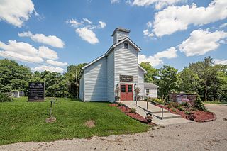
Putnamville is an unincorporated community in Warren Township, Putnam County, in the U.S. state of Indiana.

Ogilville is a diffuse, unincorporated community in Ohio Township, Bartholomew County, in the U.S. state of Indiana. It is located along State Road 58 close to where it crosses over East Fork White Creek. It is located southwest on SR 58 of North Ogilville. There is a grocery there, also a fire-and-rescue service; and scattered homes.

Fayette is an unincorporated community in Perry Township, Boone County, in the U.S. state of Indiana.

Herr is an unincorporated community in Perry Township, Boone County, in the U.S. state of Indiana.

Milledgeville is an unincorporated community in Harrison Township, Boone County, in the U.S. state of Indiana.

New Brunswick is an unincorporated community in Harrison Township, Boone County, in the U.S. state of Indiana.

Camp Roberts is an unincorporated community in Washington Township, Brown County, in the U.S. state of Indiana.

Clarksdale is an unincorporated community in Washington Township, Brown County, in the U.S. state of Indiana.

Lanam is an unincorporated community in Jackson Township, Brown County, in the U.S. state of Indiana.

Peoga is an unincorporated community in Brown and Johnson counties, in the U.S. state of Indiana.
Briarwood is an unincorporated community in Gregg Township, Morgan County, in the U.S. state of Indiana.
Bunker Hill is an unincorporated community in Monroe Township, Morgan County, in the U.S. state of Indiana.
Cope is an unincorporated community in Green Township, Morgan County, in the U.S. state of Indiana.
Exchange is an unincorporated community in Green Township, Morgan County, in the U.S. state of Indiana.
Gasburg is an unincorporated community in Monroe Township, Morgan County, in the U.S. state of Indiana.
Plano is an unincorporated community in Ashland Township, Morgan County, in the U.S. state of Indiana.
Young is an unincorporated community in Brown Township, Morgan County, in the U.S. state of Indiana.
Miller is an unincorporated community in Madison Township, Morgan County, in the U.S. state of Indiana.
Denmark is an unincorporated community in the southwest portion of Marion Township, Owen County, in the U.S. state of Indiana. It lies near the intersection of County Road 1400 West and County Road 150 South, which is a community about fifteen miles west of the city of Spencer, the county seat of Owen County. Its elevation is 722 feet, and it is located at 39°16′11″N87°1′33″W.
Smithville is an unincorporated community in the northwest corner of Marion Township, Owen County, in the U.S. state of Indiana. It lies near the intersection of County Road 200 North and County Road 1400 West, which is a community about fifteen miles west of the city of Spencer, the county seat. Its elevation is 591 feet, and it is located at 39°19′15″N87°1′33″W.


