Waynesville, Indiana | |
|---|---|
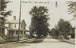 Waynesville in 1912 | |
 Bartholomew County's location in Indiana | |
 Waynesville Location in Bartholomew County | |
| Coordinates: 39°06′47″N85°53′28″W / 39.11306°N 85.89111°W | |
| Country | United States |
| State | Indiana |
| County | Bartholomew |
| Township | Wayne |
| Elevation | 600 ft (200 m) |
| Time zone | UTC-5 (Eastern (EST)) |
| • Summer (DST) | UTC-4 (EDT) |
| ZIP code | 47201 |
| FIPS code | 18-82034 [2] |
| GNIS feature ID | 2830319 [1] |
Waynesville is an unincorporated community and census designated place (CDP) in Wayne Township, Bartholomew County, in the U.S. state of Indiana. [1]
