
Columbus is a city in, and the county seat of, Bartholomew County, Indiana, United States. The population was 50,474 at the 2020 Census. The city is known for its architectural significance, having commissioned numerous noted works of modern architecture and public art since the mid-20th century; the annual program Exhibit Columbus celebrates this legacy. Located about 40 mi (64 km) south of Indianapolis, on the east fork of the White River, it is the state's 20th-largest city. It is the principal city of the Columbus, Indiana metropolitan statistical area, which encompasses all of Bartholomew County. Columbus is the birthplace of former Indiana Governor and former Vice President of the United States, Mike Pence.

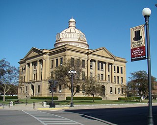
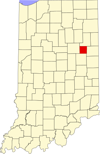
Bartholomew County is a county located in the U.S. state of Indiana. The population was 82,208 at the 2020 census. The county seat is Columbus. The county was determined by the U.S. Census Bureau to be home to the mean center of U.S. population in 1900.
Lincoln is a city in Logan County, Illinois, United States. First settled in the 1830s, it is the only town in the United States that was named for Abraham Lincoln before he became president; he practiced law there from 1847 to 1859. Lincoln is home to two prisons. It is also the home of the world's largest covered wagon and numerous other historical sites along the Route 66 corridor.

Hope is a town in Haw Creek Township, Bartholomew County, Indiana, United States, known for its historic character. The population was 2,102 at the 2010 census. It is part of the Columbus, Indiana, metropolitan statistical area.
Arcadia is a town in Jackson Township, Hamilton County, Indiana, United States. The population was 1,666 at the 2010 census.

La Crosse is a town in LaPorte County, Indiana, United States. The population was 551 at the 2010 census. It is included in the Michigan City, Indiana-La Porte, Indiana Metropolitan Statistical Area.

St. Paris or Saint Paris is a village in Champaign County, Ohio, United States. The population was 1,882 at the 2020 census.
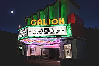
Galion is a city in Crawford, Morrow, and Richland counties in the U.S. state of Ohio. The population was 10,453 at the 2020 census. Galion is the second-largest city in Crawford County after Bucyrus.
Bellefontaine is a city in and the county seat of Logan County, Ohio, United States, located 48 miles (77 km) northwest of Columbus. The population was 14,115 at the 2020 Census. It is the principal city of the Bellefontaine micropolitan area, which includes all of Logan County. The highest point in Ohio, Campbell Hill, is within the city limits.

Redfield is a city in and the county seat of Spink County, South Dakota, United States. The population was 2,214 at the 2020 census. The city was named for J. B. Redfield, a railroad official.

Chauncey Rose was a successful American businessman of the 19th century.

Riverside is a small unincorporated community on the border of Davis Township and Logan Township in Fountain County, Indiana, United States.

Logansport is a city in and the county seat of Cass County, Indiana, United States. The population was 18,366 at the 2020 census. Logansport is located in northern Indiana at the junction of the Wabash and Eel rivers, northwest of Kokomo.

Flat Rock Township is one of twelve townships in Bartholomew County, Indiana, United States. As of the 2010 census, its population was 1,574 and it contained 653 housing units.

Azalia is an unincorporated community in Sand Creek Township, Bartholomew County, in the U.S. state of Indiana.
Grammer is an unincorporated community in Rock Creek Township, Bartholomew County, in the U.S. state of Indiana.
Lowell is an unincorporated community in Columbus Township, Bartholomew County, in the U.S. state of Indiana.
Old Saint Louis is an unincorporated community in Haw Creek Township, Bartholomew County, in the U.S. state of Indiana.
Converse is an unincorporated community in Jackson Township, Blackford County, in the U.S. state of Indiana. Although not much of the community remains, the U.S. Geological Survey considers it a populated place. The community existed as a "flag" station along a railroad, and is named after railroad executive Joel N. Converse. Like many communities in Blackford County, this village declined after the end of the Indiana Gas Boom, which ended in the early 20th century.
Grandview Lake is an platted town and census-designated place in Ohio Township, Bartholomew County, in the U.S. state of Indiana. It shares its name with the lake at its center. It was largely developed in the 1960s.


