This is a list of the National Register of Historic Places listings in Porter County, Indiana.

This is a list of the National Register of Historic Places listings in Hamilton County, Indiana.
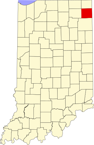
This is a list of the National Register of Historic Places listings in DeKalb County, Indiana.

This is a list of the National Register of Historic Places listings in Tippecanoe County, Indiana.

This is a list of the National Register of Historic Places listings in Brown County, Indiana.
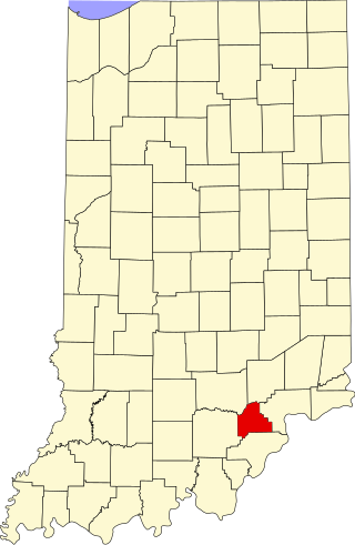
This is a list of the National Register of Historic Places listings in Scott County, Indiana.

This is a list of the National Register of Historic Places listings in Whitley County, Indiana.
This is a list of the National Register of Historic Places listings in Daviess County, Indiana.

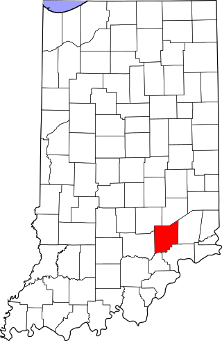
This is a list of the National Register of Historic Places listings in Decatur County, Indiana.

This is a list of the National Register of Historic Places listings in Fountain County, Indiana.

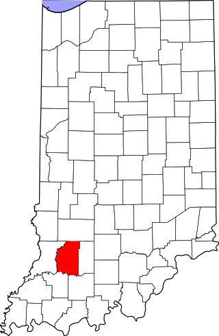
This is a list of the National Register of Historic Places listings in Greene County, Indiana.

This is a list of the National Register of Historic Places listings in Henry County, Indiana.

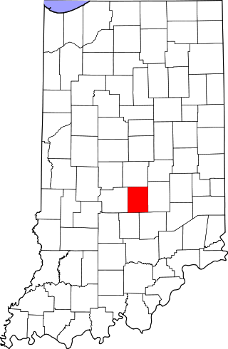
This is a list of the National Register of Historic Places listings in Jackson County, Indiana.
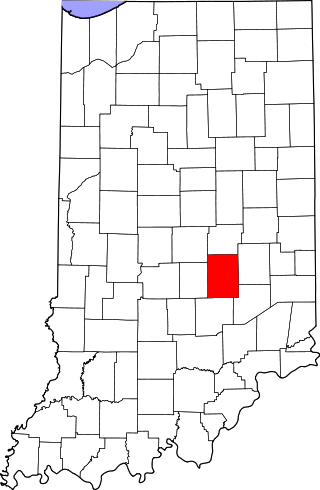
This is a list of the National Register of Historic Places listings in Jennings County, Indiana.
This is a list of the National Register of Historic Places listings in Johnson County, Indiana.
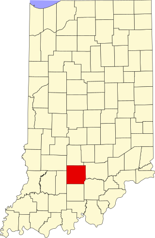
This is a list of the National Register of Historic Places listings in Lawrence County, Indiana.

This is a list of the National Register of Historic Places listings in Perry County, Indiana.

This is a list of the National Register of Historic Places listings in Pike County, Indiana.

This is a list of the National Register of Historic Places listings in Randolph County, Indiana.
This is a list of the National Register of Historic Places listings in Shelby County, Indiana.