National Register of Historic Places listings in Kosciusko County, Indiana

Last updated

Location of Kosciusko County in Indiana Map of Indiana highlighting Kosciusko County.svg
Location of Kosciusko County in Indiana

This is a list of the National Register of Historic Places listings in Kosciusko County, Indiana.

Contents

This is intended to be a complete list of the properties and districts on the National Register of Historic Places in Kosciusko County, Indiana, United States. Latitude and longitude coordinates are provided for many National Register properties and districts; these locations may be seen together in a map. [1]

There are 17 properties and districts listed on the National Register in the county.

Properties and districts located in incorporated areas display the name of the municipality, while properties and districts in unincorporated areas display the name of their civil township. Properties and districts split between multiple jurisdictions display the names of all jurisdictions.


    This National Park Service list is complete through NPS recent listings posted September 1, 2023. [2]

Map all coordinates using: OpenStreetMap

Current listings

[3] Name on the Register [4] ImageDate listed [5] Location City or townDescription
1 Chinworth Bridge
Chinworth Bridge Chinworth Bridge from northwest.jpg
Chinworth Bridge
January 2, 1997
(#96001546)
Junction of Old U.S. Route 30 and Road 350 W west of Warsaw, across the Tippecanoe River
41°14′49″N85°54′38″W / 41.246944°N 85.910556°W / 41.246944; -85.910556 (Chinworth Bridge)
Harrison and Wayne Townships
2 DIXIE (sternwheeler)
DIXIE (sternwheeler) Dixie at Webster Lake.jpg
DIXIE (sternwheeler)
September 24, 2009
(#09000757)
400 block of S. Dixie Dr.
41°19′22″N85°41′36″W / 41.322778°N 85.693333°W / 41.322778; -85.693333 (DIXIE (sternwheeler))
North Webster
3 East Fort Wayne Street Historic District
East Fort Wayne Street Historic District Fort Wayne East 503-509 in Warsaw.jpg
East Fort Wayne Street Historic District
May 27, 1993
(#93000472)
503-613 E. Fort Wayne St.
41°14′25″N85°51′01″W / 41.240278°N 85.850278°W / 41.240278; -85.850278 (East Fort Wayne Street Historic District)
Warsaw
4 Hall Farm
Hall Farm Hall Farm at Clunette.jpg
Hall Farm
September 16, 1992
(#92001164)
Junction of 600N and 400W at Clunette
41°19′13″N85°55′20″W / 41.320278°N 85.922222°W / 41.320278; -85.922222 (Hall Farm)
Prairie Township
5 Kosciusko County Jail
Kosciusko County Jail Kosciusko County Jail.jpg
Kosciusko County Jail
December 8, 1978
(#78000036)
Main and Indiana Sts.
41°14′19″N85°51′20″W / 41.238611°N 85.855556°W / 41.238611; -85.855556 (Kosciusko County Jail)
Warsaw
6 Leesburg Historic District
Leesburg Historic District West Van Buren, first block.jpg
Leesburg Historic District
May 27, 1993
(#93000465)
100 block of E. and W. Van Buren St.
41°19′54″N85°51′00″W / 41.331667°N 85.85°W / 41.331667; -85.85 (Leesburg Historic District)
Leesburg
7 Little Crow Milling Company Factory
Little Crow Milling Company Factory Little Crow Milling Company Factory.jpg
Little Crow Milling Company Factory
May 24, 2018
(#100002488)
201 S. Detroit St.
41°14′12″N85°51′10″W / 41.2367°N 85.8528°W / 41.2367; -85.8528 (Little Crow Milling Company Factory)
Warsaw
8 Mock School
Mock School Mock School from east.jpg
Mock School
December 27, 2010
(#10001081)
Northwestern corner of the junction of N550E and E875N, south of Syracuse
41°21′40″N85°44′25″W / 41.361000°N 85.740139°W / 41.361000; -85.740139 (Mock School)
Turkey Creek Township
9 Robert Orr Polygonal Barn
Robert Orr Polygonal Barn ROBERT ORR POLYGONAL BARN, KOSCIUSKO COUNTY.jpg
Robert Orr Polygonal Barn
April 2, 1993
(#93000190)
State Road 13 south of North Webster, ½ mile north of its junction with Road 150 N
41°15′43″N85°42′12″W / 41.261944°N 85.703333°W / 41.261944; -85.703333 (Robert Orr Polygonal Barn)
Washington Township
10 Pierceton Historic District
Pierceton Historic District Pierceton-indiana-downtown.jpg
Pierceton Historic District
September 4, 1992
(#92001147)
N. 1st St. from Catholic St. to the former Conrail railroad tracks
41°11′59″N85°42′19″W / 41.199722°N 85.705278°W / 41.199722; -85.705278 (Pierceton Historic District)
Pierceton
11 John Pound Store
John Pound Store John Pound Store.jpg
John Pound Store
June 17, 1992
(#92000672)
Junction of Armstrong Rd. and 2nd St. at Oswego
41°19′13″N85°47′14″W / 41.320278°N 85.787361°W / 41.320278; -85.787361 (John Pound Store)
Plain Township
12 Silver Lake Historic District
Silver Lake Historic District 101 E. Main in Silver Lake.jpg
Silver Lake Historic District
September 4, 1992
(#92001148)
100 blocks of N. and S. Jefferson and E. and W. Main Sts.
41°04′19″N85°53′32″W / 41.071944°N 85.892222°W / 41.071944; -85.892222 (Silver Lake Historic District)
Silver Lake
13 Warner House-Warner Schoolhouse August 28, 2023
(#100009298)
Northwest corner of North and East Sts.
41°19′37″N85°41′48″W / 41.3270°N 85.6966°W / 41.3270; -85.6966 (Warner House-Warner Schoolhouse)
North Webster
14 Warsaw Courthouse Square Historic District
Warsaw Courthouse Square Historic District Kosciusko County Courthouse from southeast near sunset.jpg
Warsaw Courthouse Square Historic District
March 1, 1982
(#82000046)
Bounded by Center, N. Lake, Main, and Indiana Sts.; also roughly bounded by W. Main, W. Lake, Center, and S. Indiana Sts., and the alleys behind Indiana, Market, Lake, and Main Sts.
41°14′19″N85°51′24″W / 41.238611°N 85.856667°W / 41.238611; -85.856667 (Warsaw Courthouse Square Historic District)
Warsaw Second set of boundaries represents a boundary increase of September 21, 1993
15 Warsaw Cut Glass Company
Warsaw Cut Glass Company Warsaw Cut Glass Company.jpg
Warsaw Cut Glass Company
March 1, 1984
(#84001059)
505 S. Detroit St.
41°14′01″N85°51′10″W / 41.233611°N 85.852639°W / 41.233611; -85.852639 (Warsaw Cut Glass Company)
Warsaw
16 Winona Lake Historic District
Winona Lake Historic District Westminster Hotel in Winona Lake.jpg
Winona Lake Historic District
December 10, 1993
(#93001411)
Roughly bounded by Kings Highway, Chestnut Ave., 12th St., and Park Ave.
41°13′39″N85°49′13″W / 41.2275°N 85.820278°W / 41.2275; -85.820278 (Winona Lake Historic District)
Winona Lake
17 Justin Zimmer House
Justin Zimmer House Justin Zimmer House.jpg
Justin Zimmer House
December 19, 1991
(#91001865)
2513 E. Center St.
41°14′18″N85°49′18″W / 41.238333°N 85.821666°W / 41.238333; -85.821666 (Justin Zimmer House)
Warsaw

See also

Related Research Articles

<span class="mw-page-title-main">National Register of Historic Places listings in Elkhart County, Indiana</span>

This is a list of the National Register of Historic Places listings in Elkhart County, Indiana.

<span class="mw-page-title-main">National Register of Historic Places listings in DeKalb County, Indiana</span>

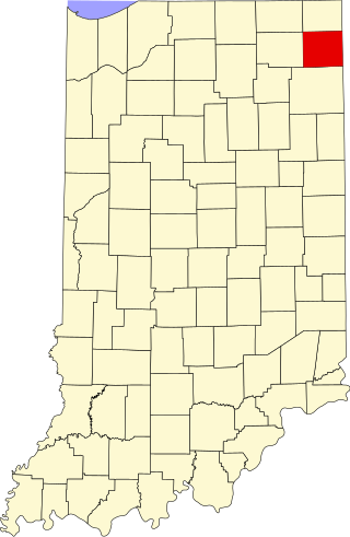
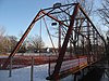
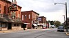
This is a list of the National Register of Historic Places listings in DeKalb County, Indiana.

<span class="mw-page-title-main">National Register of Historic Places listings in Bartholomew County, Indiana</span>

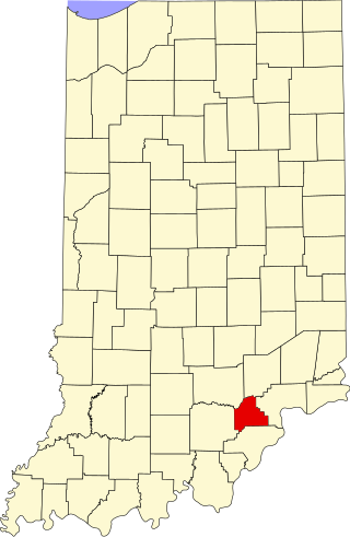
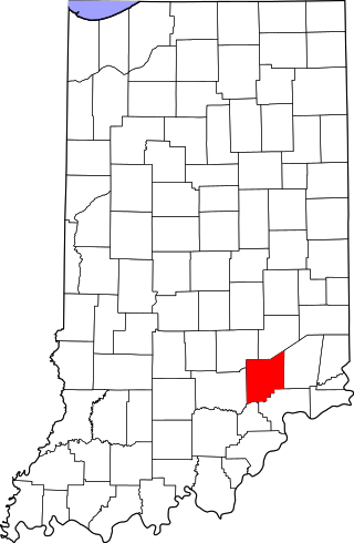
This is a list of the National Register of Historic Places listings in Bartholomew County, Indiana.

<span class="mw-page-title-main">National Register of Historic Places listings in Wabash County, Indiana</span>

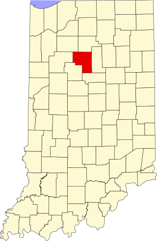
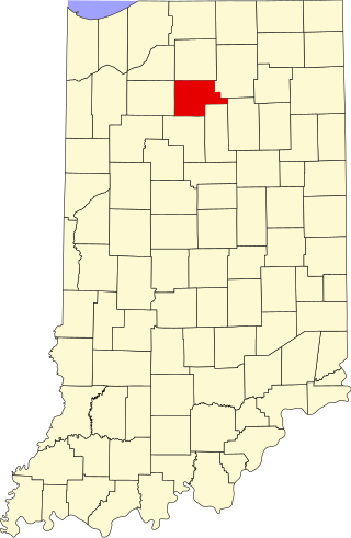
This is a list of the National Register of Historic Places listings in Wabash County, Indiana.

<span class="mw-page-title-main">National Register of Historic Places listings in Adams County, Indiana</span>

This is a list of the National Register of Historic Places listings in Adams County, Indiana.

<span class="mw-page-title-main">National Register of Historic Places listings in Blackford County, Indiana</span>

This is a list of the National Register of Historic Places listings in Blackford County, Indiana.

<span class="mw-page-title-main">National Register of Historic Places listings in Cass County, Indiana</span>

This is a list of the National Register of Historic Places listings in Cass County, Indiana.

<span class="mw-page-title-main">National Register of Historic Places listings in Montgomery County, Indiana</span>

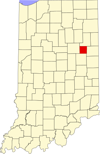
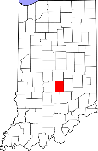
This is a list of the National Register of Historic Places listings in Montgomery County, Indiana.

<span class="mw-page-title-main">National Register of Historic Places listings in Scott County, Indiana</span>

This is a list of the National Register of Historic Places listings in Scott County, Indiana.

<span class="mw-page-title-main">National Register of Historic Places listings in Whitley County, Indiana</span>

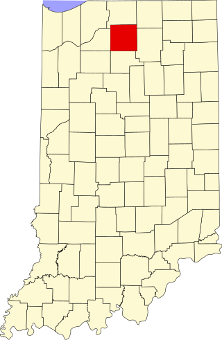
This is a list of the National Register of Historic Places listings in Whitley County, Indiana.

<span class="mw-page-title-main">National Register of Historic Places listings in Decatur County, Indiana</span>

This is a list of the National Register of Historic Places listings in Decatur County, Indiana.

<span class="mw-page-title-main">National Register of Historic Places listings in Dubois County, Indiana</span>

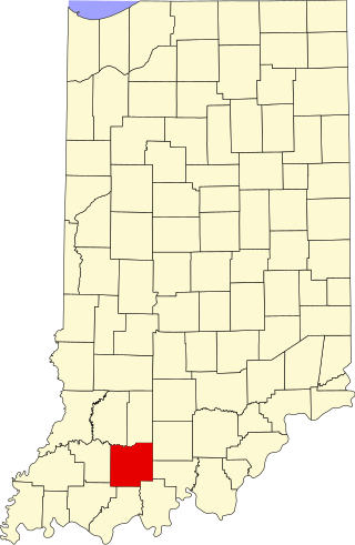
This is a list of the National Register of Historic Places listings in Dubois County, Indiana.

<span class="mw-page-title-main">National Register of Historic Places listings in Fountain County, Indiana</span>

This is a list of the National Register of Historic Places listings in Fountain County, Indiana.

<span class="mw-page-title-main">National Register of Historic Places listings in Fulton County, Indiana</span>

This is a list of the National Register of Historic Places listings in Fulton County, Indiana.

<span class="mw-page-title-main">National Register of Historic Places listings in Hendricks County, Indiana</span>

This is a list of the National Register of Historic Places listings in Hendricks County, Indiana.

<span class="mw-page-title-main">National Register of Historic Places listings in Jefferson County, Indiana</span>

This is a list of the National Register of Historic Places listings in Jefferson County, Indiana.

<span class="mw-page-title-main">National Register of Historic Places listings in Jennings County, Indiana</span>

This is a list of the National Register of Historic Places listings in Jennings County, Indiana.

<span class="mw-page-title-main">National Register of Historic Places listings in Johnson County, Indiana</span>

This is a list of the National Register of Historic Places listings in Johnson County, Indiana.

<span class="mw-page-title-main">National Register of Historic Places listings in Marshall County, Indiana</span>

This is a list of the National Register of Historic Places listings in Marshall County, Indiana.

<span class="mw-page-title-main">National Register of Historic Places listings in Noble County, Indiana</span>

This is a list of the National Register of Historic Places listings in Noble County, Indiana.

References

  1. The latitude and longitude information provided in this table was derived originally from the National Register Information System, which has been found to be fairly accurate for about 99% of listings. Some locations in this table may have been corrected to current GPS standards.
  2. National Park Service, United States Department of the Interior, "National Register of Historic Places: Weekly List Actions", retrieved September 1, 2023.
  3. Numbers represent an alphabetical ordering by significant words. Various colorings, defined here, differentiate National Historic Landmarks and historic districts from other NRHP buildings, structures, sites or objects.
  4. "National Register Information System". National Register of Historic Places . National Park Service. March 13, 2009.
  5. The eight-digit number below each date is the number assigned to each location in the National Register Information System database, which can be viewed by clicking the number.