National Register of Historic Places listings in Jackson County, Indiana

Last updated

Location of Jackson County in Indiana Map of Indiana highlighting Jackson County.svg
Location of Jackson County in Indiana

This is a list of the National Register of Historic Places listings in Jackson County, Indiana.

Contents

This is intended to be a complete list of the properties and districts on the National Register of Historic Places in Jackson County, Indiana, United States. Latitude and longitude coordinates are provided for many National Register properties and districts; these locations may be seen together in a map. [1]

There are 21 properties and districts listed on the National Register in the county. Another property was once listed but has been removed.

Properties and districts located in incorporated areas display the name of the municipality, while properties and districts in unincorporated areas display the name of their civil township. Properties and districts split between multiple jurisdictions display the names of all jurisdictions.


    This National Park Service list is complete through NPS recent listings posted March 15, 2024. [2]

Current listings

[3] Name on the Register [4] ImageDate listed [5] Location City or townDescription
1 Beatty-Trimpe Farm
Beatty-Trimpe Farm Beatty-Trimpe Farmhouse.jpg
Beatty-Trimpe Farm
March 26, 2003
(#03000138)
4475 E. State Road 258, west of Seymour
38°58′24″N85°57′00″W / 38.9733°N 85.95°W / 38.9733; -85.95 (Beatty-Trimpe Farm)
Hamilton Township
2 Brownstown Courthouse Square Historic District March 4, 2021
(#100006202)
Roughly Walnut St. between Sugar and Poplar Sts. and Main St. between Cross and Spring Sts.
38°52′44″N86°02′30″W / 38.8790°N 86.0417°W / 38.8790; -86.0417 (Brownstown Courthouse Square Historic District)
Brownstown
3 Carr High School
Carr High School Carr High School.jpg
Carr High School
December 15, 2011
(#11000910)
10059 W. County Road 250 S., west of Medora
38°50′18″N86°13′25″W / 38.8382°N 86.2237°W / 38.8382; -86.2237 (Carr High School)
Carr Township
4 Cavanaugh Bridge
Cavanaugh Bridge Cavanaugh Bridge southwestern angle.jpg
Cavanaugh Bridge
December 19, 2007
(#07001280)
0.6 miles south of County Road 700S on County Road 550W over the Muscatatuck River, southwest of Brownstown
38°45′48″N86°08′12″W / 38.7633°N 86.1367°W / 38.7633; -86.1367 (Cavanaugh Bridge)
Driftwood Township Extends into Washington County
5 Crothersville Independent Order of Oddfellows (IOOF) Lodge March 4, 2024
(#100010030)
121 East Howard Street
38°47′45″N85°50′25″W / 38.7958°N 85.8402°W / 38.7958; -85.8402 (Crothersville Independent Order of Oddfellows (IOOF) Lodge)
Crothersville
6 Farmers Club
Farmers Club Farmers Club in Seymour front.jpg
Farmers Club
August 11, 1983
(#83000037)
105 S. Chestnut St.
38°57′28″N85°53′22″W / 38.9578°N 85.8894°W / 38.9578; -85.8894 (Farmers Club)
Seymour
7 First Presbyterian Church
First Presbyterian Church First Presbyterian Church in Seymour, Indiana.jpg
First Presbyterian Church
December 19, 1991
(#91001867)
301 N. Walnut St.
38°57′35″N85°53′32″W / 38.9597°N 85.8922°W / 38.9597; -85.8922 (First Presbyterian Church)
Seymour
8 Jackson County Courthouse
Jackson County Courthouse Jackson County Courthouse in Brownstown, northern side and front.jpg
Jackson County Courthouse
December 15, 2011
(#11000911)
111 S. Main St.
38°52′43″N86°02′29″W / 38.8785°N 86.0414°W / 38.8785; -86.0414 (Jackson County Courthouse)
Brownstown
9 Joseph Jackson Hotel
Joseph Jackson Hotel Joseph Jackson Hotel, southern side and front.jpg
Joseph Jackson Hotel
June 17, 2005
(#05000610)
2420 S. Main St. in Vallonia
38°50′39″N86°05′52″W / 38.8442°N 86.0978°W / 38.8442; -86.0978 (Joseph Jackson Hotel)
Driftwood Township
10 Low Spur Archeological Site (12J87)
Low Spur Archeological Site (12J87) Low Spur Archaeological Site.jpg
Low Spur Archeological Site (12J87)
May 1, 1987
(#87000646)
Address Restricted
Jackson Township
11 Medora Covered Bridge
Medora Covered Bridge Medora Covered Bridge.jpg
Medora Covered Bridge
September 19, 2007
(#07000977)
Off State Road 235, ½ mile southeast of Medora over the east fork of the White River
38°49′06″N86°08′49″W / 38.8183°N 86.1469°W / 38.8183; -86.1469 (Medora Covered Bridge)
Carr and Driftwood Townships
12 T. Harlan and Helen Montgomery House
T. Harlan and Helen Montgomery House T. Harlan and Helen Montgomery House.jpg
T. Harlan and Helen Montgomery House
December 27, 2010
(#10001080)
628 N. Poplar St.
38°57′49″N85°53′39″W / 38.9636°N 85.8942°W / 38.9636; -85.8942 (T. Harlan and Helen Montgomery House)
Seymour
13 Picnic Area-Jackson State Forest
Picnic Area-Jackson State Forest Stone picnic table in the CCC picnic grounds at Jackson-Washington State Forest.jpg
Picnic Area-Jackson State Forest
January 2, 1997
(#96001554)
Approximately 1 mile north of State Road 250 in the Jackson-Washington State Forest, southeast of Brownstown
38°52′00″N85°59′58″W / 38.8667°N 85.9994°W / 38.8667; -85.9994 (Picnic Area-Jackson State Forest)
Driftwood Township
14 Sand Hill Archeological Site 12J62
Sand Hill Archeological Site 12J62 Sand Hill Archaeological Site.jpg
Sand Hill Archeological Site 12J62
September 7, 1982
(#82004914)
Address Restricted
Jackson Township
15 Seymour Commercial Historic District
Seymour Commercial Historic District Chestnut and St. Louis in Seymour.jpg
Seymour Commercial Historic District
June 9, 1995
(#95000708)
Roughly bounded by Walnut, 3rd, Ewing, and Bruce Sts.
38°57′28″N85°53′21″W / 38.9578°N 85.8892°W / 38.9578; -85.8892 (Seymour Commercial Historic District)
Seymour
16 Shields' Mill Covered Bridge
Shields' Mill Covered Bridge Shieldstown Covered Bridge 005 03A (Sheildstown, Jackson Cty).jpg
Shields' Mill Covered Bridge
June 7, 2016
(#16000330)
Shields Rd. across the East Fork of the White River
38°54′55″N86°00′11″W / 38.9154°N 86.0031°W / 38.9154; -86.0031 (Shields' Mill Covered Bridge)
Brownstown and Hamilton Townships
17 Southern Indiana Railroad Freighthouse
Southern Indiana Railroad Freighthouse Southern Indiana Railroad Freighthouse in Seymour.jpg
Southern Indiana Railroad Freighthouse
June 22, 2003
(#03000541)
105 N. Broadway
38°57′34″N85°53′08″W / 38.9594°N 85.8856°W / 38.9594; -85.8856 (Southern Indiana Railroad Freighthouse)
Seymour
18 George H. Vehslage House
George H. Vehslage House George H. Vehslage House.jpg
George H. Vehslage House
September 23, 2010
(#10000775)
515 N. Chestnut St.
38°57′45″N85°53′32″W / 38.9625°N 85.8922°W / 38.9625; -85.8922 (George H. Vehslage House)
Seymour
19 Walnut Street Historic District March 6, 2020
(#100005044)
Roughly bounded by North Chestnut, 7th and North Poplar Sts., but extending south on North Walnut St. to 3rd St.
38°57′49″N85°53′36″W / 38.9635°N 85.8933°W / 38.9635; -85.8933 (Walnut Street Historic District)
Seymour
20 Westside Historic District August 31, 2020
(#100005517)
Roughly bounded by Bryant Blvd., Poplar, Maple, and 6th Sts.
38°57′35″N85°53′50″W / 38.9596°N 85.8973°W / 38.9596; -85.8973 (Westside Historic District)
Seymour
21 Frank Wheeler Hotel
Frank Wheeler Hotel Frank Wheeler Hotel in Freetown.jpg
Frank Wheeler Hotel
August 9, 1991
(#91001161)
Junction of 2nd and Main Sts. at Freetown
38°58′24″N86°08′02″W / 38.9733°N 86.1339°W / 38.9733; -86.1339 (Frank Wheeler Hotel)
Pershing Township

Former listing

[3] Name on the RegisterImageDate listedDate removedLocationCity or townDescription
1 Bell Ford Post Patented Diagonal "Combination Bridge"
Bell Ford Post Patented Diagonal "Combination Bridge" Bell Ford Bridge.jpg
Bell Ford Post Patented Diagonal "Combination Bridge"
March 25, 2005
(#05000194)
September 12, 2016 State Road 258, 1.5 miles west of its junction with Community Dr., and northwest of Seymour
38°58′24″N85°55′46″W / 38.9733°N 85.9294°W / 38.9733; -85.9294 (Bell Ford Post Patented Diagonal "Combination Bridge")
Hamilton and Jackson TownshipsCollapsed

See also

Related Research Articles

<span class="mw-page-title-main">National Register of Historic Places listings in Monroe County, Indiana</span>

This is a list of the National Register of Historic Places listings in Monroe County, Indiana.

<span class="mw-page-title-main">National Register of Historic Places listings in DeKalb County, Indiana</span>

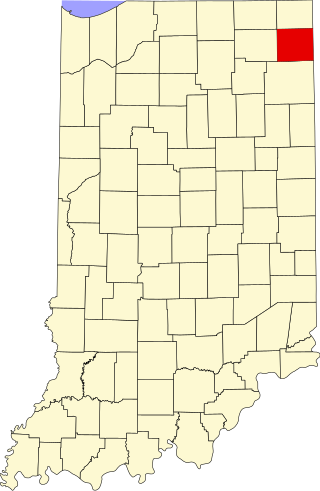
This is a list of the National Register of Historic Places listings in DeKalb County, Indiana.

<span class="mw-page-title-main">National Register of Historic Places listings in Bartholomew County, Indiana</span>

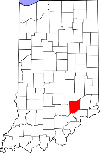
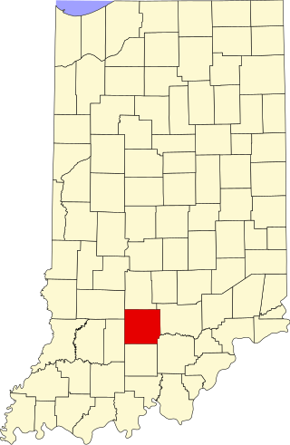
This is a list of the National Register of Historic Places listings in Bartholomew County, Indiana.

<span class="mw-page-title-main">National Register of Historic Places listings in Benton County, Indiana</span>

This is a list of the National Register of Historic Places listings in Benton County, Indiana.

<span class="mw-page-title-main">National Register of Historic Places listings in Blackford County, Indiana</span>

This is a list of the National Register of Historic Places listings in Blackford County, Indiana.

<span class="mw-page-title-main">National Register of Historic Places listings in Brown County, Indiana</span>

This is a list of the National Register of Historic Places listings in Brown County, Indiana.

<span class="mw-page-title-main">National Register of Historic Places listings in Cass County, Indiana</span>

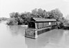
This is a list of the National Register of Historic Places listings in Cass County, Indiana.

<span class="mw-page-title-main">National Register of Historic Places listings in Montgomery County, Indiana</span>

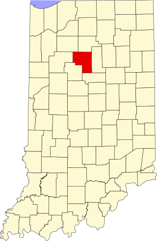
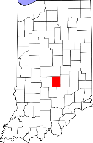
This is a list of the National Register of Historic Places listings in Montgomery County, Indiana.

<span class="mw-page-title-main">National Register of Historic Places listings in Scott County, Indiana</span>

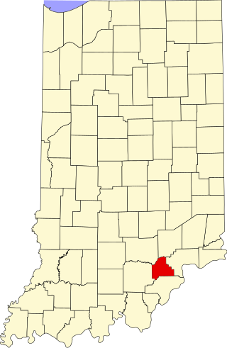
This is a list of the National Register of Historic Places listings in Scott County, Indiana.

<span class="mw-page-title-main">National Register of Historic Places listings in Washington County, Indiana</span>

This is a list of the National Register of Historic Places listings in Washington County, Indiana.

<span class="mw-page-title-main">National Register of Historic Places listings in Whitley County, Indiana</span>

This is a list of the National Register of Historic Places listings in Whitley County, Indiana.

<span class="mw-page-title-main">National Register of Historic Places listings in Fountain County, Indiana</span>

This is a list of the National Register of Historic Places listings in Fountain County, Indiana.

<span class="mw-page-title-main">National Register of Historic Places listings in Franklin County, Indiana</span>

This is a list of the National Register of Historic Places listings in Franklin County, Indiana.

<span class="mw-page-title-main">National Register of Historic Places listings in Jefferson County, Indiana</span>

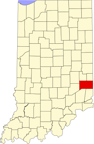
This is a list of the National Register of Historic Places listings in Jefferson County, Indiana.

<span class="mw-page-title-main">National Register of Historic Places listings in Jennings County, Indiana</span>

This is a list of the National Register of Historic Places listings in Jennings County, Indiana.

<span class="mw-page-title-main">National Register of Historic Places listings in Johnson County, Indiana</span>

This is a list of the National Register of Historic Places listings in Johnson County, Indiana.

<span class="mw-page-title-main">National Register of Historic Places listings in Lawrence County, Indiana</span>

This is a list of the National Register of Historic Places listings in Lawrence County, Indiana.

<span class="mw-page-title-main">National Register of Historic Places listings in Miami County, Indiana</span>

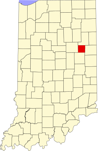
This is a list of the National Register of Historic Places listings in Miami County, Indiana.

<span class="mw-page-title-main">National Register of Historic Places listings in Orange County, Indiana</span>

This is a list of the National Register of Historic Places listings in Orange County, Indiana.

<span class="mw-page-title-main">National Register of Historic Places listings in Grant County, Indiana</span>

This is a list of the National Register of Historic Places listings in Grant County, Indiana.

References

  1. The latitude and longitude information provided in this table was derived originally from the National Register Information System, which has been found to be fairly accurate for about 99% of listings. Some locations in this table may have been corrected to current GPS standards.
  2. National Park Service, United States Department of the Interior, "National Register of Historic Places: Weekly List Actions", retrieved March 15, 2024.
  3. 1 2 Numbers represent an alphabetical ordering by significant words. Various colorings, defined here, differentiate National Historic Landmarks and historic districts from other NRHP buildings, structures, sites or objects.
  4. "National Register Information System". National Register of Historic Places . National Park Service. March 13, 2009.
  5. The eight-digit number below each date is the number assigned to each location in the National Register Information System database, which can be viewed by clicking the number.