National Register of Historic Places listings in Marshall County, Indiana

Last updated

Location of Marshall County in Indiana Map of Indiana highlighting Marshall County.svg
Location of Marshall County in Indiana

This is a list of the National Register of Historic Places listings in Marshall County, Indiana.

Contents

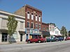
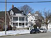
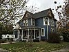
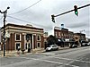
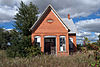
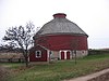
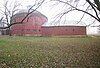
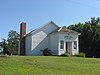
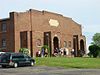
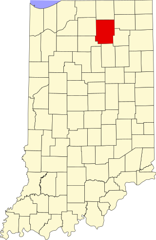
This is intended to be a complete list of the properties and districts on the National Register of Historic Places in Marshall County, Indiana, United States. Latitude and longitude coordinates are provided for many National Register properties and districts; these locations may be seen together on a map. [1]

There are 32 properties and districts listed on the National Register in the county. Another 3 properties were once listed but have been removed.

Properties and districts located in incorporated areas display the name of the municipality, while properties and districts in unincorporated areas display the name of their civil township. Properties and districts split between multiple jurisdictions display the names of all jurisdictions.


    This National Park Service list is complete through NPS recent listings posted July 28, 2023. [2]

Map all coordinates using: OpenStreetMap

Current listings

[3] Name on the Register [4] ImageDate listed [5] Location City or townDescription
1 Argos Downtown Historic District
Argos Downtown Historic District Argos Downtown Historic District.jpg
Argos Downtown Historic District
September 16, 2001
(#01000991)
Western side of Michigan St. between Smith and Williams, and the eastern side between Smith and Walnut
41°14′12″N86°14′43″W / 41.236667°N 86.245278°W / 41.236667; -86.245278 (Argos Downtown Historic District)
Argos
2 Argos Izaak Walton League Historic District
Argos Izaak Walton League Historic District Argos Izaak Walton League Historic District Clubhouse.jpg
Argos Izaak Walton League Historic District
December 15, 2011
(#11000914)
7184 E. 16th Rd., east of Argos
41°14′43″N86°11′44″W / 41.245383°N 86.195417°W / 41.245383; -86.195417 (Argos Izaak Walton League Historic District)
Walnut Township
3 Argos Northside Historic District
Argos Northside Historic District 208 N Michigan 20-02-29 057.jpg
Argos Northside Historic District
September 18, 2017
(#100001613)
N. Michigan St. between Smith and north of North St., and Maple St. between Church and Poplar Sts.
41°14′28″N86°14′47″W / 41.241111°N 86.246389°W / 41.241111; -86.246389 (Argos Northside Historic District)
Argos
4 Isaac and Ruth Arnold House September 4, 2018
(#100002864)
1003 N. Main St.
41°18′11″N86°06′59″W / 41.303056°N 86.116389°W / 41.303056; -86.116389 (Isaac and Ruth Arnold House)
Bourbon
5 Lewis and Sarah Boggs House
Lewis and Sarah Boggs House SARAH AND LEWIS BOGGS HOUSE, MARSHALL COUNTY, INDIANA.jpg
Lewis and Sarah Boggs House
June 15, 2012
(#12000337)
9564 14th Rd., north of Argos
41°16′29″N86°14′33″W / 41.274642°N 86.242532°W / 41.274642; -86.242532 (Lewis and Sarah Boggs House)
Center Township
6 Bourbon Commercial Historic District
Bourbon Commercial Historic District Bourbon-indiana-downtown.jpg
Bourbon Commercial Historic District
June 12, 2017
(#100001061)
Parts of Main and Center Sts.
41°17′44″N86°06′58″W / 41.295556°N 86.116111°W / 41.295556; -86.116111 (Bourbon Commercial Historic District)
Bourbon
7 Bourbon Residential Historic District
Bourbon Residential Historic District Bourbon Residential HD2 NRHP 100001062 Marshall County, IN.jpg
Bourbon Residential Historic District
June 12, 2017
(#100001062)
Main between Park and Shaffer Sts. in blocks bounded by Sunset St. and Park Ave. between Thompson and Harris Sts., and also along Park Ave.
41°17′59″N86°06′58″W / 41.299722°N 86.116111°W / 41.299722; -86.116111 (Bourbon Residential Historic District)
Bourbon
8 Bremen Commercial Historic District
Bremen Commercial Historic District Bremen Commercial HD NRHP 100000715 Marshall County, IN.jpg
Bremen Commercial Historic District
March 7, 2017
(#100000715)
Between Jackson, Washington, North, and South Sts.
41°26′47″N86°08′46″W / 41.446389°N 86.146111°W / 41.446389; -86.146111 (Bremen Commercial Historic District)
Bremen
9 Bremen Residential Historic District
Bremen Residential Historic District Bremen Residential HD NRHP 100000716 Marshall County, IN.jpg
Bremen Residential Historic District
March 7, 2017
(#100000716)
Between Bowen, Montgomery, South, and Bike Sts.
41°26′51″N86°09′10″W / 41.447500°N 86.152780°W / 41.447500; -86.152780 (Bremen Residential Historic District)
Bremen
10 Bremen Water Tower
Bremen Water Tower Bremen-indiana-water-tower.jpg
Bremen Water Tower
January 9, 2013
(#12001152)
Western side of the 100 block of S. Jackson St.
41°26′46″N86°08′52″W / 41.446056°N 86.147778°W / 41.446056; -86.147778 (Bremen Water Tower)
Bremen
11 Culver Commercial Historic District
Culver Commercial Historic District Culver-Union Township Public Library.jpg
Culver Commercial Historic District
January 11, 1996
(#95001530)
Roughly bounded by Washington St., the north-south alley east of Main St., Madison St., and Ohio St.
41°13′00″N86°25′25″W / 41.216667°N 86.423611°W / 41.216667; -86.423611 (Culver Commercial Historic District)
Culver
12 Dietrich-Bowen House
Dietrich-Bowen House Dietrich-Bowen House.jpg
Dietrich-Bowen House
November 21, 1978
(#78000023)
304 N. Center St.
41°26′54″N86°08′46″W / 41.448472°N 86.146111°W / 41.448472; -86.146111 (Dietrich-Bowen House)
Bremen
13 East Laporte Street Footbridge
East Laporte Street Footbridge East Laporte Street Footbridge.jpg
East Laporte Street Footbridge
July 23, 1981
(#81000001)
Spans the Yellow River
41°20′25″N86°18′15″W / 41.340278°N 86.304167°W / 41.340278; -86.304167 (East Laporte Street Footbridge)
Plymouth
14 East Shore Historic District
East Shore Historic District East Lake Shore Drive off Maxinkuckee.jpg
East Shore Historic District
August 14, 1998
(#98001054)
Roughly E. Shore Dr. southeast of Culver from W. 18th Rd., to the eastern turn of State Road 117, including Maxinkuckee Country Club
41°12′10″N86°23′27″W / 41.202778°N 86.390833°W / 41.202778; -86.390833 (East Shore Historic District)
Union Township
15 Erwin House
Erwin House Erwin House in Tippecanoe Township.jpg
Erwin House
March 15, 2016
(#16000080)
2518 14-B Rd.
41°16′01″N86°06′18″W / 41.266944°N 86.105000°W / 41.266944; -86.105000 (Erwin House)
Tippecanoe Township
16 Forest Place Historic District
Forest Place Historic District Forest Place in Culver.jpg
Forest Place Historic District
June 15, 2000
(#00000671)
Forest Place, between College Ave. and Lake Shore Dr.
41°13′14″N86°25′01″W / 41.220556°N 86.416944°W / 41.220556; -86.416944 (Forest Place Historic District)
Culver
17 Gaskill-Erwin Farm
Gaskill-Erwin Farm Gaskill-Erwin Farmhouse.jpg
Gaskill-Erwin Farm
March 17, 2015
(#15000078)
2595 14-B Rd.
41°15′59″N86°06′23″W / 41.266250°N 86.106389°W / 41.266250; -86.106389 (Gaskill-Erwin Farm)
Tippecanoe Township
18 Heminger Travel Lodge
Heminger Travel Lodge Heminger Travel Lodge.jpg
Heminger Travel Lodge
January 11, 2001
(#00001629)
800 Lincolnway East
41°20′35″N86°17′59″W / 41.343056°N 86.299722°W / 41.343056; -86.299722 (Heminger Travel Lodge)
Plymouth
19 Hoham-Klinghammer-Weckerle House and Brewery Site
Hoham-Klinghammer-Weckerle House and Brewery Site Hoham-Klinghammer-Weckerle House and Brewery Site east side.jpg
Hoham-Klinghammer-Weckerle House and Brewery Site
June 15, 2012
(#12000338)
1715 Lake Ave.
41°20′07″N86°19′43″W / 41.335407°N 86.328679°W / 41.335407; -86.328679 (Hoham-Klinghammer-Weckerle House and Brewery Site)
Center Township and Plymouth
20 Jacoby Church and Cemetery
Jacoby Church and Cemetery Jacoby Church from north.jpg
Jacoby Church and Cemetery
January 25, 2007
(#06001291)
Western side of N. King Rd., south of 8A Rd. and east of Plymouth
41°21′16″N86°15′42″W / 41.354444°N 86.261667°W / 41.354444; -86.261667 (Jacoby Church and Cemetery)
Center Township
21 Marshall County Court House
Marshall County Court House Plymouth-indiana-courthouse.jpg
Marshall County Court House
June 30, 1983
(#83000139)
117 W. Jefferson St.
41°20′37″N86°18′40″W / 41.343611°N 86.311111°W / 41.343611; -86.311111 (Marshall County Court House)
Plymouth
22 Marshall County Infirmary
Marshall County Infirmary Marshall County Infirmary main building entrance.jpg
Marshall County Infirmary
October 9, 2000
(#00001139)
10924 Lincoln Highway, southeast of Plymouth
41°19′58″N86°16′08″W / 41.332778°N 86.268889°W / 41.332778; -86.268889 (Marshall County Infirmary)
Center Township
23 Chief Menominee Memorial Site
Chief Menominee Memorial Site Chief Menominee Statue Plymouth Indiana closeup.jpg
Chief Menominee Memorial Site
December 27, 2010
(#10001082)
S. Peach Rd., north of W. 13th Rd. and southwest of Plymouth
41°17′43″N86°21′43″W / 41.295278°N 86.361944°W / 41.295278; -86.361944 (Chief Menominee Memorial Site)
West Township
24 Norris Farm-Maxinkuckee Orchard
Norris Farm-Maxinkuckee Orchard Norris Farm with soybeans.jpg
Norris Farm-Maxinkuckee Orchard
June 7, 2016
(#16000337)
18799 Peach Rd.
41°12′21″N86°21′52″W / 41.205833°N 86.364444°W / 41.205833; -86.364444 (Norris Farm-Maxinkuckee Orchard)
Union Township
25 Plymouth Downtown Historic District
Plymouth Downtown Historic District Downtown Plymouth IN 1.JPG
Plymouth Downtown Historic District
December 17, 1998
(#98001524)
Roughly bounded by Center, Washington, and Water Sts., and the Yellow River; also 110, 112, 116, 120 Washington, 101 Michigan & the blk. bounded by Garro, Water, LaPorte & Michigan Sts.
41°20′27″N86°18′34″W / 41.340833°N 86.309444°W / 41.340833; -86.309444 (Plymouth Downtown Historic District)
Plymouth
26 Plymouth Northside Historic District
Plymouth Northside Historic District First United Methodist Church Plymouth Indiana.jpg
Plymouth Northside Historic District
September 25, 2013
(#13000760)
Center and Michigan Sts. between Adams and Novelty Sts., and the blocks surrounding the courthouse square
41°20′42″N86°18′40″W / 41.345000°N 86.311111°W / 41.345000; -86.311111 (Plymouth Northside Historic District)
Plymouth
27 Plymouth Southside Historic District
Plymouth Southside Historic District Trinity UMC in Plymouth.jpg
Plymouth Southside Historic District
December 31, 2013
(#13001016)
S. Michigan St. roughly bounded by the former Pennsylvania Railroad line and Oakhill Ave.
41°20′11″N86°18′25″W / 41.336389°N 86.306944°W / 41.336389; -86.306944 (Plymouth Southside Historic District)
Plymouth
28 Plymouth Fire Station
Plymouth Fire Station Plymouth IN Firestation.JPG
Plymouth Fire Station
July 9, 1981
(#81000002)
220 N. Center St.
41°20′29″N86°18′37″W / 41.341389°N 86.310278°W / 41.341389; -86.310278 (Plymouth Fire Station)
Plymouth
29 Polk Township District No. 2 School
Polk Township District No. 2 School Polk Township Polk Township District No. 2 School entrance.jpg
Polk Township District No. 2 School
January 9, 2013
(#12001153)
18998 W. 2A Rd., southeast of Walkerton
41°26′40″N86°25′30″W / 41.444583°N 86.425000°W / 41.444583; -86.425000 (Polk Township District No. 2 School)
Polk Township
30 Ramsay-Fox Round Barn and Farm
Ramsay-Fox Round Barn and Farm Ramsay-Fox Round Barn.jpg
Ramsay-Fox Round Barn and Farm
April 10, 2012
(#12000187)
18889 9th Rd., west of Plymouth
41°20′45″N86°25′20″W / 41.345833°N 86.422222°W / 41.345833; -86.422222 (Ramsay-Fox Round Barn and Farm)
West Township
31 Sults-Quivey-Hartman Polygonal Barn and Farm
Sults-Quivey-Hartman Polygonal Barn and Farm Quivey Rd Barn Pan.jpg
Sults-Quivey-Hartman Polygonal Barn and Farm
September 3, 2019
(#100004367)
15605 S. Olive Trail
41°15′03″N86°20′16″W / 41.2508°N 86.3377°W / 41.2508; -86.3377 (Sults-Quivey-Hartman Polygonal Barn and Farm)
Plymouth
32 Tippecanoe Twp. District No. 3 Schoolhouse and Cemetery
Tippecanoe Twp. District No. 3 Schoolhouse and Cemetery Summit Chapel School.jpg
Tippecanoe Twp. District No. 3 Schoolhouse and Cemetery
June 24, 2008
(#08000567)
State Road 10 at Birch Rd., northeast of Tippecanoe
41°14′44″N86°05′05″W / 41.245556°N 86.084722°W / 41.245556; -86.084722 (Tippecanoe Twp. District No. 3 Schoolhouse and Cemetery)
Tippecanoe Township

Former listings

[3] Name on the RegisterImageDate listedDate removedLocationCity or townDescription
1 Bourbon Community Building-Gymnasium
Bourbon Community Building-Gymnasium Bourbon Community Building-Gymnasium.jpg
Bourbon Community Building-Gymnasium
December 15, 2015
(#15000888)
May 13, 2021800 N. Harris St.
41°18′08″N86°06′48″W / 41.3022°N 86.1133°W / 41.3022; -86.1133 (Bourbon Community Building-Gymnasium)
Bourbon Demolished in 2020
2 Marshall County Jail October 25, 1973
(#73000250)
October 13, 1983601 N. Center St.
Plymouth
3 Woodbank
Woodbank Woodbank site near Culver.jpg
Woodbank
December 2, 1982
(#82000022)
September 5, 20142738 East Shore Lane, along Lake Maxinkuckee southeast of Culver
41°11′25″N86°23′36″W / 41.190278°N 86.393333°W / 41.190278; -86.393333 (Woodbank)
Union Township

See also

Related Research Articles

<span class="mw-page-title-main">National Register of Historic Places listings in Wayne County, Indiana</span>

This is a list of the National Register of Historic Places listings in Wayne County, Indiana.

<span class="mw-page-title-main">National Register of Historic Places listings in St. Joseph County, Indiana</span>

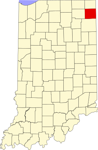
This is a list of the National Register of Historic Places listings in St. Joseph County, Indiana.

<span class="mw-page-title-main">National Register of Historic Places listings in Elkhart County, Indiana</span>

This is a list of the National Register of Historic Places listings in Elkhart County, Indiana.

<span class="mw-page-title-main">National Register of Historic Places listings in DeKalb County, Indiana</span>

This is a list of the National Register of Historic Places listings in DeKalb County, Indiana.

<span class="mw-page-title-main">National Register of Historic Places listings in Bartholomew County, Indiana</span>

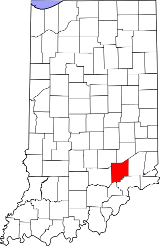
This is a list of the National Register of Historic Places listings in Bartholomew County, Indiana.

<span class="mw-page-title-main">National Register of Historic Places listings in Blackford County, Indiana</span>

This is a list of the National Register of Historic Places listings in Blackford County, Indiana.

<span class="mw-page-title-main">National Register of Historic Places listings in Cass County, Indiana</span>

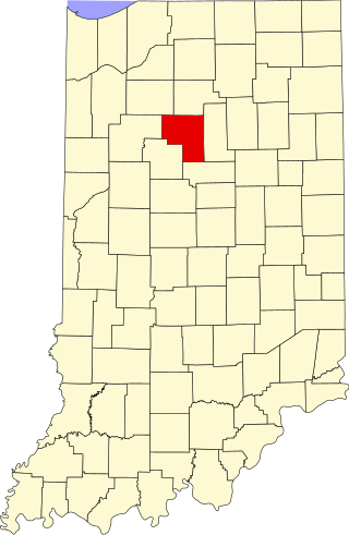
This is a list of the National Register of Historic Places listings in Cass County, Indiana.

<span class="mw-page-title-main">National Register of Historic Places listings in Scott County, Indiana</span>

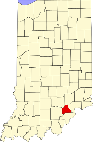
This is a list of the National Register of Historic Places listings in Scott County, Indiana.

<span class="mw-page-title-main">National Register of Historic Places listings in Whitley County, Indiana</span>

This is a list of the National Register of Historic Places listings in Whitley County, Indiana.

<span class="mw-page-title-main">National Register of Historic Places listings in Decatur County, Indiana</span>

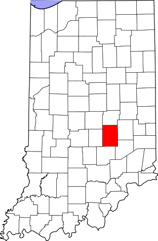
This is a list of the National Register of Historic Places listings in Decatur County, Indiana.

<span class="mw-page-title-main">National Register of Historic Places listings in Dubois County, Indiana</span>

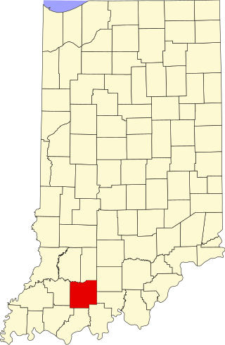
This is a list of the National Register of Historic Places listings in Dubois County, Indiana.

<span class="mw-page-title-main">National Register of Historic Places listings in Franklin County, Indiana</span>

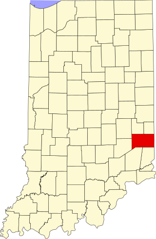
This is a list of the National Register of Historic Places listings in Franklin County, Indiana.

<span class="mw-page-title-main">National Register of Historic Places listings in Fulton County, Indiana</span>

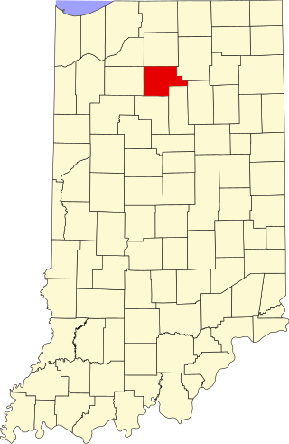
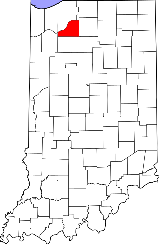
This is a list of the National Register of Historic Places listings in Fulton County, Indiana.

<span class="mw-page-title-main">National Register of Historic Places listings in Hendricks County, Indiana</span>

This is a list of the National Register of Historic Places listings in Hendricks County, Indiana.

<span class="mw-page-title-main">National Register of Historic Places listings in Jennings County, Indiana</span>

This is a list of the National Register of Historic Places listings in Jennings County, Indiana.

<span class="mw-page-title-main">National Register of Historic Places listings in Miami County, Indiana</span>

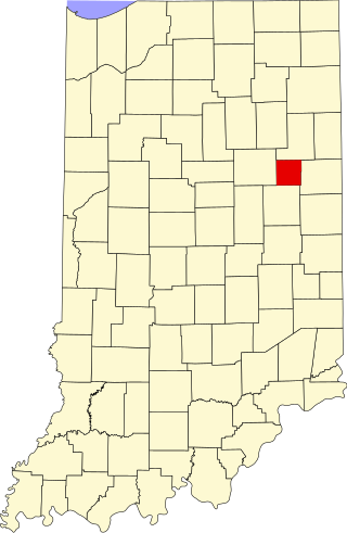
This is a list of the National Register of Historic Places listings in Miami County, Indiana.

<span class="mw-page-title-main">National Register of Historic Places listings in Pulaski County, Indiana</span>

This is a list of the National Register of Historic Places listings in Pulaski County, Indiana.

<span class="mw-page-title-main">National Register of Historic Places listings in Shelby County, Indiana</span>

This is a list of the National Register of Historic Places listings in Shelby County, Indiana.

<span class="mw-page-title-main">National Register of Historic Places listings in Starke County, Indiana</span>

This is a list of the National Register of Historic Places listings in Starke County, Indiana.

<span class="mw-page-title-main">National Register of Historic Places listings in Kosciusko County, Indiana</span>

This is a list of the National Register of Historic Places listings in Kosciusko County, Indiana.

References

  1. The latitude and longitude information provided in this table was derived originally from the National Register Information System, which has been found to be fairly accurate for about 99% of listings. Some locations in this table may have been corrected to current GPS standards.
  2. National Park Service, United States Department of the Interior, "National Register of Historic Places: Weekly List Actions", retrieved July 28, 2023.
  3. 1 2 Numbers represent an alphabetical ordering by significant words. Various colorings, defined here, differentiate National Historic Landmarks and historic districts from other NRHP buildings, structures, sites or objects.
  4. "National Register Information System". National Register of Historic Places . National Park Service. March 13, 2009.
  5. The eight-digit number below each date is the number assigned to each location in the National Register Information System database, which can be viewed by clicking the number.