National Register of Historic Places listings in Decatur County, Indiana

Last updated

Location of Decatur County in Indiana Map of Indiana highlighting Decatur County.svg
Location of Decatur County in Indiana

This is a list of the National Register of Historic Places listings in Decatur County, Indiana.

Contents

This is intended to be a complete list of the properties and districts on the National Register of Historic Places in Decatur County, Indiana, United States. Latitude and longitude coordinates are provided for many National Register properties and districts; these locations may be seen together in a map. [1]

There are 10 properties and districts listed on the National Register in the county.

Properties and districts located in incorporated areas display the name of the municipality, while properties and districts in unincorporated areas display the name of their civil township. Properties and districts split between multiple jurisdictions display the names of all jurisdictions.


    This National Park Service list is complete through NPS recent listings posted April 1, 2022. [2]

Map all coordinates using: OpenStreetMap  
Download coordinates as: KML

Current listings

[3] Name on the Register [4] ImageDate listed [5] Location City or townDescription
1 Bromwell Wire Works
Bromwell Wire Works Bromwell Wire Works with blue sky.jpg
Bromwell Wire Works
June 7, 1990
(#90000810)
Junction of 1st and Ireland Sts.
39°20′39″N85°29′22″W / 39.344167°N 85.489444°W / 39.344167; -85.489444 (Bromwell Wire Works)
Greensburg
2 Champ's Ford Bridge
Champ's Ford Bridge Champ's Ford Bridge, downstream side.jpg
Champ's Ford Bridge
December 22, 2009
(#09001127)
County Road 100S over Clifty Creek, 2 miles west of Burney
39°19′12″N85°40′33″W / 39.319906°N 85.675853°W / 39.319906; -85.675853 (Champ's Ford Bridge)
Clay Township
3 Decatur County Courthouse
Decatur County Courthouse Decatur County Courthouse, Greensburg, IN (48477403112).jpg
Decatur County Courthouse
April 27, 1973
(#73000014)
Courthouse Square
39°20′13″N85°29′01″W / 39.336944°N 85.483611°W / 39.336944; -85.483611 (Decatur County Courthouse)
Greensburg
4 Greensburg Carnegie Public Library
Greensburg Carnegie Public Library Greensburg Carnegie Public Library.jpg
Greensburg Carnegie Public Library
June 9, 1995
(#95000701)
114 N. Michigan Ave.
39°20′23″N85°29′09″W / 39.339722°N 85.485833°W / 39.339722; -85.485833 (Greensburg Carnegie Public Library)
Greensburg
5 Greensburg Downtown Historic District
Greensburg Downtown Historic District Franklin Street, Greensburg, IN (48477310671).jpg
Greensburg Downtown Historic District
September 14, 1995
(#95001113)
Roughly the area surrounding the courthouse square
39°20′15″N85°29′01″W / 39.3375°N 85.483611°W / 39.3375; -85.483611 (Greensburg Downtown Historic District)
Greensburg
6 Bright B. Harris House
Bright B. Harris House Bright B. Harris House with blue sky.jpg
Bright B. Harris House
December 28, 2000
(#00001545)
413 N. Franklin St.
39°20′25″N85°28′59″W / 39.340278°N 85.483056°W / 39.340278; -85.483056 (Bright B. Harris House)
Greensburg
7 Jerman School
Jerman School Jerman School with blue sky.jpg
Jerman School
September 15, 2005
(#05001017)
316 W. Walnut St.
39°20′32″N85°29′13″W / 39.342222°N 85.486944°W / 39.342222; -85.486944 (Jerman School)
Greensburg
8 Knights of Pythias Building and Theatre
Knights of Pythias Building and Theatre Knights of Pythias Building, Greensburg, IN (48477423197).jpg
Knights of Pythias Building and Theatre
March 28, 1978
(#78000028)
215 N. Broadway
39°20′17″N85°29′05″W / 39.338056°N 85.484722°W / 39.338056; -85.484722 (Knights of Pythias Building and Theatre)
Greensburg
9 Strauther Pleak Round Barn
Strauther Pleak Round Barn Strauther Pleak Round Barn.jpg
Strauther Pleak Round Barn
June 24, 1993
(#93000557)
Moscow Rd., 0.2 miles east of County Road 100W and north of Greensburg
39°22′28″N85°30′01″W / 39.374444°N 85.500278°W / 39.374444; -85.500278 (Strauther Pleak Round Barn)
Washington Township
10 Westport Covered Bridge
Westport Covered Bridge Westport Covered Bridge from the south.jpg
Westport Covered Bridge
June 25, 1982
(#82000031)
East of Westport
39°10′01″N85°32′47″W / 39.166944°N 85.546389°W / 39.166944; -85.546389 (Westport Covered Bridge)
Sand Creek Township

See also

Related Research Articles

National Register of Historic Places listings in Rush County, Indiana

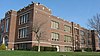
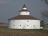
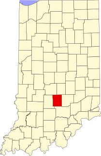
This is a list of the National Register of Historic Places listings in Rush County, Indiana.

National Register of Historic Places listings in Bartholomew County, Indiana

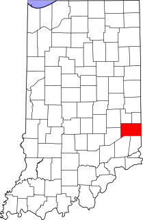
This is a list of the National Register of Historic Places listings in Bartholomew County, Indiana.

National Register of Historic Places listings in Benton County, Indiana

This is a list of the National Register of Historic Places listings in Benton County, Indiana.

National Register of Historic Places listings in Blackford County, Indiana

This is a list of the National Register of Historic Places listings in Blackford County, Indiana.

National Register of Historic Places listings in Brown County, Indiana

This is a list of the National Register of Historic Places listings in Brown County, Indiana.

National Register of Historic Places listings in Cass County, Indiana

This is a list of the National Register of Historic Places listings in Cass County, Indiana.

National Register of Historic Places listings in Montgomery County, Indiana

This is a list of the National Register of Historic Places listings in Montgomery County, Indiana.

National Register of Historic Places listings in Whitley County, Indiana

This is a list of the National Register of Historic Places listings in Whitley County, Indiana.

National Register of Historic Places listings in Franklin County, Indiana

This is a list of the National Register of Historic Places listings in Franklin County, Indiana.

National Register of Historic Places listings in Jefferson County, Indiana

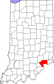
This is a list of the National Register of Historic Places listings in Jefferson County, Indiana.

National Register of Historic Places listings in Jennings County, Indiana

This is a list of the National Register of Historic Places listings in Jennings County, Indiana.

National Register of Historic Places listings in Lawrence County, Indiana

This is a list of the National Register of Historic Places listings in Lawrence County, Indiana.

National Register of Historic Places listings in Madison County, Indiana

This is a list of the National Register of Historic Places listings in Madison County, Indiana.

National Register of Historic Places listings in Newton County, Indiana

This is a list of the National Register of Historic Places listings in Newton County, Indiana.

National Register of Historic Places listings in Orange County, Indiana

This is a list of the National Register of Historic Places listings in Orange County, Indiana.

National Register of Historic Places listings in Pulaski County, Indiana

This is a list of the National Register of Historic Places listings in Pulaski County, Indiana.

National Register of Historic Places listings in Ripley County, Indiana

This is a list of the National Register of Historic Places listings in Ripley County, Indiana.

National Register of Historic Places listings in Shelby County, Indiana

This is a list of the National Register of Historic Places listings in Shelby County, Indiana.

National Register of Historic Places listings in Warren County, Indiana

This is a list of the National Register of Historic Places listings in Warren County, Indiana.

National Register of Historic Places listings in Grant County, Indiana

This is a list of the National Register of Historic Places listings in Grant County, Indiana.

References

  1. The latitude and longitude information provided in this table was derived originally from the National Register Information System, which has been found to be fairly accurate for about 99% of listings. Some locations in this table may have been corrected to current GPS standards.
  2. National Park Service, United States Department of the Interior, "National Register of Historic Places: Weekly List Actions", retrieved April 1, 2022.
  3. Numbers represent an alphabetical ordering by significant words. Various colorings, defined here, differentiate National Historic Landmarks and historic districts from other NRHP buildings, structures, sites or objects.
  4. "National Register Information System". National Register of Historic Places . National Park Service. March 13, 2009.
  5. The eight-digit number below each date is the number assigned to each location in the National Register Information System database, which can be viewed by clicking the number.