National Register of Historic Places listings in Boone County, Indiana

Last updated

Location of Boone County in Indiana Map of Indiana highlighting Boone County.svg
Location of Boone County in Indiana

This is a list of the National Register of Historic Places listings in Boone County, Indiana.

Contents

This is intended to be a complete list of the properties and districts on the National Register of Historic Places in Boone County, Indiana, United States. Latitude and longitude coordinates are provided for many National Register properties and districts; these locations may be seen together in a map. [1]

There are 14 properties and districts listed on the National Register in the county.

Properties and districts located in incorporated areas display the name of the municipality, while properties and districts in unincorporated areas display the name of their civil township. Properties and districts split between multiple jurisdictions display the names of all jurisdictions.


    This National Park Service list is complete through NPS recent listings posted March 1, 2024. [2]

Current listings

[3] Name on the Register [4] ImageDate listed [5] Location City or townDescription
1 Boone County Courthouse
Boone County Courthouse Boone County Indiana Courthouse.jpg
Boone County Courthouse
September 22, 1986
(#86002703)
Courthouse Sq.
40°02′52″N86°28′07″W / 40.047778°N 86.468611°W / 40.047778; -86.468611 (Boone County Courthouse)
Lebanon
2 Pryor Brock Farmstead
Pryor Brock Farmstead Pryor Brock Farmstead.jpg
Pryor Brock Farmstead
June 27, 2008
(#08000569)
8602 County Road 500S, west of Zionsville
39°58′05″N86°18′21″W / 39.968056°N 86.305833°W / 39.968056; -86.305833 (Pryor Brock Farmstead)
Eagle Township Carpenter's rendering of Italianate architecture, symbolic of the "golden age" of Hoosier agriculture
3 Strange Nathanial Cragun House
Strange Nathanial Cragun House Strange Nathanial Cragun House.jpg
Strange Nathanial Cragun House
December 15, 2011
(#11000908)
404 W. Main St.
40°02′52″N86°28′18″W / 40.047778°N 86.471667°W / 40.047778; -86.471667 (Strange Nathanial Cragun House)
Lebanon
4 Howard School
Howard School Howard School near Brownsburg.jpg
Howard School
September 24, 2009
(#09000754)
4555 E. County Road 750S, north of Brownsburg
39°55′51″N86°22′56″W / 39.93075°N 86.382222°W / 39.93075; -86.382222 (Howard School)
Perry Township
5 Lebanon Courthouse Square Historic District
Lebanon Courthouse Square Historic District Boone County Courthouse in Lebanon from northwest.jpg
Lebanon Courthouse Square Historic District
September 12, 2016
(#16000610)
Roughly bounded by North, East, South, Superior, and West Sts.
40°02′54″N86°28′07″W / 40.048372°N 86.468605°W / 40.048372; -86.468605 (Lebanon Courthouse Square Historic District)
Lebanon
6 Maplelawn Farmstead
Maplelawn Farmstead Maplelawn Farmstead.jpg
Maplelawn Farmstead
September 15, 2011
(#11000656)
9575 Whitestown Rd., near Zionsville
39°57′53″N86°17′15″W / 39.964722°N 86.2875°W / 39.964722; -86.2875 (Maplelawn Farmstead)
Eagle Township
7 Oak Hill Cemetery
Oak Hill Cemetery Oak Hill Cemetery chapel in Lebanon.jpg
Oak Hill Cemetery
March 26, 2014
(#14000068)
935 E. Washington St.
40°02′50″N86°27′16″W / 40.047222°N 86.454444°W / 40.047222; -86.454444 (Oak Hill Cemetery)
Lebanon
8 Simpson-Breedlove House
Simpson-Breedlove House Simpson-Breedlove House.jpg
Simpson-Breedlove House
March 15, 2016
(#16000075)
3650 U.S. Route 421
39°59′24″N86°15′40″W / 39.989872°N 86.261111°W / 39.989872; -86.261111 (Simpson-Breedlove House)
Union Township
9 Thorntown Public Library
Thorntown Public Library Thorntown Public Library front and northern side.jpg
Thorntown Public Library
September 22, 1986
(#86002708)
124 N. Market St.
40°07′50″N86°36′22″W / 40.130556°N 86.606111°W / 40.130556; -86.606111 (Thorntown Public Library)
Thorntown
10 Traders Point Eagle Creek Rural Historic District
Traders Point Eagle Creek Rural Historic District Farm in the Traders Point Rural HD.jpg
Traders Point Eagle Creek Rural Historic District
June 17, 2009
(#09000433)
Roughly between Interstate 865, Interstate 465, and Lafayette Rd.
39°55′32″N86°17′47″W / 39.925556°N 86.296389°W / 39.925556; -86.296389 (Traders Point Eagle Creek Rural Historic District)
Eagle Township Extends into Pike Township in Marion County [6]
11 Traders Point Hunt Rural Historic District
Traders Point Hunt Rural Historic District Salem United Methodist Church and cemetery.jpg
Traders Point Hunt Rural Historic District
June 17, 2009
(#09000421)
Roughly bounded by State Road 334, Interstate 865, Old Hunt Club Rd., and County Road 850E, southwest of Zionsville
39°56′25″N86°19′17″W / 39.940294°N 86.321297°W / 39.940294; -86.321297 (Traders Point Hunt Rural Historic District)
Eagle Township Eagle Township and Pike Township, Indiana MPS.
12 Town Hall (Castle Hall)
Town Hall (Castle Hall) Zionsville Town Hall.jpg
Town Hall (Castle Hall)
June 9, 1983
(#83000115)
65 E. Cedar St.
39°57′05″N86°15′40″W / 39.951389°N 86.261111°W / 39.951389; -86.261111 (Town Hall (Castle Hall))
Zionsville
13 Ulen Historic District
Ulen Historic District 113 Ulen Boulevard.jpg
Ulen Historic District
September 16, 2015
(#15000591)
Roughly Ulen Country Club and Golf Course, and houses along Ulen Boulevard and East Dr.
40°03′48″N86°27′49″W / 40.063333°N 86.463611°W / 40.063333; -86.463611 (Ulen Historic District)
Ulen
14 Andrew B. VanHuys Round Barn
Andrew B. VanHuys Round Barn Andrew B. VanHuys Round Barn.jpg
Andrew B. VanHuys Round Barn
April 2, 1993
(#93000181)
755 W. County Road 125 S., south of Lebanon [7]
40°01′17″N86°29′00″W / 40.021500°N 86.483333°W / 40.021500; -86.483333 (Andrew B. VanHuys Round Barn)
Center Township

Former listings

[3] Name on the RegisterImageDate listedDate removedLocationCity or townDescription
1 Scotland Bridge
Scotland Bridge Eastern side of the Scotland Bridge.jpg
Scotland Bridge
March 17, 1994
(#94000228)
March 5, 2024Lost Rd. (County Road 200E) over Sugar Creek, east of Mechanicsburg
40°10′36″N86°25′54″W / 40.176667°N 86.431667°W / 40.176667; -86.431667 (Scotland Bridge)
Clinton Township Extends into Clinton County

See also

Related Research Articles

<span class="mw-page-title-main">National Register of Historic Places listings in Porter County, Indiana</span>

This is a list of the National Register of Historic Places listings in Porter County, Indiana.

<span class="mw-page-title-main">National Register of Historic Places listings in Hamilton County, Indiana</span>

This is a list of the National Register of Historic Places listings in Hamilton County, Indiana.

<span class="mw-page-title-main">National Register of Historic Places listings in Dearborn County, Indiana</span>

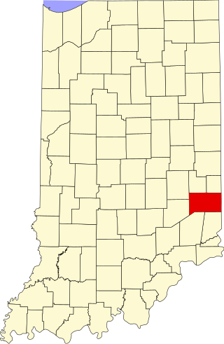
This is a list of the National Register of Historic Places listings in Dearborn County, Indiana.

<span class="mw-page-title-main">National Register of Historic Places listings in DeKalb County, Indiana</span>

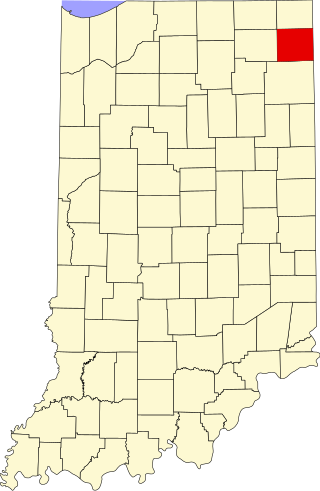
This is a list of the National Register of Historic Places listings in DeKalb County, Indiana.

<span class="mw-page-title-main">National Register of Historic Places listings in Bartholomew County, Indiana</span>

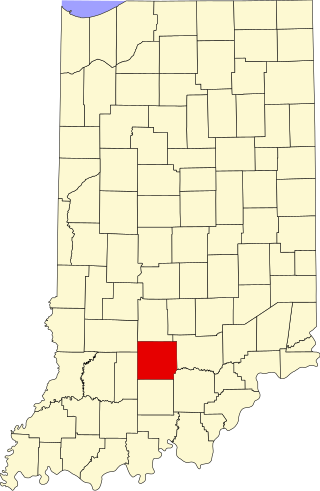
This is a list of the National Register of Historic Places listings in Bartholomew County, Indiana.

<span class="mw-page-title-main">National Register of Historic Places listings in Tippecanoe County, Indiana</span>

This is a list of the National Register of Historic Places listings in Tippecanoe County, Indiana.

<span class="mw-page-title-main">National Register of Historic Places listings in Blackford County, Indiana</span>

This is a list of the National Register of Historic Places listings in Blackford County, Indiana.

<span class="mw-page-title-main">National Register of Historic Places listings in Montgomery County, Indiana</span>

This is a list of the National Register of Historic Places listings in Montgomery County, Indiana.

<span class="mw-page-title-main">National Register of Historic Places listings in Scott County, Indiana</span>

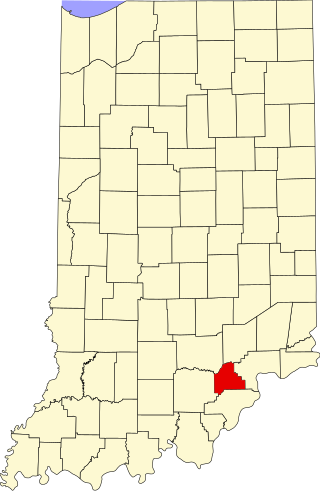
This is a list of the National Register of Historic Places listings in Scott County, Indiana.

<span class="mw-page-title-main">National Register of Historic Places listings in Whitley County, Indiana</span>

This is a list of the National Register of Historic Places listings in Whitley County, Indiana.

<span class="mw-page-title-main">National Register of Historic Places listings in Clinton County, Indiana</span>

This is a list of the National Register of Historic Places listings in Clinton County, Indiana.

<span class="mw-page-title-main">National Register of Historic Places listings in Daviess County, Indiana</span>

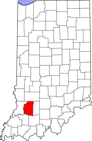
This is a list of the National Register of Historic Places listings in Daviess County, Indiana.

<span class="mw-page-title-main">National Register of Historic Places listings in Fountain County, Indiana</span>

This is a list of the National Register of Historic Places listings in Fountain County, Indiana.

<span class="mw-page-title-main">National Register of Historic Places listings in Franklin County, Indiana</span>

This is a list of the National Register of Historic Places listings in Franklin County, Indiana.

<span class="mw-page-title-main">National Register of Historic Places listings in Hendricks County, Indiana</span>

This is a list of the National Register of Historic Places listings in Hendricks County, Indiana.

<span class="mw-page-title-main">National Register of Historic Places listings in Henry County, Indiana</span>

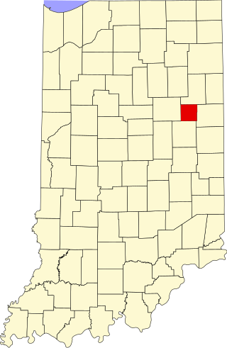
This is a list of the National Register of Historic Places listings in Henry County, Indiana.

<span class="mw-page-title-main">National Register of Historic Places listings in Lawrence County, Indiana</span>

This is a list of the National Register of Historic Places listings in Lawrence County, Indiana.

<span class="mw-page-title-main">National Register of Historic Places listings in Miami County, Indiana</span>

This is a list of the National Register of Historic Places listings in Miami County, Indiana.

<span class="mw-page-title-main">National Register of Historic Places listings in Randolph County, Indiana</span>

This is a list of the National Register of Historic Places listings in Randolph County, Indiana.

<span class="mw-page-title-main">National Register of Historic Places listings in Ohio County, Indiana</span>

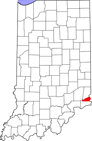
This is a list of the National Register of Historic Places listings in Ohio County, Indiana.

References

  1. The latitude and longitude information provided in this table was derived originally from the National Register Information System, which has been found to be fairly accurate for about 99% of listings. Some locations in this table may have been corrected to current GPS standards.
  2. National Park Service, United States Department of the Interior, "National Register of Historic Places: Weekly List Actions", retrieved March 1, 2024.
  3. 1 2 Numbers represent an alphabetical ordering by significant words. Various colorings, defined here, differentiate National Historic Landmarks and historic districts from other NRHP buildings, structures, sites or objects.
  4. "National Register Information System". National Register of Historic Places . National Park Service. March 13, 2009.
  5. The eight-digit number below each date is the number assigned to each location in the National Register Information System database, which can be viewed by clicking the number.
  6. Fife, Camille B. National Register of Historic Places Inventory/Nomination: Traders Point Eagle Creek Rural Historic District . National Park Service, 2008-05, 90.
  7. Location derived from Indiana Division of Historic Preservation and Archaeology, Historic Indiana: Indiana Properties Listed in the National Register of Historic Places 2003 - 2004 Archived 2011-06-14 at the Wayback Machine , n.d., 17. Accessed 2010-11-16. The NRIS lists the site as "Address Restricted".