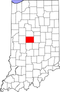
Eagle Village, Indiana | |
---|---|
Boone County's location in Indiana | |
Coordinates: 39°57′38″N86°14′44″W / 39.96056°N 86.24556°W Coordinates: 39°57′38″N86°14′44″W / 39.96056°N 86.24556°W | |
Country | United States |
State | Indiana |
County | Boone |
Township | Eagle |
Elevation | 896 ft (273 m) |
Time zone | UTC-5 (Eastern (EST)) |
• Summer (DST) | UTC-4 (EDT) |
ZIP code | 46077 |
GNIS feature ID | 433855 |
Eagle Village is an unincorporated community in Eagle Township, Boone County, in the U.S. state of Indiana. [2]
William Miller, an early settler of the area, hired George L. Kinnard, the Marion County surveyor, to lay out a town that would be named Eagle Village. [3] [4] It was named from Eagle Township. [5] The original town plat consisted of 18 blocks of 108 lots, including a post office that was established on December 15, 1832, and remained in operation until it was discontinued in 1858. [3] [6] The town's first postmaster was William Miller. [3] In 1836 William Miller sold his farm and the remaining unsold lots in Eagle Village to Daniel Larimore, who added seven lots extending southward on the west side of the Michigan Road. [3]
Eagle Village is located at 39°57′38″N86°14′44″W / 39.96056°N 86.24556°W .
Ogilville is an unincorporated community in Ohio Township, Bartholomew County, in the U.S. state of Indiana. The community is located along State Road 58 close to where it crosses over East Fork White Creek. It is located southwest on SR 58 of North Ogilville.
Hazelrigg is an unincorporated community in Jefferson Township, Boone County, in the U.S. state of Indiana.
Mechanicsburg is an unincorporated community in Washington Township, Boone County, in the U.S. state of Indiana.
Milledgeville is an unincorporated community in Harrison Township, Boone County, in the U.S. state of Indiana.
New Brunswick is an unincorporated community in Harrison Township, Boone County, in the U.S. state of Indiana.
Rosston is an unincorporated community in Union Township, Boone County, in the U.S. state of Indiana.
Royalton is an unincorporated community in Eagle Township, Boone County, in the U.S. state of Indiana.
Shepherd is an unincorporated community in Perry Township, Boone County, in the U.S. state of Indiana.
Mount Healthy is an unincorporated community in Jackson Township, Bartholomew County, in the U.S. state of Indiana.
Elkinsville is an unincorporated community in Van Buren Township, Brown County, in the U.S. state of Indiana. It was once a thriving farming village, but was evacuated during the construction of nearby Lake Monroe Reservoir by eminent domain in 1964. All that remains of Elkinsville today are some private residences, the Elkinsville Cemetery, and post office. The area is part of Hoosier National Forest.
Hamilton is an unincorporated community in Madison Township, Clinton County, Indiana. The town is named for Alexander Hamilton.
Middlefork is an unincorporated community in Warren Township, Clinton County, Indiana. It is named for the Middle Fork of Wildcat Creek which runs along the north side of the town.
Portersville is an unincorporated community in Boone Township, Dubois County, in the U.S. state of Indiana.
Ward is an unincorporated community in Jackson Township, Boone County, in the U.S. state of Indiana.
Arney is an unincorporated community in eastern Jefferson Township, Owen County, in the U.S. state of Indiana. It lies near the intersection of County Road 880 West and County Road 500 South, which is a community nearly ten miles southwest of the city of Spencer, the county seat of Owen County. Its elevation is 705 feet, and it is located at 39°13′7″N86°55′54″W.
Cuba is an unincorporated community in the northwestern part of Montgomery Township, Owen County, in the U.S. state of Indiana. It lies near the intersection of County Road 150 West and County Road 600 North, which is a community about ten miles north of the town of Spencer, the county seat of Owen County. Its elevation is 722 feet, and it is located at 39°22′41″N86°47′53″W.
Devore is an unincorporated community in the southwest portion of Taylor Township, Owen County, in the U.S. state of Indiana. It lies just south of the intersection of County Road 1000 North and County Road 100 East, which is a community about ten miles north of the city of Spencer, the county seat of Owen County. Its elevation is 755 feet, and it is located at 39°25′47″N86°45′10″W. This community is also known as Mill Grove.
Clinton Falls is an unincorporated community in Clinton Township, Putnam County, in the U.S. state of Indiana.
The Woodlands is an unincorporated community in Eagle Township, Boone County, in the U.S. state of Indiana.
Fox Hollow is an unincorporated community in Eagle Township, Boone County, in the U.S. state of Indiana.
...in Eagle Township, for which it was named.
This Boone County, Indiana location article is a stub. You can help Wikipedia by expanding it. |