Sugar Creek Township, Boone County, Indiana

Last updated

Sugar Creek Township
Map highlighting Sugar Creek Township, Boone County, Indiana.svg
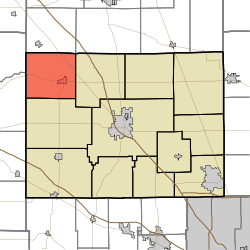
Location of Sugar Creek Township in Boone County
Coordinates: 40°08′09″N86°38′22″W / 40.13583°N 86.63944°W / 40.13583; -86.63944
Country United States
State Indiana
County Boone
Government
  Type Indiana township
Area
  Total
33.59 sq mi (87.0 km2)
  Land33.57 sq mi (86.9 km2)
  Water0.03 sq mi (0.078 km2)
Elevation
[1]
814 ft (248 m)
Population
 (2020) [2]
  Total
2,172
  Density66.8/sq mi (25.8/km2)
FIPS code 18-73844 [3]
GNIS feature ID 453880

Sugar Creek Township is one of twelve townships in Boone County, Indiana. As of the 2010 census, its population was 2,243 and it contained 919 housing units. [4]

Contents

Geography

According to the 2010 census, the township has a total area of 33.59 square miles (87.0 km2), of which 33.57 square miles (86.9 km2) (or 99.94%) is land and 0.03 square miles (0.078 km2) (or 0.09%) is water. [4] The township is named for the Sugar Creek.

Cities and towns

Adjacent townships

Major highways

Cemeteries

The township contains seven cemeteries: Gipson, Sugar Plain, Old Cemetery, Walnut Grove, Green, Curry and Maple Lawn.

References

  1. "US Board on Geographic Names". United States Geological Survey. October 25, 2007. Retrieved January 31, 2008.
  2. "Census Bureau profile: Sugar Creek Township, Boone County, Indiana". United States Census Bureau. May 2023. Retrieved March 24, 2024.
  3. "U.S. Census website". United States Census Bureau . Retrieved January 31, 2008.
  4. 1 2 "Population, Housing Units, Area, and Density: 2010 - County -- County Subdivision and Place -- 2010 Census Summary File 1". United States Census. Archived from the original on February 12, 2020. Retrieved May 10, 2013.