National Register of Historic Places listings in Dearborn County, Indiana

Last updated

Location of Dearborn County in Indiana Map of Indiana highlighting Dearborn County.svg
Location of Dearborn County in Indiana

This is a list of the National Register of Historic Places listings in Dearborn County, Indiana.

Contents

This is intended to be a complete list of the properties and districts on the National Register of Historic Places in Dearborn County, Indiana, United States. Latitude and longitude coordinates are provided for many National Register properties and districts; these locations may be seen together in a map. [1]

There are 27 properties and districts listed on the National Register in the county, including 1 National Historic Landmark. There is also one former listing.

Properties and districts located in incorporated areas display the name of the municipality, while properties and districts in unincorporated areas display the name of their civil township. Properties and districts split between multiple jurisdictions display the names of all jurisdictions.


    This National Park Service list is complete through NPS recent listings posted December 8, 2023. [2]

Map all coordinates using: OpenStreetMap

Current listings

[3] Name on the Register [4] ImageDate listed [5] Location City or townDescription
1 Aurora City Hall
Aurora City Hall City hall in Aurora, Indiana.jpg
Aurora City Hall
March 14, 1996
(#96000288)
216 3rd St. and 233-237 Main St.
39°03′19″N84°54′00″W / 39.055278°N 84.900000°W / 39.055278; -84.900000 (Aurora City Hall)
Aurora
2 Aurora Methodist Episcopal Church
Aurora Methodist Episcopal Church Aurora First Methodist Church.jpg
Aurora Methodist Episcopal Church
September 8, 1994
(#94001113)
304 3rd St.
39°03′20″N84°54′03″W / 39.055556°N 84.900833°W / 39.055556; -84.900833 (Aurora Methodist Episcopal Church)
Aurora
3 Aurora Public Library
Aurora Public Library Aurora Public Library, Indiana.jpg
Aurora Public Library
May 27, 1993
(#93000474)
414 2nd St.
39°03′26″N84°54′07″W / 39.057222°N 84.901944°W / 39.057222; -84.901944 (Aurora Public Library)
Aurora Neo-Renaissance style building designed by Garber & Woodward in 1923
4 Carnegie Hall of Moores Hill College
Carnegie Hall of Moores Hill College Carnegie Hall in Moores Hill.jpg
Carnegie Hall of Moores Hill College
March 17, 1994
(#94000229)
14687 Main St.
39°06′44″N85°05′33″W / 39.112222°N 85.092500°W / 39.112222; -85.092500 (Carnegie Hall of Moores Hill College)
Moores Hill
5 Dearborn County Asylum for the Poor
Dearborn County Asylum for the Poor Dearborn County Asylum for the Poor.jpg
Dearborn County Asylum for the Poor
September 22, 2000
(#00001143)
11636 County Farm Rd., northwest of Aurora
39°09′02″N85°02′03″W / 39.150556°N 85.034167°W / 39.150556; -85.034167 (Dearborn County Asylum for the Poor)
Manchester Township
6 Dearborn County Courthouse
Dearborn County Courthouse Dearborn County Courthouse -- Lawrenceburg, Indiana.jpg
Dearborn County Courthouse
April 9, 1981
(#81000008)
High and Mary Sts.
39°05′28″N84°51′00″W / 39.091111°N 84.850000°W / 39.091111; -84.850000 (Dearborn County Courthouse)
Lawrenceburg
7 Downtown Aurora Historic District
Downtown Aurora Historic District St. John's Evangelical Lutheran Church in Aurora.jpg
Downtown Aurora Historic District
September 8, 1994
(#94001134)
Bounded by Importing, Water, Market, 5th, and Exporting Sts.
39°03′22″N84°54′05″W / 39.056111°N 84.901389°W / 39.056111; -84.901389 (Downtown Aurora Historic District)
Aurora
8 Downtown Lawrenceburg Historic District
Downtown Lawrenceburg Historic District Walnut Street, Lawrenceburg, IN (48369813466).jpg
Downtown Lawrenceburg Historic District
March 1, 1984
(#84001009)
Roughly bounded by the former Conrail railroad line and Charlotte, Tate, Williams, and Elm Sts.
39°05′36″N84°50′55″W / 39.093333°N 84.848611°W / 39.093333; -84.848611 (Downtown Lawrenceburg Historic District)
Lawrenceburg
9 First Evangelical United Church of Christ
First Evangelical United Church of Christ First Evangelical Church of Christ, Aurora, IN (48353514132).jpg
First Evangelical United Church of Christ
September 23, 1994
(#94001104)
111 5th St.
39°03′11″N84°53′56″W / 39.052917°N 84.898889°W / 39.052917; -84.898889 (First Evangelical United Church of Christ)
Aurora
10 First Presbyterian Church
First Presbyterian Church First Presbyterian Church, Aurora, IN (48353502562).jpg
First Presbyterian Church
September 8, 1994
(#94001116)
215 4th St.
39°03′15″N84°54′02″W / 39.054167°N 84.900556°W / 39.054167; -84.900556 (First Presbyterian Church)
Aurora
11 George Street Bridge
George Street Bridge George Street Bridge in Aurora.jpg
George Street Bridge
March 1, 1984
(#84001012)
George, Main, and Importing Sts.
39°03′28″N84°53′58″W / 39.057778°N 84.899444°W / 39.057778; -84.899444 (George Street Bridge)
Aurora
12 Greendale Historic District December 3, 2019
(#100004720)
Roughly bounded by Gages Ln., Ridge Ave., Tanners Creek, Probasco St. & Nowlin Ave.
39°06′44″N84°51′50″W / 39.1122°N 84.8640°W / 39.1122; -84.8640 (Greendale Historic District)
Greendale
13 Hamline Chapel, United Methodist Church
Hamline Chapel, United Methodist Church Hamline Chapel United Methodist Church, Lawrenceburg, IN (48370187132).jpg
Hamline Chapel, United Methodist Church
September 9, 1982
(#82000030)
High and Vine Sts.
39°05′30″N84°50′54″W / 39.091667°N 84.848333°W / 39.091667; -84.848333 (Hamline Chapel, United Methodist Church)
Lawrenceburg
14 Hillforest (Forest Hill)
Hillforest (Forest Hill) Hillforest Mansion (Thomas Gaff House), Aurora, IN (48353560426).jpg
Hillforest (Forest Hill)
August 5, 1971
(#71000005)
213 5th St.
39°03′12″N84°54′04″W / 39.053333°N 84.901111°W / 39.053333; -84.901111 (Hillforest (Forest Hill))
Aurora
15 Lewis Hurlbert, Sr. House
Lewis Hurlbert, Sr. House Lewis Hurlbert, Sr. House.jpg
Lewis Hurlbert, Sr. House
November 25, 1994
(#94001350)
412 5th St.
39°03′16″N84°54′13″W / 39.054583°N 84.903511°W / 39.054583; -84.903511 (Lewis Hurlbert, Sr. House)
Aurora
16 Jennison Guard Site
Jennison Guard Site Jennison Guard Site.jpg
Jennison Guard Site
May 12, 1975
(#75000014)
Between a rail line and the Ohio River, just west of the mouth of the Great Miami River and northeast of Lawrenceburg [6]
39°06′32″N84°49′30″W / 39.108889°N 84.825000°W / 39.108889; -84.825000 (Jennison Guard Site)
Lawrenceburg Township
17 Laughery Creek Bridge
Laughery Creek Bridge Laughery Creek Bridge Dearborn County Indiana.jpg
Laughery Creek Bridge
September 29, 1976
(#76000018)
South of Aurora west of State Road 56
39°01′28″N84°53′09″W / 39.024444°N 84.885833°W / 39.024444; -84.885833 (Laughery Creek Bridge)
Center Township Extends into Ohio County
18 Leive, Parks and Stapp Opera House
Leive, Parks and Stapp Opera House Leive, Parks and Stapp Opera House.jpg
Leive, Parks and Stapp Opera House
September 20, 1994
(#94001120)
321-325 2nd St.
39°03′23″N84°54′03″W / 39.056389°N 84.900833°W / 39.056389; -84.900833 (Leive, Parks and Stapp Opera House)
Aurora
19 Daniel S. Major House
Daniel S. Major House Daniel S. Major House.jpg
Daniel S. Major House
December 23, 2003
(#03001320)
761 W. Eads Parkway
39°05′21″N84°52′35″W / 39.089167°N 84.876389°W / 39.089167; -84.876389 (Daniel S. Major House)
Lawrenceburg
20 Moore's Hill United Methodist Church
Moore's Hill United Methodist Church Moores Hill United Methodist Church.jpg
Moore's Hill United Methodist Church
December 15, 1997
(#97001537)
13476 Main St.
39°06′47″N85°05′16″W / 39.113056°N 85.087778°W / 39.113056; -85.087778 (Moore's Hill United Methodist Church)
Moores Hill
21 River View Cemetery
River View Cemetery River View Cemetery graves.jpg
River View Cemetery
December 31, 2013
(#13001011)
3635 E. Laughery Creek Rd., south of Aurora
39°01′33″N84°53′16″W / 39.025833°N 84.887778°W / 39.025833; -84.887778 (River View Cemetery)
Center Township
22 St. John's Lutheran Church and School
St. John's Lutheran Church and School St. John's Lutheran Church near Dillsboro.jpg
St. John's Lutheran Church and School
March 29, 1996
(#96000289)
7291 State Road 62, southwest of Dillsboro
38°58′36″N85°06′10″W / 38.976667°N 85.102778°W / 38.976667; -85.102778 (St. John's Lutheran Church and School)
Caesar Creek Township
23 Levi Stevens House
Levi Stevens House Levi Stevens House in Aurora.jpg
Levi Stevens House
May 30, 1996
(#96000599)
122 5th St.
39°03′12″N84°53′58″W / 39.053333°N 84.899444°W / 39.053333; -84.899444 (Levi Stevens House)
Aurora
24 State Line Archeological District
State Line Archeological District State Line Archeological District.jpg
State Line Archeological District
July 24, 1975
(#75001423)
Straddling the Ohio/Indiana border, 2 miles (3.2 km) north of the Ohio River [7]
39°08′15″N84°49′12″W / 39.137500°N 84.820000°W / 39.137500; -84.820000 (State Line Archeological District)
Greendale Extends into Hamilton County, Ohio
25 Dr. George Sutton Medical Office Building
Dr. George Sutton Medical Office Building George Sutton Medical Office.jpg
Dr. George Sutton Medical Office Building
September 8, 1994
(#94001118)
315 3rd St.
39°03′19″N84°54′06″W / 39.055278°N 84.901528°W / 39.055278; -84.901528 (Dr. George Sutton Medical Office Building)
Aurora
26 Vance-Tousey House
Vance-Tousey House Vance-Tousey House -- Lawrenceburg, Indiana.jpg
Vance-Tousey House
December 28, 2000
(#00001547)
508 W. High St.
39°05′20″N84°51′07″W / 39.088889°N 84.851944°W / 39.088889; -84.851944 (Vance-Tousey House)
Lawrenceburg
27 Veraestau
Veraestau Veraestau.jpg
Veraestau
April 11, 1973
(#73000013)
1 mile south of Aurora on State Road 56
39°02′33″N84°53′44″W / 39.042500°N 84.8955556°W / 39.042500; -84.8955556 (Veraestau)
Center Township

Former listings

[3] Name on the RegisterImageDate listedDate removedLocationCity or townDescription
1 ELIZABETH LEA-JOSEPH THROCKMORTON (Towboat) June 10, 2019
(#100004044)
December 7, 202311042 St. Rd. 56, Lighthouse Point Yacht Club
39°01′51″N84°52′45″W / 39.0307°N 84.8792°W / 39.0307; -84.8792 (ELIZABETH LEA-JOSEPH THROCKMORTON (Towboat))
Aurora vicinity

See also

Related Research Articles

<span class="mw-page-title-main">National Register of Historic Places listings in Allen County, Indiana</span>

This is a list of the National Register of Historic Places listings in Allen County, Indiana.

<span class="mw-page-title-main">National Register of Historic Places listings in Porter County, Indiana</span>

This is a list of the National Register of Historic Places listings in Porter County, Indiana.

<span class="mw-page-title-main">National Register of Historic Places listings in Hamilton County, Indiana</span>

This is a list of the National Register of Historic Places listings in Hamilton County, Indiana.

<span class="mw-page-title-main">National Register of Historic Places listings in Bartholomew County, Indiana</span>

This is a list of the National Register of Historic Places listings in Bartholomew County, Indiana.

<span class="mw-page-title-main">National Register of Historic Places listings in Clark County, Indiana</span>

This is a list of the National Register of Historic Places listings in Clark County, Indiana.

<span class="mw-page-title-main">National Register of Historic Places listings in Daviess County, Indiana</span>

This is a list of the National Register of Historic Places listings in Daviess County, Indiana.

<span class="mw-page-title-main">National Register of Historic Places listings in Gibson County, Indiana</span>

This is a list of the National Register of Historic Places listings in Gibson County, Indiana.

<span class="mw-page-title-main">National Register of Historic Places listings in Greene County, Indiana</span>

This is a list of the National Register of Historic Places listings in Greene County, Indiana.

<span class="mw-page-title-main">National Register of Historic Places listings in Henry County, Indiana</span>

This is a list of the National Register of Historic Places listings in Henry County, Indiana.

<span class="mw-page-title-main">National Register of Historic Places listings in Jay County, Indiana</span>

This is a list of the National Register of Historic Places listings in Jay County, Indiana.

<span class="mw-page-title-main">National Register of Historic Places listings in Knox County, Indiana</span>

This is a list of the National Register of Historic Places listings in Knox County, Indiana.

<span class="mw-page-title-main">National Register of Historic Places listings in Lawrence County, Indiana</span>

This is a list of the National Register of Historic Places listings in Lawrence County, Indiana.

<span class="mw-page-title-main">National Register of Historic Places listings in Perry County, Indiana</span>

This is a list of the National Register of Historic Places listings in Perry County, Indiana.

<span class="mw-page-title-main">National Register of Historic Places listings in Pike County, Indiana</span>

This is a list of the National Register of Historic Places listings in Pike County, Indiana.

<span class="mw-page-title-main">National Register of Historic Places listings in Posey County, Indiana</span>

This is a list of the National Register of Historic Places listings in Posey County, Indiana.

<span class="mw-page-title-main">National Register of Historic Places listings in Putnam County, Indiana</span>

This is a list of the National Register of Historic Places listings in Putnam County, Indiana.

<span class="mw-page-title-main">National Register of Historic Places listings in Randolph County, Indiana</span>

This is a list of the National Register of Historic Places listings in Randolph County, Indiana.

<span class="mw-page-title-main">National Register of Historic Places listings in Sullivan County, Indiana</span>

This is a list of the National Register of Historic Places listings in Sullivan County, Indiana.

<span class="mw-page-title-main">National Register of Historic Places listings in Warrick County, Indiana</span>

This is a list of the National Register of Historic Places listings in Warrick County, Indiana.

<span class="mw-page-title-main">National Register of Historic Places listings in Ohio County, Indiana</span>

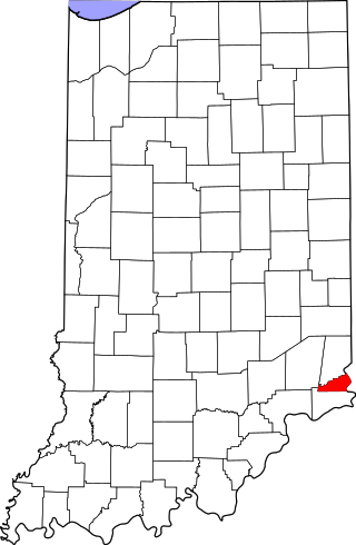
This is a list of the National Register of Historic Places listings in Ohio County, Indiana.

References

  1. The latitude and longitude information provided in this table was derived originally from the National Register Information System, which has been found to be fairly accurate for about 99% of listings. Some locations in this table may have been corrected to current GPS standards.
  2. National Park Service, United States Department of the Interior, "National Register of Historic Places: Weekly List Actions", retrieved December 8, 2023.
  3. 1 2 Numbers represent an alphabetical ordering by significant words. Various colorings, defined here, differentiate National Historic Landmarks and historic districts from other NRHP buildings, structures, sites or objects.
  4. "National Register Information System". National Register of Historic Places . National Park Service. March 13, 2009.
  5. The eight-digit number below each date is the number assigned to each location in the National Register Information System database, which can be viewed by clicking the number.
  6. Location derived from Kozarek, Sue Ellen. "Determining Sedentism in the Archaeological Record". Ohio Hopewell Community Organization. Ed. William S. Dancey and Paul J. Pacheco. Kent: Kent State UP, 1997. 131-152: 141. The NRIS lists the site as "Address Restricted".
  7. Location derived from Gosman, James Howard. Patterns in Ontogeny of Human Trabecular Bone from Sunwatch Village in the Prehistoric Ohio Valley . Diss. Ohio State University, 2007. Accessed 2010-04-14. The NRIS lists the site as "Address Restricted".