Bright, Indiana

Last updated

Bright, Indiana
Dearborn County Indiana Incorporated and Unincorporated areas Bright Highlighted 1807624.svg
Location of Bright in Dearborn County, Indiana.
Coordinates: 39°13′35″N84°51′55″W / 39.22639°N 84.86528°W / 39.22639; -84.86528
Country United States
State Indiana
County Dearborn
Townships Logan, Harrison, Miller
Area
[1]
  Total12.56 sq mi (32.53 km2)
  Land12.54 sq mi (32.48 km2)
  Water0.02 sq mi (0.05 km2)
Elevation
[2]
938 ft (286 m)
Population
 (2020)
  Total5,814
  Density463.60/sq mi (179.00/km2)
Time zone UTC-5 (Eastern (EST))
  Summer (DST) UTC-4 (EDT)
Area code 812
FIPS code 18-07624 [3]
GNIS feature ID2393348 [2]

Bright is an unincorporated community and census-designated place (CDP) in Dearborn County, Indiana, United States. The population was 5,814 at the 2020 census.

Contents

History

A post office was established at Bright in 1847, and remained in operation until it was discontinued in 1904. [4]

At least since the 1980s, Bright has been transformed from a small town to an exurb of Cincinnati. [5]

Geography

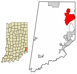
Bright is located in northeastern Dearborn County in Logan, Harrison, and Miller townships. The eastern edge of the Bright CDP follows the Indiana–Ohio border. Harrison, Ohio, is 4 miles (6 km) to the northeast via Jamison Road, and downtown Cincinnati is 27 miles (43 km) to the east.

According to the United States Census Bureau, the Bright CDP has a total area of 12.6 square miles (32.6 km2), of which 0.02 square miles (0.05 km2), or 0.15%, is water. [6]

Demographics

Historical population
CensusPop.Note
2000 5,405
2010 5,6935.3%
2020 5,8142.1%
U.S. Decennial Census [7] [6]

As of the census [3] of 2000, there were 5,405 people, 1,770 households, and 1,493 families residing in the CDP. The population density was 377.7 inhabitants per square mile (145.8/km2). There were 1,811 housing units at an average density of 126.6 per square mile (48.9/km2). The racial makeup of the CDP was 98.43% White, 0.41% African American, 0.11% Native American, 0.09% Asian, 0.30% from other races, and 0.67% from two or more races. Hispanic or Latino of any race were 0.63% of the population.

There were 1,770 households, out of which 46.8% had children under the age of 18 living with them, 73.4% were married couples living together, 8.3% had a female householder with no husband present, and 15.6% were non-families. 12.8% of all households were made up of individuals, and 3.7% had someone living alone who was 65 years of age or older. The average household size was 3.05 and the average family size was 3.36.

In the CDP, the population was spread out, with 31.7% under the age of 18, 7.9% from 18 to 24, 31.6% from 25 to 44, 22.1% from 45 to 64, and 6.7% who were 65 years of age or older. The median age was 34 years. For every 100 females, there were 100.6 males. For every 100 females age 18 and over, there were 98.4 males.

The median income for a household in the CDP was $63,813, and the median income for a family was $66,639. Males had a median income of $41,923 versus $27,917 for females. The per capita income for the CDP was $22,401. About 1.6% of families and 1.7% of the population were below the poverty line, including 1.8% of those under age 18 and 2.6% of those age 65 or over.

Related Research Articles

<span class="mw-page-title-main">Pelican Bay, Florida</span> Census-designated place in Florida

Pelican Bay is a census-designated place (CDP) in Collier County, Florida, United States. The population was 6,346 at the 2010 census. It is part of the Naples–Marco Island Metropolitan Statistical Area.

<span class="mw-page-title-main">Heathrow, Florida</span> CDP in Florida, United States

Heathrow is a census-designated place and an unincorporated suburban community in Seminole County, Florida, United States. Heathrow is on the I-4 Corridor in Central Florida, 19 miles northeast of Orlando and 38 miles southwest of Daytona Beach. Heathrow comprises a master-planned, private gated residential community of approximately 2,200 homes, and the Heathrow International Business Center, an office park. Heathrow was founded in 1985 by Jeno Paulucci, a food business entrepreneur. The area had been a source of celery used in making his Chun King Foods American Chinese style food. The population was 4,068 at the 2000 census. Heathrow is home to the national headquarters of the American Automobile Association (AAA).

<span class="mw-page-title-main">Greendale, Indiana</span> City in Indiana, United States

Greendale is a city in Dearborn County, Indiana, United States. The population was 4,520 at the 2010 census.

<span class="mw-page-title-main">Hidden Valley, Indiana</span> Census-designated place in Indiana, United States

Hidden Valley is a private residential community in Dearborn County, Indiana, United States. For statistical purposes it is a census-designated place (CDP), with a population of 5,387 at the 2010 census, up from 4,417 at the 2000 census.

<span class="mw-page-title-main">Lawrenceburg, Indiana</span> City in Indiana, United States

Lawrenceburg is a city and the county seat of Dearborn County, Indiana, United States. The population was 5,129 at the 2020 census. It is the largest city in Dearborn County. Lawrenceburg is in southeast Indiana, on the Ohio River west of Cincinnati.

<span class="mw-page-title-main">St. Leon, Indiana</span> Town in Indiana, United States

St. Leon or Saint Leon is a town in Kelso Township, Dearborn County, Indiana, United States. The population was 678 at the 2010 census.

<span class="mw-page-title-main">West Harrison, Indiana</span> Town in Indiana, United States

West Harrison is a town in Harrison Township, Dearborn County, Indiana, United States. The population was 289 at the 2010 census.

<span class="mw-page-title-main">Simonton Lake, Indiana</span> Census-designated place in Indiana, United States

Simonton Lake is a census-designated place (CDP) in Elkhart County, Indiana, United States. The population was 4,678 at the 2010 census.

<span class="mw-page-title-main">Koontz Lake, Indiana</span> Census-designated place in Indiana, United States

Koontz Lake is an unincorporated community and census-designated place in Starke and Marshall counties in Indiana. The population was 1,667 at the 2020 census.

<span class="mw-page-title-main">Osgood, Indiana</span> Town in Indiana, United States

Osgood is a town in Center Township, Ripley County, in the U.S. state of Indiana. The population was 1,624 at the 2010 census.

<span class="mw-page-title-main">Georgetown, St. Joseph County, Indiana</span> Census-designated place in Indiana, United States

Georgetown is a census-designated place in Clay Township, St. Joseph County, in the U.S. state of Indiana. The population was 4,497 at the 2000 census. It is part of the South Bend–Mishawaka, IN-MI, Metropolitan Statistical Area.

<span class="mw-page-title-main">Shark River Hills, New Jersey</span> Populated place in Monmouth County, New Jersey, US

Shark River Hills is an unincorporated community and census-designated place (CDP) within Neptune Township, in Monmouth County, in the U.S. state of New Jersey. As of the 2010 United States Census, the CDP's population was 3,697.

<span class="mw-page-title-main">Covedale, Ohio</span> Census-designated place in Ohio, United States

Covedale is a census-designated place (CDP) in Green Township, Hamilton County, Ohio, United States. The population was 6,472 at the 2020 census. The CDP represents the part of the former village of Covedale that was not annexed by the city of Cincinnati in the 1890s.

<span class="mw-page-title-main">Groesbeck, Ohio</span> Census-designated place in Ohio, United States

Groesbeck is a census-designated place (CDP) in Hamilton County, Ohio, United States. The population was 7,365 at the 2020 census. It is a suburb of Cincinnati.

<span class="mw-page-title-main">Kenwood, Ohio</span> Census-designated place in Ohio, United States

Kenwood is a census-designated place (CDP) in Sycamore Township, Hamilton County, Ohio, United States. The population was 7,570 at the 2020 census. It is a major shopping destination for the Cincinnati area, featuring properties such as Kenwood Towne Centre and The Kenwood Collection.

<span class="mw-page-title-main">Northgate, Ohio</span> Census-designated place in Ohio, United States

Northgate is a census-designated place (CDP) in Colerain Township, Hamilton County, Ohio, United States. The population was 7,277 at the 2020 census.

<span class="mw-page-title-main">White Oak, Ohio</span> Census-designated place in Ohio, United States

White Oak is a census-designated place (CDP) in Hamilton County, Ohio, United States. It is seven miles northwest of Cincinnati. The population was 19,541 at the 2020 census. White Oak is situated in both Green Township and Colerain Township.

Jacksonville is a census-designated place (CDP) in Indiana County, Pennsylvania, United States. The population was 637 at the 2010 census. It was formerly an independent borough, until January 1, 1993 when it was returned to Black Lick Township, Pennsylvania.

<span class="mw-page-title-main">Buffalo, Indiana</span> Census-designated place in Indiana, United States

Buffalo is a census-designated place (CDP) in Liberty Township, White County, in the U.S. state of Indiana. The population was 692 at the 2010 census.

<span class="mw-page-title-main">Shawnee, Hamilton County, Ohio</span> Census-designated place in Ohio, United States

Shawnee is a census-designated place (CDP) in Miami Township, Hamilton County, Ohio, United States, 21 miles (34 km) west of downtown Cincinnati. The population of Shawnee was 747 at the 2020 census.

References

  1. "2020 U.S. Gazetteer Files". United States Census Bureau. Retrieved March 16, 2022.
  2. 1 2 U.S. Geological Survey Geographic Names Information System: Bright, Indiana
  3. 1 2 "U.S. Census website". United States Census Bureau . Retrieved January 31, 2008.
  4. "Dearborn County". Jim Forte Postal History. Archived from the original on September 3, 2014. Retrieved August 31, 2014.
  5. Communications, Emmis (December 1989). Cincinnati Magazine. Emmis Communications. p. 62. ISSN   0746-8210.
  6. 1 2 "Geographic Identifiers: 2010 Demographic Profile Data (G001): Bright CDP, Indiana". U.S. Census Bureau, American Factfinder. Retrieved October 23, 2015.[ dead link ]
  7. "Census of Population and Housing". Census.gov. Retrieved June 4, 2016.