
Koontz Lake is an unincorporated community and census-designated place in Starke and Marshall counties in Indiana. The population was 1,667 at the 2020 census.

Pleasant Hill is an unincorporated community and census-designated place (CDP) in Lebanon County, Pennsylvania, United States. The population was 2,643 at the 2010 census, up from 2,301 at the 2000 census.

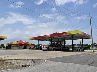
Washington Township is one of nine townships in Starke County, in the U.S. state of Indiana. As of the 2020 census, its population was 2,944 and it contained 1,214 housing units.

Union Township is one of thirteen townships in St. Joseph County, in the U.S. state of Indiana. As of the 2000 census, its population was 3,289.

West Township is one of ten townships in Marshall County, Indiana, United States. As of the 2020 census, its population was 3,849 and it contained 1,684 housing units.
Fishersburg is an unincorporated community and census-designated place (CDP) in Stony Creek Township, Madison County, Indiana, United States.

Coalmont is an unincorporated community and census-designated place in Lewis Township, Clay County, Indiana, United States. It is part of the Terre Haute Metropolitan Statistical Area. As of the 2010 census, it had a population of 402.

Raglesville is an unincorporated community and census-designated place (CDP) in Van Buren Township, Daviess County, Indiana, United States. As of the 2010 census it had a population of 141.

Westphalia is an unincorporated community and census-designated place (CDP) in Vigo Township, Knox County, Indiana. As of the 2010 census it had a population of 202.

Avoca is an unincorporated community and census-designated place in Marshall Township, Lawrence County, Indiana, United States. As of the 2010 census the population was 583.
Teegarden is an unincorporated community and census-designated place (CDP) in Polk Township, Marshall County, Indiana, United States.
Tippecanoe is an unincorporated community and census-designated place (CDP) in Tippecanoe Township, Marshall County, Indiana, United States.
Tyner is an unincorporated community and census-designated place (CDP) in Polk Township, Marshall County, Indiana, United States. Originally named "Tyner City", it is named after Thomas Tyner, who died in 1880 and is buried in the town's cemetery.

Buffalo is a census-designated place (CDP) in Liberty Township, White County, in the U.S. state of Indiana. The population was 692 at the 2010 census.

Joppa is a census-designated place (CDP) and unincorporated community in Cullman and Marshall counties, Alabama, United States. As of the 2020 census, its population was 556.
Mount Pleasant is a census-designated place and unincorporated community in Marshall County, Mississippi, United States, located along U.S. Highway 72 at State Highway 311. The community has a volunteer fire department on Boswell Road, and a K-12 school located off Highway 72.
Bennetts Switch is an unincorporated community and census-designated place (CDP) in Deer Creek Township, Miami County, in the U.S. state of Indiana.
Pine Lake is an unincorporated community and census-designated place (CDP) in Mohave County, Arizona, United States. The population was 142 at the 2020 census.
Lake of the Woods is an unincorporated community in Marshall County, Indiana, United States. It was labeled a census-designated place (CDP) following the 2020 census.
Foxcliff Estates is an unincorporated community and census-designated place (CDP) in Washington Township, Morgan County, Indiana, United States. It was named a CDP after the 2020 census.


