Hamilton County is part of the Indianapolis metropolitan area. Since the beginning of the 21st century, Hamilton County has been the second most populous county in Central Indiana. It is the highest-income county in Indiana, and one of the highest-income counties in the United States.
Hamilton County's roots are in agriculture. However, after World War II, development in Indianapolis grew northward, and cities/towns in the southern and central part of Hamilton County developed as suburbs. Residential and commercial development have replaced many farm fields, although the county's northern part remains largely agricultural. In the first decades of the 21st century, the county is one of the fastest-growing counties in the United States. According to 2007 estimates by the US Census, the county's population increased from 182,740 in 2000 to an estimated 261,661 in 2007, making it the fastest-growing county of Indiana's 92. As of the 2010 census, Hamilton County surpassed St. Joseph County in population, making it the state's fourth most populous.[2]
In 2020, Hamilton County was home to three of the state's 20 largest cities and towns: Carmel (5th), Fishers (6th), and Noblesville (12th).
Geist and Morse reservoirs are two man-made lakes in Hamilton County that offer boating, fishing, and waterfront living.
In June 2008, Hamilton County was named America's Best Place to Raise a Family by Forbes.com[3] due to its strong economy, affordable living, top-ranked schools, and close proximity to Indianapolis. The city of Carmel in southwestern Hamilton County was designated CNN Money's top place to live in 2013[4] and in 2017, the city of Fishers was named best place to live.[5]
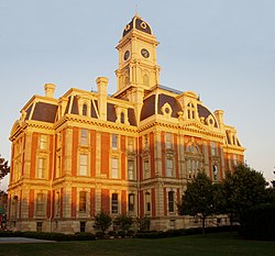
History
Illustrated history of Hamilton County, Indiana
The land containing Hamilton County was brought into the possession of the United States by the Treaty of St. Mary's in 1818. William Conner was the first white settler in the county. In the summer of 1822, after realizing there were enough settlers in the area, Conner and other settlers applied to the Indiana Legislature for a charter authorizing them to become a separate and independent county under Indiana law. The application was presented to the 1822–23 session of the Indiana General Assembly, and the act was passed and approved by the governor on January 8, 1823. The act took effect on the first Monday in April (April 7), 1823. The county commissioners first met on May 5, 1823, at Conner's house; it also served as the county circuit courthouse. The county was named for Alexander Hamilton, the first secretary of the US treasury.[6][7][8]
2,165 soldiers from Hamilton County served in the Civil War.[9] The last veteran residing in the county died in 1942.[10]
Most Belgian immigration to Indiana occurred in the northwestern part of the state in Lake County and Porter County. However, in the 1890s, a significant number of Belgian immigrants also settled in the Noblesville area of Hamilton County. Similarly, chain migration led to numerous first generation Serbian immigrants who had settled in Indianapolis, and their Indiana-born children, to move to Arcadia, Carmel, Sheridan, Noblesville, and Cicero around the turn of the 20th century.[11][12]
Like most of Indiana, the area was also heavily German-American, with Germans being the second largest single ethnic group in the county at the time, second only to so-called "native born whites" whose ancestry extended to the original Thirteen Colonies and who were the largest ethnic group in Hamilton County at the turn of the century.[13] During World War I, Hamilton County was noted for an extreme rise in anti-German sentiment. The name of Wilhelm Street in Noblesville was changed to Washington Street and German-Americans were subjected to bullying and abuse from their neighbors. German-Americans were one of the largest ethnic groups in the county, but the remaining two-thirds of the county were "whipped into an anti-German frenzy" during which Germanness and Americanness were presented as being antithetical throughout the press. Hamilton County was labeled the "most anti-German county" in Indiana,[14] although such attitudes were common throughout the rest of Indiana as well.[15] During most of 1940 and 1941, Indiana as a whole was very isolationist, with much of the state preferring that the country stay neutral in the European conflict. However, Hamilton County was a "hot-bed of interventionist and pro-British sentiment", which stood out because unlike many other places in Indiana, most people in Hamilton County were in favor of American entry into the war, and were in favor of providing Britain with as much aid as possible as well.[16]
In recent years, average temperatures in Noblesville have ranged from a low of 17°F (−8°C) in January to a high of 85°F (29°C) in July, although a record low of −23°F (−31°C) was recorded in January 1994 and a record high of 105°F (41°C) was recorded in July 1954. Average monthly precipitation ranged from 2.42 inches (61mm) in January to 4.86 inches (123mm) in May. Hamilton County's climate thus falls within the Köppen climate classification system as a humid continentaltemperate climate, with pleasant spring and fall seasons surrounded by harsh cold and humid heat in the winter and summer, respectively.[17]
Geography
According to the 2010 census, the county has a total area of 402.44 square miles (1,042.3km2), of which 394.27 square miles (1,021.2km2) (or 97.97%) is land and 8.17 square miles (21.2km2) (or 2.03%) is water.[18]
US Decennial Census[20] 1790-1960[21] 1900-1990[22] 1990-2000[23] 2010-2019[1]
2020 census
As of the 2020 census, the county had a population of 347,467. The median age was 38.0 years. 27.1% of residents were under the age of 18 and 13.4% of residents were 65 years of age or older. For every 100 females there were 94.9 males, and for every 100 females age 18 and over there were 91.8 males age 18 and over.[24][25]
94.3% of residents lived in urban areas, while 5.7% lived in rural areas.[26]
There were 128,475 households in the county, of which 38.7% had children under the age of 18 living in them. Of all households, 61.2% were married-couple households, 12.7% were households with a male householder and no spouse or partner present, and 21.0% were households with a female householder and no spouse or partner present. About 21.6% of all households were made up of individuals and 8.0% had someone living alone who was 65 years of age or older.[24]
There were 135,064 housing units, of which 4.9% were vacant. Among occupied housing units, 76.5% were owner-occupied and 23.5% were renter-occupied. The homeowner vacancy rate was 1.1% and the rental vacancy rate was 8.2%.[24]
2010 census
Age and gender distribution in Hamilton County
As of the 2010 United States census, there were 274,569people, 99,835households, and 74,755families in the county.[27] The population density was 696.4 inhabitants per square mile (268.9/km2). There were 106,772 housing units at an average density of 270.8 per square mile (104.6/km2).[18] The racial makeup of the county was 88.5% white, 4.8% Asian, 3.5% black or African American, 0.2% American Indian, 1.2% from other races, and 1.8% from two or more races. Those of Hispanic or Latino origin made up 3.4% of the population.[27] In terms of ancestry, 29.0% were German, 14.6% were Irish, 13.0% were English, and 7.7% were American.[28]
Of the 99,835households, 43.2% had children under the age of 18 living with them, 63.2% were married couples living together, 8.3% had a female householder with no husband present, 25.1% were non-families, and 20.5% of all households were made up of individuals. The average household size was 2.73 and the average family size was 3.19. The median age was 35.6 years.[27]
The median income for a household in the county was $47,697 and the median income for a family was $95,376. Males had a median income of $67,221 versus $44,273 for females. The per capita income for the county was $38,500. About 3.6% of families and 4.5% of the population were below the poverty line, including 5.6% of those under age 18 and 3.5% of those age 65 or over.[29]
Life expectancy
The life expectancy in Hamilton County in 2010 was 81.21 years, up 6.6 percent from 76.16 years in 1980.[30][31] By comparison, the US national average in 2010 was 78.49 years.[32][33]
Government
The county executive body is the Board of County Commissioners, which consists of three Commissioners representing their three respective districts.
District 1 consists of Carmel, which is coextensive with Clay Township. District 2 consists of Fishers, Noblesville, Delaware Township, and Noblesville Township. District 3 consists of Adams Township, Fall Creek Township, Jackson Township, Washington Township, Wayne Township, White River Township, Arcadia, Atlanta, Cicero, Sheridan and Westfield.
The current (2024) County Commissioners are:
Christine Altman - District 1
Steven C. Dillinger - District 2
Mark Heirbrandt - District 3
The county's finances are managed by the County Council, which consists of seven members, four elected by district and three elected at-large.
District 1 consists of parts of Clay Township (45 precincts). District 2 consists of Delaware, Fall Creek, and Wayne Townships. District 3 consists of Noblesville, Jackson and White River Townships. District 4 consists of parts of Clay Township (17 precincts), Adams and Washington Townships.
The current (2024) members of the County Council are:
Hamilton County has long been reckoned as a Republican stronghold. Woodrow Wilson remains the only Democratic presidential candidate to carry Hamilton County, a feat he accomplished in 1912, when Theodore Roosevelt's third-party candidacy split the Republican vote and allowed Wilson to carry the county with a slim plurality over incumbent President William H. Taft.[36] Otherwise, the county has reliably voted Republican in every presidential race since 1856, prior to which it supported the Whig candidate in every election of the Second Party System.
The county has long been reckoned as a classic bastion of suburban conservatism. Underlining this, in modern political history, the county rejected Franklin Roosevelt in all four of his bids for president, and Barry Goldwater easily carried the county in 1964 with 61 percent of the vote. In 2018, Senator Joe Donnelly came within 10 percent of winning the county, winning 44.4% of the vote in his re-election loss.[37]
In 2020, Democrat Joe Biden won 45.4% of the vote in the county, while Donald Trump won 52.2% of the vote. It was the first time since 1936 that a Democrat won 40 percent of the county's vote, and only the second time since 1932 that a Republican had won the county by fewer than 10 points. Biden carried both Carmel and Fishers.[38]
In 2024, Kamala Harris improved slightly on Biden's performance, winning 46% of the vote in the county. This is the highest percentage of the vote ever won by a Democratic presidential nominee despite Harris losing the presidential election, while Trump received 52% of the vote.
Hamilton County is one of nine counties that shifted more than 25 percentage points to the left from 2012 to 2024, as well as the most left-trending county in that time period outside of Metro Atlanta in Georgia. Although still Republican-leaning, the county's Republican margin shrank from 34% to 6%, despite Indiana remaining a Republican stronghold.[39]
United States presidential election results for Hamilton County, Indiana[40][41][42]
↑Belgian Settlement and Society in the Indiana Rust Belt Susan E. Hume - Geographical Review - Vol. 93, No. 1 (Jan. 2003), pp. 30-50
↑The Yugoslav Immigrants in America by Joseph S. Roucek - American Journal of Sociology - Vol. 40, No. 5 (Mar. 1935), pp. 602-611
↑The German-Americans: An Ethnic Experience by Willi Paul Adams Max Kade German-American Center, Indiana University-Purdue University at Indianapolis, 1993
↑Indiana's War History - Indiana Magazine of History - Vol. 47, No. 2 (June 1951), pp. 189-190
↑Peopling Indiana: The Ethnic Experience - Indiana Historical Society, 1996 - p. 172
↑Hoosier Labor in the Second World War Hugh M. Ayer Indiana Magazine of History Vol. 59, No. 2 (June 1963), p. 95 - Indiana University Press
This page is based on this Wikipedia article Text is available under the CC BY-SA 4.0 license; additional terms may apply. Images, videos and audio are available under their respective licenses.