Pendleton, Indiana

Last updated • 8 min readFrom Wikipedia, The Free Encyclopedia

Pendleton, Indiana
Pendleton, Indiana.jpg
Downtown Pendleton
Motto: 
"Strong roots empower healthy growth." [1]
Madison County Indiana Incorporated and Unincorporated areas Pendleton Highlighted 1858662.svg
Location in Madison County, Indiana
Coordinates: 40°00′10″N85°45′48″W / 40.00278°N 85.76333°W / 40.00278; -85.76333
Country United States
State Indiana
County Madison
Township Fall Creek
Platted1830
Government
  Type Town council
Area
[2]
  Total13.43 sq mi (34.79 km2)
  Land13.36 sq mi (34.61 km2)
  Water0.07 sq mi (0.18 km2)
Elevation
[3]
876 ft (267 m)
Population
 (2020) [4]
  Total4,717
  Density352.99/sq mi (136.29/km2)
Time zone UTC-5 (Eastern (EST))
  Summer (DST) UTC-4 (EDT)
ZIP code
46064
Area code 765
FIPS code 18-58662 [5]
GNIS feature ID2396852 [3]
Website town.pendleton.in.us

Pendleton is a town in Fall Creek Township, Madison County, Indiana, United States. The population was 4,717 at the 2020 census, [4] up from 4,253 in 2010.

Contents

History

Pendleton was platted in 1830, and incorporated as a town in 1854. [6] It was named for town founder Thomas Pendleton. [1] [7]

Fall Creek Massacre

The Fall Creek Massacre is the name given to the brutal murders of a peaceful group of Seneca and Miami Indians by white settlers. The massacre occurred on March 22, 1824, in Madison County between Fall Creek and Deer Lick Creek. James Hudson's trial was held October 7–9, 1824. Trials of the other men were held in 1825. The trial set an important precedent in recognizing the civil rights of Native Americans. The three men were hanged for their crimes in Pendleton. This marked the first time white men were executed for the murder of Native Americans in the United States. A historical marker in Falls Park marks the place of the hanging. The inscription reads: "Three white men were hung here in 1825 for killing Indians." [8]

Attack on Frederick Douglass

Frederick Douglass wrote of being attacked by a mob as he promoted the Abolition cause in 1843. His party had erected a platform in nearby woods. A crowd of "rough characters", largely from "Andersonville", tried to silence them, then severely beat them. He defended himself with a stick, but was knocked unconscious. He was nursed back to health over days by the Quaker Neal Hardy and his wife. Douglass never regained full use of his injured hand. [9]

2019 tornado

Pendleton was struck by a strong tornado during the evening of May 27, 2019, during a major tornado outbreak. Moderate damage was reported to the town, with search and rescue efforts beginning that night. [10] The tornado received a rating of high-end EF-2, with winds of 130 miles per hour (210 km/h).

Photo from Small Town Indiana survey Pendleton,Indiana.jpg
Photo from Small Town Indiana survey
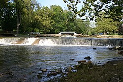
Falls Park Fallspark.jpg
Falls Park

Geography

Pendleton is located in southern Madison County. It is bordered to the north by the city of Anderson, the county seat. It is bordered to the west by the town of Lapel and to the southwest by the town of Ingalls.

Interstate 69 passes through the west side of the town and travels along its northern border, with access from Exits 219 and 222. I-69 leads southwest 30 miles (48 km) to Indianapolis and north-northeast 91 miles (146 km) to Fort Wayne. U.S. Route 36 passes through the southeast side of Pendleton, leading southwest to Indianapolis and east 62 miles (100 km) to Greenville, Ohio. Indiana State Road 9 passes through the east side of Pendleton, leading north 10 miles (16 km) to Anderson and south 15 miles (24 km) to Greenfield. State Road 38 passes through the center of Pendleton as State Street, leading east-southeast 21 miles (34 km) to New Castle and west-northwest 14 miles (23 km) to Noblesville. State Road 132 (Lapel Road) leads northwest from Pendleton 7 miles (11 km) to Lapel.

According to the U.S. Census Bureau, Pendleton has a total area of 13.43 square miles (34.78 km2), of which 0.07 square miles (0.18 km2), or 0.52%, are water. [2] Fall Creek passes through the town west of its center, flowing southwest to the White River in Indianapolis.

Demographics

Historical population
CensusPop.Note
1850 389
1870 675
1880 614−9.0%
1890 99662.2%
1900 1,51251.8%
1910 1,293−14.5%
1920 1,244−3.8%
1930 1,53823.6%
1940 1,6819.3%
1950 2,08223.9%
1960 2,47218.7%
1970 2,243−9.3%
1980 2,130−5.0%
1990 2,3098.4%
2000 3,87367.7%
2010 4,2539.8%
2020 4,71710.9%
US Decennial Census [11]

Pendleton is part of the Indianapolis–Carmel–Anderson metropolitan statistical area.

2010 census

As of the 2010 United States Census, [12] there were 4,253 people, 1,754 households, and 1,154 families in the town. The population density was 380.8 inhabitants per square mile (147.0/km2). There were 1,893 housing units at an average density of 169.5 per square mile (65.4/km2). The racial makeup of the town was 96.6% White, 1.0% African American, 0.3% Native American, 0.8% Asian, 0.1% Pacific Islander, 0.3% from other races, and 0.9% from two or more races. Hispanic or Latino of any race were 1.0% of the population.

There were 1,754 households, of which 34.9% had children under the age of 18 living with them, 47.4% were married couples living together, 13.7% had a female householder with no husband present, 4.7% had a male householder with no wife present, and 34.2% were non-families. 30.4% of all households were made up of individuals, and 12.8% had someone living alone who was 65 years of age or older. The average household size was 2.37 and the average family size was 2.94.

The median age in the town was 37.6 years. 26.4% of residents were under the age of 18; 6.7% were between the ages of 18 and 24; 27.4% were from 25 to 44; 24.5% were from 45 to 64; and 15% were 65 years of age or older. The gender makeup of the town was 47.3% male and 52.7% female.

2000 census

As of the 2000 United States Census, [11] of 2000, there were 3,873 people, 1,550 households, and 1,052 families in the town. The population density was 577.6 inhabitants per square mile (223.0/km2). There were 1,631 housing units at an average density of 243.2 per square mile (93.9/km2). The racial makeup of the town was 98.27% White, 0.39% African American, 0.10% Native American, 0.46% Asian, 0.21% from other races, and 0.57% from two or more races. Hispanic or Latino of any race were 0.52% of the population.

There were 1,550 households, out of which 34.6% had children under the age of 18 living with them, 53.3% were married couples living together, 10.8% had a female householder with no husband present, and 32.1% were non-families. 27.9% of all households were made up of individuals, and 11.6% had someone living alone who was 65 years of age or older. The average household size was 2.41 and the average family size was 2.94.

The town population contained 25.7% under the age of 18, 7.2% from 18 to 24, 29.9% from 25 to 44, 21.3% from 45 to 64, and 15.9% who were 65 years of age or older. The median age was 36 years. For every 100 females, there were 88.1 males. For every 100 females age 18 and over, there were 84.0 males.

The median income for a household in the town was $46,204, and the median income for a family was $54,556. Males had a median income of $39,545 versus $25,753 for females. The per capita income for the town was $20,074. About 3.7% of families and 4.1% of the population were below the poverty line, including 5.7% of those under age 18 and none of those age 65 or over.

Arts and culture

Museums and other points of interest

The Pendleton Historic District covers an area roughly bounded by Fall Creek, the Conrail right-of-way, and Madison and Adams streets. It is listed on the National Register of Historic Places along with Madison County Bridge No. 149. [13]

Education

The town houses the schools for South Madison Community School Corporation. [14] The district has three elementary schools: Pendleton Elementary (formerly South Elementary), East Elementary and Maple Ridge Elementary. Pendleton Heights High School sits atop a hill on the edge of the east side of town and serves as the local high school. A newly constructed Pendleton Heights Middle School opened in August 2009 across from the high school. The former middle school, located in the downtown area just north of Pendleton Elementary, now serves as Pendleton Elementary School - Intermediate.

The town has a lending library, the Pendleton Community Public Library. [15]

Newspaper

The Times-Post is a weekly newspaper serving Pendleton and the surrounding communities. [16] The paper was formerly known as The Pendleton Times, and was the first to feature Jim Davis' original comic strip "Gnorm Gnat" and "Jon", a prototype of Garfield .[ citation needed ]

Radio

WEEM (91.7 FM) is a radio station located on the campus of Pendleton Heights High School and run by the students. It is a non-commercial, 1200 watt station that covers about 20 miles (32 km) and also supports a mobile application on both iOS and Google Play. The format of the station is contemporary rock. WEEM has been operational since 1970. WEEM competes in the annual IASB State Radio Contest.

Transportation

Highways

Ambulance service

According to the Indiana EMS commission, Pendleton Emergency Ambulance operates one of only two volunteer Advanced Life Support (ALS) ambulance services in Indiana.

Prisons

Three facilities of the Indiana Department of Corrections are in Fall Creek Township, near Pendleton [17]

The Pendleton Correctional Facility is located on the south edge of town. Famous former inmates include: John Dillinger, Harry Pierpont, Jim "Goose" Ligon and Homer Van Meter. The Pendleton Reformatory is a maximum security prison and is located at 4490 Reformatory Rd.

Notable people

Related Research Articles

<span class="mw-page-title-main">Alexandria, Indiana</span> City in Indiana, United States

Alexandria is a city in Monroe Township, Madison County, Indiana, United States. It is about 48 miles (77 km) northeast of Indianapolis. According to the 2020 census, its population was 5,149, nearly unchanged from 2010.

<span class="mw-page-title-main">Madison County, Indiana</span> County in Indiana, United States

Madison County is a county in the U.S. state of Indiana. The 2020 census states the population is standing at 130,129. The county seat since 1836 has been Anderson, one of three incorporated cities within the county.

<span class="mw-page-title-main">Greenfield, Indiana</span> City in Indiana, United States

Greenfield is a city in and the county seat of Hancock County, Indiana, United States It lies in Center Township and is part of the Indianapolis metropolitan area. The population was 23,488 at the 2020 census.

<span class="mw-page-title-main">Amo, Indiana</span> Town in Indiana, United States

Amo is a town in Clay Township, Hendricks County, Indiana, United States. The population was 408 at the 2020 census.

<span class="mw-page-title-main">Avon, Indiana</span> Town in Indiana, United States

Avon is a town in Washington Township, Hendricks County, Indiana, United States. The population was 21,474 at the 2020 census. It is part of the Indianapolis metropolitan area.

<span class="mw-page-title-main">Plainfield, Indiana</span> Town in Indiana, United States

Plainfield is a town in Guilford, Liberty, and Washington townships, Hendricks County, Indiana, United States. The population was 27,631 at the 2010 census, and in 2022 the estimated population was 36,074.

<span class="mw-page-title-main">Madison, Indiana</span> City in Indiana, United States

Madison is a city in and the county seat of Jefferson County, Indiana, United States, along the Ohio River. As of the 2010 United States Census its population was 11,967. Over 55,000 people live within 15 miles (24 km) of downtown Madison. Madison is the largest city along the Ohio River between Louisville and Cincinnati. Madison is one of the core cities of the Louisville-Elizabethtown-Madison metroplex, an area with a population of approximately 1.5 million. In 2006, the majority of Madison's downtown area was designated a National Historic Landmark—133 blocks of the downtown area is known as the Madison Historic Landmark District.

<span class="mw-page-title-main">Greenwood, Indiana</span> City in Indiana, United States

Greenwood is a city in Johnson County, Indiana, United States. The population was 63,830 at the 2020 Census. Greenwood is located southeast of central Indianapolis between Indiana State Road 37 and Interstate 65. The city shares a border with Indianapolis and is the most populous suburban municipality in the southern portion of the Indianapolis Metropolitan Area.

<span class="mw-page-title-main">Anderson, Indiana</span> City in Indiana, United States

Anderson is a city in Madison County, Indiana, United States, and the county seat of Madison County. The population was 54,788 at the 2020 census. It is named after Chief William Anderson. The city is the headquarters of the Church of God and its Anderson University. Highlights of the city include the historic Paramount Theatre and the Gruenewald House.

<span class="mw-page-title-main">Frankton, Indiana</span> Town in Indiana, United States

Frankton is a town in Pipe Creek and Lafayette townships, Madison County, Indiana, United States. It is part of the Indianapolis–Carmel–Anderson metropolitan statistical area. The population was 1,775 at the 2020 census.

<span class="mw-page-title-main">Ingalls, Indiana</span> Town in Indiana, United States

Ingalls is a town in Green Township, Madison County, Indiana, United States. It is part of the Indianapolis–Carmel–Anderson metropolitan statistical area. The population was 2,223 at the 2020 census.

<span class="mw-page-title-main">Lapel, Indiana</span> Town in Indiana, United States

Lapel is a town in Stony Creek and Green townships, Madison County, Indiana, United States. It is part of the Indianapolis–Carmel–Anderson metropolitan statistical area. The population was 2,325 at the 2020 census, up from 2,068 in 2010.

<span class="mw-page-title-main">Markleville, Indiana</span> Town in Indiana, United States

Markleville is a town in Adams Township, Madison County, Indiana, United States. It is part of the Indianapolis–Carmel–Anderson metropolitan statistical area. The population was 484 at the 2020 census.

<span class="mw-page-title-main">Summitville, Indiana</span> Town in Indiana, United States

Summitville is a town in Van Buren Township, Madison County, Indiana, United States. It is part of the Indianapolis–Carmel–Anderson metropolitan statistical area. The population was 989 at the 2020 census.

<span class="mw-page-title-main">Lawrence, Indiana</span> City in Indiana, United States

Lawrence is a city in Marion County, Indiana, United States. It is one of four "excluded cities" in Marion County. The city is home to Fort Benjamin Harrison within Fort Harrison State Park. The population was 49,370 at the 2020 census. The city is on the northeast side of Indianapolis.

<span class="mw-page-title-main">Southport, Indiana</span> City in Indiana, United States

Southport is an excluded city in Marion County, Indiana, United States. The population was 2,123 at the 2020 census, up from 1,712 in 2010.

<span class="mw-page-title-main">Darlington, Indiana</span> Town in Indiana, United States

Darlington is a town in Franklin Township, Montgomery County, in the U.S. state of Indiana. The population was 711 at the 2020 census, down from 843 in 2010.

<span class="mw-page-title-main">Monrovia, Indiana</span> Town in Indiana, United States

Monrovia is a town in Monroe Township, Morgan County, in the U.S. state of Indiana. The population was 1,643 at the 2020 census, up from 1,063 in 2010.

<span class="mw-page-title-main">Mooresville, Indiana</span> Town in Indiana, United States

Mooresville is a town in Brown Township, Morgan County, in the U.S. state of Indiana. As of the 2020 census, the town population was 9,411.

<span class="mw-page-title-main">Verona, Wisconsin</span> City in Wisconsin, United States

Verona is a city in Dane County, Wisconsin, in the United States and is a suburb of Madison. The population was 14,030 at the 2020 census. The city is located ten miles southwest of downtown Madison within the Town of Verona. It is part of the Madison Metropolitan Statistical Area.

References

  1. 1 2 "Town of Pendleton Indiana". Town of Pendleton Indiana. Retrieved September 29, 2012.
  2. 1 2 "2022 U.S. Gazetteer Files: Indiana". United States Census Bureau. Retrieved April 12, 2023.
  3. 1 2 U.S. Geological Survey Geographic Names Information System: Pendleton, Indiana
  4. 1 2 "P1. Race – Pendleton town, Indiana: 2020 DEC Redistricting Data (PL 94-171)". U.S. Census Bureau. Retrieved April 12, 2023.
  5. "US Census website". US Census Bureau. Retrieved January 31, 2008.
  6. Forkner, John La Rue & Dyson, Byron H. (1897). Historical Sketches and Reminiscences of Madison County, Indiana. Wilson, Humphreys & Co. p. 729.
  7. "Profile for Pendleton IN". ePodunk. Retrieved September 29, 2012.
  8. "Three White Men Were Hung Here Historical Marker". www.hmdb.org.
  9. Douglass, Frederick (1882). Life and Times of Frederick Douglass. p.  287 288. Retrieved March 15, 2011. Pendleton this mobocratic spirit was even more pronounced. It was found impossible to obtain a building in which to hold our convention, and our friends, Dr. Fussell and others, erected a platform in the woods, where quite a large audience assembled. Mr. Bradburn, Mr. White, and myself were in attendance. As soon as we began to speak a mob of about sixty of the roughest characters I ever looked upon ordered us, through its leaders, to "be silent," threatening us, if we were not, with violence. We attempted to dissuade them, but they had not come to parley but to fight, and were well armed. They tore down the platform on which we stood, assaulted Mr. White and knocking out several of his teeth, dealt a heavy blow on William A. White, striking him on the back part of the head, badly cutting his scalp and felling him to the ground. Undertaking to fight my way through the crowd with a stick which I caught up in the mêlée, I attracted the fury of the mob, which laid me prostrate on the ground under a torrent of blows. Leaving me thus, with my right hand broken, and in a state of unconsciousness, the mobocrats hastily mounted their horses and rode to Andersonville, where most of them resided. I was soon raised up and revived by Neal Hardy, a kind-hearted member of the Society of Friends, and carried by him in his wagon about three miles (5 km) in the country to his home, where I was tenderly nursed and bandaged by good Mrs. Hardy till I was again on my feet, but as the bones broken were not properly set my hand has never recovered its natural strength and dexterity. We lingered long in Indiana, and the good effects of our labors there are felt at this day. I have lately visited Pendleton, now one of the best republican towns in the State, and looked again upon the spot where I was beaten down, and have again taken by the hand some of the witnesses of that scene, amongst whom was the kind, good lady—Mrs. Hardy—who, so like the good Samaritan of old, bound up my wounds, and cared for me so kindly.
  10. "Indiana weather: Tornado watches extended, search and rescue underway in Pendleton. During the tornado other tornados were spotted about 10 miles away from Pendleton which were classified as EF-2 with winds reaching 135 mph". Indianapolis Star. Retrieved May 28, 2019.
  11. 1 2 "Census of Population and Housing". Census.gov. Retrieved June 4, 2015.
  12. "US Census website". US Census Bureau. Retrieved December 11, 2012.
  13. "National Register Information System". National Register of Historic Places . National Park Service. July 9, 2010.
  14. "South Madison Community School Corporation". South Madison Community School Corporation. Archived from the original on July 22, 2012. Retrieved September 29, 2012.
  15. "Indiana public library directory" (PDF). Indiana State Library. Retrieved March 10, 2018.
  16. "Times Post Pendleton Indiana". Times Post Pendleton Indiana. Archived from the original on September 4, 2012. Retrieved September 29, 2012.
  17. Pendleton town, Indiana [ permanent dead link ]. US Census Bureau. Retrieved December 26, 2010.