Bargersville, Indiana

Last updated

Bargersville, Indiana
Downtown Bargersville.jpg
Johnson County Indiana Incorporated and Unincorporated areas Bargersville Highlighted 1803394.svg
Location of Bargersville in Johnson County, Indiana.
Coordinates: 39°32′40″N86°13′10″W / 39.54444°N 86.21944°W / 39.54444; -86.21944
Country United States
State Indiana
County Johnson
Townships White River, Union
Government
  Town ManagerDan Cartwright[ citation needed ]
Area
[1]
  Total18.73 sq mi (48.50 km2)
  Land18.71 sq mi (48.46 km2)
  Water0.02 sq mi (0.05 km2)
Elevation
[2]
801 ft (244 m)
Population
 (2020)
  Total9,560
  Density510.98/sq mi (197.29/km2)
Time zone UTC-5 (EST)
  Summer (DST) UTC-5 (EST)
ZIP code
46106
Area code 317
FIPS code 18-03394
GNIS ID2396585 [2]
Website townofbargersville.org
Bargersville Town Hall Bargersville Town Hall.jpg
Bargersville Town Hall

Bargersville is a town in White River and Union townships, Johnson County, Indiana, United States. The population was 9,560 at the 2020 census.

Contents

History

Bargersville was established in 1906 when the railroad was extended to that point. It took its name from Old Bargersville, Indiana. [3]

Geography

According to the 2010 census, Bargersville has a total area of 4.93 square miles (12.77 km2), all land. [4]

Demographics

Historical population
CensusPop.Note
1880 77
1920 290
1930 282−2.8%
1940 2975.3%
1950 41339.1%
1960 58641.9%
1970 87349.0%
1980 1,64788.7%
1990 1,6812.1%
2000 2,12026.1%
2010 4,01389.3%
2020 9,560138.2%
U.S. Decennial Census [5]

2010 census

As of the 2010 census, [6] there were 4,013 people, 1,492 households, and 1,055 families living in the town. The population density was 814.0 inhabitants per square mile (314.3/km2). There were 1,692 housing units at an average density of 343.2 per square mile (132.5/km2). The racial makeup of the town was 95.6% White, 1.1% African American, 0.3% Native American, 1.0% Asian, 0.4% from other races, and 1.6% from two or more races. Hispanic or Latino of any race were 2.1% of the population.

There were 1,492 households, of which 41.0% had children under the age of 18 living with them, 56.0% were married couples living together, 9.9% had a female householder with no husband present, 4.8% had a male householder with no wife present, and 29.3% were non-families. 21.8% of all households were made up of individuals, and 5% had someone living alone who was 65 years of age or older. The average household size was 2.69 and the average family size was 3.18.

The median age in the town was 33.2 years. 29.2% of residents were under the age of 18; 7.2% were between the ages of 18 and 24; 32.6% were from 25 to 44; 23.2% were from 45 to 64; and 7.7% were 65 years of age or older. The gender makeup of the town was 51.2% male and 48.8% female.

2000 census

As of the 2000 census, [7] there were 2,120 people, 770 households, and 588 families living in the town. The population density was 1,941.4 inhabitants per square mile (749.6/km2). There were 787 housing units at an average density of 720.7 per square mile (278.3/km2). The racial makeup of the town was 99.10% White, 0.05% African American, 0.19% Native American, 0.14% Asian, 0.05% from other races, and 0.47% from two or more races. Hispanic or Latino of any race were 0.47% of the population.

There were 770 households, out of which 43.0% had children under the age of 18 living with them, 60.3% were married couples living together, 11.6% had a female householder with no husband present, and 23.6% were non-families. 18.8% of all households were made up of individuals, and 5.1% had someone living alone who was 65 years of age or older. The average household size was 2.74 and the average family size was 3.12.

In the town, the population was spread out, with 30.4% under the age of 18, 8.8% from 18 to 24, 35.0% from 25 to 44, 19.4% from 45 to 64, and 6.5% who were 65 years of age or older. The median age was 31 years. For every 100 females, there were 100.9 males. For every 100 females age 18 and over, there were 97.6 males.

The median income for a household in the town was $48,264, and the median income for a family was $50,417. Males had a median income of $37,139 versus $24,205 for females. The per capita income for the town was $19,499. About 3.7% of families and 4.3% of the population were below the poverty line, including 5.1% of those under age 18 and 1.3% of those age 65 or over.

Education

Most of Bargersville is in Center Grove Community School Corporation, served by Center Grove High School. Small sections of Bargersville are in Franklin Community Schools, served by Franklin Community High School. [8]

Related Research Articles

<span class="mw-page-title-main">Odon, Indiana</span> Town in Indiana, United States

Odon is a town in Madison Township, Daviess County, Indiana, United States. The population was 1,354 at the 2010 census.

<span class="mw-page-title-main">Westport, Indiana</span> Town in Indiana, United States

Westport is a town located in Sand Creek Township, Decatur County, Indiana. The population was 1,379 at the 2010 census. A covered bridge, built in 1880, is located about 1.5 miles east of town.

<span class="mw-page-title-main">Albany, Indiana</span> Town in Indiana, United States

Albany is a town in Delaware and Randolph counties in the U.S. state of Indiana, along the Mississinewa River. The population was 2,295 at the 2020 census. It is part of the Muncie, IN Metropolitan Statistical Area.

<span class="mw-page-title-main">Salamonia, Indiana</span> Town in Indiana, United States

Salamonia is a town in Madison Township, Jay County, Indiana, United States. The population was 157 at the 2010 census. The town is situated along the Salamonie River, near its headwaters in Northern Indiana.

<span class="mw-page-title-main">New Whiteland, Indiana</span> Town in Indiana, United States

New Whiteland is a town in Pleasant Township, Johnson County, Indiana, United States. The population was 5,550 at the 2020 census.

<span class="mw-page-title-main">Syracuse, Indiana</span> Town in Indiana, United States

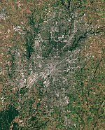
Syracuse is a town in Turkey Creek Township, Kosciusko County, in the U.S. state of Indiana. The population was 3,079 at the 2020 census. Syracuse is the location of Lake Syracuse and the nearby, larger Lake Wawasee, in addition to several other lakes in the region. The National Weather Service operates a Weather Forecast Office in the town. It serves Northern Indiana.

<span class="mw-page-title-main">Pottawattamie Park, Indiana</span> Town in Indiana, United States

Pottawattamie Park is a town in Michigan Township, LaPorte County, Indiana, United States. The population was 235 at the 2010 census. It is included in the Michigan City, Indiana-La Porte, Indiana Metropolitan Statistical Area.

<span class="mw-page-title-main">Woodlawn Heights, Indiana</span> Town in Indiana, United States

Woodlawn Heights is a town in Anderson Township, Madison County, Indiana, United States. It is part of the Indianapolis–Carmel–Anderson metropolitan statistical area. The population was 91 at the 2020 census.

<span class="mw-page-title-main">Amboy, Indiana</span> Town in Indiana, United States

Amboy is a town in Jackson Township, Miami County, in the U.S. state of Indiana. The population was 317 at the 2020 census, down from 384 in 2010.

<span class="mw-page-title-main">Bunker Hill, Indiana</span> Town in Indiana, United States

Bunker Hill is a town in Pipe Creek Township, Miami County, in the U.S. state of Indiana. The population was 814 at the 2020 census, down from 888 in 2010.

<span class="mw-page-title-main">Bethany, Indiana</span> Town in Indiana, United States

Bethany is a town in Clay Township, Morgan County, in the U.S. state of Indiana. The population was 95 at the 2020 census.

<span class="mw-page-title-main">Paragon, Indiana</span> Town in Indiana, United States

Paragon is a town in Ray Township, Morgan County, in the U.S. state of Indiana. The population was 556 at the 2020 census, down from 659 in 2010.

<span class="mw-page-title-main">Spurgeon, Indiana</span> Town in Indiana, United States

Spurgeon is a town in Monroe Township, Pike County, in the U.S. state of Indiana. The population was 207 at the 2010 census. It is part of the Jasper Micropolitan Statistical Area.

<span class="mw-page-title-main">Town of Pines, Indiana</span> Town in Indiana, United States

Town of Pines is a town in Pine Township, Porter County, in the U.S. state of Indiana. The population was 708 at the 2010 census.

<span class="mw-page-title-main">Francesville, Indiana</span> Town in Indiana, United States

Francesville is a town in Salem Township, Pulaski County, in the U.S. state of Indiana. The population was 852 at the 2020 census. The motto for Francesville is “A small town with a big heart.”

<span class="mw-page-title-main">Shadeland, Indiana</span> Town in Indiana, United States

Shadeland is a town in Union Township, Tippecanoe County, in the U.S. state of Indiana. The population was 1,610 at the 2010 census.

<span class="mw-page-title-main">Spring Grove, Indiana</span> Town in Indiana, United States

Spring Grove is a town in Wayne Township, Wayne County, in the U.S. state of Indiana. The population was 344 at the 2010 census.

Bradley is a town in Penobscot County, Maine, United States. It is part of the Bangor Metropolitan Statistical Area. The population was 1,532 at the 2020 census. The village of Bradley is in the northwestern corner of the town.

<span class="mw-page-title-main">Dunn, Dunn County, Wisconsin</span> Town in Wisconsin, United States

Dunn is a town in Dunn County, Wisconsin, United States. The population was 1,492 at the 2000 census. The unincorporated communities of Downsville and Dunnville are located in the town.

<span class="mw-page-title-main">Wynnedale, Indiana</span> Town in Indiana, United States

Wynnedale is a town in Washington Township, Marion County, Indiana, United States. The population was 215 at the 2020 census. It has existed as an "included town" since 1970, when it was incorporated into Indianapolis as part of Unigov. It is part of Indianapolis, but retains a functioning town government under IC 36-3-1-11.

References

  1. "2020 U.S. Gazetteer Files". United States Census Bureau. Retrieved March 16, 2022.
  2. 1 2 U.S. Geological Survey Geographic Names Information System: Bargersville, Indiana
  3. Baker, Ronald L. (October 1995). From Needmore to Prosperity: Hoosier Place Names in Folklore and History . Indiana University Press. p.  60. ISBN   978-0-253-32866-3. This village, first called New Bargersville, was named for Old Bargersville, q.v., formerly called Bargersville, too. It was founded in 1906 when a railroad came through here.
  4. "G001 - Geographic Identifiers - 2010 Census Summary File 1". United States Census Bureau. Archived from the original on February 13, 2020. Retrieved July 13, 2015.
  5. "Census of Population and Housing". Census.gov. Retrieved June 4, 2015.
  6. "U.S. Census website". United States Census Bureau . Retrieved December 11, 2012.
  7. "U.S. Census website". United States Census Bureau . Retrieved January 31, 2008.
  8. "SCHOOL DISTRICT REFERENCE MAP (2010 CENSUS): Johnson County, IN." U.S. Census Bureau. Retrieved on December 5, 2016.