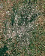
Indianapolis (balance)

Last updated
Indianapolis (balance)
Statistical entity
USA Indiana location map.svg
Red pog.svg
Indianapolis (balance)
Location within the state of Indiana
Coordinates: 39°47′27″N86°8′52″W / 39.79083°N 86.14778°W / 39.79083; -86.14778
Country United States
State Indiana
County Marion
Area
  Total368.1 sq mi (953.5 km2)
  Land361.5 sq mi (936.2 km2)
  Water6.7 sq mi (17.3 km2)
Population
 (2020)
  Total887,642
  Density2,400/sq mi (930/km2)
Time zone UTC-5 (Eastern (EST))
  Summer (DST) UTC-4 (EDT)

Indianapolis (balance) is a statistical entity defined by the United States Census Bureau to represent the portion of the city of Indianapolis, Indiana, that is not within the "included towns". As of the 2020 census the balance had a total population of 887,642.

Contents

Geography

According to the United States Census Bureau, the balance has a total area of 368.2 square miles (953.6 km2). 361.5 square miles (936.3 km2) of it is land and 6.7 square miles (17.4 km2) of it is water. The total area is 1.81% water.

Census areas

In addition to Indianapolis (balance), the consolidated Indianapolis-Marion County metropolitan government includes the following "included towns." These towns maintain their identity as separate towns under Indiana law, but are part of the consolidated government. [1] [2] They are Clermont, Crows Nest, Cumberland, Homecroft, Meridian Hills, North Crows Nest, Rocky Ripple, Spring Hill, Warren Park, Williams Creek, and Wynnedale. These "included towns" are distinct from what are termed the "excluded cities and towns" that are not part of the consolidated metropolitan government, namely, Beech Grove, Lawrence, Southport, and Speedway.

The demographic data in the Indianapolis article represents the entire consolidated governmental area. The data in this "balance" article represents the balance of the consolidated governmental area except the included towns listed above.

Demographics

At the 2000 census there were 781,870 people, 320,107 households, and 192,704 families residing in the balance. The population density was 2,163.0/mi2 (835.1/km2). There were 352,429 housing units at an average density of 376.4/km2 (975.0/mi2). The racial makeup was 69.09% White, 25.50% Black or African American, 0.25% Native American, 1.43% Asian, 0.04% Pacific Islander, 2.04% from other races, and 1.64% from two or more races. Hispanic or Latino people of any race were 3.92%. [3]

There were 320,107 households, 29.8% had children under the age of 18 living with them, 40.6% were married couples living together, 15.1% had a female householder with no husband present, and 39.8% were non-families. 32.0% of households were one person, and 8.5% were one person aged 65 or older. The average household size was 2.39 and the average family size was 3.04.

In the balance the population was spread out, with 25.7% under 18, 10.2% from 18 to 24, 32.9% from 25 to 44, 20.3% from 45 to 64, and 11.0% who were 65 or older. The median age was 34 years. For every 100 females, there were 93.7 males. For every 100 females age 18 and over, there were 90.2 males.

The median household income was $40,051 and the median family income was $48,755. Males had a median income of $36,302 versus $27,738 for females. The per capita income for "the balance" was $21,640. About 9.1% of families and 11.9% of the population were below the poverty line, including 16.2% of those under the age of 18 and 8.1% of those 65 and older.

Education

Nine K–12 public school districts serve residents of the balance of Indianapolis as defined by the U.S. Census Bureau: [4]

Beech Grove City Schools and Speedway School Town do not include any portions of the balance.

See also

Related Research Articles

<span class="mw-page-title-main">Marion County, Indiana</span> County in Indiana, United States

Marion County is located in the U.S. state of Indiana. The 2020 United States census reported a population of 977,203, making it the 54th-most populous county in the U.S., the most populous county in the state, and the main population center of the 11-county Indianapolis–Carmel–Greenwood MSA in central Indiana. Indianapolis is the county seat, the state capital, and most populous city. Marion County is consolidated with Indianapolis through an arrangement known as Unigov.

<span class="mw-page-title-main">Big Flat, Arkansas</span> Town in Arkansas, United States

Big Flat is a town in Baxter and Searcy counties in the U.S. state of Arkansas. The population was 88 at the 2020 census.

<span class="mw-page-title-main">Bergman, Arkansas</span> Town in Arkansas, United States

Bergman is a town in Boone County, Arkansas, United States. The population was 439 at the 2010 census. It is part of the Harrison Micropolitan Statistical Area.

<span class="mw-page-title-main">Caraway, Arkansas</span> City in Arkansas, United States

Caraway is a city in Craighead County, Arkansas, United States. The population was 1,279 at the 2010 census. It is included in the Jonesboro, Arkansas Metropolitan Statistical Area.

<span class="mw-page-title-main">Cash, Arkansas</span> City in Arkansas, United States

Cash is a city in western Craighead County, Arkansas, United States. The population was 342 at the 2010 census. Cash Arkansas population was of mostly white with 99.8% and partial Puerto Rican ethnicity. It is included in the Jonesboro, Arkansas Metropolitan Statistical Area.

<span class="mw-page-title-main">Jennette, Arkansas</span> Town in Arkansas, United States

Jennette is a town in Crittenden and St. Francis counties, Arkansas, United States. The population was 118 at the 2020 census.

<span class="mw-page-title-main">Moro, Arkansas</span> Town in Arkansas, United States

Moro is a town in Lee County, Arkansas, United States. The population was 216 at the 2010 census.

<span class="mw-page-title-main">Garland, Arkansas</span> Town in Arkansas, United States

Garland, also known as Garland City, is a town in Miller County, Arkansas, United States. It is part of the Texarkana, Texas - Texarkana, Arkansas Metropolitan Statistical Area. The population was 195 at the 2020 census, down from 242 in 2010.

<span class="mw-page-title-main">Bodcaw, Arkansas</span> Town in Arkansas, United States

Bodcaw is a town in Nevada County, Arkansas, United States. The population was 121 at the 2020 census. It is part of the Hope Micropolitan Statistical Area.

<span class="mw-page-title-main">Cale, Arkansas</span> Town in Arkansas, United States

Cale is a town in Nevada County, Arkansas, United States. The population was 75 at the 2000 census. It is part of the Hope Micropolitan Statistical Area.
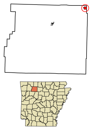
<span class="mw-page-title-main">Western Grove, Arkansas</span> Town in Arkansas, United States

Western Grove is a town in northeastern Newton County, Arkansas, United States. The population was 384 at the 2010 census. It is part of the Harrison Micropolitan Statistical Area.

<span class="mw-page-title-main">Casa, Arkansas</span> Town in Arkansas, United States

Casa is a town in Perry County, Arkansas, United States. Located in Central Arkansas, the town initially grew due to the mining of coal, harvesting of timber and cultivation of cotton. The Great Depression reduced the population greatly, and the community's economy never recovered. The population was 171 at the 2010 census.

<span class="mw-page-title-main">Perry, Arkansas</span> Town in Arkansas, United States

Perry is a town in Perry County, Arkansas, United States. The population was 314 at the 2000 census. It is part of the Little Rock–North Little Rock–Conway Metropolitan Statistical Area.

<span class="mw-page-title-main">Wickes, Arkansas</span> City in Arkansas, United States

Wickes is a city in Polk County, Arkansas, United States. The population was 754 at the 2010 census.
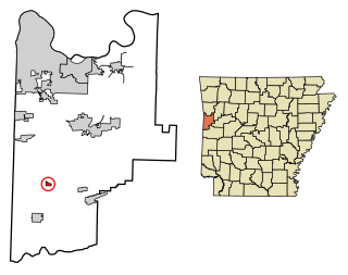
<span class="mw-page-title-main">Midland, Arkansas</span> Town in Sebastian County, Arkansas, United States

Midland is a town in Sebastian County, Arkansas, United States. It is part of the Fort Smith, Arkansas-Oklahoma Metropolitan Statistical Area. The population was 325 at the 2010 census.

<span class="mw-page-title-main">Gillham, Arkansas</span> Town in Arkansas, United States

Gillham is a town in Sevier County, Arkansas, United States. The population was 188 at the 2000 census. It is located six miles from Gillham Lake.

<span class="mw-page-title-main">Griffithville, Arkansas</span> Town in Arkansas, United States

Griffithville is a town in White County, Arkansas, United States. The population was 262 at the 2000 census.
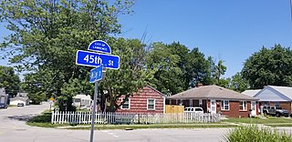
<span class="mw-page-title-main">Lawrence, Indiana</span> City in Indiana, United States

Lawrence is a city in Marion County, Indiana, United States. It is one of four "excluded cities" in Marion County. The city is home to Fort Benjamin Harrison within Fort Harrison State Park. The population was 49,370 at the 2020 census. The city is on the northeast side of Indianapolis.

<span class="mw-page-title-main">Mount Morris Township, Michigan</span> Charter township in Michigan, United States

Mount Morris Charter Township is a charter township of Genesee County in the U.S. state of Michigan. The population was 20,024 as of the 2020 census. The city of Mount Morris borders on the east, but the two are administered autonomously.

Nashville-Davidson (balance) is the name used by the U.S. Census Bureau to designate the portion of Davidson County, Tennessee, United States that does not include satellite cities of Nashville. Because Nashville and Davidson County share a consolidated metropolitan government, the parts of these cities that fall within Davidson County are considered part of Nashville, although they still retain their own municipal governments. The cities that are a part of Nashville-Davidson County, but are excluded from the balance are:

References

  1. http://www.in.gov/legislative/ic/code/title36/ar3/ch1.html IC 36-3-1-11
  2. http://www.in.gov/legislative/ic/code/title36/ar3/ch2.html IC 36-3-2-5
  3. "U.S. Census website". United States Census Bureau . Retrieved 2008-01-31.
  4. "2020 CENSUS - SCHOOL DISTRICT REFERENCE MAP: Marion County, IN" (PDF). U.S. Census Bureau . Retrieved 2024-06-13. - Text list.