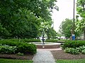
Indianapolis, Indiana, features a diverse network of publicly accessible parks and greenspaces that provide recreational, cultural, and environmental benefits across the city. The system includes neighborhood and regional parks, sports fields, nature preserves, golf courses, urban trails, and parkways following the city's primary waterways.[1]
The city's public park system originated in the mid-19th century, when civic leaders and private citizens advocated for public green areas amid rapid urban growth. Early parks emerged through land donations and municipal purchases in the 1860s and 1870s, and the Indianapolis Park Board, established in 1895, provided formal oversight for systematic expansion and planning. Landscape architects and successive municipal initiatives shaped a network of parkways and recreational grounds that balanced active programming with natural preservation. By the early 21st century, the city's parks department managed more than 200 properties totaling over 11,000 acres (4,500ha) of greenspace.[1]
Indianapolis is home to more than 200 public parks overseen by multiple jurisdictions. Parks operated by the City of Indianapolis collectively cover 11,258 acres (4,556ha) and include 129 playgrounds, 155 sports fields, 153 miles (246km) of recreational trails, 23 recreation and nature centers, 21 spraygrounds, 19 aquatic centers, 13 golf courses, and four dog parks.[1]
To maintain focus and avoid undue exhaustiveness, this list limits entries to municipal and state managed parks within the consolidated City of Indianapolis. It therefore excludes the following categories:
Privately administered parks—including those that may be open to public use but are overseen by community development corporations, homeowners associations, or other nongovernmental entities. Notable exceptions (like privately owned public spaces with separate Wikipedia articles) are explicitly identified with a “†” symbol.
Neighborhood pocket parks developed through the Keep Indianapolis Beautiful and AES Indiana Project GreenSpace program, which comprise approximately 82 sites across Marion County. These small-scale green spaces, while publicly accessible, are excluded due to their limited size, decentralized administration, and a planning and maintenance framework distinct from the city's primary park system.[2][3]
The site in the Acton neighborhood was originally the location of a Methodist summer retreat from 1859 until it was destroyed by a fire in 1905. It remained in private hands until the city of Indianapolis purchased it in 2004 for a public park.[4]
Features include a basketball court, benches, picnic tables, a playground, and a shelter. Originally named Meikel Street Park, it was renamed to honor civic leader Edward "Babe" Denny in 1989.[8][9]
Features include basketball courts, benches, a football field, a playground, and a shelter.[13] Originally named Salem Village Park, it was renamed to honor Frank R. Beckwith, the first African American in Indiana to run as a major party candidate in a presidential primary.[14]
Features include ball diamonds, basketball courts, a disc golf course, a family center, a football field, open space, an outdoor swimming pool, paved trails, picnic tables, playgrounds, shelters, and tennis courts.[18] The park is included in the Indianapolis Park and Boulevard System.[19] It is part of the Indy Birding Trail.[17]
Features include the Sun King Market District Stage,[20] benches, planters, moveable tables and chairs, and an original archway from Tomlinson Hall. The plaza is located on the west side of Indianapolis City Market and was named to honor civic leader Charles L. Whistler in 1987.[21] The plaza is maintained by the Indianapolis–Marion County Building Authority.
Features include a beach volleyball court, a playground, a shelter, a splash pad, and tennis courts.[24] Originally named Broadway & 61st Park, it was renamed to honor author and journalist Dan Wakefield in 2016.[25]
The largest park in Indianapolis and among the largest municipal parks in the U.S. Features include a 1,400-acre (570ha) reservoir, an amphitheater, a bait shop, a beach, a bird sanctuary, a dog park, the Mary and John Geisse Soccer Complex, a golf course, a marina, a nature center, three nature preserves, an ornithology center, a playground, two retreat centers, a rowing course, sailing club, shelters, sledding hills, trails, and a zip line course. Canoes, kayaks, paddle boats, stand-up paddle boards, pontoon boats, sailboats, and mountain bikes are rentable. Birdwatching, canoeing, cross-country skiing, cycling, fishing, golfing, hiking, kayaking, picnicking, rowing, sailing, sledding, and swimming are popular recreational activities at the park. Eagle Creek is the only municipal park that requires an entrance fee.[27][28][29][30] It is part of the Indy Birding Trail.[17]
Features include a beach volleyball court, a bocce ball court, picnic tables, a playground, a shelter, and a shuffleboard court.[31] Originally named Greer Park, it was renamed to honor philanthropist Edna Balz Lacy in 1995.[32]
Features include athletic fields, ball diamonds, open space, an outdoor swimming pool, playgrounds, a shelter, a sledding hill, tennis courts, trails, and a volleyball court.[33] It also serves as the northern terminus of the Pleasant Run Greenway. The park is included in the Indianapolis Park and Boulevard System.[19] It is part of the Indy Birding Trail.[17]
Features include ball diamonds, basketball courts, benches, open space, picnic tables, a playground, a shelter, soccer fields, trails, and woods.[36] It is part of the Indy Birding Trail.[17]
Features include ball diamonds, a basketball court, a family center, a football field, a golf course, a paved fitness trail, picnic tables, a playground, an outdoor swimming pool, and tennis courts. Originally named Douglass Park, it was renamed to honor abolitionist Frederick Douglass in 2017.[37]
The oldest municipal park in Indianapolis, the park features the Burrello Family Center, MacAllister Center for the Performing Arts, an aquatic center, ball diamonds, a basketball court, a community arts center, a conservatory and sunken gardens, football/soccer fields, a public library branch, playgrounds, shelters, sledding hill, statuary, tennis courts, and trails, notably Pleasant Run Greenway.[38] Originally named Southern Park, it was renamed to honor PresidentJames A. Garfield in 1881.[39] The park is included in the Indianapolis Park and Boulevard System.[19] It is part of the Indy Birding Trail.[17]
Features include a nature center, open space, picnic tables, trails, and woods. A playground is shared with neighboring Glenns Valley Elementary School.[40] It is part of the Indy Birding Trail.[17]
Established as German Church & 30th Park, it originally covered 41 acres (17ha). A series of acquisitions since 2000 have brought the park to its current acreage. Features include a basketball court, a playground, a shelter, soccer fields, softball diamonds, a splash pad, tennis courts, and trails. Much of the acreage is undeveloped open space with some woods and wetlands.[41] It is part of the Indy Birding Trail.[17]
Features include basketball courts, benches, football fields, an outdoor swimming pool, picnic tables, playgrounds, a shelter, tennis courts, and the Randy Shambaugh Baseball Park.[42] Originally named Northwest Park, it was renamed to honor civic leader Howard Gustafson in 1967.[43]
Situated along the White River, the park features an arboretum, a nature center, open space, picnic tables, a playground, a rock garden, wooded ravines, and 3.5 miles (5.6km) of trails.[44] The park is home to three atlantes designed by Karl Bitter from the façade of the demolished St. Paul Building. Referred to as "The Ruins," the pieces and accompanying grotto were dedicated in 1973. A performance space was added as part of a restoration completed in 2016.[45] It is part of the Indy Birding Trail.[17]
Built atop an underground parking garage, features include benches, decorative brick walkways, fountains, an Indiana Pacers Bikeshare station, pergolas, gardens, and a lawn. Originally named Capitol Commons, the plaza was dedicated in 2014 to honor William "Bill" Hudnut, former mayor (1976–1992).[46] It is owned and maintained by the Capital Improvement Board, a municipal corporation that also owns the neighboring Indiana Convention Center.[47]
Features a gravel path that terminates at a vista overlooking the I-65/I-70 "South Split" interchange. The park contains benches, a shade canopy, and repurposed seats from the former Bush Stadium. It is accessible from the Indianapolis Cultural Trail.[48]
Features include benches, a carillon, a fountain, a garden house, a pond, walking paths, a waterfall, woods, and a 500-foot (150m) mall that terminates at the sculpture Persephone. The gardens are owned and maintained by Butler University. The gardens are named for James Irving Holcomb who served 24 years on the university's board of directors.[49][50] It is part of the Indy Birding Trail.[17]
Features include picnic tables, a shelter, trails, and woods. The preserve is bounded by the White River (south) and Monon Trail (east).[53] It is part of the Indy Birding Trail.[17]
Features include a café building, fountains, seating, trellises, and landscaping. Located on the Sidney & Lois Eskenazi Hospital campus, the plaza is owned and maintained by Health & Hospital Corporation of Marion County, a municipal corporation. It is named after Matthew Gutwein, former president and chief executive officer.[54]
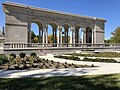
The oldest park in Indianapolis and a listed national historic site. Features include a shelter house, walking paths, and open green space. The park is included in the Indianapolis Park and Boulevard System.[19]The Indianapolis Cultural Trail runs along its western boundary and the Canal Walk forms its southern boundary. It is managed by the White River State Park Development Commission.[55]
Features include benches, bike racks, a covered basketball court/seasonal ice skating rink, moveable tables and chairs, public artworks, and restrooms. The plaza is on the north side of Gainbridge Fieldhouse and often hosts events in coordination with the Indiana Pacers and Fever. Its name honors civic leader Jim Morris and Indianapolis's bicentennial. It is owned and maintained by the Capital Improvement Board, a municipal corporation.
James A. Allison commissioned landscape architect Jens Jensen to design the grounds of Allison's estate to complement the site's natural features. The restored property features Jensen's original stonework, outdoor classroom space, a pond, trails, wetlands, and woods. It is owned and maintained by Marian University's Environmental Studies Department. The park is named for philanthropist Nina Mason Pulliam.[57] It is part of the Indy Birding Trail.[17]
Features include benches, planters, and landscaping. It is among the smallest city parks, occupying 3,600 square feet (330m2) on a triangular plot.[58]
Features include a dog park, open space, a playground, a pond, shelters, a sledding hill, trails, and woods.[59] Originally named Prospect & Muessing Park, it was renamed to honor local educator and coach Paul Ruster in 1979.[60] It is part of the Indy Birding Trail.[17]
Designed as part of a flood control project on the Pogue's Run waterway, features include benches, public art, trails, wetlands, and open space. It is part of the Indy Birding Trail.[17]
Features a small brick plaza modeled after the Mile Square plan of Indianapolis as well as a memorial elm tree planted by former U.S. president George H. W. Bush in 1990. The tree honors Ryan White.
Features prairie, trails, wetlands, and woods. In partnership with the Metropolitan School District of Warren Township, baseball fields, basketball courts, a disc golf course, tennis courts, and the Indy Island Aquatic Center are located on the grounds of neighboring Raymond Park Middle School.[61] It is part of the Indy Birding Trail.[17]
Features include an interactive fountain, an event lawn, Indiana Pacers Bikeshare station, bike racks, moveable tables and chairs, and access to the Indianapolis Cultural Trail. It is named for Richard Lugar, former mayor (1968–1976) and U.S. Senator (1977–2013).[62] The plaza is located on the south side of the City–County Building on the site of the former Marion County Courthouse and is maintained by the Indianapolis–Marion County Building Authority. It was formally declared to be a park on February 26, 2026.[63]
Features include an aquatic center, a basketball court, a disc golf course, a golf course, open space, picnic tables, playgrounds, shelters, soccer fields, tennis/pickleball courts, sand volleyball courts, and woods. Originally named Northeastway Park, it was renamed in honor of William S. Sahm in 1978.
The nature preserve features benches and hiking trails. It is owned and managed by the nonprofit land trust Mud Creek Conservancy in Lawrence Township.[65]
Features include restored prairie, woods, and paved and unpaved trails, including access to the Fall Creek Greenway.[66] It is part of the Indy Birding Trail.[17]
Features a dog park and 18-hole golf course, including a pro shop, clubhouse, and driving range. Originally known as County Line South Golf Course, it was renamed in honor of Carl E. Smock in 1977.
Features include an activity center, open space, picnic tables, playgrounds, a pond, shelters, short and tallgrass prairie, a sledding hill, paved and unpaved trails, wetlands, and woods.[67] It is part of the Indy Birding Trail.[17]
Features include benches, an event lawn, landscaping, and walking paths. Under a public–private partnership, Eli Lilly and Company developed the property, then donated it to Indy Parks. The company maintains the park.[68]
Located along the White River, the park contains Winding River Golf Course and Mann Hill, featuring ball diamonds, open space, a playground, a shelter, soccer fields, trails, and woods.[69] Popular recreational activities include birdwatching, fishing, hiking, horseback riding, and mountain biking. It is part of the Indy Birding Trail.[17]
Features include a basketball court, open space, picnic tables, a playground, restrooms, a shelter, a splash pad, and walking paths.[74] It is named for the former Stout Field airport.[75]
Features include benches, basketball courts, a café and restroom building, open space, picnic tables, a playground, a splash pad, and tennis courts. A $6 million renovation of the park was completed in 2017.[76] It is named for author Booth Tarkington.[77]
Accessible from East 96th Street, the park features a singletrack mountain bike course and 7 miles (11km) of natural surface hiking trails. It is maintained by the Hoosier Mountain Bike Association.[79] The park's southernmost reaches overlap with Oliver's Woods Nature Preserve, managed by the Central Indiana Land Trust. Accessible from North River Road, the preserve contains 16 acres (6.5ha) of woods and 37 acres (15ha) of restored prairie-savanna. Both properties hug the western bank of the White River.[80]
The park houses several site-specificart installations by national and international artists. Other features include bike racks, meadows, a quarry pond, walking paths, wetlands, woods, an Indiana Pacers Bikeshare station, and the Ruth Lilly Visitors Pavilion. It is owned and maintained by the Indianapolis Museum of Art. Admission to the park is free. Virginia B. Fairbanks, the wife of benefactor Richard M. Fairbanks, is the park's namesake.[83][84] It is part of the Indy Birding Trail.[17]
Features include basketball courts, a disc golf course, a family center, open space, playgrounds, shelters, walking paths, wetlands, and woods. It is home to the Indianapolis Metropolitan Police Department North District offices and The Headquarters: Mountain Bike Skills Park.[87] The original Indianapolis Zoo was located in the park from 1964 to 1987.[88] It is part of the Indy Birding Trail.[17]
Features include benches, a playground, a shelter, and woods.[93] Crooked Creek is the park's northern boundary. The park is named for local television station WISH-TV which donated the land to the city.[94]
Contains a 38-acre (15ha) state nature preserve. The park is heavily wooded and hugs the southern bank of Fall Creek. It is named for William Watson Woollen.[95] The park is included in the Indianapolis Park and Boulevard System.[19]
↑Size is estimated based on the verbal boundary description noted in Section 10, Page 11 of the National Register of Historic Places Inventory Form.[10]
References
1234Hale, Michelle D.; Fischer, Jessica Erin (2021) [1994]. "Parks and Greenspaces". Digital Encyclopedia of Indianapolis. Indianapolis Public Library. Retrieved September 24, 2022.
↑Ridgeway, Danielle (2024) [2022]. "Keep Indianapolis Beautiful, Inc. (KIB)". Digital Encyclopedia of Indianapolis. Indianapolis Public Library. Retrieved December 31, 2025.
↑"Arsenal Park". Indy Parks & Recreation. Retrieved January 3, 2026.
↑"ARTSPARK". Indianapolis Art Center. Retrieved October 1, 2022.
↑Sommers, Joyce A.; Fischer, Jessica Erin (2021) [1994]. "Indianapolis Art Center"(website). Digital Encyclopedia of Indianapolis. Indianapolis Public Library. Retrieved October 1, 2022.
↑"Beckwith Memorial Park"(PDF). Indianapolis Department of Parks and Recreation. February 22, 2011 [May 27, 2010]. Retrieved October 4, 2022.
↑"Salem Village Park Honors F. R. Beckwith". The Indianapolis News. October 13, 1970. p.2. Retrieved October 4, 2022– via Newspapers.com. A park in Salem Village today was named in memory of Frank R. Beckwith of Indianapolis who was the first Negro to run in the Indiana presidential primary.
↑"Broad Ripple Park"(PDF). Indianapolis Department of Parks and Recreation. February 16, 2011 [June 12, 2010]. Retrieved October 1, 2022.
↑Vanderstel, David G.; Hague, Alan (2021) [1994]. "Broad Ripple Park". Digital Encyclopedia of Indianapolis. Indianapolis Public Library. Retrieved October 1, 2022.
↑"Citizens Forum leader receives civic award". The Indianapolis Star. December 11, 1987. p.2. Retrieved October 4, 2022– via Newspapers.com. At noon Thursday, city leaders dedicated the west plaza of the City Market as the Charles L. Whistler Memorial Plaza, in honor of the civic leader who died in 1981.
↑Darbee, Leigh; Fischer, Jessica Erin (2021) [1994]. "Eagle Creek Park". Digital Encyclopedia of Indianapolis. Indianapolis Public Library. Retrieved September 25, 2022.
↑"Park Activities". Eagle Creek Park Foundation. Retrieved September 25, 2022.
↑"Eagle Creek Park". Indianapolis Department of Parks and Recreation. Retrieved September 25, 2022.
↑"Edna Balz Lacy Park"(PDF). Indianapolis Department of Parks and Recreation. February 16, 2011 [June 1, 2010]. Retrieved October 4, 2022.
↑Mannweiler, David (August 28, 1995). "Greer Park gets new name, more land". The Indianapolis News. p.11. Retrieved October 4, 2022– via Newspapers.com. The L-shaped park will be renamed the Edna Balz Lacy Family Park in honor of the late community leader.
↑"Ellenberger Park"(PDF). Indianapolis Department of Parks and Recreation. February 16, 2011 [July 16, 2010]. Retrieved October 1, 2022.
↑Hankins, Melanie (February 2021). "Fort Benjamin Harrison State Park". Digital Encyclopedia of Indianapolis. Indianapolis Public Library. Retrieved September 24, 2022.
↑"Franklin Township Community Park"(PDF). Indianapolis Department of Parks and Recreation. February 22, 2011 [July 12, 2010]. Retrieved October 7, 2022.
↑Verderame, Jyoti (November 2023). "Frederick Douglass Park". Digital Encyclopedia of Indianapolis. Indianapolis Public Library. Retrieved November 19, 2024.
↑"Garfield Park"(PDF). Indianapolis Department of Parks and Recreation. February 2, 2011 [July 20, 2010]. Retrieved September 25, 2022.
↑Walton, Vi; Hall, Carol A.; Fischer, Jessica Erin (2021) [1994]. "Garfield Park and Conservatory". Digital Encyclopedia of Indianapolis. Indianapolis Public Library. Retrieved September 25, 2022.
↑"Glenns Valley Nature Park"(PDF). Indianapolis Department of Parks and Recreation. February 22, 2011 [July 14, 2010]. Retrieved October 2, 2022.
↑"Gustafson Park"(PDF). Indianapolis Department of Parks and Recreation. February 16, 2011. Retrieved October 6, 2022.
↑"Gustafson Park Master Plan"(PDF). Indianapolis Department of Parks and Recreation. 1993. p.3. Retrieved October 6, 2022.
↑"Holliday Park"(PDF). Indianapolis Department of Parks and Recreation. February 22, 2011 [June 16, 2010]. Retrieved October 1, 2022.
↑Cunningham, Joan; Fischer, Jessica Erin (2021) [1994]. "Holliday Park". Digital Encyclopedia of Indianapolis. Indianapolis Public Library. Retrieved October 1, 2022.
↑Frantz, Edward O. (July 2021). "William H. Hudnut III". Digital Encyclopedia of Indianapolis. Indianapolis Public Library. Retrieved September 26, 2022.
↑Petroskey, Dorothy (September 20, 1988). "Board names plaza Capitol Commons". The Indianapolis Star. p.38. Retrieved September 26, 2022– via Newspapers.com. The plaza nearing completion between the State House and the Indiana Convention Center and Hoosier Dome has been named Capitol Commons. (...) The vote by the Capital Improvement Board was 6–1.
↑Miller, Evan (September 2022). "James Irving Holcomb"(website). Digital Encyclopedia of Indianapolis. Indianapolis Public Library. Retrieved October 1, 2022.
↑Hall, Steve (August 6, 1982). "Park Honors Hubbard". The Indianapolis News. p.3. Retrieved October 8, 2022– via Newspapers.com. During a noontime ceremony today at the park, Emerson and New York, Mayor William Hudnut honored Hubbard and presented memorabilia about the cartoonist to his children, Virginia Schotters and Ohio newspaperman Tom Hubbard.
↑Trulock, James A. (2021) [1994]. "Military Park". Digital Encyclopedia of Indianapolis. Indianapolis Public Library. Retrieved September 24, 2022.
↑Cunningham, Joan (2021) [1994]. "Municipal Gardens". Digital Encyclopedia of Indianapolis. Indianapolis Public Library. Retrieved December 30, 2025.
↑McLaren, George (December 13, 2002). "Habitat for learning". The Indianapolis Star. pp.65, 72. Retrieved October 2, 2022– via Newspapers.com. Managed by Environmental Studies Department at the college; used by K-12 students and open to the public. (...) [Jens] Jensen was hired by James Allison to design the park-like grounds around the businessman's Indianapolis estate. His prairie-style landscaping used native plants and materials and was designed in harmony with nature. (...) The EcoLab project also received $250,000 from the Nina Mason Pulliam Charitable Trust...
↑Aamidor, Abe (September 14, 1995). "A pocket of peace". The Indianapolis Star. p.21. Retrieved September 27, 2022– via Newspapers.com. The new Downtown park will be dedicated at 10 a.m. Saturday, Sept. 23. (...) The Peace Garden is a 3,600-square-foot pocket park...
↑"Paul Ruster Park"(PDF). Indianapolis Department of Parks and Recreation. February 22, 2011 [June 7, 2010]. Retrieved October 7, 2022.
↑"Mayor to dedicate Paul Ruster Park". The Indianapolis News. September 29, 1979. p.16. Retrieved October 7, 2022– via Newspapers.com. Mayor William Hudnut will lead dedication ceremonies at 1 p.m. Wednesday when Prospect and Muessing Park, 11300 Prospect, is renamed Paul Ruster Park. The name was chosen last June to honor Ruster, a 10-year physical education teacher and coach at Lowell Elementary School, 2150 Hunter Road.
↑"Raymond Park"(PDF). Indianapolis Department of Parks and Recreation. February 16, 2011 [June 17, 2010]. Retrieved September 27, 2022.
↑Johnson, Spencer (December 2025). "Sarah Shank Golf Course". Digital Encyclopedia of Indianapolis. Indianapolis Public Library. Retrieved December 30, 2025.
↑Horgan, Sean (March 31, 1998). "Parks provide name game". The Indianapolis Star. p.14. Retrieved October 5, 2022– via Newspapers.com. Betty Walker, a teacher in Wayne Township for 14 years, says the name for the park and school came from Stout Field – the old airport (and now the home of the Indiana National Guard) situated directly across the [Sam Jones] expressway.
↑"New City Park is Named in Honor of Booth Tarkington". The Indianapolis News. August 31, 1945. p.17. Retrieved October 5, 2022– via Newspapers.com. Booth Tarkington park is the officially adopted name of the newly-acquired, ten-acre city park...
↑"Tolin-Akeman Park"(PDF). Indianapolis Department of Parks and Recreation. February 17, 2011 [July 13, 2010]. Retrieved September 27, 2022.
↑"Oliver's Woods". Central Indiana Land Trust. Retrieved January 3, 2026.
↑Rollins Stanis, Suzanne T.; Glass, James A. (2021) [1994]. "Indiana World War Memorial Plaza". Digital Encyclopedia of Indianapolis. Indianapolis Public Library. Retrieved September 24, 2022.
↑Rollins Stanis, Suzanne T. (2021) [1994]. "University Park". Digital Encyclopedia of Indianapolis. Indianapolis Public Library. Retrieved September 24, 2022.
↑Lindquist, David (June 20, 2010). "Nature & art intertwined: Indy's new art park is a cultural oasis offering a taste of two worlds". The Indianapolis Star. pp.A1, A16. Retrieved September 7, 2022– via Newspapers.com. Also billed as 100 Acres, the park — consisting of woodlands, wetlands and a meadow — opens today as the newest attraction at the IMA. (...) An $11 million gift from the Richard M. Fairbanks Foundation will be used to offset the operating costs of 100 Acres. (...) The park is named after his wife, Virginia, who died in 2007.
↑"Virginia Lee O'Brien Park"(PDF). Indianapolis Department of Parks and Recreation. February 17, 2011 [June 8, 2010]. Retrieved September 27, 2022.
↑"Washington Park"(PDF). Indianapolis Department of Parks and Recreation. February 16, 2011 [July 15, 2010]. Retrieved September 27, 2022.
↑Hurst, Richard M.; Hillier-Geisler, Megan (2021) [1994]. "Indianapolis Zoo". Digital Encyclopedia of Indianapolis. Indianapolis Public Library. Retrieved September 27, 2022.
↑"Watkins Park"(PDF). Indianapolis Department of Parks and Recreation. February 16, 2011 [July 15, 2010]. Retrieved September 27, 2022.
↑"Watson Road Bird Preserve"(PDF). Indianapolis Department of Parks and Recreation. February 22, 2011 [July 15, 2010]. Retrieved October 1, 2022.
↑Fischer, Jessica Erin (March 2021). "John Leslie (Wes) Montgomery". Digital Encyclopedia of Indianapolis. Indianapolis Public Library. Retrieved December 30, 2025.
↑Knight, Jerold; Blair, Lyndsey D. (2021) [1994]. "White River State Park". Digital Encyclopedia of Indianapolis. Indianapolis Public Library. Retrieved September 24, 2022.
↑"WISH Park"(PDF). Indianapolis Department of Parks and Recreation. February 17, 2011 [June 15, 2010]. Retrieved September 27, 2022.
↑"City TV station gives 16 acres for mini-park". The Indianapolis News. April 17, 1995. p.35. Retrieved September 27, 2022– via Newspapers.com. WISH Park, 16 acres of mostly woods on Westland Road near Michigan Road, was donated to the city by WISH-TV. (...) The park, which straddles the Pike-Washington township line, is bordered on the north by Crooked Creek.
↑Strunk, Kevin (2021) [1994]. "Woollen's Garden". Digital Encyclopedia of Indianapolis. Indianapolis Public Library. Retrieved November 19, 2024.
This page is based on this Wikipedia article Text is available under the CC BY-SA 4.0 license; additional terms may apply. Images, videos and audio are available under their respective licenses.