The Idle

Last updated

The Idle
The Idle (4).jpg
The Idle in 2022
Location map Indianapolis.png
Red pog.svg
USA Indiana location map.svg
Red pog.svg
Usa edcp location map.svg
Red pog.svg
Type Urban park
Motto"The Idle - A Point of View"
Location Fletcher Place and Fountain Square, Indianapolis
Coordinates 39°45′20″N86°08′38″W / 39.75556°N 86.14389°W / 39.75556; -86.14389 Coordinates: 39°45′20″N86°08′38″W / 39.75556°N 86.14389°W / 39.75556; -86.14389
OpenedSeptember 2018 (September 2018)
FounderTom Battista
Operated byIndianapolis Beautiful, Inc. [1]
Cost$89,462 [2]
Website www.idleindy.com

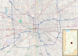
The Idle is a public park overlooking the I-65 and I-70 interstate interchanges in Indianapolis, Indiana. [3] The park is located right off the Indianapolis Cultural Trail on Virginia Avenue, directly in-between the city's Fletcher Place and Fountain Square neighborhoods, [4] which themselves are geographically separated by I-65. [5]

Contents

The concept behind The Idle was conceived in 2013, [2] through the vision of Tom Battista, a local Indianapolis property developer and entrepreneur. [6] It was partially funded through Patronicity, a crowdfunding website which raised $48,462. [5] Through a match, the Indiana Housing and Community Development Authority had contributed an additional $41,000. [2] Since the park is located on federal highway land, its creation required cooperation between the Federal Highway Administration, the Indiana Department of Transportation, and the Indianapolis Department of Public Works. [5]

The park features an accessible limestone trail leading to a viewing platform, which is furnished with seats salvaged from the city's former Bush Stadium. [4] It also features native vegetation, repurposed ash tree benches, as well as informative signage explaining the area's history and concept behind the project. [5]

See also

Related Research Articles

<span class="mw-page-title-main">Interstate Highway System</span> Network of freeways in the United States

The Dwight D. Eisenhower National System of Interstate and Defense Highways, commonly known as the Interstate Highway System, is a network of controlled-access highways that forms part of the National Highway System in the United States. The system extends throughout the contiguous United States and has routes in Hawaii, Alaska, and Puerto Rico.

<span class="mw-page-title-main">Indianapolis</span> Capital and the largest city of Indiana, United States

Indianapolis, colloquially known as Indy, is the state capital and most-populous city of the U.S. state of Indiana and the seat of Marion County. According to the United States Census Bureau, the consolidated population of Indianapolis and Marion County in 2020 was 977,203. The "balance" population, which excludes semi-autonomous municipalities in Marion County, was 887,642. It is the 15th most populous city in the U.S., the third-most populous city in the Midwest, after Chicago and Columbus, Ohio, and the fourth-most populous state capital after Phoenix, Arizona; Austin, Texas; and Columbus. The Indianapolis metropolitan area is the 33rd most populous metropolitan statistical area in the U.S., with 2,111,040 residents. Its combined statistical area ranks 28th, with a population of 2,431,361. Indianapolis covers 368 square miles (950 km2), making it the 18th largest city by land area in the U.S.

<span class="mw-page-title-main">Interstate 70</span> East–west Interstate Highway across central US

Interstate 70 (I-70) is a major east–west Interstate Highway in the United States that runs from I-15 near Cove Fort, Utah, to a park and ride lot just east of I-695 in Baltimore, Maryland, and is the fifth-longest Interstate in the country. I-70 approximately traces the path of U.S. Route 40 east of the Rocky Mountains. West of the Rockies, the route of I-70 was derived from multiple sources. The Interstate runs through or near many major cities, including Denver, Topeka, Kansas City, St. Louis, Indianapolis, Columbus, Pittsburgh, and Baltimore. The sections of the Interstate in Missouri and Kansas have laid claim to be the first Interstate in the United States. The Federal Highway Administration (FHWA) has claimed the section of I-70 through Glenwood Canyon, Colorado, completed in 1992, to be the last piece of the Interstate Highway System, as originally planned, to open to traffic. The construction of I-70 in Colorado and Utah is considered an engineering marvel, as the route passes through the Eisenhower Tunnel, Glenwood Canyon, and the San Rafael Swell. The Eisenhower Tunnel is the highest point along the Interstate Highway System, with an elevation of 11,158 feet (3,401 m).

<span class="mw-page-title-main">Interstate 65</span> Interstate Highway from Alabama to Indiana

Interstate 65 (I-65) is a major north–south Interstate Highway in the central United States. As with most Interstates with two-digit numbers ending in 5, it is a major crosscountry, north–south route, connecting between the Great Lakes and the Gulf of Mexico. Its southern terminus is located at an interchange with I-10 in Mobile, Alabama, and its northern terminus is at an interchange with I-90, U.S. Route 12 (US 12), and US 20 in Gary, Indiana, just southeast of Chicago. I-65 connects several major metropolitan areas in the Midwest and Southern US. It connects the four largest cities in Alabama: Mobile, Montgomery, Birmingham, and Huntsville. It also serves as one of the main north–south routes through Nashville, Tennessee; Louisville, Kentucky; and Indianapolis, Indiana, each a major metropolitan area in its respective state.

<span class="mw-page-title-main">Fountain County, Indiana</span> County in Indiana, United States

Fountain County lies in the western part of the U.S. state of Indiana on the east side of the Wabash River. The county was officially established in 1826 and was the 53rd in Indiana. The county seat is Covington.

<span class="mw-page-title-main">Greenwood, Indiana</span> City in Indiana, United States

Greenwood is a city in Johnson County, Indiana, United States. The population was 63,830 at the 2020 Census. Greenwood is located between Indiana State Road 37 and Interstate 65. The city shares a border with Indianapolis and is the most populous suburban municipality in the southern portion of the Indianapolis Metropolitan Area.

<span class="mw-page-title-main">Interstate 465</span> Interstate Highway loop in Indiana, United States

Interstate 465 (I-465), also known as the USS Indianapolis Memorial Highway, is the beltway circling Indianapolis, Indiana, United States. It is roughly rectangular in shape and has a perimeter of approximately 53 miles (85 km). It lies almost completely within the boundaries of Marion County, except for two short sections on the north leg in Boone and Hamilton counties. It intersects with I-65, I-69, I-70, and I-74 and provides additional access to I-65 via I-865.

<span class="mw-page-title-main">Indiana State Road 69</span>

State Road 69 (SR 69) is a part of the Indiana State Road system that runs between Hovey Lake Fish and Wildlife Area and Griffin in US state of Indiana. The 35.07 miles (56.44 km) of SR 69 that lie within Indiana serve as a major conduit. Some of the highway is listed on the National Highway System. Various sections are urban two-lane highway, three-lane highway and rural two-lane highway. The highway passes through residential, industrial and commercial properties.

<span class="mw-page-title-main">Downtown Indianapolis</span> Central business district of Indianapolis, Indiana, U.S.

Downtown Indianapolis is a neighborhood area and the central business district of Indianapolis, Indiana, United States. Downtown is bordered by Interstate 65, Interstate 70, and the White River, and is situated near the geographic center of Marion County. Downtown has grown from the original 1821 town plat—often referred to as the Mile Square—to encompass a broader geographic area of central Indianapolis, containing several smaller historic neighborhoods.

<span class="mw-page-title-main">Interstate 65 in Indiana</span> Highway in Indiana

Interstate 65 (I-65) in the US state of Indiana traverses from the south-southeastern Falls City area bordering Louisville, Kentucky, through the centrally located capital city of Indianapolis, to the northwestern Calumet Region of the Hoosier State which is part of the Chicago metropolitan area. The Indiana portion of I-65 begins in Jeffersonville after crossing the Ohio River and travels mainly north, passing just west of Columbus prior to reaching the Indianapolis metro area. Upon reaching Indianapolis, the route alignment of I-65 begins to run more to the northwest and subsequently passes Lafayette on that city's east and north sides. Northwest of there, in west-central Jasper County, the route again curves more northward as it approaches the Calumet Region. Shortly after passing a major junction with I-80 and I-94, I-65 reaches its northern national terminus in Gary at I-90 which is carried on the Indiana East–West Toll Road. I-65 covers 261.27 miles (420.47 km) in the state of Indiana. This is one of the principal Interstate Highways that cross the state, and, more specifically, intersect at the city of Indianapolis, that has given the state the nickname of "Crossroads of America".

<span class="mw-page-title-main">Interstate 80 in Illinois</span>

Interstate 80 (I-80) is a part of the Interstate Highway System that runs from San Francisco, California, to Teaneck, New Jersey. I-80 enters Illinois from Iowa in the west, southwest of Rapids City, and runs generally eastward through East Moline, LaSalle, and Joliet, before entering Indiana in Lansing. The Interstate runs for approximately 163.52 miles (263.16 km) through the state.

<span class="mw-page-title-main">Interstate 94 in Indiana</span> Section of Interstate Highway in Lake, Porter, and LaPorte counties in Indiana, United States

Interstate 94 (I-94) is a part of the Interstate Highway System that runs from Billings, Montana, to Port Huron, Michigan. I-94 enters Indiana from Illinois in the west, in Munster and runs generally eastward through Hammond, Gary and Portage, before entering Michigan northeast of Michigan City. The interstate runs for approximately 45.75 miles (73.63 km) through the state. The landscape traversed by I-94 includes urban areas of Northwest Indiana, wooded areas, and farmland. The section of I-94 between the Illinois state line and Lake Station is named the Borman Expressway.

<span class="mw-page-title-main">U.S. Route 41 in Indiana</span> Section of U.S. Highway in Indiana, United States

U.S. Route 41 (US 41) in the state of Indiana is a north–south US Highway that is parallel to the Illinois state line. It enters the state south of Evansville as a four-lane divided highway passing around Vincennes and traveling north to Terre Haute. In Terre Haute, it is known as 3rd Street. North of Terre Haute, it hooks east and becomes a two-lane surface road. Those wanting to stay on a four-lane divided highway can use State Road 63 to the west. It passes through Rockville, Veedersburg, and Attica before returning to a four-lane divided highway when SR 63 terminates in Warren County. It remains a four-lane divided highway until Lake County, where it becomes a main road known as Indianapolis Boulevard. It overlaps US 12 and US 20 in Hammond and exits Indiana into the South Side of Chicago.

<span class="mw-page-title-main">Fountain Square, Indianapolis</span> Neighborhood and cultural district in Indianapolis, Indiana, U.S.

Fountain Square is one of seven designated cultural districts in Indianapolis, Indiana. Located just outside the city's downtown district, Fountain Square is home to three designated national historic districts, the Laurel and Prospect, the State and Prospect, and the Virginia Avenue districts, all of which were listed on the National Register of Historic Places in 1983. The neighborhood derives its name from the successive fountains that have been prominently featured at the intersection of Virginia Avenue, East Prospect Street, and Shelby Street.

<span class="mw-page-title-main">Interstate 70 in Indiana</span>

Interstate 70 (I-70) in the US state of Indiana travels east–west across the state passing through the capital of Indianapolis. I-70 crosses from Illinois into Indiana near Terre Haute and departs into Ohio at Richmond. It covers 156.6 miles (252.0 km) in Indiana, paralleling U.S. Highway 40 (US 40), the old National Road.

<span class="mw-page-title-main">U.S. Route 27 in Indiana</span> Highway in Indiana

US Highway 27 (US 27) is a part of the United States Numbered Highway System that runs from Miami, Florida, to Fort Wayne in the US state of Indiana. In Indiana, it is a State Road that enters the state in College Corner, Ohio, and West College Corner, Indiana. The 117.78 miles (189.55 km) of US 27 that lie within Indiana serve as a major conduit. Most of the highway is listed on the National Highway System. Various sections are rural two-lane highway, urbanized four-lane divided highway. The northernmost community along the highway is Fort Wayne in the northeast part of the state. The highway ends at an interchange with Interstate 69 (I–69) north of downtown Fort Wayne after serving the east central and northeast regions of Indiana.

<span class="mw-page-title-main">Interstate 64 in Kentucky</span> Highway in Kentucky

Interstate 64 (I-64) in the US state of Kentucky travels for 191 miles (307 km), passing by the major towns and cities of Louisville, Frankfort, Lexington, and Ashland. It has several major junctions with other Interstates, including I-65, I-71, I-264, and I-265 in Louisville and I-75 in Lexington.

<span class="mw-page-title-main">Interstate 74 in Indiana</span>

Interstate 74 (I-74) in the US state of Indiana traverses central parts of the state from west to east. It connects Champaign, Illinois, with Indianapolis in the center of the state, and Indianapolis with Cincinnati, Ohio. I-74 covers 171.54 miles (276.07 km) across Indiana, a portion of which is concurrently routed through Indianapolis along the southern and western legs of I-465.

Transportation in Indianapolis consists of a complex network that includes a local public bus system, several private intercity bus providers, Amtrak passenger rail service, four freight rail lines, an Interstate Highway System, two airports, a heliport, bikeshare system, 115 miles (185 km) of bike lanes, and 110 miles (177 km) of trails and greenways. The city has also become known for its prevalence of electric scooters.

<span class="mw-page-title-main">Washington Street (Indianapolis)</span> Primary east-west street in Indianapolis, Indiana, U.S.

Washington Street is the primary east–west street in Indianapolis, in the central part of the U.S. state of Indiana. The street follows the route of the National Road for almost all of its length in the city of Indianapolis. For a time, its entire length was designated as U.S. Route 40 (US 40) before that highway was re-aligned with the southern segment of Interstate 465 (I-465); now only the segments of Washington Street between I-465 and the city limits on either side of the city are part of US 40.

References

  1. Lynch, Amy (October 1, 2018). "Indy's Newest Urban Green Space is One of a Kind". Visit Indiana. Indiana Office of Tourism Development. Retrieved February 17, 2020.
  2. 1 2 3 Bongiovanni, Domenica (September 12, 2018). "You can now sit and watch highway traffic at this viewing perch by Fountain Square". Indystar . Retrieved February 17, 2020.
  3. Mhatre, Amol (October 13, 2019). "The Idle: An oasis in the midst of traffic". CBS Sunday Morning . CBS News . Retrieved February 17, 2020.
  4. 1 2 "The Idle". Lonely Planet . Retrieved February 17, 2020.
  5. 1 2 3 4 "The Idle, A Point of View". Patronicity. Retrieved February 17, 2020.
  6. Fernandez, Megan (May 2, 2017). "A Bizarre Park Called The Idle Is Planned For Downtown". Indianapolis Monthly . Retrieved February 17, 2020.