Posey County, Indiana

Last updated

Posey County
Posey County Courthouse.jpg
Posey County Courthouse in Mount Vernon
Map of Indiana highlighting Posey County.svg
Location within the U.S. state of Indiana
Indiana in United States.svg
Indiana's location within the U.S.
Coordinates: 38°01′N87°52′W / 38.02°N 87.86°W / 38.02; -87.86
CountryFlag of the United States.svg United States
StateFlag of Indiana.svg  Indiana
FoundedNovember 11, 1814
Named for Thomas Posey
Seat Mount Vernon
Largest cityMount Vernon
Area
  Total419.32 sq mi (1,086.0 km2)
  Land409.57 sq mi (1,060.8 km2)
  Water9.75 sq mi (25.3 km2)
Population
 (2020)
  Total25,222
  Density60/sq mi (23/km2)
Time zone UTC−6 (Central)
  Summer (DST) UTC−5 (CDT)
Congressional district 8th
Website www.poseycountyin.gov
  • Indiana county number 65
  • Southernmost county in Indiana
  • Westernmost county in Indiana
  • Lowest point in Indiana located at county's southwestern tip

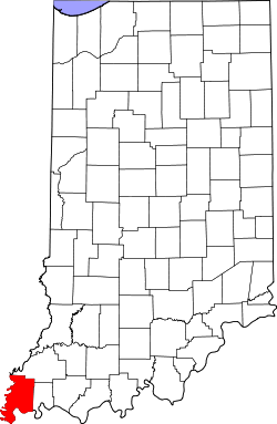
Posey County is the southernmost, southwesternmost, and westernmost county in the U.S. state of Indiana. Its southern border is formed by the Ohio River, and its western border by the Wabash River, a tributary to the Ohio. As of 2020, the population was 25,222. [1] The county seat is Mount Vernon. [2]

Contents

Posey County is part of the Evansville, Indiana metropolitan statistical area. The Ports of Indiana-Mount Vernon, on the Ohio River, is the seventh-largest inland port complex in the nation. Mechanization of dock technology has altered the number of workers at the port, but Posey County is still the seventh-largest internal port in the United States, based on the tons of materials handled. Grain from the Midwest is among the products shipped.

History

After the American Revolutionary War, Posey County was originally considered part of the Northwest Territory, organized in 1787 by the new United States. As part of the Indiana Territory, it was organized in November 1814 from Gibson and Warrick counties. It was named for Revolutionary War Gen. Thomas Posey, who was then serving as Governor of the Territory. [3] Mount Vernon was designated as the county seat in 1825. Its port on the Ohio River continues to be integral to the economy of the state and county.

Like other parts of southern Ohio, Indiana and Illinois, Posey County was first settled by people from the Upper South, many of whom arrived via the Ohio River. Farming was the primary development at first. In the mid- to late 19th century, the county received many German immigrants. The river port had rougher areas of vice, and a higher population of single men, as was typical. African Americans were among the men who worked on ships and at the port.

Posey County was the site of the largest recorded lynching of African Americans in Indiana's history. In October 1878, a white mob lynched seven black men in the span of a few days. No one in the mob was prosecuted, and at each court session for the next three years, the prosecutor asked the judge to "set the case over to the next session". A grand jury was called to investigate the mob action, but with an election pending for the prosecuting attorney, no one was ever indicted. Following years of research, Posey County judge Jim Redwine wrote a novel, Judge Lynch! (2008), based on the events. Redwine sometimes lectures on the riot, inviting his audience to imagine how they would have acted and stressing the injustice done to the African Americans who were denied the right to a fair trial. [4] [5]

Geography

The low rolling hills of southwest Indiana are carved by drainages; the Black River flows southwestward through the county's upper portion, discharging into the Wabash River north of New Harmony. Rush Creek drains the county's central portion, flowing westward to discharge into the Wabash in Harmonie State Park. The area is largely cleared and devoted to agriculture or urban use, although the drainages and lowlands are still wooded or brush-filled. [6]

According to the 2010 United States Census, the county has a total area of 419.32 square miles (1,086.0 km2), of which 409.57 square miles (1,060.8 km2) (or 97.67%) is land and 9.75 square miles (25.3 km2) (or 2.33%) is water. [7] The lowest point in the state of Indiana is located on the Ohio River in Posey County, where the Wabash River flows into it, and Posey County's highest point (590 feet/180 meters ASL) is a small rise 1.6 miles (2.6 km) SSW from Saint Wendel, near the county's southeast corner. [8] Posey county lies at the tripoint of Indiana, Kentucky and Illinois.

Adjacent counties

Cities and towns

Townships

Unincorporated places

Protected areas

Transportation

Major highways

Railroads

River ports

Climate and weather

Mount Vernon, Indiana
Climate chart (explanation)
J
F
M
A
M
J
J
A
S
O
N
D
 
 
3.4
 
 
38
23
 
 
3.2
 
 
44
26
 
 
4.6
 
 
54
35
 
 
4.4
 
 
65
45
 
 
5.4
 
 
75
55
 
 
4
 
 
84
64
 
 
4.1
 
 
87
68
 
 
3
 
 
86
65
 
 
2.7
 
 
80
58
 
 
2.9
 
 
69
46
 
 
4.4
 
 
55
37
 
 
3.7
 
 
43
27
Average max. and min. temperatures in °F
Precipitation totals in inches
Source: The Weather Channel [11]
Metric conversion
J
F
M
A
M
J
J
A
S
O
N
D
 
 
86
 
 
3
−5
 
 
80
 
 
7
−3
 
 
116
 
 
12
2
 
 
111
 
 
18
7
 
 
137
 
 
24
13
 
 
103
 
 
29
18
 
 
104
 
 
31
20
 
 
77
 
 
30
18
 
 
67
 
 
27
14
 
 
74
 
 
21
8
 
 
110
 
 
13
3
 
 
94
 
 
6
−3
Average max. and min. temperatures in °C
Precipitation totals in mm

In recent years, average temperatures in Mount Vernon have ranged from a nighttime low of 23 °F (−5 °C) in January to a daytime high of 87 °F (31 °C) in July, although a record low of −21 °F (−29 °C) was recorded in January 1912 and a record high of 109 °F (43 °C) was recorded in July 1901. Average monthly precipitation ranged from 2.65 inches (67 mm) in September to 5.38 inches (137 mm) in May. [11]

Government

The county government is a constitutional body, and is granted specific powers by the Constitution of Indiana, and by the Indiana Code.

County Council: The legislative branch of the county government; controls spending and revenue collection in the county. Representatives are elected to four-year terms from single-member districts of roughly equal population in the county. They set salaries, the annual budget, and special spending. The council has limited authority to impose local taxes, in the form of an income and property tax that is subject to state level approval, excise taxes, and service taxes. [12] [13]

Board of Commissioners: The executive body of the county is a three-person board of commissioners, who are elected at-large (county-wide), to staggered four-year terms. One commissioner serves as president. The commissioners execute acts legislated by the council, collect revenue, and manage the county government. [12] [13]

Court: The county maintains a small claims court that handles civil cases. The court judge is elected to a four-year term and must be a member of the Indiana Bar Association. The judge is assisted by a constable, who is also elected to a four-year term. In some cases, court decisions can be appealed to the state level circuit court. [13]

County Officials: Other county elected offices include sheriff, coroner, auditor, treasurer, recorder, surveyor, and circuit court clerk. Each serves a four-year term. Members elected to county government positions are required to declare party affiliations and to be residents of the county. [13]

United States presidential election results for Posey County, Indiana [14]
Year Republican Democratic Third party
No.%No.%No.%
2020 9,20969.38%3,81728.76%2471.86%
2016 8,40466.74%3,52127.96%6675.30%
2012 7,43060.77%4,53337.08%2632.15%
2008 6,80453.28%5,82845.63%1391.09%
2004 7,83365.35%4,08534.08%680.57%
2000 6,49858.49%4,43039.87%1821.64%
1996 4,63842.34%4,96545.33%1,35012.33%
1992 4,43538.72%4,63240.44%2,38620.83%
1988 5,98757.07%4,46842.59%350.33%
1984 6,47259.07%4,45240.63%330.30%
1980 6,09653.69%4,46539.33%7936.98%
1976 5,13648.97%5,29850.51%540.51%
1972 6,77165.24%3,58634.55%210.20%
1968 5,04549.70%3,88938.32%1,21611.98%
1964 3,57336.57%6,16463.09%330.34%
1960 5,36954.47%4,45745.22%310.31%
1956 5,78059.44%3,91940.30%250.26%
1952 5,29357.61%3,83541.74%590.64%
1948 3,87944.43%4,72954.16%1231.41%
1944 4,37450.75%4,18348.53%620.72%
1940 4,51447.06%5,02252.35%570.59%
1936 3,08834.74%5,63063.34%1701.91%
1932 2,87633.27%5,64165.26%1271.47%
1928 4,39651.80%4,05247.74%390.46%
1924 4,17348.82%4,11548.14%2603.04%
1920 4,80249.72%4,69548.61%1611.67%
1916 2,29142.97%2,92254.80%1192.23%
1912 1,19323.95%2,76755.55%1,02120.50%
1908 2,44442.49%3,08453.62%2243.89%
1904 2,41944.32%2,82551.76%2143.92%
1900 2,55343.57%3,17754.22%1292.20%
1896 2,52644.50%3,10354.66%480.85%
1892 2,07739.99%2,66051.21%4578.80%
1888 2,36945.70%2,68451.77%1312.53%

Demographics

Historical population
CensusPop.Note
1820 4,061
1830 6,54961.3%
1840 9,68347.9%
1850 12,54929.6%
1860 16,16728.8%
1870 19,18518.7%
1880 20,8578.7%
1890 21,5293.2%
1900 22,3333.7%
1910 21,670−3.0%
1920 19,334−10.8%
1930 17,853−7.7%
1940 19,1837.4%
1950 19,8183.3%
1960 19,214−3.0%
1970 21,74013.1%
1980 26,41421.5%
1990 25,968−1.7%
2000 27,0614.2%
2010 25,910−4.3%
2020 25,222−2.7%
2023 (est.)25,040 [15] −0.7%
US Decennial Census [16]
1790-1960 [17] 1900-1990 [18]
1990-2000 [19] 2010 [20]

As of the 2010 United States Census, there were 25,910 people, 10,171 households, and 7,442 families in the county. [21] The population density was 63.3 inhabitants per square mile (24.4/km2). There were 11,207 housing units at an average density of 27.4 per square mile (10.6/km2). [7] The racial makeup of the county was 97.2% white, 0.9% black or African American, 0.3% Asian, 0.2% American Indian, 0.4% from other races, and 1.1% from two or more races. Those of Hispanic or Latino origin made up 1.0% of the population. [21] In terms of ancestry, 43.6% were German, 13.6% were American, 11.6% were Irish, and 11.2% were English. [22]

Of the 10,171 households, 32.7% had children under the age of 18 living with them, 60.4% were married couples living together, 8.5% had a female householder with no husband present, 26.8% were non-families, and 23.3% of all households were made up of individuals. The average household size was 2.52 and the average family size was 2.97. The median age was 41.6 years. [21]

The median income for a household in the county was $47,697 and the median income for a family was $68,722. Males had a median income of $55,786 versus $32,747 for females. The per capita income for the county was $26,727. About 6.0% of families and 8.3% of the population were below the poverty line, including 12.2% of those under age 18 and 8.3% of those age 65 or over. [23]

Education

Tourism and recreation

Representation in other media

See also

Related Research Articles

<span class="mw-page-title-main">Washington County, Indiana</span> County in Indiana, United States

Washington County is a county in the U.S. state of Indiana. As of the 2020 United States Census, the population was 28,182. The county seat is Salem.

<span class="mw-page-title-main">Warrick County, Indiana</span> County in Indiana, United States

Warrick County is a county located in the U.S. state of Indiana. As of 2020, the population was 63,898. The county seat is Boonville. It was organized in 1813 and was named for Captain Jacob Warrick, an Indiana militia company commander killed in the Battle of Tippecanoe in 1811. It is one of the ten fastest-growing counties in Indiana.

<span class="mw-page-title-main">Wabash County, Indiana</span> County in Indiana, United States

Wabash County is a county located in the northern central part of the U.S. state of Indiana. As of 2020, the population was 30,976. The county seat is Wabash.

<span class="mw-page-title-main">Sullivan County, Indiana</span> County in Indiana, United States

Sullivan County is a county in the U.S. state of Indiana, and determined by the US Census Bureau to include the mean center of U.S. population in 1940. As of 2020, the population was 20,758. The county seat is Sullivan.

<span class="mw-page-title-main">Knox County, Indiana</span> County in Indiana, United States

Knox County is a county in the U.S. state of Indiana in the United States. The oldest county in Indiana, it was one of two original counties created in the Northwest Territory in 1790, alongside St. Clair County, Illinois. Knox County was gradually reduced in size as subsequent counties were established. It was established in its present configuration when Daviess County was partitioned off. At the 2020 United States Census, the county population was 36,282. The county seat is Vincennes.

<span class="mw-page-title-main">Jay County, Indiana</span> County in Indiana, United States

Jay County is a county in the U.S. state of Indiana. As of 2020, the population was 20,478. The county seat is Portland.

<span class="mw-page-title-main">Grant County, Indiana</span> County in Indiana, United States

Grant County is a county in central Indiana in the United States Midwest. At the time of the 2020 census, the population was 66,674. The county seat is Marion. Important paleontological discoveries, dating from the Pliocene epoch, have been made at the Pipe Creek Sinkhole in Grant County.

<span class="mw-page-title-main">Gibson County, Indiana</span> County in Indiana, United States

Gibson County is a county in the southwestern part of the U.S. state of Indiana. As of the 2020 United States Census, the population was 33,011. The county seat is Princeton.

<span class="mw-page-title-main">Carroll County, Indiana</span> County in Indiana, United States

Carroll County is a county located in the U.S. state of Indiana. As of the 2020 United States Census, the population was 20,306. The county seat is Delphi.

<span class="mw-page-title-main">White County, Illinois</span> County in Illinois, United States

White County is a county located in the U.S. state of Illinois. According to the 2020 census, it had a population of 13,877. Its county seat is Carmi. It is located in the southern portion of Illinois known locally as "Little Egypt".

<span class="mw-page-title-main">Mount Carmel, Illinois</span> City in Illinois, United States

Mount Carmel is a city in and the county seat of Wabash County, Illinois, United States. At the time of the 2010 census, the population was 7,284, and it is the largest city in the county. The next largest town in Wabash County is Allendale, population 475.

<span class="mw-page-title-main">Mount Vernon, Indiana</span> City in Indiana, United States

Mount Vernon is a city in and the county seat of Posey County, Indiana, United States. Located in the state's far southwestern corner, within 15 miles (24 km) of both the southernmost or westernmost points, it is the westernmost city in the state. The southernmost is Rockport, located along the Ohio River about 40 miles (64 km) to the southeast.

<span class="mw-page-title-main">Wabash River</span> Tributary of the Ohio River in the United States

The Wabash River is a 503-mile-long (810 km) river that drains most of the state of Indiana, and a significant part of Illinois, in the United States. It flows from the headwaters in Ohio, near the Indiana border, then southwest across northern Indiana turning south near the Illinois border, where the southern portion forms the Indiana-Illinois border before flowing into the Ohio River.

<span class="mw-page-title-main">Indiana State Road 62</span> Highway in Indiana

State Road 62 (SR 62) in the U.S. state of Indiana is an east–west route that travels 204 miles (328 km) from the Illinois state line in the southwest corner of Indiana to the Louisville, Kentucky area, then northeast toward the Cincinnati, Ohio area.

<span class="mw-page-title-main">Indiana State Road 69</span> State highway in Indiana, United States

State Road 69 (SR 69) is a part of the Indiana State Road system that runs between Hovey Lake Fish and Wildlife Area and Griffin in US state of Indiana. The 35.07 miles (56.44 km) of SR 69 that lie within Indiana serve as a major conduit. Some of the highway is listed on the National Highway System. Various sections are urban two-lane highway, three-lane highway and rural two-lane highway. The highway passes through residential, industrial and commercial properties.

<span class="mw-page-title-main">Montgomery Township, Gibson County, Indiana</span> Township in Indiana, United States

Montgomery Township is the largest of the ten townships in Gibson County, Indiana as well as one of the largest townships by area in Southwestern Indiana, USA. At the 2020 census, its population was 4,020 and it contained 1,624 housing units, 75% of which were in areas adjacent to Owensville. Montgomery Township is served by the South Gibson School Corporation. Gibson Generating Station and Gibson Lake are located at the northern end of Montgomery Township.

<span class="mw-page-title-main">Wabash Township, Gibson County, Indiana</span> Township in Indiana, United States

Wabash Township is one of ten townships in Gibson County, Indiana, United States. As of the 2020 census, its population was 52 and it contained 22 housing units. Wabash Township has no organized seat within the township, as the only settlement is in two river camps Crawleyville and Jimtown. The township seat is Owensville, in Montgomery Township. This area is occasionally referred to as the "Tail of Gibson County", owing to its shape and position within the county. Nevertheless, the township is a panhandle of Gibson County, bordered by the Wabash River to the north, northwest, west, and in some parts, east, even southeast, and by Posey County to the south.

<span class="mw-page-title-main">Point Township, Posey County, Indiana</span> Township in Indiana, United States

Point Township is one of ten townships in Posey County, Indiana. As of the 2020 census, its population was 306. The lowest, the southernmost, and the westernmost points in Indiana are all located along the township's boundaries.

The Black River is a 19.6-mile-long (31.5 km) river with headwaters located just south of Owensville, Indiana. It flows southwest through southwestern Gibson County and northwestern Posey County under Interstate 64 between Poseyville and Griffin before emptying into the Wabash River just north of New Harmony.

<span class="mw-page-title-main">Ashworth Archaeological Site</span> Archaeological site in Indiana, US

The Ashworth Archaeological Site is a significant archaeological site in the extreme southwestern corner of the U.S. state of Indiana. Located near the confluence of the Ohio and Wabash Rivers, it lies near several similar archaeological sites. It was first examined by archaeologists in the middle of the twentieth century and found to be the site of a relatively recent Native American village, and it has been designated a historic site because of its archaeological value.

References

  1. "Quickfacts: Posey County, Indiana". United States Census Bureau . Retrieved June 6, 2023.
  2. "Find a County". National Association of Counties. Retrieved June 7, 2011.
  3. De Witt Clinton Goodrich & Charles Richard Tuttle (1875). An Illustrated History of the State of Indiana. Indiana: R. S. Peale & co. p.  570.
  4. "Lynching in America; Supplement: Lynching by County, 3rd ed., 2017, Montgomery, Alabama: Equal Justice Initiative, p. 5" (PDF). Archived from the original (PDF) on October 23, 2017. Retrieved May 31, 2018.
  5. 1 2 Barry Cleveland, "Seven killed in Posey County violence", Carmi Times, February 7, 2011; accessed May 31, 2018
  6. 1 2 Posey County IN (Google Maps, accessed 23 August 2020)
  7. 1 2 "Population, Housing Units, Area, and Density: 2010 - County". US Census Bureau. Archived from the original on February 13, 2020. Retrieved July 10, 2015.
  8. Posey County High Point, Indiana (PeakBagger.com, accessed 23 August 2020)
  9. Dead Mans Crossing, Black Township IN (Google Maps, accessed 24 June 2020)
  10. Ports of Indiana-Mt. Vernon website
  11. 1 2 "Monthly Averages for Mount Vernon IN". The Weather Channel. Retrieved January 27, 2011.
  12. 1 2 Indiana Code. "Title 36, Article 2, Section 3". IN.gov. Retrieved September 16, 2008.
  13. 1 2 3 4 Indiana Code. "Title 2, Article 10, Section 2" (PDF). IN.gov. Retrieved September 16, 2008.
  14. Leip, David. "Atlas of US Presidential Elections". uselectionatlas.org. Retrieved May 19, 2018.
  15. "Annual Estimates of the Resident Population for Counties: April 1, 2020 to July 1, 2023". United States Census Bureau. Retrieved April 2, 2024.
  16. "US Decennial Census". US Census Bureau. Retrieved July 10, 2014.
  17. "Historical Census Browser". University of Virginia Library. Retrieved July 10, 2014.
  18. "Population of Counties by Decennial Census: 1900 to 1990". US Census Bureau. Retrieved July 10, 2014.
  19. "Census 2000 PHC-T-4. Ranking Tables for Counties: 1990 and 2000" (PDF). US Census Bureau. Retrieved July 10, 2014.
  20. "Posey County QuickFacts". US Census Bureau. Archived from the original on January 26, 2016. Retrieved September 25, 2011.
  21. 1 2 3 "Profile of General Population and Housing Characteristics: 2010 Demographic Profile Data". US Census Bureau. Archived from the original on February 13, 2020. Retrieved July 10, 2015.
  22. "Selected Social Characteristics in the US – 2006-2010 American Community Survey 5-Year Estimates". US Census Bureau. Archived from the original on February 14, 2020. Retrieved July 10, 2015.
  23. "Selected Economic Characteristics – 2006-2010 American Community Survey 5-Year Estimates". US Census Bureau. Archived from the original on February 14, 2020. Retrieved July 10, 2015.
  24. Visit Posey County
  25. "Hovey Lake Fish & Wildlife Area". January 29, 2021.
  26. Historic New Harmony Archived August 17, 2009, at the Wayback Machine
  27. James M. Redwine, Judge Lynch!, AuthorHouse, 2008

38°01′N87°52′W / 38.02°N 87.86°W / 38.02; -87.86