Knox County is a county in the U.S. state of Indiana in the United States. The oldest county in Indiana, it was one of two original counties created in the Northwest Territory in 1790, alongside St. Clair County, Illinois. Knox County was gradually reduced in size as subsequent counties were established. It was established in its present configuration when Daviess County was partitioned off (February 2, 1818). At the 2020 United States census, the county population was 36,282.[1] The county seat is Vincennes.[2] Knox County comprises the Vincennes, IN Micropolitan Statistical Area.
Many of Knox County townships and lots were surveyed with the French system, which employs non-cardinal compass points. Knox and Clark counties are the only ones laid out in this fashion.[4]
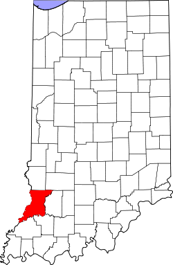
Geography
1875 county map
Knox County lies on the west edge of the state; its western border abuts the eastern border of Illinois across the Wabash River. According to the 2010 census, the county has a total area of 524.04 square miles (1,357.3km2), of which 516.03 square miles (1,336.5km2) (or 98.47%) is land and 8.01 square miles (20.7km2) (or 1.53%) is water.[5] The county's west border is defined by the south-flowing Wabash River, and its east border is defined by the south-southwest-flowing White River. Its southwesternmost point occurs at the confluence of the two rivers, near Mount Carmel, Illinois. The terrain consists of verdant low-rolling hills, largely devoted to agriculture.[6] Its highest points (around 620 feet/190 meters ASL) occur in the hills midway between Bruceville and Bicknell.[7]
In recent years, the average temperature in Vincennes has ranged from a low of 20°F (−7°C) in January to a high of 88°F (31°C) in July, although a record low of −26°F (−32°C) was recorded in January 1994 and a record high of 104°F (40°C) was recorded in June 1988. Average monthly precipitation ranged from 2.51 inches (64mm) in February to 5.13 inches (130mm) in May.[8]
County Council: The legislative branch of the county government; controls the county's spending and revenue collection. Representatives are elected from county districts to four-year terms. They set salaries, the annual budget, and special spending. The council has limited authority to impose local taxes, in the form of an income and property tax that is subject to state level approval, excise taxes, and service taxes.[9][10]
Board of Commissioners: The executive body of the county. The commissioners are elected county-wide to staggered four-year terms. One commissioner serves as president. The commissioners are charged with executing the legislative acts of the County Council, collecting revenue, and managing the county government's functions.[9][10]
Court: The county maintains a small claims court that can handle some civil cases. The court judge is elected to a four-year term, and must be a member of the Indiana Bar Association. The judge is assisted by a constable, who is elected county-wide to a four-year term. Some court decisions can be appealed to the state level circuit court.[10]
County Officials: The county has several other elected offices, including sheriff, coroner, auditor, treasurer, recorder, surveyor, and circuit court clerk. Each is elected county-wide to a four-year term. Members elected to county government positions are required to declare party affiliations and to be residents of the county.[10]
As of the 2010 United States census, there were 38,440people, 15,249households, and 9,725families in the county.[5] The population density was 74.5 inhabitants per square mile (28.8/km2). There were 17,038 housing units at an average density of 33.0 per square mile (12.7/km2).[20] The racial makeup of the county was 94.9% white, 2.6% black or African American, 0.6% Asian, 0.2% American Indian, 0.5% from other races, and 1.2% from two or more races. Those of Hispanic or Latino origin made up 1.5% of the population.[5] In terms of ancestry, 26.9% were German, 19.9% were American, 13.0% were Irish, and 9.1% were English.[21]
Of the 15,249households, 29.1% had children under the age of 18 living with them, 48.5% were married couples living together, 11.1% had a female householder with no husband present, 36.2% were non-families, and 30.1% of all households were made up of individuals. The average household size was 2.35 and the average family size was 2.90. The median age was 38.5 years.[5]
The median income for a household in the county was $47,697 and the median income for a family was $51,534. Males had a median income of $40,553 versus $27,201 for females. The per capita income for the county was $20,381. About 12.6% of families and 16.4% of the population were below the poverty line, including 22.7% of those under age 18 and 11.4% of those age 65 or over.[22]
Workforce
In 2005, Knox County had 998 business units and 16,240 jobs. The largest employing industry in the county was education and health services (including both public and private employment) with almost 34 percent of total industry employment. Trade, transportation, and utilities came in second with over 22 percent of total industry employment. Manufacturing showed the most job growth and the largest percentage gain since 2001, increasing 316 jobs or almost 21 percent.
The 2005 all industry earnings average for Knox County was $26,875, up $2,824 or 11.7 percent over the county's 2001 average. The manufacturing industry had the highest average annual earnings at $33,238, increasing $1,695 since 2001. Annual earnings in the information sector increased the most between 2001 and 2005, up $6,518 or 29.7 percent.
The Vincennes area has a diversified economy. In 2005 retail trade was the largest of 20 major sectors. It had an average wage per job of $19,743. Per capita income grew by 17.9% between 1994 and 2004 (adjusted for inflation). While manufacturing accounts for 8.2% of the jobs, the services sector is rapidly growing. Knox County's ground breaking Pathways Program insures a well-trained, highly motivated labor force. Knox County encompasses an area that attracts approximately 300,000 potential employees within an easy commute. Because of the proximity of the surrounding counties, and ease of access to the Vincennes area, businesses routinely draw from a labor force that lies within a 50-mile radius of their work site.
This page is based on this Wikipedia article Text is available under the CC BY-SA 4.0 license; additional terms may apply. Images, videos and audio are available under their respective licenses.