Sandborn, Indiana

Last updated

Sandborn, Indiana
Sandborn-RR-tracks-in.jpg
Sandborn
Knox County Indiana Incorporated and Unincorporated areas Sandborn Highlighted 1867698.svg
Location of Sandborn in Knox County, Indiana.
Coordinates: 38°53′48″N87°11′05″W / 38.89667°N 87.18472°W / 38.89667; -87.18472
Country United States
State Indiana
County Knox
Township Vigo
Area
[1]
  Total
0.39 sq mi (1.01 km2)
  Land0.39 sq mi (1.01 km2)
  Water0.00 sq mi (0.00 km2)
Elevation
[2]
476 ft (145 m)
Population
 (2020)
  Total
359
  Density920.51/sq mi (355.17/km2)
Time zone UTC-5 (EST)
  Summer (DST) UTC-4 (EDT)
ZIP code
47578
Area code 812
FIPS code 18-67698 [3]
GNIS feature ID2396904 [2]
Website TownofSandborn.IN.gov

Sandborn is a town in Vigo Township, Knox County, Indiana, United States. The population was 359 at the 2020 census. It is the home of the annual Black Creek Festival.

Contents

History

Sandborn was laid out in 1868. It was named for a railroad official. [4] The Sandborn post office was established in 1869. [5]

Geography

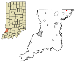
Sandborn lies in northeastern Knox County, just south of the Knox-Greene county line. Indiana State Road 59 traverses Sandborn, connecting the town with Linton and the Greene-Sullivan State Forest to the north. State Road 67 passes through the northwestern limits of Sandborn, connecting the town with the Vincennes area to the southwest.

According to the 2010 census, Sandborn has a total area of 0.39 square miles (1.01 km2), all land. [6]

Demographics

Historical population
CensusPop.Note
1880 252
1910 445
1920 53019.1%
1930 64120.9%
1940 602−6.1%
1950 572−5.0%
1960 547−4.4%
1970 528−3.5%
1980 5769.1%
1990 455−21.0%
2000 451−0.9%
2010 415−8.0%
2020 359−13.5%
U.S. Decennial Census [7]

2010 census

As of the census [8] of 2010, there were 415 people, 174 households, and 114 families living in the town. The population density was 1,064.1 inhabitants per square mile (410.9/km2). There were 202 housing units at an average density of 517.9 per square mile (200.0/km2). The racial makeup of the town was 98.6% White, 0.2% African American, 1.0% Native American, and 0.2% from other races. Hispanic or Latino of any race were 0.7% of the population.

There were 174 households, of which 29.9% had children under the age of 18 living with them, 55.7% were married couples living together, 8.0% had a female householder with no husband present, 1.7% had a male householder with no wife present, and 34.5% were non-families. 28.7% of all households were made up of individuals, and 12.6% had someone living alone who was 65 years of age or older. The average household size was 2.39 and the average family size was 2.98.

The median age in the town was 42.1 years. 22.7% of residents were under the age of 18; 7.8% were between the ages of 18 and 24; 23.9% were from 25 to 44; 28.8% were from 45 to 64; and 16.9% were 65 years of age or older. The gender makeup of the town was 48.0% male and 52.0% female.

2000 census

As of the census [3] of 2000, there were 451 people, 193 households, and 132 families living in the town. The population density was 1,127.5 inhabitants per square mile (435.3/km2). There were 214 housing units at an average density of 535.0 per square mile (206.6/km2). The racial makeup of the town was 97.34% White, 0.44% African American, 1.11% Native American, and 1.11% from two or more races. Hispanic or Latino of any race were 0.44% of the population.

Block of old buildings along Anderson Street (SR 59) Sandborn-Lions-Club-block-in.jpg
Block of old buildings along Anderson Street (SR 59)

There were 193 households, out of which 29.0% had children under the age of 18 living with them, 62.2% were married couples living together, 5.7% had a female householder with no husband present, and 31.1% were non-families. 29.0% of all households were made up of individuals, and 16.1% had someone living alone who was 65 years of age or older. The average household size was 2.34 and the average family size was 2.88.

In the town, the population was spread out, with 23.1% under the age of 18, 6.0% from 18 to 24, 25.9% from 25 to 44, 26.2% from 45 to 64, and 18.8% who were 65 years of age or older. The median age was 41 years. For every 100 females, there were 93.6 males. For every 100 females age 18 and over, there were 87.6 males.

The median income for a household in the town was $31,000, and the median income for a family was $47,031. Males had a median income of $38,594 versus $25,417 for females. The per capita income for the town was $17,878. About 7.9% of families and 11.5% of the population were below the poverty line, including 11.2% of those under age 18 and 6.1% of those age 65 or over.

Education

Sandborn has a public library, a branch of the Bicknell-Vigo Township Public Library. [9]

Notable people

Related Research Articles

<span class="mw-page-title-main">Alfordsville, Indiana</span> Town in Indiana, United States

Alfordsville is a town in Reeve Township, Daviess County, Indiana, United States. The population was 101 at the 2010 census.

<span class="mw-page-title-main">Cannelburg, Indiana</span> Town in Indiana, United States

Cannelburg is a town in Barr Township, Daviess County, Indiana, United States. The population was 135 at the 2010 census.

<span class="mw-page-title-main">Elnora, Indiana</span> Town in Indiana, United States

Elnora is a town in Elmore Township, Daviess County, Indiana, United States. The population was 640 at the 2010 census.

<span class="mw-page-title-main">Odon, Indiana</span> Town in Indiana, United States

Odon is a town in Madison Township, Daviess County, Indiana, United States. The population was 1,354 at the 2010 census.

<span class="mw-page-title-main">Plainville, Indiana</span> Town in Indiana, United States

Plainville is a town in Steele Township, Daviess County, Indiana, United States. The population was 476 at the 2010 census. The former high school mascot was the Plainville Midgets.

<span class="mw-page-title-main">Bicknell, Indiana</span> City in Indiana, United States

Bicknell is a city in Knox County, Indiana, United States. The population was 2,915 at the 2010 census.

<span class="mw-page-title-main">Bruceville, Indiana</span> Town in Indiana, United States

Bruceville is a town in Washington Township, Knox County, Indiana, United States. The population was 478 at the 2010 census.

<span class="mw-page-title-main">Decker, Indiana</span> Town in Indiana, United States

Decker is a town in Johnson Township, Knox County, Indiana, United States. The population was 249 at the 2010 census. It was founded in 1869 by Isaac Decker. Decker is near the White River, and is well known for the watermelon and cantaloupe produced in the surrounding rural area.

<span class="mw-page-title-main">Edwardsport, Indiana</span> Town in Indiana, United States

Edwardsport is a town in Vigo Township, Knox County, Indiana, United States. The population was 303 at the 2010 census. It was founded in 1832 and named after Edward Wilkins, a founding father.

<span class="mw-page-title-main">Monroe City, Indiana</span> Town in Indiana, United States

Monroe City is a town in Harrison Township, Knox County, Indiana, United States. The population was 545 at the 2010 census.

<span class="mw-page-title-main">Oaktown, Indiana</span> Town in Indiana, United States

Oaktown is a town in Busseron Township, Knox County, Indiana. The population was 608 at the 2010 census.

<span class="mw-page-title-main">Wheatland, Indiana</span> Town in Indiana, United States

Wheatland is a town in Steen Township, Knox County, Indiana, United States. The population was 480 at the 2010 census.

<span class="mw-page-title-main">Knox, Indiana</span> City in Indiana, United States

Knox is a city in Center Township, Starke County, in the U.S. state of Indiana. The population was 3,704 at the 2010 census. The city is the county seat of Starke County.

<span class="mw-page-title-main">Clear Lake, Indiana</span> Town in Indiana, United States

Clear Lake is a town located in the northeast corner of Steuben County, Indiana, in Clear Lake Township. As such, is the northeasternmost community in the State of Indiana. The population was 339 at the 2010 census.

<span class="mw-page-title-main">Farmersburg, Indiana</span> Town in Indiana, United States

Farmersburg is a town in Curry Township, Sullivan County, Indiana, United States. The population was 1,118 at the 2010 census. It is part of the Terre Haute Metropolitan Statistical Area. The town is adjacent to the Vigo County line and is overshadowed by several large TV and radio transmitter towers.

<span class="mw-page-title-main">Cayuga, Indiana</span> Town in Indiana, United States

Cayuga is a town in Eugene Township, Vermillion County, in the U.S. state of Indiana. The population was 1,162 at the 2010 census.

<span class="mw-page-title-main">Riley, Indiana</span> Town in Indiana, United States

Riley, once known as Lockport, is a town in Riley Township, Vigo County, in the U.S. state of Indiana. The population was 221 at the 2010 census. It is part of the Terre Haute Metropolitan Statistical Area.

<span class="mw-page-title-main">Seelyville, Indiana</span> Town in Indiana, United States

Seelyville is a town in Lost Creek Township, Vigo County, in the U.S. state of Indiana. The population was 1,029 at the 2010 census. It is part of the Terre Haute Metropolitan Statistical Area.

<span class="mw-page-title-main">West Terre Haute, Indiana</span> Town in Indiana, United States

West Terre Haute is a town in Sugar Creek Township, Vigo County, Indiana, on the western side of the Wabash River near Terre Haute. The population was 2,236 at the 2010 census. It is part of the Terre Haute Metropolitan Statistical Area. Bethany Congregational Church was placed on the National Register of Historic Places in 2003.

<span class="mw-page-title-main">Knox, Maine</span> Town in the state of Maine, United States

Knox is a town in Waldo County, Maine, United States. The town was named for General Henry Knox, the first United States Secretary of War. The population was 811 at the 2020 census.

References

  1. "2020 U.S. Gazetteer Files". United States Census Bureau. Retrieved March 16, 2022.
  2. 1 2 U.S. Geological Survey Geographic Names Information System: Sandborn, Indiana
  3. 1 2 "U.S. Census website". United States Census Bureau . Retrieved January 31, 2008.
  4. History of Knox and Daviess County, Indiana: From the Earliest Time to the Present. Goodspeed. 1886. pp.  269.
  5. "Knox County". Jim Forte Postal History. Retrieved November 25, 2014.
  6. "G001 - Geographic Identifiers - 2010 Census Summary File 1". United States Census Bureau. Archived from the original on February 13, 2020. Retrieved July 25, 2015.
  7. "Census of Population and Housing". Census.gov. Retrieved June 4, 2015.
  8. "U.S. Census website". United States Census Bureau . Retrieved December 11, 2012.
  9. "Sandborn Branch". Bicknell-Vigo Township Public Library. Retrieved March 8, 2018.