Wayne County, Indiana

Last updated

Wayne County
WayneCountyCourthouse.jpg
Wayne County Courthouse
Map of Indiana highlighting Wayne County.svg
Location within the U.S. state of Indiana
Indiana in United States.svg
Indiana's location within the U.S.
Coordinates: 39°52′N85°01′W / 39.86°N 85.01°W / 39.86; -85.01
CountryFlag of the United States.svg United States
StateFlag of Indiana.svg  Indiana
Founded1811
Named for Anthony Wayne
Seat Richmond
Largest cityRichmond
Area
  Total404.34 sq mi (1,047.2 km2)
  Land401.74 sq mi (1,040.5 km2)
  Water2.60 sq mi (6.7 km2)  0.64%
Population
  Estimate 
(2021)
66,456 Decrease2.svg
  Density176/sq mi (68/km2)
Time zone UTC−5 (Eastern)
  Summer (DST) UTC−4 (EDT)
Congressional district 6th
Website co.wayne.in.us
Indiana county number 89

Wayne County is a county located in east central Indiana, United States, on the border with Ohio. As of the 2020 United States Census, the population was 66,553. [1] The county seat is Richmond. [2] Wayne County comprises the Richmond, IN Micropolitan Statistical Area. Richmond hosts Earlham College, a small private liberal arts college.

Contents

History

The first permanent European-American settlers in the area were Quakers from North Carolina. They settled about 1806 near the east fork of the Whitewater River, an area including what is today the city of Richmond. Jeptha Turner, the first white child in the county, was born here in 1806. [3]

Wayne County was formed in 1811 from portions of Clark and Dearborn counties. It was named for Gen. "Mad" Anthony Wayne, who was an officer during the Revolutionary War. Wayne is mainly remembered for his service in the 1790s in the Northwest Indian War, which included many actions in Indiana and Ohio. Randolph County was formed from the northern portion of Wayne County, effective August 1818.

The first county seat was Salisbury, Indiana, a town which no longer exists. It was later moved to Centerville, Indiana in 1818, where it remained until Richmond was designated as the seat in 1873.

During the antebellum years, Wayne County had a number of stations on the Underground Railroad, a network of blacks and whites who aided refugees from slavery to reach freedom. Levi Coffin and his wife Catharine aided more than 1,000 refugees at their home in Fountain City, now designated as a National Historic Landmark and State Historic Site significant to the Ohio River National

In the 1920s, Indiana had the strongest Ku Klux Klan organization in the country, led by Grand Dragons D. C. Stephenson and Walter F. Bossert. Its members controlled the state legislature and had an ally in Governor Ed Jackson. [4] At its height, national membership during the second Klan movement reached 1.5 million, with 300,000 in Indiana. [5] Records show that Wayne County was home to Whitewater Klan No. 60. [5] Robert Lyons, of Richmond, was national chief of staff for the Klan. [6] During this period, the Klan had the most members in cities rather than rural areas; it attracted members new to cities who were unsettled by waves of immigrants from Europe and migrants from other regions of the US.

Geography

Richmond is the county seat. Richmond-indiana-from-above.jpg
Richmond is the county seat.

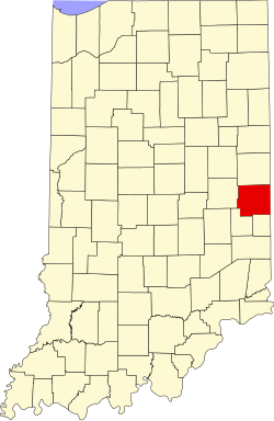
According to the 2010 census, the county has a total area of 404.34 square miles (1,047.2 km2), of which 401.74 square miles (1,040.5 km2) (or 99.36%) is land and 2.60 square miles (6.7 km2) (or 0.64%) is water. [7] Wayne County includes Indiana's highest natural elevation, Hoosier Hill, at 1,257 feet (383 m).

Adjacent counties

Cities

Towns

Unincorporated towns

Townships

Transit

Major highways

Climate and weather

Richmond, Indiana
Climate chart (explanation)
J
F
M
A
M
J
J
A
S
O
N
D
 
 
2.5
 
 
32
15
 
 
2.3
 
 
37
19
 
 
3.2
 
 
48
28
 
 
3.8
 
 
60
37
 
 
4.4
 
 
71
47
 
 
4.3
 
 
81
58
 
 
3.8
 
 
85
62
 
 
3.6
 
 
83
59
 
 
2.5
 
 
74
50
 
 
3
 
 
62
38
 
 
3.3
 
 
49
30
 
 
2.9
 
 
37
21
Average max. and min. temperatures in °F
Precipitation totals in inches
Source: The Weather Channel [8]
Metric conversion
J
F
M
A
M
J
J
A
S
O
N
D
 
 
64
 
 
0
−9
 
 
58
 
 
3
−7
 
 
80
 
 
9
−2
 
 
98
 
 
16
3
 
 
112
 
 
22
8
 
 
108
 
 
27
14
 
 
96
 
 
29
17
 
 
90
 
 
28
15
 
 
65
 
 
23
10
 
 
77
 
 
17
3
 
 
84
 
 
9
−1
 
 
74
 
 
3
−6
Average max. and min. temperatures in °C
Precipitation totals in mm

In recent years, average temperatures in Richmond have ranged from a low of 15 °F (−9 °C) in January to a high of 85 °F (29 °C) in July, although a record low of −29 °F (−34 °C) was recorded in January 1994 and a record high of 100 °F (38 °C) was recorded in July 1988. Average monthly precipitation ranged from 2.27 inches (58 mm) in February to 4.41 inches (112 mm) in May. [8]

Government

The county government is a constitutional body, and is granted specific powers by the Constitution of Indiana, and by the Indiana Code.

County Council: The county council is the legislative branch of the county government and controls all the spending and revenue collection in the county. Representatives are elected from county districts. The council members serve four-year terms. They are responsible for setting salaries, the annual budget, and special spending. The council also has limited authority to impose local taxes, in the form of an income and property tax that is subject to state level approval, excise taxes, and service taxes. [9] [10]

Board of Commissioners: The executive body of the county is made of a board of commissioners. The commissioners are elected at-large, county-wide, in staggered terms, and each serves a four-year term. One of the commissioners, typically the most senior, serves as president. The commissioners are charged with executing the acts legislated by the council, collecting revenue, and managing the day-to-day functions of the county government. [9] [10]

Court: The county maintains a small claims court that can handle some civil cases. The judge on the court is elected to a term of four years and must be a member of the Indiana Bar Association. The judge is assisted by a constable who is also elected to a four-year term. In some cases, court decisions can be appealed to the state level circuit court. [10]

County Officials: The county has several other elected offices, including sheriff, coroner, auditor, treasurer, recorder, surveyor, and circuit court clerk. Each of these elected officers serves a term of four years and oversees a different part of county government. Members elected to county government positions are required to declare party affiliations and to be residents of the county. [10]

Politics

Wayne County is very Republican, even by the standards of traditionally Republican Indiana. It has not supported a Democrat for president since 1936. Since then, the Democrats have only come reasonably close to winning the county four times. Lyndon Johnson lost the county by only 87 votes in 1964, Bill Clinton held the GOP to pluralities during both of his bids, and Barack Obama came within three percent of carrying the county in 2008.

United States presidential election results for Wayne County, Indiana [11]
Year Republican Democratic Third party
No.%No.%No.%
2020 17,56763.47%9,52434.41%5882.12%
2016 16,02862.66%8,32232.53%1,2294.80%
2012 14,32156.21%10,59141.57%5652.22%
2008 14,55850.83%13,45946.99%6242.18%
2004 16,58659.97%10,77538.96%2961.07%
2000 14,27356.75%10,27340.85%6052.41%
1996 12,18847.24%10,90542.27%2,70810.50%
1992 12,22144.69%9,96036.42%5,16518.89%
1988 16,38861.37%10,20938.23%1050.39%
1984 18,95564.80%10,17334.78%1230.42%
1980 16,98160.53%9,59934.22%1,4725.25%
1976 16,69757.20%12,30642.16%1880.64%
1972 21,61073.60%7,65526.07%960.33%
1968 17,33553.66%10,68633.08%4,28713.27%
1964 15,34249.93%15,26949.70%1130.37%
1960 19,76460.66%12,72139.05%950.29%
1956 20,15761.76%12,33737.80%1440.44%
1952 20,06862.36%11,81936.73%2930.91%
1948 15,44557.81%10,74940.23%5221.95%
1944 15,29554.51%12,43244.31%3321.18%
1940 15,05851.27%14,13948.14%1730.59%
1936 12,12645.98%13,69651.93%5512.09%
1932 12,68347.85%13,28750.13%5362.02%
1928 15,93667.52%7,54731.98%1180.50%
1924 11,48759.75%6,21132.31%1,5277.94%
1920 12,63159.52%8,01537.77%5752.71%
1916 6,11251.84%5,00742.46%6725.70%
1912 1,85116.11%3,80633.12%5,83450.77%
1908 6,73157.34%4,50338.36%5044.29%
1904 7,39066.32%3,11627.96%6375.72%
1900 6,73661.04%4,02036.43%2792.53%
1896 6,84161.67%4,09836.94%1541.39%
1892 5,71457.27%3,72637.34%5385.39%
1888 6,13860.91%3,65336.25%2862.84%

Demographics

Historical population
CensusPop.Note
1820 12,119
1830 18,57153.2%
1840 23,29025.4%
1850 25,3208.7%
1860 29,55816.7%
1870 34,04815.2%
1880 38,61313.4%
1890 37,628−2.6%
1900 38,9703.6%
1910 43,75712.3%
1920 48,13610.0%
1930 54,80913.9%
1940 59,2298.1%
1950 68,56615.8%
1960 74,0398.0%
1970 79,1096.8%
1980 76,058−3.9%
1990 71,951−5.4%
2000 71,097−1.2%
2010 68,917−3.1%
2020 66,553−3.4%
2023 (est.)66,127 [12] −0.6%
U.S. Decennial Census [13]
1790-1960 [14] 1900-1990 [15]
1990-2000 [16] 2010-2021 [1]

As of the 2010 United States Census, there were 68,917 people, 27,551 households, and 18,126 families residing in the county. [17] The population density was 171.5 inhabitants per square mile (66.2/km2). There were 31,242 housing units at an average density of 77.8 per square mile (30.0/km2). [7] The racial makeup of the county was 90.2% white, 5.0% black or African American, 0.8% Asian, 0.2% American Indian, 0.1% Pacific islander, 1.1% from other races, and 2.7% from two or more races. Those of Hispanic or Latino origin made up 2.6% of the population. [17] In terms of ancestry, 24.4% were German, 11.8% were Irish, 11.0% were English, and 10.9% were American. [18]

Of the 27,551 households, 30.5% had children under the age of 18 living with them, 47.4% were married couples living together, 13.3% had a female householder with no husband present, 34.2% were non-families, and 28.5% of all households were made up of individuals. The average household size was 2.41 and the average family size was 2.93. The median age was 40.2 years. [17]

The median income for a household in the county was $47,697 and the median income for a family was $51,155. Males had a median income of $40,644 versus $30,194 for females. The per capita income for the county was $21,789. About 12.6% of families and 16.1% of the population were below the poverty line, including 24.9% of those under age 18 and 9.3% of those age 65 or over. [19]

Notable people

School Corporations

See also

Related Research Articles

<span class="mw-page-title-main">Union County, Indiana</span> County in Indiana, United States

Union County is a county in the U.S. state of Indiana. As of the 2020 United States census, the population was 7,087. The county seat is Liberty.

<span class="mw-page-title-main">Switzerland County, Indiana</span> County in Indiana, United States

Switzerland County is a county in the southeast corner of the U.S. state of Indiana. As of the 2020 United States Census, the population was 9,737. The county seat is Vevay, one of two incorporated towns in the county.

<span class="mw-page-title-main">Spencer County, Indiana</span> County in Indiana, United States

Spencer County is a county located in the U.S. state of Indiana. As of the 2020 census, the population was 19,810. The county seat is Rockport. Despite not being in the Owensboro Metropolitan Area, the entire riverfront of the city of Owensboro, Kentucky borders the southern tip of the county.

<span class="mw-page-title-main">Randolph County, Indiana</span> County in Indiana, United States

Randolph County is a county located in the central section of U.S. state of Indiana, on its eastern border with Ohio. As of 2020, the population was 24,502. The county seat is Winchester.

<span class="mw-page-title-main">Franklin County, Indiana</span> County in Indiana, United States

Franklin County is a county on the eastern border of the U.S. state of Indiana. In the 2020 United States Census, the county population was 22,785. The county seat is the town of Brookville. Franklin County is part of the Cincinnati, OH–KY–IN Metropolitan Statistical Area. The only incorporated city in Franklin County is Batesville, which lies mostly in adjoining Ripley County.

<span class="mw-page-title-main">Fayette County, Indiana</span> County in Indiana, United States

Fayette County is one of 92 counties in U.S. state of Indiana located in the east central portion of the state. As of 2020, the population was 23,398. Most of the county is rural; land use is farms, pasture and unincorporated woodland. The county seat and only incorporated town is Connersville, which holds a majority of the county's population.

<span class="mw-page-title-main">Dearborn County, Indiana</span> County in Indiana, United States

Dearborn County is one of 92 counties of the U.S. state of Indiana. Located on the Ohio border near the southeast corner of the state, Dearborn County was formed in 1803 from a portion of Hamilton County, Ohio. In 2020, the population was 50,679. The county seat and largest city is Lawrenceburg. Dearborn County is part of the Cincinnati, OH-KY-IN Metropolitan Statistical Area.

<span class="mw-page-title-main">Bartholomew County, Indiana</span> County in Indiana, United States

Bartholomew County is a county located in the U.S. state of Indiana. The population was 82,208 at the 2020 census. The county seat is Columbus. The county was determined by the U.S. Census Bureau to be home to the mean center of U.S. population in 1900.

<span class="mw-page-title-main">Morehouse Parish, Louisiana</span> Parish in Louisiana, United States

Morehouse Parish is a parish located in the U.S. state of Louisiana. As of the 2020 census, the population was 25,629. The parish seat is Bastrop. The parish was formed in 1844.

<span class="mw-page-title-main">Richmond, Indiana</span> City in Indiana, United States

Richmond is a city in eastern Wayne County, Indiana, United States. Bordering the state of Ohio, it is the county seat of Wayne County. In the 2020 census, the city had a population of 35,720. It is the principal city of the Richmond micropolitan area. Situated largely within Wayne Township, its area includes a non-contiguous portion in nearby Boston Township, where Richmond Municipal Airport is located.

<span class="mw-page-title-main">Zinc, Arkansas</span> Town in Arkansas, United States

Zinc is a town near the east-central edge of Boone County, Arkansas, United States. The population was 92 at the 2020 census. It is part of the Harrison Micropolitan Statistical Area. A chapter of the Ku Klux Klan operates in Zinc.

<span class="mw-page-title-main">Butler, Indiana</span> City in Indiana, United States

Butler is a city in DeKalb County, Indiana, United States. The population was 2,684 at the 2010 census.

<span class="mw-page-title-main">Noblesville, Indiana</span> City in Indiana, United States

Noblesville is a city in and the county seat of Hamilton County, Indiana, United States, a part of the north Indianapolis suburbs along the White River. The population was 69,604 at the 2020 census, making it the state's 10th most populous city, up from 14th in 2010. The city is part of Delaware, Fall Creek, Noblesville, and Wayne townships.

<span class="mw-page-title-main">Liberty, Indiana</span> Town in Indiana, United States

Liberty is a town in and the county seat of Union County, Indiana, United States, located about 5 miles (8.0 km) west of the state's border with Ohio. The population was 2,000 at the 2020 census.

<span class="mw-page-title-main">Centerville, Indiana</span> Town in Indiana, United States

Centerville is a town in Center Township, Wayne County, in the U.S. state of Indiana. The population was 2,552 at the 2010 United States Census.

<span class="mw-page-title-main">Whitewater, Indiana</span> Town in Indiana, United States

Whitewater is a town in Franklin Township, Wayne County, in the U.S. state of Indiana. The population was 83 at the 2010 census.

Dixonville is an unincorporated community in Indiana County, Pennsylvania, United States. The area is recorded as the "Dicksonville" census-designated place (CDP), with a population of 467 at the 2010 census. The CDP lies mostly on the western edge of Green Township, though a small portion extends west into Rayne Township.

<span class="mw-page-title-main">Whitewater Township, Hamilton County, Ohio</span> Township in Ohio, United States

Whitewater Township is one of the twelve townships of Hamilton County, Ohio, United States. The population was 6,375 as of the 2020 census.

<span class="mw-page-title-main">Center Township, Wayne County, Indiana</span> Township in Indiana, United States

Center Township is one of fifteen townships in Wayne County, Indiana, United States. As of the 2010 census, its population was 7,579 and it contained 3,204 housing units.

<span class="mw-page-title-main">Hagerstown, Indiana</span> Town in Indiana, United States

Hagerstown is a town in Jefferson Township, Wayne County, in the U.S. state of Indiana. As of the 2020 census, the population was 1,681.

References

  1. 1 2 "Wayne County QuickFacts". United States Census Bureau . Retrieved January 23, 2023.
  2. "Find a County". National Association of Counties. Retrieved June 7, 2011.
  3. A Biographical History of Darke County, Ohio: Compendium of National Biography. Lewis Publishing Company. 1900. p. 301.
  4. Indiana State Library, Ku Klux Klan Resources from the Indiana Division, "The Ku Klux Klan in Indiana". Archived from the original on January 14, 2009. Retrieved June 5, 2010., URL accessed May 30, 2006
  5. 1 2 "Historical Sketch" in "Ku Klux Klan, Wayne County, Indiana Records, 1916–1933, Collection Guide" (PDF). Indiana Historical Society. February 2, 2004. Retrieved November 5, 2012.
  6. Klan issue in Democrat race for president. (May 14, 1924). Richmond Evening Item, p. 1.
  7. 1 2 "Population, Housing Units, Area, and Density: 2010 - County". United States Census Bureau. Archived from the original on February 12, 2020. Retrieved July 10, 2015.
  8. 1 2 "Monthly Averages for Richmond, Indiana". The Weather Channel. Retrieved January 27, 2011.
  9. 1 2 Indiana Code. "Title 36, Article 2, Section 3". IN.gov. Retrieved September 16, 2008.
  10. 1 2 3 4 Indiana Code. "Title 2, Article 10, Section 2" (PDF). IN.gov. Archived (PDF) from the original on December 27, 2004. Retrieved September 16, 2008.
  11. Leip, David. "Dave Leip's Atlas of U.S. Presidential Elections". uselectionatlas.org. Retrieved May 20, 2018.
  12. "Annual Estimates of the Resident Population for Counties: April 1, 2020 to July 1, 2023". United States Census Bureau. Retrieved April 2, 2024.
  13. "U.S. Decennial Census". United States Census Bureau. Retrieved July 10, 2014.
  14. "Historical Census Browser". University of Virginia Library. Retrieved July 10, 2014.
  15. "Population of Counties by Decennial Census: 1900 to 1990". United States Census Bureau. Retrieved July 10, 2014.
  16. "Census 2000 PHC-T-4. Ranking Tables for Counties: 1990 and 2000" (PDF). United States Census Bureau. Archived (PDF) from the original on March 27, 2010. Retrieved July 10, 2014.
  17. 1 2 3 "DP-1 Profile of General Population and Housing Characteristics: 2010 Demographic Profile Data". United States Census Bureau. Archived from the original on February 13, 2020. Retrieved July 10, 2015.
  18. "DP02 SELECTED SOCIAL CHARACTERISTICS IN THE UNITED STATES – 2006-2010 American Community Survey 5-Year Estimates". United States Census Bureau. Archived from the original on February 14, 2020. Retrieved July 10, 2015.
  19. "DP03 SELECTED ECONOMIC CHARACTERISTICS – 2006-2010 American Community Survey 5-Year Estimates". United States Census Bureau. Archived from the original on February 14, 2020. Retrieved July 10, 2015.
  20. "Kansas Governor Walter Roscoe Stubbs". National Governors Association. Retrieved September 29, 2012.

39°52′N85°01′W / 39.86°N 85.01°W / 39.86; -85.01