Wayne County is a county located in east central Indiana, United States, on the border with Ohio. As of the 2020 United States Census, the population was 66,553. The county seat is Richmond. Wayne County comprises the Richmond, IN Micropolitan Statistical Area. Richmond hosts Earlham College, a small private liberal arts college.

Richmond is a city in eastern Wayne County, Indiana, United States. Bordering the state of Ohio, it is the county seat of Wayne County. In the 2020 census, the city had a population of 35,720. It is the principal city of the Richmond micropolitan area. Situated largely within Wayne Township, its area includes a non-contiguous portion in nearby Boston Township, where Richmond Municipal Airport is located.

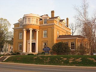
Centerville is a town in Center Township, Wayne County, in the U.S. state of Indiana. The population was 2,552 at the 2010 United States Census.

U.S. Route 27 or U.S. Highway 27 (US 27) is a north–south United States Numbered Highway in the Southern and Midwestern U.S. The southern terminus is at US 1 in Miami, Florida. The northern terminus is at Interstate 69 (I-69) in Fort Wayne, Indiana. From Miami, it goes up the center of Florida, then west to Tallahassee, Florida, and north through such cities and towns as Columbus, Georgia; Rome, Georgia; Chattanooga, Tennessee; Lexington, Kentucky; Cincinnati, Ohio; Oxford, Ohio; Richmond, Indiana; and Fort Wayne, Indiana. It once extended north through Lansing, Michigan, to Cheboygan, Mackinaw City, and, for about three years, even as far as St. Ignace. US 27 was first signed in 1926, replacing what had been the eastern route of the Dixie Highway in many states.

U.S. Route 33 (US 33) is a United States Numbered Highway that runs northwest–southeast for 709 miles (1,141 km) from northern Indiana to Richmond, Virginia, passing through Ohio and West Virginia en route. Although most odd-numbered U.S. routes are north–south, US 33 is labeled east–west throughout its route, except in Indiana where it is labeled north–south. It roughly follows a historic trail used by Native Americans from Chesapeake Bay to Lake Michigan.

U.S. Route 35 (US 35) is a United States Highway that runs southeast-northwest for approximately 412 miles (663 km) from the western suburbs of Charleston, West Virginia to northern Indiana. Although the highway is physically southeast-northwest, it is nominally north–south. The highway's southern terminus is in Teays Valley, West Virginia, near Scott Depot, at Interstate 64 (I-64). Its northern terminus is near Michigan City, Indiana, at US 20. The West Virginia portion of the highway is mostly expressway, becoming a freeway shortly before it crosses the Ohio River into Ohio. The Ohio portion has been upgraded to a four-lane highway/freeway between the West Virginia state line and Trotwood, west of Dayton.

State Road 1 (SR 1) is a north–south state highway in eastern Indiana, consisting of two segments. Its southern segment begins at U.S. Highway 50 and Interstate 275 in east-central Dearborn County, just east of Lawrenceburg, and ends at Interstate 469 south of Fort Wayne. Its northern segment begins at Interstate 69 on Fort Wayne's north side, and ends at U.S. Route 20 in east-central Steuben County, approximately 6 miles (9.7 km) east of Angola.
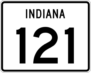
State Road 121 (SR 121) is a part of the Indiana State Road that exists in two sections. The first runs between Metamora and Connersville and the second from Richmond to the Ohio state line in US state of Indiana. The 19.52 miles (31.41 km) of SR 121 that lie within Indiana serve as a minor highway. None of the highway is listed on the National Highway System. The entire route is rural two-lane highway that passes through farmland, residential and commercial properties.

State Road 227 is a north–south highway at the eastern edge of the U.S. state of Indiana. It is nearly parallel with the Ohio state line.
Route 368 is a collector road in the Canadian province of Nova Scotia.
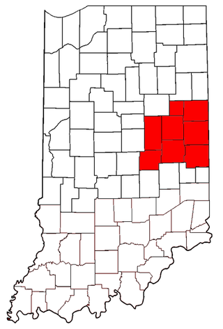
East Central Indiana is a region in Indiana east of Indianapolis, Indiana, and borders the Ohio state line. The Indiana Gas Boom, which took place during the 1890s, changed much of the area from small agricultural communities to larger cities with economies that included manufacturing. Companies such as Ball Corporation and Overhead Door once had their headquarters in the region. Glass manufacturing was the first industry to be widespread in the area, because of the natural gas. As the glass industry faded, many of the skilled workers became employed at auto parts factories in cities such as Muncie and Anderson. With the decline of the American automobile industry, East Central Indiana became part of the Rust Belt. Many communities have been forced to reinvent themselves with a focus on services or a return to agriculture.
U.S. Route 27 (US 27) is a part of the United States Numbered Highway System that runs from Miami, Florida, to Fort Wayne in the U.S. state of Indiana. In Indiana, it is a state road that enters the state in College Corner, Ohio, and West College Corner. The 117.765 miles (189.524 km) of US 27 that lie within Indiana serve as a major conduit. Most of the highway is listed on the National Highway System. Various sections are a rural two-lane highway or an urbanized four-lane divided highway. The northernmost community along the highway is Fort Wayne in the northeast part of the state. The highway ends at an interchange with Interstate 69 (I-69) north of downtown Fort Wayne after serving the east central and northeast regions of Indiana.
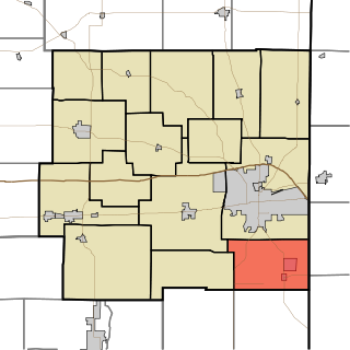
Boston Township is one of fifteen townships in Wayne County, Indiana, United States. As of the 2010 census, its population was 887 and it contained 404 housing units.

Franklin Township is one of fifteen townships in Wayne County, Indiana, United States. As of the 2010 census, its population was 1,370 and it contained 534 housing units.

Wayne Township is one of fifteen townships in Wayne County, Indiana, United States. As of the 2010 census, its population was 41,217 and it contained 19,510 housing units.
The East Main Street–Glen Miller Park Historic District is a neighborhood of historic residential buildings and national historic district located at Richmond, Wayne County, Indiana. The district encompasses 84 contributing buildings, 11 contributing structures, and 5 contributing objects along the National Road and sometimes called Millionaire's Row. A portion of the district is recognized by the City of Richmond's Historic Preservation Commission as the Linden Hill conservation district. It developed between about 1830 and 1937 and includes representative examples of Italianate, Queen Anne, Colonial Revival, Tudor Revival, Classical Revival, and Bungalow / American Craftsman style architecture. Located in the district is the separately listed Henry and Alice Gennett House. Other notable contributing resources include elaborate iron bridges and "Madonna of the Trail" statue located in Glen Miller Park, Isham Sedgwick House (1884-1885), John A. Hasecoster House (1895), William H. Campbell House (1905), Howard Campbell House (1909), E.G. Hill House, Crain Sanitarium, and Dr. T. Henry Davis House.
U.S. Route 33 (US 33) is part of the United States Numbered Highway System that runs from Richmond, Virginia, to Elkhart of the US state of Indiana. In Indiana, it is a state road that enters the state at the Ohio state line between Willshire, Ohio, and Pleasant Mills, Indiana. The 106.217 miles (170.940 km) of US 33 that lie within Indiana serve as a major conduit. All of the highway is listed on the National Highway System. Various sections are rural two-lane highway, urbanized four-lane divided expressway and the Lincoln Highway. The northernmost community along the highway is Elkhart. The highway ends at an interchange in southern Elkhart after serving the northeastern region of Indiana. US 33 passes through farm fields and urban areas.

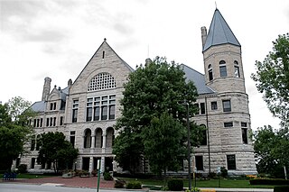
The Richmond Downtown Historic District is an area of primarily commercial buildings and national historic district located at Richmond, Wayne County, Indiana. The district encompasses 47 contributing buildings located along the National Road. It developed between about 1868 and 1960 and includes representative examples of Italianate, Romanesque Revival, Queen Anne, Classical Revival, and Chicago School style architecture. Located in the district is the separately listed Murray Theater. Other notable buildings include the I.O.O.F. Building (1868), Hittle Building (1878), Tivoli Theater (1926), Romey's Building (1920), George H. Knollenberg Building (1877), Kresge Building, Dickinson Building (1880), former U.S. Post Office (1905), and YMCA (1908).


