Switzerland County, Indiana

Last updated

Switzerland County
Switzerland County Courthouse, Vevay, IN (48458045947).jpg
Switzerland County Courthouse in Vevay
Map of Indiana highlighting Switzerland County.svg
Location within the U.S. state of Indiana
Indiana in United States.svg
Indiana's location within the U.S.
Coordinates: 38°49′N85°02′W / 38.82°N 85.03°W / 38.82; -85.03
CountryFlag of the United States.svg United States
StateFlag of Indiana.svg  Indiana
Founded1814
Named for Switzerland
Seat Vevay
Largest townVevay
Area
  Total223.44 sq mi (578.7 km2)
  Land220.63 sq mi (571.4 km2)
  Water2.81 sq mi (7.3 km2)  1.26%
Population
 (2020)
  Total9,737
  Estimate 
(2023)
10,019 Increase2.svg
  Density44/sq mi (17/km2)
Time zone UTC−5 (Eastern)
  Summer (DST) UTC−4 (EDT)
Congressional district 9th
Website www.switzerland-county.com
Indiana county number 78

Switzerland County is a county in the southeast corner of the U.S. state of Indiana. As of the 2020 United States Census, the population was 9,737. [1] The county seat is Vevay, [2] one of two incorporated towns in the county.

Contents

History

In 1787, the fledgling United States defined the Northwest Territory, which included the area of present-day Indiana. In 1800, Congress separated Ohio from the Northwest Territory, designating the rest of the land as the Indiana Territory. [3] President Thomas Jefferson chose William Henry Harrison as the territory's first governor, and Vincennes was established as the territorial capital. [4] After the Michigan Territory was separated and the Illinois Territory was formed, Indiana was reduced to its current size and geography. [3] By December 1816 the Indiana Territory was admitted to the Union as a state.

Starting in 1794, Native American titles to Indiana lands were extinguished by usurpation, purchase, or war and treaty. The United States acquired land from the Native Americans in the 1809 treaty of Fort Wayne, and by the treaty of St. Mary's in 1818, the SE portion of Indiana Territory was acquired for settlement.

The area included in present-day Switzerland County was first placed in Knox County, formed in 1790. Parts of that extremely large county were partitioned off in 1803 to form Dearborn County and in 1810 to form Jefferson County. Settlers had been pouring into the extreme SE part of the Indiana Territory starting in 1795, and by 1814 there was sufficient population to form a local governing body. Accordingly, the state legislature authorized Switzerland County effective October 1, 1814, partitioning portions of Dearborn and Jefferson counties to make the creation. Four fledgling settlements were considered as the seat of government (Vevay, Little York [present-day Florence], Troy [present-day Patriot], and Center Square). [5] Center Square was nearest the geographic center and was the presumed site, but Vevay carried the day.

Several early settlers were originally from Switzerland. The first was probably Heathcoat Pickett, in 1795. He was followed by John James Dufour (1796), and the Dickason, Cotton, and Rayl families in 1798. Pickett also made the area's first flatboats; he floated them (loaded with goods for sale) to New Orleans and sold the entire package, then walked back to Switzerland County. He made 20 such trips. [5] Early county residents noted the passage of the first steamboat on the Ohio River in 1811; this form of transport quickly transformed the river into a conduit for commerce and travel. [5] Although Indiana was criss-crossed with railroad tracks during the nineteenth century, none was laid to Switzerland County. This hindered its growth after the decline of steamboat travel. [6] [7]

Industrial wine grape production in Switzerland County earned the area the title "The Rhineland of America". [8]

Geography

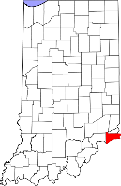
Switzerland County lies at the SE tip of Indiana, with its southeastern border defined by the Ohio River; the state of Kentucky abuts on the opposite shore. Its rolling hills were originally completely wooded. Its more flat areas have been cleared for agricultural or urban use, but its many drainages are still wooded. [9] Its highest elevation (981 feet/299 meters ASL) is a hill in its NW quadrant, 0.7 miles (1.1 km) west of Avonburg. [10]

According to the 2010 census, the county has a total area of 223.44 square miles (578.7 km2), of which 220.63 square miles (571.4 km2) (or 98.74%) is land and 2.81 square miles (7.3 km2) (or 1.26%) is water. [11]

Adjacent counties

Incorporated towns

Unincorporated towns

Townships

Highways

Climate and weather

Vevay, Indiana
Climate chart (explanation)
J
F
M
A
M
J
J
A
S
O
N
D
 
 
3.2
 
 
40
23
 
 
3
 
 
46
26
 
 
4.1
 
 
56
35
 
 
4.2
 
 
67
43
 
 
4.7
 
 
77
53
 
 
4.6
 
 
85
62
 
 
3.9
 
 
88
67
 
 
4
 
 
86
65
 
 
3.1
 
 
80
58
 
 
3.1
 
 
68
46
 
 
3.7
 
 
55
37
 
 
3.7
 
 
44
28
Average max. and min. temperatures in °F
Precipitation totals in inches
Source: The Weather Channel [12]
Metric conversion
J
F
M
A
M
J
J
A
S
O
N
D
 
 
81
 
 
4
−5
 
 
76
 
 
8
−3
 
 
103
 
 
13
2
 
 
107
 
 
19
6
 
 
120
 
 
25
12
 
 
116
 
 
29
17
 
 
98
 
 
31
19
 
 
102
 
 
30
18
 
 
79
 
 
27
14
 
 
78
 
 
20
8
 
 
93
 
 
13
3
 
 
94
 
 
7
−2
Average max. and min. temperatures in °C
Precipitation totals in mm

In recent years, average temperatures in Vevay have ranged from a low of 23 °F (−5 °C) in January to a high of 88 °F (31 °C) in July, although a record low of −24 °F (−31 °C) was recorded in January 1977 and a record high of 106 °F (41 °C) was recorded in July 1999. Average monthly precipitation ranged from 3.00 inches (76 mm) in February to 4.72 inches (120 mm) in May. [12]

Government

The county government is a constitutional body, and is granted specific powers by the Constitution of Indiana, and by the Indiana Code.

County Council: The legislative branch of the county government; controls spending and revenue collection in the county. Representatives are elected to four-year terms from county districts. They set salaries, the annual budget, and special spending. The council has limited authority to impose local taxes, in the form of an income and property tax that is subject to state level approval, excise taxes, and service taxes. [13] [14]

Board of Commissioners: The executive body of the county; commissioners are elected county-wide to staggered four-year terms. One commissioner serves as president. The commissioners execute acts legislated by the council, collect revenue, and manage the county government. [13] [14]

Court: The county maintains a circuit court which was established January 1, 2009. The first Judge of the Switzerland Circuit Court is W. Gregory Coy. The Judge is elected to a term of six years. The Court is a general jurisdiction court, meaning it handles all types of cases. The Judge must be a licensed attorney. All decisions of the Court are appealable to the Indiana Court of Appeals or the Indiana Supreme Court.

County Officials: The county has other elected offices, including sheriff, coroner, auditor, treasurer, recorder, surveyor, and circuit court clerk. They are elected to four-year terms. Members elected to county government positions are required to declare party affiliations and to be residents of the county. [14]

Switzerland County is part of Indiana's 6th congressional district. [15]

United States presidential election results for Switzerland County, Indiana [16]
Year Republican Democratic Third party(ies)
No.%No.%No.%
2020 3,13375.33%96423.18%621.49%
2016 2,55868.97%93025.07%2215.96%
2012 1,87255.11%1,43742.30%882.59%
2008 1,94053.30%1,63845.00%621.70%
2004 2,16158.87%1,47940.29%310.84%
2000 1,83156.53%1,33641.25%722.22%
1996 1,26639.72%1,49646.94%42513.34%
1992 1,21135.74%1,53545.31%64218.95%
1988 1,57251.39%1,47948.35%80.26%
1984 1,85755.48%1,48444.34%60.18%
1980 1,58447.14%1,70450.71%722.14%
1976 1,32938.07%2,15061.59%120.34%
1972 1,87253.53%1,61246.10%130.37%
1968 1,51544.07%1,46642.64%45713.29%
1964 1,39038.19%2,23161.29%190.52%
1960 1,92949.40%1,95550.06%210.54%
1956 2,07449.28%2,11450.23%210.50%
1952 2,07048.42%2,16750.69%380.89%
1948 1,83943.30%2,37555.92%330.78%
1944 2,01947.32%2,19151.35%571.34%
1940 2,28546.01%2,65953.54%220.44%
1936 2,21243.66%2,84056.06%140.28%
1932 1,95338.79%2,98159.21%1012.01%
1928 2,61758.62%1,80540.43%420.94%
1924 2,34648.29%2,41449.69%982.02%
1920 2,52550.12%2,41247.88%1012.00%
1916 1,21444.05%1,44652.47%963.48%
1912 88232.81%1,34249.93%46417.26%
1908 1,44447.27%1,53750.31%742.42%
1904 1,46147.48%1,55450.50%622.01%
1900 1,63148.50%1,71350.94%190.56%
1896 1,63748.27%1,74251.37%120.35%
1892 1,49747.42%1,58950.33%712.25%
1888 1,56047.87%1,63750.23%621.90%

Demographics

Historical population
CensusPop.Note
1820 3,934
1830 7,02878.6%
1840 9,92041.1%
1850 12,93230.4%
1860 12,698−1.8%
1870 12,134−4.4%
1880 13,3369.9%
1890 12,514−6.2%
1900 11,840−5.4%
1910 9,914−16.3%
1920 9,311−6.1%
1930 8,432−9.4%
1940 8,167−3.1%
1950 7,599−7.0%
1960 7,092−6.7%
1970 6,306−11.1%
1980 7,15313.4%
1990 7,7388.2%
2000 9,06517.1%
2010 10,61317.1%
2020 9,737−8.3%
2023 (est.)10,019 [17] 2.9%
US Decennial Census [18]
1790-1960 [19] 1900-1990 [20]
1990-2000 [21] 2010-2013 [1]

2010 census

As of the 2010 United States Census, there were 10,613 people, 4,034 households, and 2,847 families in the county. [22] The population density was 48.1 inhabitants per square mile (18.6/km2). There were 4,969 housing units at an average density of 22.5 per square mile (8.7/km2). [11] The racial makeup of the county was 97.8% white, 0.3% black or African American, 0.2% Asian, 0.2% American Indian, 0.7% from other races, and 0.8% from two or more races. Those of Hispanic or Latino origin made up 1.4% of the population. [22] In terms of ancestry, 25.4% were German, 16.1% were American, 13.2% were Irish, and 10.1% were English. [23]

Of the 4,034 households, 33.5% had children under the age of 18 living with them, 54.2% were married couples living together, 10.0% had a female householder with no husband present, 29.4% were non-families, and 24.3% of all households were made up of individuals. The average household size was 2.60 and the average family size was 3.07. The median age was 39.1 years. [22]

The median income for a household in the county was $47,697 and the median income for a family was $51,769. Males had a median income of $39,167 versus $30,814 for females. The per capita income for the county was $21,214. About 11.0% of families and 14.4% of the population were below the poverty line, including 19.2% of those under age 18 and 7.5% of those age 65 or over. [24]

See also

Related Research Articles

<span class="mw-page-title-main">Whitley County, Indiana</span> County in Indiana, United States

Whitley County is a rural county in the U.S. state of Indiana. As of the 2020 United States census, the population was 36,825. Whitley County is the 49th largest county in Indiana. The county seat is Columbia City. The county has the highest county number (92) on Indiana license plates, as it is alphabetically the last in the state's list of counties. It is part of the Fort Wayne Metropolitan Statistical Area and the Fort Wayne–Huntington–Auburn Combined Statistical Area.

<span class="mw-page-title-main">Shelby County, Indiana</span> County in Indiana, United States

Shelby County is a county in the U.S. state of Indiana. As of the 2020 United States Census, the population was 45,055. The county seat is Shelbyville.

<span class="mw-page-title-main">Ripley County, Indiana</span> County in Indiana, United States

Ripley County is a county located at the southeastern corner of the U.S. state of Indiana. According to the 2020 Census, the population was 28,995. The county seat is Versailles.

<span class="mw-page-title-main">Pike County, Indiana</span> County in Indiana, United States

Pike County is a county in the southwest portion of the U.S. state of Indiana. As of the 2020 United States census, the population was 12,250. The county seat is Petersburg. It contains the geographic point representing median center of US population in 2010.

<span class="mw-page-title-main">Owen County, Indiana</span> County in Indiana, United States

Owen County is a county in the U.S. state of Indiana. In 1920 the United States Census Bureau calculated the mean center of U.S. population to fall within this county. As of the 2020 United States Census, it had a population of 21,321. Its county seat is Spencer.

<span class="mw-page-title-main">Ohio County, Indiana</span> County in Indiana, United States

Ohio County is a county located in southeastern Indiana. With a 2020 population of 5,940, and an area of just 87 square miles, Ohio County is the smallest county in Indiana by area and the least populous. The county seat and only incorporated municipality is Rising Sun. The county was officially established in 1844 and was one of the last Indiana counties to be created. Ohio County borders the state of Kentucky across the Ohio River for which it was named. It is part of the Cincinnati, OH-KY-IN Metropolitan Statistical Area. The county is divided into four townships which provide local services. Three state roads pass through or into the county.

<span class="mw-page-title-main">Miami County, Indiana</span> County in Indiana, United States

Miami County is a county located in the U.S. state of Indiana. As of 2020, the population was 35,962. The county seat is the City of Peru. Miami County is part of the Kokomo-Peru CSA.

<span class="mw-page-title-main">Madison County, Indiana</span> County in Indiana, United States

Madison County is a county in the U.S. state of Indiana. The 2020 census states the population is standing at 130,129. The county seat since 1836 has been Anderson, one of three incorporated cities within the county.

<span class="mw-page-title-main">Knox County, Indiana</span> County in Indiana, United States

Knox County is a county in the U.S. state of Indiana in the United States. The oldest county in Indiana, it was one of two original counties created in the Northwest Territory in 1790, alongside St. Clair County, Illinois. Knox County was gradually reduced in size as subsequent counties were established. It was established in its present configuration when Daviess County was partitioned off. At the 2020 United States Census, the county population was 36,282. The county seat is Vincennes.

<span class="mw-page-title-main">Jefferson County, Indiana</span> County in Indiana, United States

Jefferson County is a county located in the U.S. state of Indiana. As of 2020, the population was 33,147. The county seat is Madison.

<span class="mw-page-title-main">Hendricks County, Indiana</span> County in Indiana, United States

Hendricks County is a county in the U.S. state of Indiana. As of the 2020 United States Census, the population was 174,788. The county seat is the town of Danville.

<span class="mw-page-title-main">Greene County, Indiana</span> County in Indiana, United States

Greene County is a county in the U.S. state of Indiana. As of 2020, the population was 30,803. The county seat is Bloomfield. The county was determined by the US Census Bureau to include the mean center of U.S. population in 1930.

<span class="mw-page-title-main">Decatur County, Indiana</span> County in Indiana, United States

Decatur County is a county in the U.S. state of Indiana. As of the 2020 United States Census, the population was 26,472. The county seat is Greensburg.

<span class="mw-page-title-main">Dearborn County, Indiana</span> County in Indiana, United States

Dearborn County is one of 92 counties of the U.S. state of Indiana. Located on the Ohio border near the southeast corner of the state, Dearborn County was formed in 1803 from a portion of Hamilton County, Ohio. In 2020, the population was 50,679. The county seat and largest city is Lawrenceburg. Dearborn County is part of the Cincinnati, OH-KY-IN Metropolitan Statistical Area.

<span class="mw-page-title-main">Daviess County, Indiana</span> County in Indiana, United States

Daviess County is a county in the U.S. state of Indiana. As of the 2020 United States Census, the population was 33,381. The county seat is Washington. About 15% of the county's population is Amish of Swiss origin, as of 2017.

<span class="mw-page-title-main">Carroll County, Indiana</span> County in Indiana, United States

Carroll County is a county located in the U.S. state of Indiana. As of the 2020 United States Census, the population was 20,306. The county seat is Delphi.

<span class="mw-page-title-main">Boone County, Indiana</span> County in Indiana, United States

Boone County is a county in the U.S. state of Indiana. As of 2020, the population was 70,812. The county seat is Lebanon.

<span class="mw-page-title-main">Vevay, Indiana</span> Town in Indiana, United States

Vevay is a town located in Jefferson Township and the county seat of Switzerland County, Indiana, United States, along the Ohio River. The population was 1,741 at the 2020 census.

<span class="mw-page-title-main">Vevay Township, Michigan</span> Civil township in Michigan, United States

Vevay Township is a civil township of Ingham County in the U.S. state of Michigan. The population was 3,606 at the 2020 census. The township is part of the Lansing–East Lansing metropolitan area and mostly surrounds the city of Mason, but the two are administered autonomously.

<span class="mw-page-title-main">Scott County, Indiana</span> County in Indiana, United States

Scott County is a county located in the U.S. state of Indiana. As of 2020, the population was 24,384. The county seat is Scottsburg.

References

  1. 1 2 "Switzerland County QuickFacts". US Census Bureau. Retrieved September 25, 2021.
  2. "Find a County". National Association of Counties. Retrieved June 7, 2021.
  3. 1 2 "Government at Crossroads: An Indiana chronology". The Herald Bulletin . January 5, 2008. Retrieved July 22, 2009.
  4. Brill, Marlene Targ (2005). Indiana. Marshall Cavendish. p. 35. ISBN   978-0-7614-2020-0.
  5. 1 2 3 "Brief History of Switzerland County, In". INGenWeb Project. 1913. Retrieved September 13, 2020.
  6. Soil Survey of Switzerland County, Indiana. US Dept. of Agriculture. 1987. p. 1.
  7. "History of Settlement". Vevay Bicentennial. Archived from the original on July 23, 2014. Retrieved June 5, 2014.
  8. Wissing, Douglas (March 1, 2001). Indiana. Globe Pequot. p. 15. Retrieved October 16, 2013.
  9. Switzerland County IN (Google Maps, accessed 13 September 2020)
  10. Switzerland County High Point, Indiana (PeakBagger.com, accessed 13 September 2020)
  11. 1 2 "Population, Housing Units, Area, and Density: 2010 - County". US Census Bureau. Archived from the original on February 12, 2020. Retrieved July 10, 2015.
  12. 1 2 "Monthly Averages for Vevay IN". The Weather Channel. Retrieved January 27, 2011.
  13. 1 2 Indiana Code. "Title 36, Article 2, Section 3". IN.gov. Retrieved September 16, 2008.
  14. 1 2 3 Indiana Code. "Title 2, Article 10, Section 2" (PDF). IN.gov. Archived (PDF) from the original on December 27, 2004. Retrieved September 16, 2008.
  15. "Congressman Baron Hill". House.Gov. Archived from the original on March 20, 2010. Retrieved September 12, 2008.
  16. Leip, David. "Atlas of US Presidential Elections". uselectionatlas.org. Retrieved May 20, 2018.
  17. "Annual Estimates of the Resident Population for Counties: April 1, 2020 to July 1, 2023". United States Census Bureau. Retrieved April 2, 2024.
  18. "US Decennial Census". US Census Bureau. Retrieved July 10, 2014.
  19. "Historical Census Browser". University of Virginia Library. Retrieved July 10, 2014.
  20. "Population of Counties by Decennial Census: 1900 to 1990". US Census Bureau. Retrieved July 10, 2014.
  21. "Census 2000 PHC-T-4. Ranking Tables for Counties: 1990 and 2000" (PDF). US Census Bureau. Archived (PDF) from the original on March 27, 2010. Retrieved July 10, 2014.
  22. 1 2 3 "Profile of General Population and Housing Characteristics: 2010 Demographic Profile Data". US Census Bureau. Archived from the original on February 13, 2020. Retrieved July 10, 2015.
  23. "Selected Social Characteristics in the US – 2006-2010 American Community Survey 5-Year Estimates". US Census Bureau. Archived from the original on February 14, 2020. Retrieved July 10, 2015.
  24. "Selected Economic Characteristics – 2006-2010 American Community Survey 5-Year Estimates". US Census Bureau. Archived from the original on February 14, 2020. Retrieved July 10, 2015.

38°49′N85°02′W / 38.82°N 85.03°W / 38.82; -85.03