Craig Township | |
|---|---|
 The Venoge Farmhouse, a historic site in the township | |
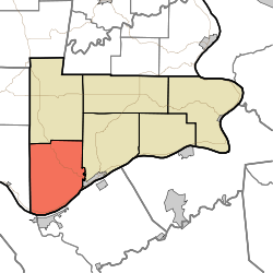 Location in Switzerland County | |
| Coordinates: 38°44′48″N85°08′53″W / 38.74667°N 85.14806°W | |
| Country | |
| State | |
| County | Switzerland |
| Government | |
| • Type | Indiana township |
| Area | |
• Total | 39.56 sq mi (102.5 km2) |
| • Land | 39.26 sq mi (101.7 km2) |
| • Water | 0.3 sq mi (0.8 km2) 0.76% |
| Elevation | 574 ft (175 m) |
| Population (2020) | |
• Total | 766 |
| • Density | 19/sq mi (7.5/km2) |
| ZIP codes | 47011, 47043, 47250 |
| GNIS feature ID | 453249 |
Craig Township is one of six townships in Switzerland County, Indiana, United States. As of the 2020 census, its population was 766 and it contained 393 housing units. [1]
Contents
- History
- Geography
- Unincorporated towns
- Adjacent townships
- Cemeteries
- Major highways
- Airports and landing strips
- School districts
- Political districts
- References
- External links
| Census | Pop. | Note | %± |
|---|---|---|---|
| 1890 | 1,980 | — | |
| 1900 | 1,931 | −2.5% | |
| 1910 | 1,466 | −24.1% | |
| 1920 | 1,475 | 0.6% | |
| 1930 | 1,340 | −9.2% | |
| 1940 | 1,187 | −11.4% | |
| 1950 | 1,017 | −14.3% | |
| 1960 | 831 | −18.3% | |
| 1970 | 709 | −14.7% | |
| 1980 | 761 | 7.3% | |
| 1990 | 695 | −8.7% | |
| 2000 | 777 | 11.8% | |
| 2010 | 900 | 15.8% | |
| 2020 | 766 | −14.9% | |
| Source: US Decennial Census [2] | |||
