"}},"i":0}},"\n",{"template":{"target":{"wt":"INint","href":"./Template:INint"},"params":{"1":{"wt":"exit\n"},"county":{"wt":"Newton"},"cspan":{"wt":"5"},"location":{"wt":"Jefferson Township"},"lspan":{"wt":"2"},"ctdab":{"wt":"Newton"},"mile":{"wt":"0.000"},"espan":{"wt":"12"},"road":{"wt":"{{Jct|state=IL|US|24|US|52|dir1=west|dir2=west|city1=Sheldon|city2=Watseka}}"},"notes":{"wt":"Continuation into Illinois"}},"i":1}},"\n",{"template":{"target":{"wt":"INint\n","href":"./Template:INint"},"params":{"mile":{"wt":"1.815"},"road":{"wt":"{{Jct|state=IN|SR|71|dir1=south|city1=Raub}}"},"notes":{"wt":"Northern terminus of SR 71"}},"i":2}},"\n",{"template":{"target":{"wt":"INint\n","href":"./Template:INint"},"params":{"location":{"wt":"Kentland"},"type":{"wt":"concur"},"mile":{"wt":"4.616"},"road":{"wt":"{{Jct|state=IN|US|41|US|52|dir2=east|city1=Terre Haute|city2=Lafayette|city3=Hammond}}"},"notes":{"wt":"Eastern end of US 52 concurrency"}},"i":3}},"\n",{"template":{"target":{"wt":"INint\n","href":"./Template:INint"},"params":{"location":{"wt":"Goodland"},"lspan":{"wt":"2"},"mile":{"wt":"10.566"},"type":{"wt":"concur"},"road":{"wt":"{{Jct|state=IN|SR|55|dir1=south|city1=Fowler}}"},"notes":{"wt":"Western end of SR 55 concurrency"}},"i":4}},"\n",{"template":{"target":{"wt":"INint\n","href":"./Template:INint"},"params":{"type":{"wt":"concur"},"mile":{"wt":"11.065"},"road":{"wt":"{{Jct|state=IN|SR|55|dir1=north|city1=Crown Point}}"},"notes":{"wt":"Eastern end of SR 55 concurrecny"}},"i":5}},"\n",{"template":{"target":{"wt":"INint\n","href":"./Template:INint"},"params":{"county":{"wt":"Jasper"},"cspan":{"wt":"2"},"location":{"wt":"Remington"},"lspan":{"wt":"2"},"type":{"wt":"concur"},"mile":{"wt":"19.537"},"road":{"wt":"{{Jct|state=IN|US|231|dir1=north|city1=Rensselaer}}"},"notes":{"wt":"Western end of US 231 concurrency"}},"i":6}},"\n",{"template":{"target":{"wt":"INint\n","href":"./Template:INint"},"params":{"mile":{"wt":"21.236"},"mile2":{"wt":"21.405"},"road":{"wt":"{{Jct|state=IN|I|65|city1=Indianapolis|city2=Gary}}, [[Chicago, Illinois|Chicago]]"}},"i":7}},"\n",{"template":{"target":{"wt":"INint\n","href":"./Template:INint"},"params":{"county":{"wt":"White"},"cspan":{"wt":"4"},"location":{"wt":"Wolcott"},"type":{"wt":"concur"},"mile":{"wt":"26.270"},"road":{"wt":"{{Jct|state=IN|US|231|dir1=south|city1=Lafayette}}"},"notes":{"wt":"Eastern end of US 231 concurrency"}},"i":8}},"\n",{"template":{"target":{"wt":"INint\n","href":"./Template:INint"},"params":{"location":{"wt":"Reynolds"},"type":{"wt":"concur"},"mile":{"wt":"35.098"},"road":{"wt":"{{Jct|state=IN|US|421|SR|43|dir1=north|dir2=south|city1=Michigan City|city2=Lafayette}}"},"notes":{"wt":"Western end of US 421 concurrency; northern terminus of SR 43"}},"i":9}},"\n",{"template":{"target":{"wt":"INint\n","href":"./Template:INint"},"params":{"location":{"wt":"Monticello"},"type":{"wt":"concur"},"mile":{"wt":"41.012"},"road":{"wt":"{{Jct|state=IN|US|421|SR|39|dir1=south|dir2=south|city1=Delphi|city2=Frankfort|city3=Indianapolis}}"},"notes":{"wt":"Eastern end of US 421 concurrency; western end of SR 39 concurrency"}},"i":10}},"\n",{"template":{"target":{"wt":"INint\n","href":"./Template:INint"},"params":{"location":{"wt":"Union Township"},"ctdab":{"wt":"White"},"type":{"wt":"concur"},"mile":{"wt":"42.276"},"road":{"wt":"{{Jct|state=IN|SR|39|dir1=north|city1=Buffalo}}"},"notes":{"wt":"Eastern end of SR 39 concurrency"}},"i":11}},"\n",{"template":{"target":{"wt":"INint\n","href":"./Template:INint"},"params":{"county":{"wt":"Cass"},"cspan":{"wt":"6"},"location":{"wt":"Logansport"},"lspan":{"wt":"5"},"type":{"wt":"concur"},"mile":{"wt":"60.840"},"road":{"wt":"{{Jct|state=IN|US|35|dir1=north|city1=La Porte|city2=Logansport|US-Bus|24|dir2=east}}"},"notes":{"wt":"Western end of US 35 concurrency; western end of Bus. US 24"}},"i":12}},"\n",{"template":{"target":{"wt":"INint","href":"./Template:INint"},"params":{"1":{"wt":"exit\n"},"mile":{"wt":"62.182"},"exit":{"wt":"—"},"road":{"wt":"Old State Road 25"},"notes":{"wt":"Interchange"}},"i":13}},"\n",{"template":{"target":{"wt":"INint","href":"./Template:INint"},"params":{"1":{"wt":"exit\n"},"mile":{"wt":"62.982"},"road":{"wt":"{{Jct|state=IN|SR|25|IN|29|dir1=south|dir2=south|city1=Lafayette|city2=Delphi}}"},"type":{"wt":"concur"},"notes":{"wt":"[[Split diamond interchange]], together with interchange for SR 25 north; western end of SR 25 concurrency; northern terminus of SR 29"}},"i":14}},"\n",{"template":{"target":{"wt":"INint","href":"./Template:INint"},"params":{"1":{"wt":"exit\n"},"exit":{"wt":"—"},"mile":{"wt":"63.257"},"type":{"wt":"concur"},"road":{"wt":"{{Jct|state=IN|IN|25|SR|329|dir1=north|dir2=south}}"},"notes":{"wt":"Split diamond interchange, together with interchange for SR 25 south; eastern end of SR 25 concurrency; northern terminus of SR 329"}},"i":15}},"\n",{"template":{"target":{"wt":"INint","href":"./Template:INint"},"params":{"1":{"wt":"exit\n"},"type":{"wt":"concur"},"mile":{"wt":"67.171"},"road":{"wt":"{{Jct|state=IN|US|35|dir1=south|city1=Kokomo}}"},"notes":{"wt":"Eastern end of US 35 concurrency"}},"i":16}},"\n",{"template":{"target":{"wt":"INint","href":"./Template:INint"},"params":{"1":{"wt":"exit\n"},"township":{"wt":"Miami"},"ctdab":{"wt":"Cass"},"mile":{"wt":"74.444"},"road":{"wt":"{{Jct|state=IN|US-Bus|24|dir1=west|road|Logansport Road}}"},"notes":{"wt":"Eastern end of Bus. US 24"}},"i":17}},"\n",{"template":{"target":{"wt":"INint","href":"./Template:INint"},"params":{"1":{"wt":"exit\n"},"county":{"wt":"Miami"},"cspan":{"wt":"2"},"location":{"wt":"Peru Township"},"ctdab":{"wt":"Miami"},"mile":{"wt":"77.451"},"exit":{"wt":"—"},"road":{"wt":"{{Jct|state=IN|US|31|city1=Indianapolis|city2=Kokomo|city3=Plymouth|city4=South Bend}}"}},"i":18}},"\n",{"template":{"target":{"wt":"INint","href":"./Template:INint"},"params":{"1":{"wt":"exit\n"},"location":{"wt":"Peru"},"mile":{"wt":"81.218"},"espan":{"wt":"9"},"road":{"wt":"{{Jct|state=IN|SR|19|city1=Converse|city2=Akron}}"}},"i":19}},"\n",{"template":{"target":{"wt":"INint\n","href":"./Template:INint"},"params":{"county":{"wt":"Wabash"},"cspan":{"wt":"4"},"location":{"wt":"Noble Township"},"ctdab":{"wt":"Wabash"},"mile":{"wt":"92.028"},"road":{"wt":"{{Jct|state=IN|SR|115|dir1=north}}"},"notes":{"wt":"Southern terminus of SR 115"}},"i":20}},"\n",{"template":{"target":{"wt":"INint\n","href":"./Template:INint"},"params":{"location":{"wt":"Wabash"},"lspan":{"wt":"2"},"mile":{"wt":"94.018"},"road":{"wt":"{{Jct|state=IN|SR|15|city1=Marion|city2=Wabash|city3=Warsaw}}"}},"i":21}},"\n",{"template":{"target":{"wt":"INint\n","href":"./Template:INint"},"params":{"mile":{"wt":"96.464"},"road":{"wt":"{{Jct|state=IN|SR|13|city1=Noblesville|city2=Wabash|city3=North Manchester}}"}},"i":22}},"\n",{"template":{"target":{"wt":"INint\n","href":"./Template:INint"},"params":{"location":{"wt":"Lagro"},"mile":{"wt":"98.553"},"road":{"wt":"{{Jct|state=IN|SR|524|dir1=south|city1=Lagro}}"},"notes":{"wt":"Western terminus of SR 524"}},"i":23}},"\n",{"template":{"target":{"wt":"INint\n","href":"./Template:INint"},"params":{"county":{"wt":"Huntington"},"cspan":{"wt":"6"},"location":{"wt":"Dallas Township"},"ctdab":{"wt":"Huntington"},"type":{"wt":"concur"},"mile":{"wt":"106.531"},"road":{"wt":"{{Jct|state=IN|SR|105|dir1=north|city1=South Whitley}}"},"notes":{"wt":"Western end of SR 105 concurrency"}},"i":24}},"\n",{"template":{"target":{"wt":"INint\n","href":"./Template:INint"},"params":{"location":{"wt":"Andrews"},"type":{"wt":"concur"},"mile":{"wt":"107.659"},"road":{"wt":"{{Jct|state=IN|SR|105|dir1=south|city1=Banquo}}"},"notes":{"wt":"Eastern end of SR 105 concurrency"}},"i":25}},"\n",{"template":{"target":{"wt":"INint\n","href":"./Template:INint"},"params":{"location":{"wt":"Huntington"},"lspan":{"wt":"2"},"type":{"wt":"concur"},"mile":{"wt":"111.700"},"road":{"wt":"{{Jct|state=IN|SR|9|dir1=south|city1=Marion|city2=Anderson}}"},"notes":{"wt":"Southern end of SR 9 concurrency"}},"i":26}},"\n",{"template":{"target":{"wt":"INint\n","href":"./Template:INint"},"params":{"mile":{"wt":"113.525"},"road":{"wt":"{{Jct|state=IN|US|224|SR|5|dir1=east|city1=Huntington|city2=Decatur|city3=Warren}}"},"notes":{"wt":"Western terminus of US 224"}},"i":27}},"\n",{"template":{"target":{"wt":"INint","href":"./Template:INint"},"params":{"1":{"wt":"exit\n"},"township":{"wt":"Huntington"},"ctdab":{"wt":"Huntington"},"lspan":{"wt":"2"},"type":{"wt":"concur"},"mile":{"wt":"115.239"},"exit":{"wt":"—"},"road":{"wt":"{{Jct|state=IN|SR|9|dir1=north|city1=Columbia City}}"},"notes":{"wt":"Northern end of SR 9 concurrency"}},"i":28}},"\n",{"template":{"target":{"wt":"INint","href":"./Template:INint"},"params":{"1":{"wt":"exit\n"},"mile":{"wt":"116.424"},"exit":{"wt":"—"},"road":{"wt":"Old US 24"},"notes":{"wt":"Westbound exit and eastbound entrance"},"type":{"wt":"incomplete"}},"i":29}}," \n",{"template":{"target":{"wt":"INint","href":"./Template:INint"},"params":{"1":{"wt":"exit\n"},"county1":{"wt":"Huntington"},"county2":{"wt":"Whitley"},"township1":{"wt":"Jackson"},"ctdab1":{"wt":"Huntington"},"township2":{"wt":"Jefferson"},"ctdab2":{"wt":"Whitley"},"mile":{"wt":"126.817"},"espan":{"wt":"2"},"road":{"wt":"{{Jct|state=IN|SR|114|dir1=west|city1=North Manchester}}"},"notes":{"wt":"Eastern terminus of SR 114"}},"i":30}},"\n",{"template":{"target":{"wt":"INint\n","href":"./Template:INint"},"params":{"county":{"wt":"Allen"},"cspan":{"wt":"13"},"location":{"wt":"Fort Wayne"},"lspan":{"wt":"6"},"mile":{"wt":"131.151"},"mile2":{"wt":"132.316"},"road":{"wt":"{{Jct|state=IN|I|69|dir1=south|US|33|dir2=south|road|Jefferson Boulevard|city1=Indianapolis|location2=[[Fort Wayne International Airport]]}}"},"type":{"wt":"concur"},"notes":{"wt":"Western end of I-69 / US 33 concurrency"}},"i":31}},"\n",{"template":{"target":{"wt":"INint","href":"./Template:INint"},"params":{"1":{"wt":"exit\n"},"mile":{"wt":"135.553"},"exit":{"wt":"305"},"road":{"wt":"{{jct|state=IN|SR|14|dir1=west|road|Illinois Road}}"},"notes":{"wt":"Signed as exits 305A (east) and 305B (west)"}},"i":32}},"\n",{"template":{"target":{"wt":"INint","href":"./Template:INint"},"params":{"1":{"wt":"exit\n"},"mile":{"wt":"139.509"},"exit":{"wt":"309"},"road":{"wt":"{{jct|state=IN|US|30|dir1=west|US|33|dir2=north}}
{{Jct|state=IN|SR|930|dir1=east|road|Goshen Road}}"},"notes":{"wt":"Eastern end of US 33 concurrency; western end of US 30 concurrency; signed as exits 309A (east) and 309B (west / north); western end of SR 930"},"type":{"wt":"concur"}},"i":33}},"\n",{"template":{"target":{"wt":"INint","href":"./Template:INint"},"params":{"1":{"wt":"exit\n"},"mile":{"wt":"141.290"},"exit":{"wt":"311"},"road":{"wt":"{{jct|state=IN|US|27|dir1=south|SR|3|dir2=north|name2=Lima Road}}"},"notes":{"wt":"Signed as exits 311A (south) and 311B (north); northern terminus of US 27; southern terminus of the northern section of SR 3"}},"i":34}},"\n",{"template":{"target":{"wt":"INint","href":"./Template:INint"},"params":{"1":{"wt":"exit\n"},"mile":{"wt":"142.592"},"exit":{"wt":"312"},"road":{"wt":"Coldwater Road"},"notes":{"wt":"Signed as exits 312A (south) and 312B (north)"}},"i":35}},"\n",{"template":{"target":{"wt":"INint","href":"./Template:INint"},"params":{"1":{"wt":"exit\n"},"type":{"wt":"concur"},"mile":{"wt":"145.335"},"exit":{"wt":"315
31"},"road":{"wt":"{{jct|state=IN|I|69|dir1=north|location1=[[Lansing, MI]]}}
{{Jct|state=IN|I|469|dir1=east}}
Auburn Road"},"notes":{"wt":"Eastern end of I-69 concurrency; west end of I-469 concurrency; westbound exit only to Auburn Road; exit 315 on I-69 and exit 31 on I-469"}},"i":36}},"\n",{"template":{"target":{"wt":"INint","href":"./Template:INint"},"params":{"1":{"wt":"exit\n"},"exit":{"wt":"29"},"location":{"wt":"St. Joseph Township"},"ctdab":{"wt":"Allen"},"mile":{"wt":"147.590"},"road":{"wt":"Maplecrest Road"},"notes":{"wt":"Signed as exits 29A (north) and 29B (south) eastbound"}},"i":37}},"\n",{"template":{"target":{"wt":"INint","href":"./Template:INint"},"params":{"1":{"wt":"exit\n"},"mile":{"wt":"151.582"},"exit":{"wt":"25"},"location":{"wt":"Fort Wayne"},"road":{"wt":"{{Jct|state=IN|SR|37|city1=Fort Wayne|dir1=north|road|Maysville Road}}"},"notes":{"wt":"Southern end of the northern segment of SR 37"}},"i":38}},"\n",{"template":{"target":{"wt":"INint","href":"./Template:INint"},"params":{"1":{"wt":"exit\n"},"location":{"wt":"Jefferson Township"},"ctdab":{"wt":"Allen"},"mile":{"wt":"155.283"},"road":{"wt":"{{Jct|state=IN|I|469|dir1=south|US|30|dir2=east|city1=New Haven|location2=[[Fort Wayne International Airport]]}}"},"type":{"wt":"concur"},"notes":{"wt":"Eastern end of I-469 / US 30 concurrency"}},"i":39}},"\n",{"template":{"target":{"wt":"INint","href":"./Template:INint"},"params":{"1":{"wt":"exit\n"},"location":{"wt":"Milan Township"},"ctdab":{"wt":"Allen"},"lspan":{"wt":"2"},"mile":{"wt":"157.348"},"exit":{"wt":"—"},"road":{"wt":"Bruick Road"},"notes":{"wt":"Interchange (sub-Interstate standards)"}},"i":40}},"\n",{"template":{"target":{"wt":"INint","href":"./Template:INint"},"params":{"1":{"wt":"exit\n"},"mile":{"wt":"158.472"},"exit":{"wt":"—"},"road":{"wt":"Webster Road"},"notes":{"wt":"Interchange"}},"i":41}},"\n",{"template":{"target":{"wt":"INint","href":"./Template:INint"},"params":{"1":{"wt":"exit\n"},"location":{"wt":"Maumee Township"},"lspan":{"wt":"2"},"ctdab":{"wt":"Allen"},"mile":{"wt":"164.239"},"exit":{"wt":"—"},"road":{"wt":"{{Jct|state=IN|SR|101|city1=Woodburn}}"},"notes":{"wt":"Interchange"}},"i":42}},"\n",{"template":{"target":{"wt":"INint","href":"./Template:INint"},"params":{"1":{"wt":"exit\n"},"mile":{"wt":"166.846"},"road":{"wt":"{{Jct|state=OH|US|24|dir1=east|city1=Defiance|city2=Napoleon|city3=Toledo}}"},"notes":{"wt":"Continuation into Ohio"}},"i":43}},"\n",{"template":{"target":{"wt":"Jctbtm","href":"./Template:Jctbtm"},"params":{"1":{"wt":"exit"},"keys":{"wt":"concur,incomplete"}},"i":44}}]}" id="mwAUY">
U.S. Route 27 or U.S. Highway 27 (US 27) is a north–south United States Numbered Highway in the Southern and Midwestern U.S. The southern terminus is at US 1 in Miami, Florida. The northern terminus is at Interstate 69 (I-69) in Fort Wayne, Indiana. From Miami, it goes up the center of Florida, then west to Tallahassee, Florida, and north through such cities and towns as Columbus, Georgia; Rome, Georgia; Chattanooga, Tennessee; Lexington, Kentucky; Cincinnati, Ohio; Oxford, Ohio; Richmond, Indiana; and Fort Wayne, Indiana. It once extended north through Lansing, Michigan, to Cheboygan, Mackinaw City, and, for about three years, even as far as St. Ignace. US 27 was first signed in 1926, replacing what had been the eastern route of the Dixie Highway in many states.
U.S. Route 30 or U.S. Highway 30 (US 30) is an east–west main route of the United States Numbered Highway System, with the highway traveling across the Northern U.S. With a length of 3,072 miles (4,944 km), it is the third-longest U.S. Highway, after US 20 and US 6. The western end of the highway is at US 101 in Astoria, Oregon; the eastern end is at Virginia Avenue, Absecon Boulevard, and Adriatic Avenue in Atlantic City, New Jersey. The "0" as the last digit in the number indicates that it is a coast-to-coast route and a major east–west route. Despite long stretches of parallel and concurrent Interstate Highways, it has not been decommissioned unlike other long-haul routes such as US 66. It is also the only U.S. Highway that has always been coast-to-coast since the beginning of U.S. Numbered Highway System.
U.S. Route 24 or U.S. Highway 24 (US 24) is one of the original United States Numbered Highways of 1926. It originally ran from Pontiac, Michigan, in the east to Kansas City, Missouri, in the west. Today, the highway's eastern terminus is in Independence Township, Michigan, at an intersection with Interstate 75 (I-75), and its western terminus is near Minturn, Colorado, at an intersection with I-70. The highway transitions from north–south to east–west signage at the Ohio–Michigan state line.
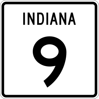
State Road 9 in the U.S. State of Indiana is a long north–south state highway in the eastern portion of Indiana. Its southern terminus is near Columbus at State Road 46, and the northern terminus is at the Michigan/Indiana border between Howe, Indiana, and Sturgis, Michigan, where it continues as M-66.
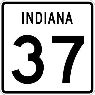
State Road 37 (SR 37) is a major route in the U.S. state of Indiana, running as a four-lane divided highway for 110 miles of its course.
U.S. Route 35 (US 35) is a United States Highway that runs southeast-northwest for approximately 412 miles (663 km) from the western suburbs of Charleston, West Virginia to northern Indiana. Although the highway is physically southeast-northwest, it is nominally north–south. The highway's southern terminus is in Teays Valley, West Virginia, near Scott Depot, at Interstate 64 (I-64). Its northern terminus is near Michigan City, Indiana, at US 20. The West Virginia portion of the highway is mostly expressway, becoming a freeway shortly before it crosses the Ohio River into Ohio. The Ohio portion has been upgraded to a four-lane highway/freeway between the West Virginia state line and Trotwood, west of Dayton.
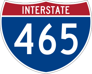
Interstate 465 (I-465), also known as the USS Indianapolis Memorial Highway, is the beltway circling Indianapolis, Indiana, United States. It is roughly rectangular in shape and has a perimeter of approximately 53 miles (85 km). It lies almost completely within the boundaries of Marion County, except for two short sections on the north leg in Boone and Hamilton counties. It intersects with I-65, I-69, I-70, and I-74 and provides additional access to I-65 via I-865.
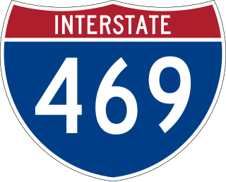
Interstate 469 (I-469) is an Interstate Highway in northeastern Indiana. It is an auxiliary route of parent I-69 that also carries portions of US Highway 24 (US 24), US 30, and US 33 around the urban parts of Fort Wayne. It is 30.83 miles (49.62 km) in length. The Interstate was originally conceived as a bypass for US 24 around the south and east ends of Fort Wayne. Due to heavy traffic on US 30 through the city, support was gained to connect the bypass to I-69 on the city's north end. I-469 was given the name Ronald Reagan Expressway in 2005.
State Road 1 (SR 1) is a north–south state highway in eastern Indiana, consisting of two segments. Its southern segment begins at U.S. Highway 50 and Interstate 275 in east-central Dearborn County, just east of Lawrenceburg, and ends at Interstate 469 south of Fort Wayne. Its northern segment begins at Interstate 69 on Fort Wayne's north side, and ends at U.S. Route 20 in east-central Steuben County, approximately 6 miles (9.7 km) east of Angola.
State Road 3 (SR 3) in the U.S. state of Indiana is a discontinuous state highway running through eastern Indiana from near the Ohio River to near the Michigan state line. The southernmost terminus is at SR 62 in Charlestown, and the northernmost terminus is at SR 120 near Brighton.
U.S. Route 30 (US 30) is a road in the United States Numbered Highway System that runs from Astoria, Oregon, to Atlantic City, New Jersey. In Indiana, the route runs from the Illinois state line at Dyer to the Ohio state line east of Fort Wayne and New Haven. The 155.96 miles (250.99 km) of US 30 that lie within Indiana serve as a major conduit. The entire length of U.S. Route 30 in Indiana is included in the National Highway System (NHS). The highway includes four-lane, rural sections, an urbanized, four-lane divided expressway, and several high-traffic, six-lane freeway areas. First designated as a US Highway in 1926, US 30 replaced the original State Road 2 (SR 2) and SR 44 designation of the highway which dated back to the formation of the Indiana State Road system. A section of the highway originally served as part of the Lincoln Highway. Realignment and construction projects have expanded the highway to four lanes across the state, and the road is now part of a long stretch of US 30 from New Lenox, Illinois, to Canton, Ohio, where the road has at least four lanes. There are over 40 traffic signals between I-65 at Merrillville and I-69 at Fort Wayne.
State Road 25 is a highway in the U. S. state of Indiana. Although it is designated a north–south road, in practice it travels generally northeast from its southern terminus at State Road 32 to its northern terminus at State Road 15 in Warsaw.
State Road 930 (SR 930) is an Indiana State Road that runs between Fort Wayne and New Haven in the US state of Indiana. The 12.97 miles (20.87 km) of SR 930 serve as a connection with U.S. Route 30 (US 30) through these two cities between the beginning of the concurrency with Interstate 69 (I-69) in Fort Wayne and the end of its concurrency with I-469 in New Haven. All of the highway is listed on the National Highway System (NHS), a network of highways that are identified as being important for the economy, mobility and defense of the nation. Various sections are urban two-lane highway, urbanized four-lane divided highway, and urbanized six-lane divided highway. The highway passes through industrial and commercial properties. SR 930 was designated in 1998, and replaced segments of US 30 in Fort Wayne and New Haven that were formerly part of the Lincoln Highway in the 1920s, as well as Coliseum Boulevard, which was designated as part of US 30 in the 1950s.
U.S. Route 41 (US 41) in the state of Indiana is a north–south US Highway that is parallel to the Illinois state line. It enters the state south of Evansville as a four-lane divided highway passing around Vincennes and traveling north to Terre Haute. In Terre Haute, it is known as 3rd Street. North of Terre Haute, it hooks east and becomes a two-lane surface road. Those wanting to stay on a four-lane divided highway can use State Road 63 to the west. It passes through Rockville, Veedersburg, and Attica before returning to a four-lane divided highway when SR 63 terminates in Warren County. It remains a four-lane divided highway until Lake County, where it becomes a main road known as Indianapolis Boulevard. It overlaps US 12 and US 20 in Hammond and exits Indiana into the South Side of Chicago.
U.S. Route 50 (US 50) is a part of the United States Numbered Highway System that runs from West Sacramento, California, to Ocean City, Maryland. In the U.S. state of Indiana, it is part of the state road system. US 50 enters the state in Vincennes. The 171.38 miles (275.81 km) of US 50 that lie within Indiana serve as a major conduit. All of the highway is listed on the National Highway System. Various sections are rural two-lane highway, urbanized four-lane undivided highway and one-way streets. The easternmost community along the highway is Lawrenceburg at the Ohio state line. US 50 passes through urban areas, farmland and woodland.
Interstate 69 (I-69) currently has two discontinuous segments of freeway in the US state of Indiana. The original 157.8-mile-long (254.0 km) highway, completed in November 1971, runs northeasterly from the state capital of Indianapolis, to the city of Fort Wayne, and then proceeds north to the state of Michigan. This original segment is also known as segment of independent utility 1 (SIU 1) in the national plan for expansion of I-69.
U.S. Route 27 (US 27) is a part of the United States Numbered Highway System that runs from Miami, Florida, to Fort Wayne in the U.S. state of Indiana. In Indiana, it is a state road that enters the state in College Corner, Ohio, and West College Corner. The 117.765 miles (189.524 km) of US 27 that lie within Indiana serve as a major conduit. Most of the highway is listed on the National Highway System. Various sections are a rural two-lane highway or an urbanized four-lane divided highway. The northernmost community along the highway is Fort Wayne in the northeast part of the state. The highway ends at an interchange with Interstate 69 (I-69) north of downtown Fort Wayne after serving the east central and northeast regions of Indiana.
U.S. Route 33 (US 33) is part of the United States Numbered Highway System that runs from Richmond, Virginia, to Elkhart of the US state of Indiana. In Indiana, it is a state road that enters the state at the Ohio state line between Willshire, Ohio, and Pleasant Mills, Indiana. The 106.217 miles (170.940 km) of US 33 that lie within Indiana serve as a major conduit. All of the highway is listed on the National Highway System. Various sections are rural two-lane highway, urbanized four-lane divided expressway and the Lincoln Highway. The northernmost community along the highway is Elkhart. The highway ends at an interchange in southern Elkhart after serving the northeastern region of Indiana. US 33 passes through farm fields and urban areas.
U.S. Route 20 (US 20) in Indiana is a main east–west highway that is parallel to the Indiana Toll Road. The western terminus of US 20 is at the Illinois state line and the eastern terminus is at the Ohio state line. US 20 through Whiting, East Chicago, and Gary is concurrent with US 12 twice. The route varies between one-way, two-lane, and four-lane streets, in Northwest Indiana. From the east side of Gary to west of South Bend, US 20 is a four-lane undivided highway. The route then heads around the west and south sides of South Bend and Elkhart as a four-lane limited access divided highway. East of State Road 15 (SR 15), US 20 is two-lane rural highway.
U.S. Route 231 is the longest numbered highway in Indiana, covering over 284 miles (457 km). It is a main north–south highway in the western part of the state. The southern terminus of US 231 is at the Kentucky state line and the northern terminus is at US 41 just south of St. John. The highway is a mixture of expressway and two-lane roadway. The expressway portions exist mainly in southern Indiana and around the Lafayette area, with the rest mainly being two lanes.
Phase I, the east side of the intersection, is fully constructed and was opened to traffic in Fall of 2020 (Des. 1383675)