Maumee Township, Allen County, Indiana

Last updated

Maumee Township
Map highlighting Maumee Township, Allen County, Indiana.svg
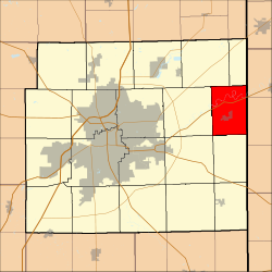
Location in Allen County, Indiana
Coordinates: 41°08′14″N84°50′22″W / 41.13722°N 84.83944°W / 41.13722; -84.83944
Country Flag of the United States (23px).png  United States
State Flag of Indiana.svg Indiana
County Allen
Government
  Type Indiana township
Area
  Total
26.69 sq mi (69.13 km2)
  Land26.37 sq mi (68.30 km2)
  Water0.32 sq mi (0.83 km2)  1.19%
Elevation
745 ft (227 m)
Population
 (2020) [1]
  Total
2,647
  Density99/sq mi (38.4/km2)
ZIP code
46797
GNIS feature ID 0453616

Maumee Township is one of twenty townships in Allen County, Indiana, United States. As of the 2010 census, its population was 2,620. [2]

Contents

Geography

According to the United States Census Bureau, Maumee Township covers an area of 26.69 square miles (69.13 km2); of this, 26.37 square miles (68.30 km2) is land and 0.32 square miles (0.83 km2), or 1.19 percent, is water. [2]

Cities, towns, villages

Unincorporated towns

(This list is based on USGS data and may include former settlements.)

Adjacent townships

Cemeteries

The township contains Diehl Cemetery.

Major highways

School districts

Political districts

References

Citations

  1. "Census Bureau profile: Maumee Township, Allen County, Indiana". United States Census Bureau. May 2023. Retrieved March 19, 2024.
  2. 1 2 "Geographic Identifiers: 2010 Demographic Profile Data (DP-1): Maumee township, Allen County, Indiana". U.S. Census Bureau, American Factfinder. Archived from the original on February 10, 2020. Retrieved March 26, 2013.

Sources